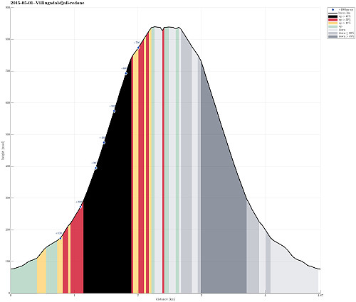
Villingadalsfjall (01.05.2015)

| Startsted | Viðareiði (35moh) |
|---|---|
| Sluttsted | Viðareiði (35moh) |
| Turtype | Fjelltur |
| Turlengde | 5t 00min |
| Distanse | 4,9km |
| Høydemeter | 781m |
| GPS |
|
| Bestigninger | Villingadalsfjall (841moh) | 01.05.2015 |
|---|

Trip Summary
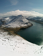
We parked in the northern end of Viðareiði (almost at the end of the upper road, near the place, where the street is a bit wider). From there we went to the end of the road, then along a small stone wall, already ascending towards Villingadalsfjall. Then, we basically followed a series of blue sticks, which someone placed in short distances from each other to indicate the best path up. Ascending to the top proved to be (very) steep in selected places and we had to concentrate -- not at the least due the snow (quite a bit of snow, still). The top itself flattens out and there are magnificent views in all directions! What a great tour! After a short break on the top (even though the weather was very good, the conditions still did not invite to stay on the top for very long), we descended basically the same way back to the car. To ease the way down, we put on the crampons, which we fortunately had with us -- on the very steep slopes and on quite hard snow, the crampons proved to be perfect and made walking down reasonably easy! All in all, a very rewarding hike indeed! :-)
Photos
Selected photos are available as Google photo album.
Useful Resources
On Hikr.org you can read about other hikes up this nice mountain.


Kommentarer
amazing
Skrevet av litljortindan 17.10.2017 20:46Looks amazing. Have been to the Faroes a couple of times but hadn't considered walking in winter type conditions.
Re: amazing
Skrevet av HHauser 18.10.2017 17:49This was an outstanding experience, certainly---highly recommended! Note that we used crampons---kind of necessary in the steep terrain.