Tveitafjellet (16.04.2016)

| Start point | Åsheim (185m) |
|---|---|
| Endpoint | Åsheim (185m) |
| Characteristic | Hillwalk |
| Duration | 2h 00min |
| Distance | 6.3km |
| Vertical meters | 496m |
| GPS |
|
| Ascents | Tveitafjellet (555m) | 16.04.2016 |
|---|---|---|
| Åsheimveten (477m) | 16.04.2016 |

Trip Summary
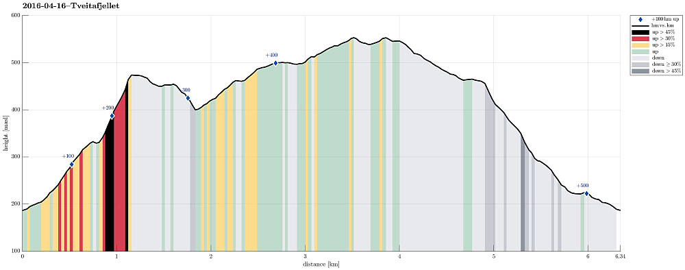
We were driving to Osterøy near Bergen and on Osterøy further, first to Lonevåg and then to Hosanger. There, we turned right (into the direction of Kossdalen, actually!), but continued a small road upwards on the Eastern side of the valley until we came to the junction, where one road continues to the left (up to Åsheim) and the other goes to the right (up to Tveiten). From there, we started hiking, first following the road up to Åsheim. The path up to Åsheimveten leaves from the road to the right (near the houses of Åsheim)---it's good to not follow the temptation of hiking along the path to Tveitafjellet, which is well marked a little underneath the houses. Once on the right path, it's quick and straight-forward to hike up Åsheimveten, which offers fantastic views of Osterfjorden and Osterøy. From there, it is easy and nice to continue to Tveitafjellet, first going east, crossing Vetaskaret, before there changing into a southeastern direction. A gentle slope leads up to the top of Tveitafjellet, also called Settnipa. Even though not the highest mountain on Osterøy, Tveitafjellet is very nice, since it stands a bit separated---it offers great views over large parts of Osterøy and also towards the north. We then followed a small ridge in parallel to the one that we had hiked up, leading us down to Tveiten. There are several very lovely spots also on this path down---all in all, Tveitafjellet proved to be very much worth the trip! :-)
Photos
Selected photos are available as Google photo album.
Useful Resources
See also the related FB-page Hiking around Bergen, Norway.
Web page WestCoastPeaks.com provides useful information about Tveitafjellet and Åsheimveten
and also Petter Bjørstad has a useful page about Tveitafjellet.


User comments