Archive - Date
Archive - Activity
-
Bike trip (108)
- Bike trip - mixed (25)
- Bike trip - road (83)
-
Drive (9)
- Car drive (9)
-
Other trip (3)
- Kayaking (3)
-
Ski trip (109)
- Backcountry skiing (65)
- Cross-country skiing (44)
- Trip by foot (1782)
Collected lists
-
Voss ≥ 100m pf.
(96/98)
 97%
97% -
Opptur Hordaland
(143/159)
89%
-
Stasjoner på Bergensbanen
(31/40)
77%
-
Ulvik ≥ 100m pf.
(28/38)
73%
-
Hordaland ≥ 100m pf.
(613/863)
71%
-
Mjølfjell PF > 100m
(21/31)
67%
-
Jondal ≥ 100m pf.
(15/23)
65%
-
Sunnhordland PF >= 100m
(104/186)
55%
-
Dagsturhyttene i Vestland
(33/61)
54%
-
Hordaland: Hardanger PF>=100m
(186/359)
51%
-
Kvinnherad ≥ 100m pf.
(40/79)
50%
-
DNT-hytter i Hordaland
(22/45)
48%
-
Sogndal ≥ 100m pf.
(23/81)
28%
-
Vik i Sogn ≥ 100m pf.
(8/46)
17%
-
DNT-hytter i Sogn og Fjordane
(8/47)
17%
-
Eidfjord ≥ 100m pf.
(7/42)
16%
-
Etne ≥ 100m pf.
(7/51)
13%
-
Ullensvang ≥ 100m pf.
(21/153)
13%
-
Sogn - Sør for Sognefjorden PF>=100m
(17/159)
10%
-
Opptur i Sogn og Fjordane peaks
(17/177)
9%

Britabu Easter Barbecue 2022 + Around Fjærlandssetvatnet
- Date:
- 14.04.2022
- Characteristic:
- Cross-country skiing
- Duration:
- 4:14h
- Distance:
- 16.6km
 Followed the ski trail from Rindabotn via Høgehaug around Fjærlandssetvatnet with an off-trail shortcut for the descent. The trip also included a visit to the traditional Easter barbecue at the Red Cross cabin Britabu .
Stedjestova from Stedje kyrkje
- Date:
- 13.04.2022
- Characteristic:
- Hillwalk
- Duration:
- 1:37h
- Distance:
- 3.3km
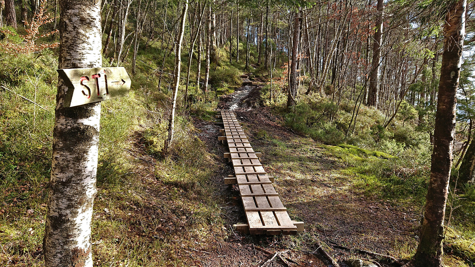
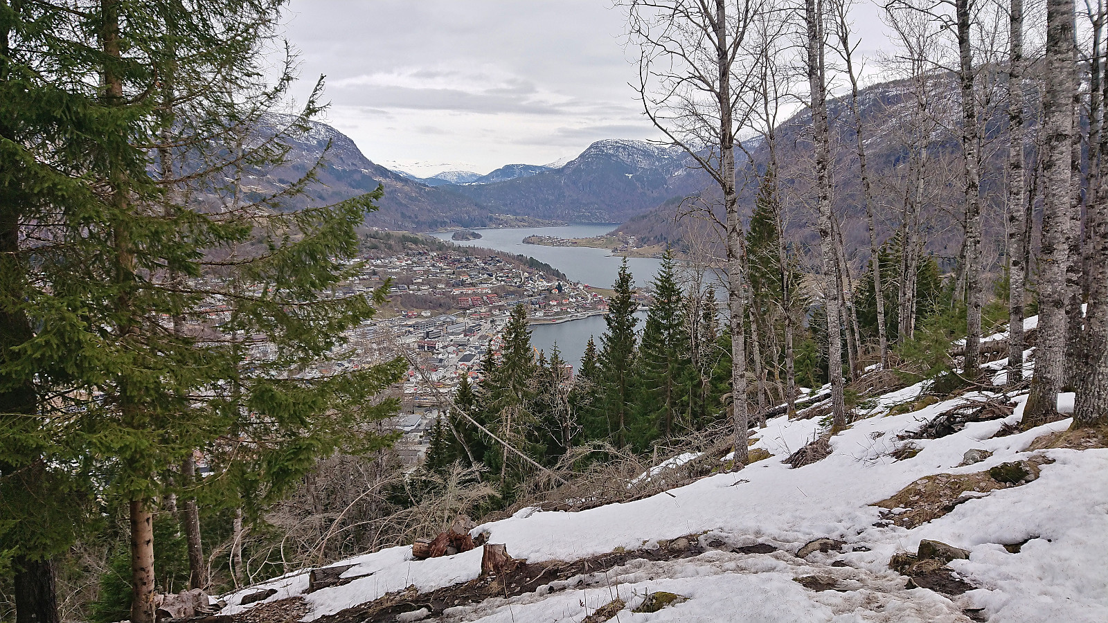 Short but steep hike from Stedje kyrkje to Stedjestova which provided more limited views than expected due to lots of trees.
Barsnesfjorden
- Date:
- 12.04.2022
- Characteristic:
- Hike
- Duration:
- 0:55h
- Distance:
- 4.4km
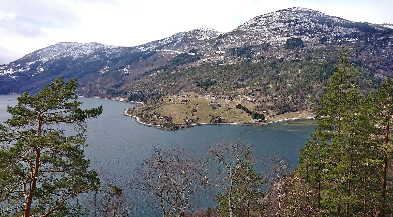
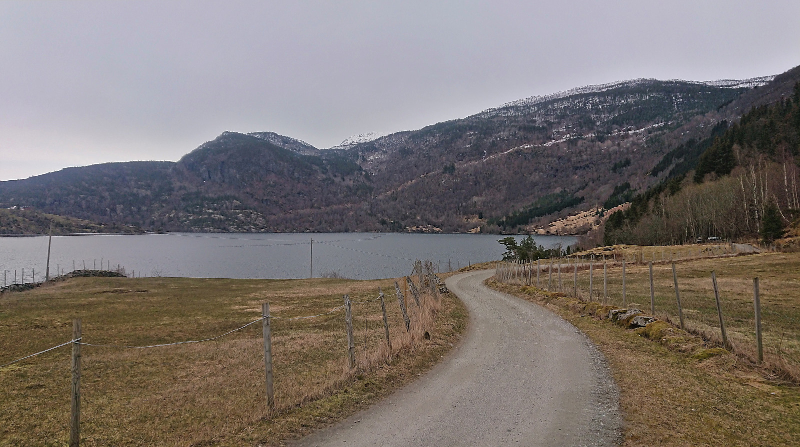 Short walk along Barsnesfjorden.
(Note that the road this hike follows is private, i.e. no cars allowed. There are however a couple of parking spaces down by the small wharf along Barsnesfjorden just before the road turns west and starts climbing slightly towards the crossroads at Barsnes.)
Short walk along Barsnesfjorden.
(Note that the road this hike follows is private, i.e. no cars allowed. There are however a couple of parking spaces down by the small wharf along Barsnesfjorden just before the road turns west and starts climbing slightly towards the crossroads at Barsnes.)
Skiing: Fagreggi
- Date:
- 11.04.2022
- Characteristic:
- Cross-country skiing
- Duration:
- 3:08h
- Distance:
- 11.8km
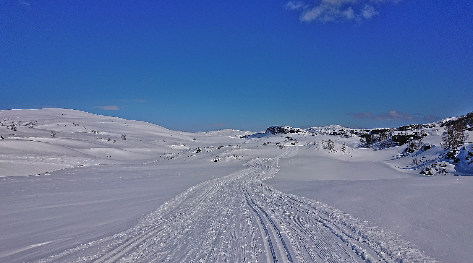
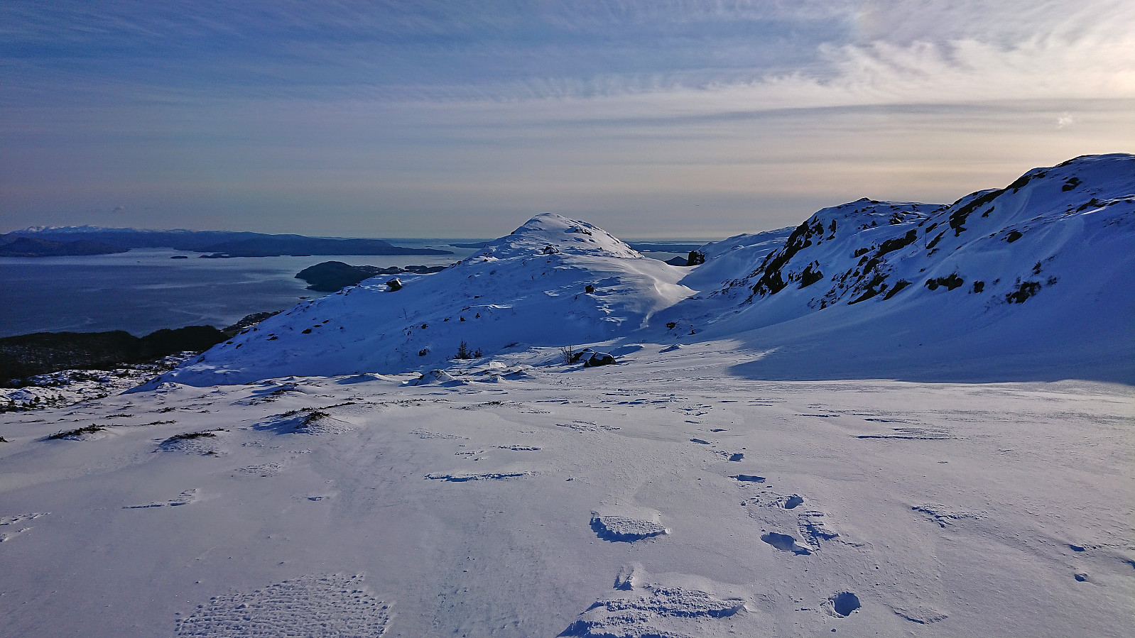
 Short skiing trip to Fagreggi on a rather gray day where the sun did not show up until we had started our off-trail descent back to Rindabotn.
Helgasete from Barsnesfjorden
- Date:
- 10.04.2022
- Characteristic:
- Hillwalk
- Duration:
- 3:55h
- Distance:
- 7.7km
 We started from the private parking lot at the end of the gravel road on the east side of Barsnesfjorden. From there we followed the trail via Dal to Helgasete . Snow covered the trail from just below Dal and there were light snow showers at Helgasete.
Note that the road to where the trail starts is private, i.e. no cars allowed. There are however a couple of parking spaces down by the small wharf along Barsnesfjorden just before the road turns west and starts climbing slightly towards the crossroads at Barsnes.
We started from the private parking lot at the end of the gravel road on the east side of Barsnesfjorden. From there we followed the trail via Dal to Helgasete . Snow covered the trail from just below Dal and there were light snow showers at Helgasete.
Note that the road to where the trail starts is private, i.e. no cars allowed. There are however a couple of parking spaces down by the small wharf along Barsnesfjorden just before the road turns west and starts climbing slightly towards the crossroads at Barsnes.
Hodlekve and Kollsetestølen
- Date:
- 09.04.2022
- Characteristic:
- Cross-country skiing
- Duration:
- 2:20h
- Distance:
- 10.5km
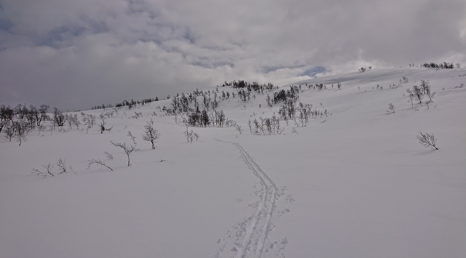
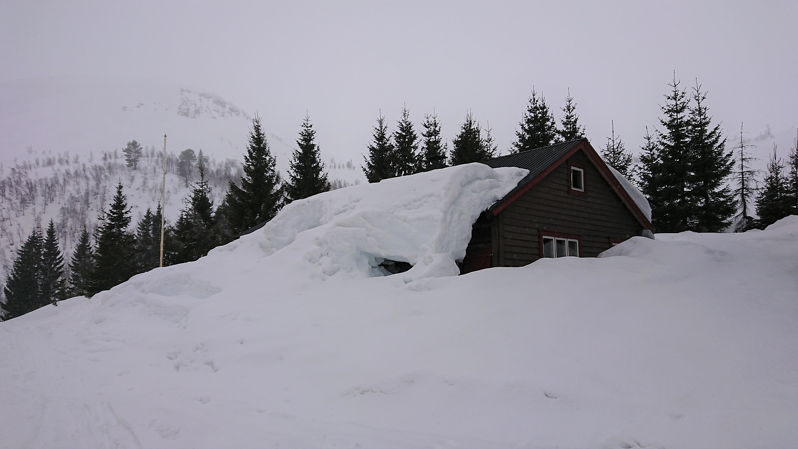 Skiing the entire 10 km track at Hodlekve Skisenter on a rather gray day during an almost constant snow shower. We also made a short detour to the DNT cabin called Kollsetestølen , which today was even more hidden than usual underneath lots of snow.
Borgafjellet and Møsnuken
- Date:
- 05.04.2022
- Characteristic:
- Hillwalk
- Duration:
- 6:15h
- Distance:
- 15.7km
 When a meeting at Solstrand ended after a late lunch, I had originally planned to take the ferry across the fjord to go hiking in Fusa. However, after waking up to a snow-covered Solstrand, it was clear that my hike would take significantly longer than planned and I would be at risk of not catching the all-important bus back to Bergen. I therefore decided to play it safe and instead do a revisit of Borgafjellet and Møsnuken . At least this would allow me to visit the new dagsturhytte at Borgafjellet, in addition to some other minor summits I had not previously visited.
When the rest of my colleagues embarked on the bus back to Bergen, I began my hike from Solstrand and soon arrived at the steep ascent to Borgafjellet. Little to no snow at the start, but it gradually increased as I got closer to the summit, with perhaps a couple of centimeters >>>
When a meeting at Solstrand ended after a late lunch, I had originally planned to take the ferry across the fjord to go hiking in Fusa. However, after waking up to a snow-covered Solstrand, it was clear that my hike would take significantly longer than planned and I would be at risk of not catching the all-important bus back to Bergen. I therefore decided to play it safe and instead do a revisit of Borgafjellet and Møsnuken . At least this would allow me to visit the new dagsturhytte at Borgafjellet, in addition to some other minor summits I had not previously visited.
When the rest of my colleagues embarked on the bus back to Bergen, I began my hike from Solstrand and soon arrived at the steep ascent to Borgafjellet. Little to no snow at the start, but it gradually increased as I got closer to the summit, with perhaps a couple of centimeters >>>
Moldaneset and Moldaåsen from Solstrand
- Date:
- 04.04.2022
- Characteristic:
- Hillwalk
- Duration:
- 2:09h
- Distance:
- 9.6km
 At the first return to Solstrand after the pandemic, I used the extended break before dinner to explore Moldaneset and Moldaåsen . Roads and trails were followed for the entire hike, except for the short off-trail detour to the summit of Moldaåsen. The first part of the hike even had a marked trail, although I misunderstood the signs and made an unnecessary detour instead of heading directly to the tip of Moldaneset. On my way to Moldaåsen, I also visited Salbuneset/Salbuvika (still following a trail), mainly to get at least some views, as I knew that these would be limited from the summit. This was indeed also the case, and while the summit could be reached without any issues, it is probably not a location that most hikers will feel the need to visit. I also went to the highest point at Gråberget (on the other side >>>
Across Hellen festning
- Date:
- 03.04.2022
- Characteristic:
- Hike
- Duration:
- 0:36h
- Distance:
- 3.1km
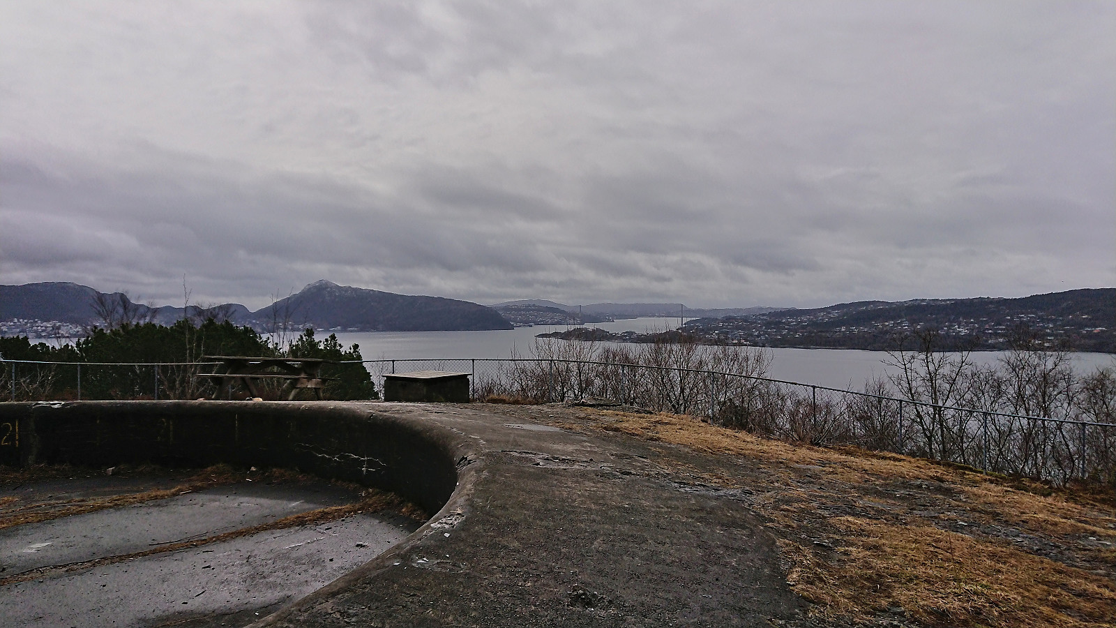 Short local hike on an overall gray Sunday where I managed avoid all of the rain showers.
Steinsdalsfossen from Norheimsund
- Date:
- 02.04.2022
- Characteristic:
- Walk
- Duration:
- 0:45h
- Distance:
- 3.1km
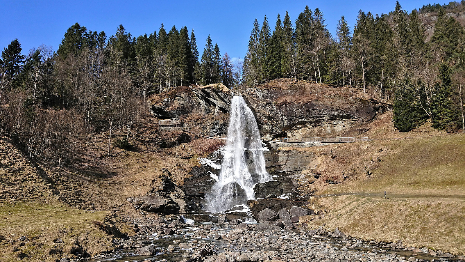 After my short hike to Åsen , I returned by bus to Norheimsund, where I had almost an hour to kill before the next bus to Bergen. I therefore decided to pay Steinsdalsfossen a visit. A location I had not visited since I was a child. Sadly, the waterfall was not yet officially opened for the summer, and I could not do the unique walk behind the waterfall. But at least I more or less had the waterfall to myself, which is rarely the case during the summer. After a short lunch break, the bus arrived to take me back to Bergen.
