Archive - Date
Archive - Activity
-
Bike trip (108)
- Bike trip - mixed (25)
- Bike trip - road (83)
-
Drive (9)
- Car drive (9)
-
Other trip (3)
- Kayaking (3)
-
Ski trip (109)
- Backcountry skiing (65)
- Cross-country skiing (44)
- Trip by foot (1782)
Collected lists
-
Voss ≥ 100m pf.
(96/98)
 97%
97% -
Opptur Hordaland
(143/159)
89%
-
Stasjoner på Bergensbanen
(31/40)
77%
-
Ulvik ≥ 100m pf.
(28/38)
73%
-
Hordaland ≥ 100m pf.
(613/863)
71%
-
Mjølfjell PF > 100m
(21/31)
67%
-
Jondal ≥ 100m pf.
(15/23)
65%
-
Sunnhordland PF >= 100m
(104/186)
55%
-
Dagsturhyttene i Vestland
(33/61)
54%
-
Hordaland: Hardanger PF>=100m
(186/359)
51%
-
Kvinnherad ≥ 100m pf.
(40/79)
50%
-
DNT-hytter i Hordaland
(22/45)
48%
-
Sogndal ≥ 100m pf.
(23/81)
28%
-
Vik i Sogn ≥ 100m pf.
(8/46)
17%
-
DNT-hytter i Sogn og Fjordane
(8/47)
17%
-
Eidfjord ≥ 100m pf.
(7/42)
16%
-
Etne ≥ 100m pf.
(7/51)
13%
-
Ullensvang ≥ 100m pf.
(21/153)
13%
-
Sogn - Sør for Sognefjorden PF>=100m
(17/159)
10%
-
Opptur i Sogn og Fjordane peaks
(17/177)
9%

Ørneberget and Furukammen
- Date:
- 23.04.2025
- Characteristic:
- Hillwalk
- Duration:
- 1:04h
- Distance:
- 4.0km
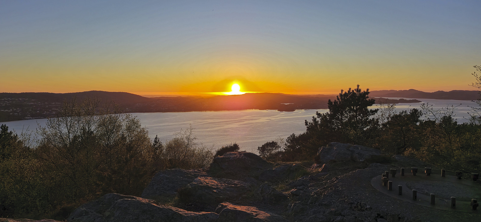 Short local hike just before sunset.
Across Hellen festning
- Date:
- 22.04.2025
- Characteristic:
- Hike
- Duration:
- 0:49h
- Distance:
- 3.6km
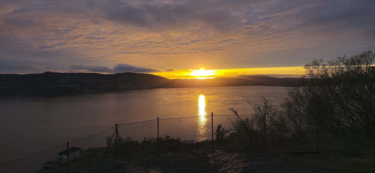 Short local hike just before sunset.
Skiing: Flakavassnutane and Såtehjallane from Finse
- Date:
- 20.04.2025
- Characteristic:
- Backcountry skiing
- Duration:
- 5:04h
- Distance:
- 18.9km
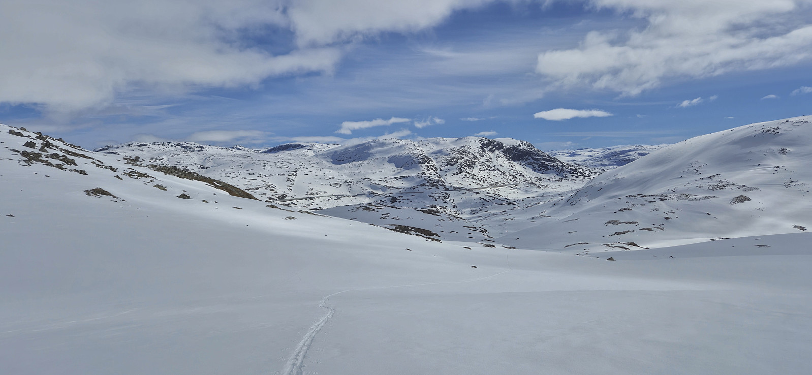
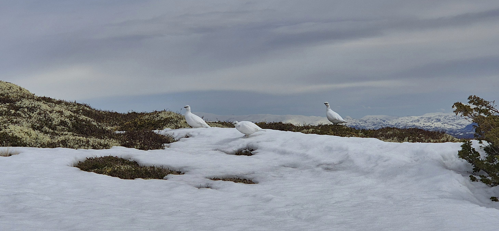
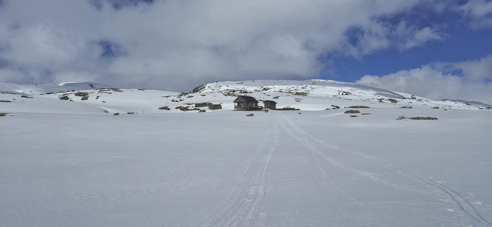
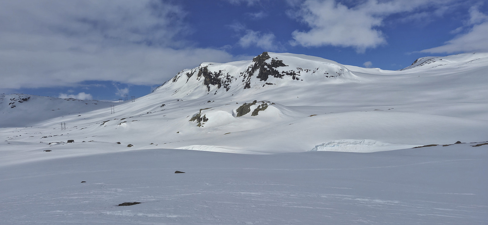 Two days after my skiing trip from Hallingskeid to Nyrjuven I was back on the train from Bergen but this time taking the train one stop further and getting off at Finse . After safely crossing the train tracks I put on the skis and started on the marked winter route to Klemsbu . Around 1 km before the cabin I however left the marked route and headed more directly northeast towards Flakavassnutane .
South of the summit I shortly reconnected with the marked route before finding my own way to the top, arriving at the large cairn without any difficulties. Excellent views from the summit, even though the sunshine promised by the weather forecast never materialized. A cold wind resulted in a short stay and after a couple of pictures I descended along the same route before following the marked route west to Klemsbu.
I had initially considered to also include Vargabreen on today's trip >>>
Two days after my skiing trip from Hallingskeid to Nyrjuven I was back on the train from Bergen but this time taking the train one stop further and getting off at Finse . After safely crossing the train tracks I put on the skis and started on the marked winter route to Klemsbu . Around 1 km before the cabin I however left the marked route and headed more directly northeast towards Flakavassnutane .
South of the summit I shortly reconnected with the marked route before finding my own way to the top, arriving at the large cairn without any difficulties. Excellent views from the summit, even though the sunshine promised by the weather forecast never materialized. A cold wind resulted in a short stay and after a couple of pictures I descended along the same route before following the marked route west to Klemsbu.
I had initially considered to also include Vargabreen on today's trip >>>
Bryggen to Lønborg
- Date:
- 19.04.2025
- Characteristic:
- Hike
- Duration:
- 1:19h
- Distance:
- 6.6km
 Short hike home from the city center after spending all of the day before skiing in Ulvik .
Skiing: Nyrjuven/Osaskavlen from Hallingskeid
- Date:
- 18.04.2025
- Characteristic:
- Backcountry skiing
- Duration:
- 4:56h
- Distance:
- 16.4km
 After spending the first half of Easter in Sogndal, I was now back in Bergen and after a night at home I got up early to take the train to Hallingskeid with the plan to ski to Nyrjuven/Osaskavlen . The sun was shining when the train arrived at Hallingskeid and I could put on the skis immediately after exiting the station from where I headed towards the bridge across Moldo .
Given the issues I had had with the missing summer bridge during my recent attempt to cross the river south of Mjølfjell (which I later learnt opened just three days later…), I had in advance made sure that the bridge would in fact be there this time around , and could therefore easily cross to the other side.
Safely across the river, I continued west along Buadalen where I pretty much followed the marked summer route to Osa/Rembesdalsseter until getting to the unnamed 1272 lake southwest of Daurmålsvatnet. From there it was simply a matter of navigating more or less directly west >>>
After spending the first half of Easter in Sogndal, I was now back in Bergen and after a night at home I got up early to take the train to Hallingskeid with the plan to ski to Nyrjuven/Osaskavlen . The sun was shining when the train arrived at Hallingskeid and I could put on the skis immediately after exiting the station from where I headed towards the bridge across Moldo .
Given the issues I had had with the missing summer bridge during my recent attempt to cross the river south of Mjølfjell (which I later learnt opened just three days later…), I had in advance made sure that the bridge would in fact be there this time around , and could therefore easily cross to the other side.
Safely across the river, I continued west along Buadalen where I pretty much followed the marked summer route to Osa/Rembesdalsseter until getting to the unnamed 1272 lake southwest of Daurmålsvatnet. From there it was simply a matter of navigating more or less directly west >>>
Barsnesfjorden
- Date:
- 17.04.2025
- Characteristic:
- Hike
- Duration:
- 1:07h
- Distance:
- 4.7km
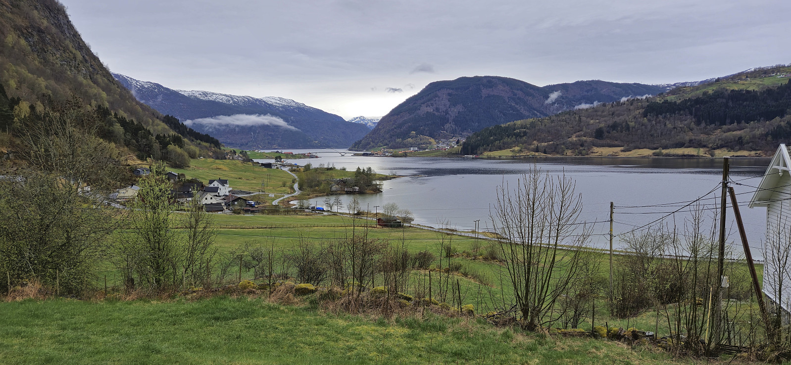 Short hike along Barsnesfjorden in light rain before taking the boat back to Bergen in the afternoon.
(Note that this hike is along a private road, i.e. no cars allowed.)
Short hike along Barsnesfjorden in light rain before taking the boat back to Bergen in the afternoon.
(Note that this hike is along a private road, i.e. no cars allowed.)
Barsnesfjorden
- Date:
- 16.04.2025
- Characteristic:
- Hike
- Duration:
- 0:59h
- Distance:
- 4.1km
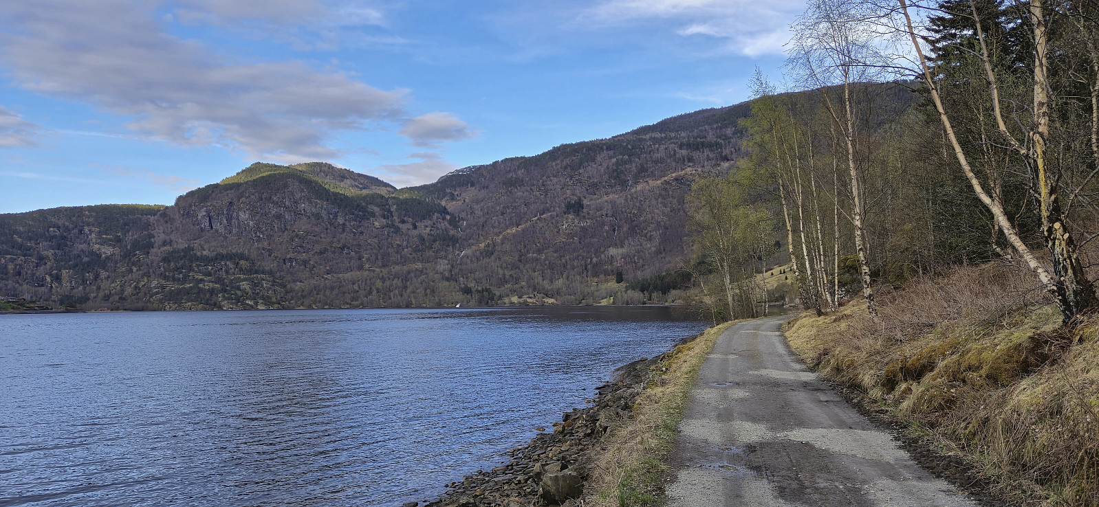 Short evening walk along Barsnesfjorden.
(Note that this hike is along a private road, i.e. no cars allowed.)
Short evening walk along Barsnesfjorden.
(Note that this hike is along a private road, i.e. no cars allowed.)
Helleberget
- Date:
- 15.04.2025
- Characteristic:
- Backcountry skiing
- Duration:
- 3:10h
- Distance:
- 9.3km
 Even though the snow was rapidly melting we managed to keep the skis on all the way from Rindabotn to the summit. Limited snow at the summit and almost no snow for the final part of the descent back to the parking lot.
Høgehaug and Britabu
- Date:
- 14.04.2025
- Characteristic:
- Cross-country skiing
- Duration:
- 3:03h
- Distance:
- 9.6km
 The traditional Easter skiing trip from Rindabotn to Høgehaug with a short lunch break outside Britabu .
Skavasshaugane
- Date:
- 13.04.2025
- Characteristic:
- Cross-country skiing
- Duration:
- 2:13h
- Distance:
- 6.7km
 Short skiing trip to check if there was still enough snow for a slightly longer trip the next day.
