Archiv - Nach Datum
Archiv - Nach Aktivität
-
Andere Tour (3)
- Kayaking (3)
-
Fahrradtour (108)
- Fahrradtour Straße (83)
- Fahrradtour gemischt (25)
-
Fahrzeugtour (9)
- Autotour (9)
-
Fußtour (1782)
- Bergtour (1054)
- Jogging (1)
- Spaziergang (54)
- Wanderung (673)
-
Skitour (109)
- Langlauf (44)
- Tourenskilauf (65)
Gesammelte Listen
-
Voss ≥ 100m pf.
(96/98)
 97%
97% -
Opptur Hordaland
(143/159)
89%
-
Stasjoner på Bergensbanen
(31/40)
77%
-
Ulvik ≥ 100m pf.
(28/38)
73%
-
Hordaland ≥ 100m pf.
(613/863)
71%
-
Mjølfjell PF > 100m
(21/31)
67%
-
Jondal ≥ 100m pf.
(15/23)
65%
-
Sunnhordland PF >= 100m
(104/186)
55%
-
Dagsturhyttene i Vestland
(33/61)
54%
-
Hordaland: Hardanger PF>=100m
(186/359)
51%
-
Kvinnherad ≥ 100m pf.
(40/79)
50%
-
DNT-hytter i Hordaland
(22/45)
48%
-
Sogndal ≥ 100m pf.
(23/81)
28%
-
Vik i Sogn ≥ 100m pf.
(8/46)
17%
-
DNT-hytter i Sogn og Fjordane
(8/47)
17%
-
Eidfjord ≥ 100m pf.
(7/42)
16%
-
Etne ≥ 100m pf.
(7/51)
13%
-
Ullensvang ≥ 100m pf.
(21/153)
13%
-
Sogn - Sør for Sognefjorden PF>=100m
(17/159)
10%
-
Opptur i Sogn og Fjordane peaks
(17/177)
9%

Kaupangsholtane
- Datum:
- 25.05.2017
- Tourcharakter:
- Bergtour
- Tourlänge:
- 1:58h
- Entfernung:
- 6,1km
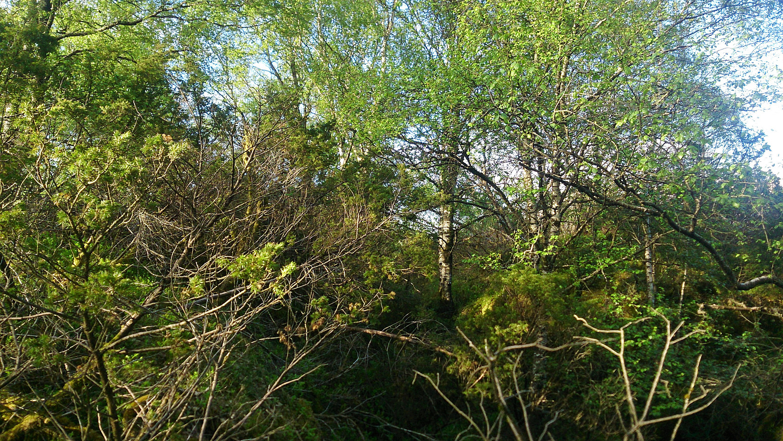
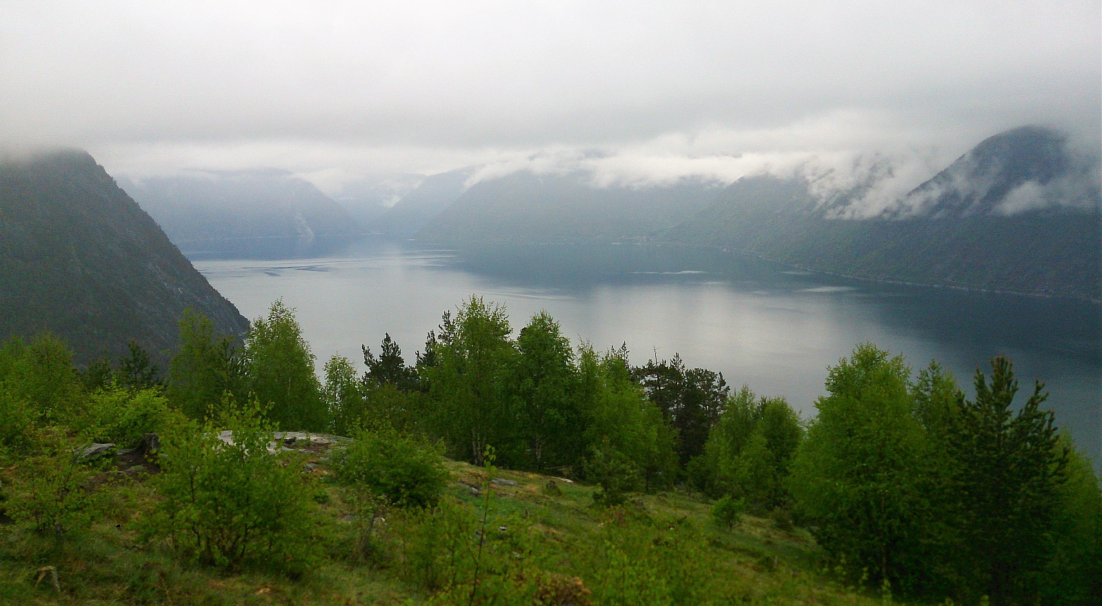 The marked trail started from Haukåsvegen soon after leaving Kaupanger, and we first followed this trail/forest road to Kaupangsholten . Note that this is not the highest point of Kaupangsholtane, but it did provide a very nice view towards the south and seems to be where most people visit.
We then followed the trail west to another viewpoint towards the south, before taking the mandatory visit to the highest point . The summit itself was filled with small pine trees and provided no views. The same was true for the slightly lower hill to the northwest, although here the forest was not as dense. From the summit, we followed trails and forest roads back to where we started the hike.
All in all, a nice and easy hike, along easy to follow trails and forest roads.
The marked trail started from Haukåsvegen soon after leaving Kaupanger, and we first followed this trail/forest road to Kaupangsholten . Note that this is not the highest point of Kaupangsholtane, but it did provide a very nice view towards the south and seems to be where most people visit.
We then followed the trail west to another viewpoint towards the south, before taking the mandatory visit to the highest point . The summit itself was filled with small pine trees and provided no views. The same was true for the slightly lower hill to the northwest, although here the forest was not as dense. From the summit, we followed trails and forest roads back to where we started the hike.
All in all, a nice and easy hike, along easy to follow trails and forest roads.
Amlaholten
- Datum:
- 25.05.2017
- Tourcharakter:
- Bergtour
- Tourlänge:
- 1:40h
- Entfernung:
- 5,2km
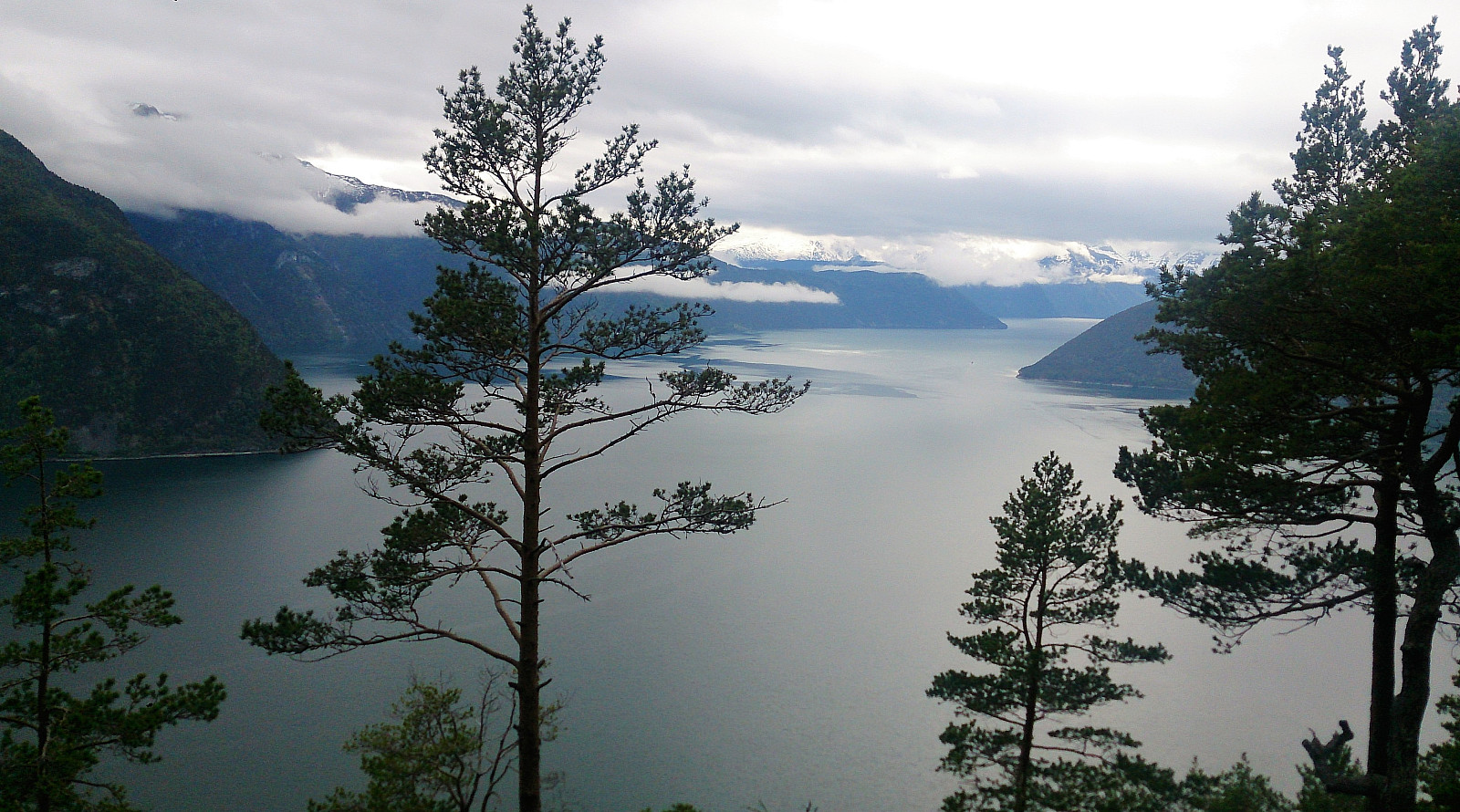 From Kaupanger we drove towards Mannheller (where the ferry goes to Fodnes), but before heading into the tunnel going down to the ferry, we left the highway and followed the road towards Festingdalen. A bit more than halfway to Festingdalen we located a small parking lot with signs indicating the trail to Amlaholten . We followed this trail/forest road west until it turned south and then east. Here we shortly left the main trail and located a nice viewpoint to the southwest.
Next, we relocated the trail, which now got a lot steeper, and quickly arrived at the summit of Amlaholten. The views from the summit were nice, but rather limited due to all the trees. We continued east across the summit and followed the trail in the direction of Festingdalen, and finally arrived back at the road for a short 200 >>>
From Kaupanger we drove towards Mannheller (where the ferry goes to Fodnes), but before heading into the tunnel going down to the ferry, we left the highway and followed the road towards Festingdalen. A bit more than halfway to Festingdalen we located a small parking lot with signs indicating the trail to Amlaholten . We followed this trail/forest road west until it turned south and then east. Here we shortly left the main trail and located a nice viewpoint to the southwest.
Next, we relocated the trail, which now got a lot steeper, and quickly arrived at the summit of Amlaholten. The views from the summit were nice, but rather limited due to all the trees. We continued east across the summit and followed the trail in the direction of Festingdalen, and finally arrived back at the road for a short 200 >>>
Helldalssåta
- Datum:
- 23.05.2017
- Tourcharakter:
- Bergtour
- Tourlänge:
- 0:37h
- Entfernung:
- 2,0km
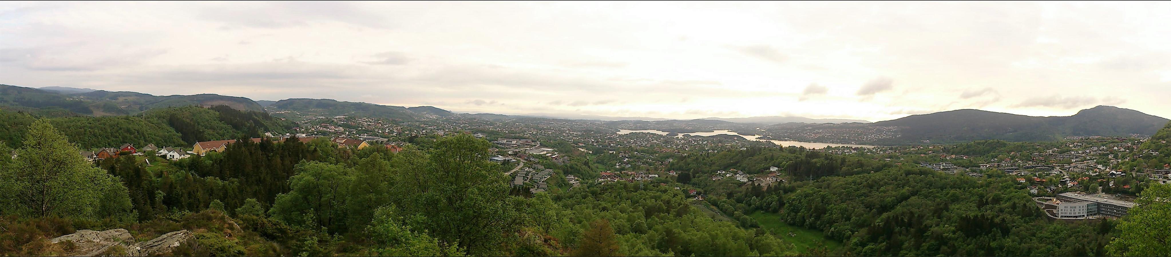 Started by taking the bus to Helldalssåta (the street has the same name as the peak, indicating how short the hike would be). The start of the trail was easy to locate and after just a few minutes I arrived at the summit. For being such an easily accessible summit, and only 250 meters above sea level, the views were surprisingly good in all directions. Well worth a visit.
From the summit I followed the trail southwest along the ridge to quickly arrive at the trig marker next to Storesåta , which also provided excellent views towards the west. The distance from Helldalssåta to Storesåta was less than one kilometer, so I'd definitely recommend including a visit if at Helldalssåta. Instead of going all the way back to Helldalssåta I rather located a shortcut down to Sanddalsringen, where a trail was indicated on >>>
Started by taking the bus to Helldalssåta (the street has the same name as the peak, indicating how short the hike would be). The start of the trail was easy to locate and after just a few minutes I arrived at the summit. For being such an easily accessible summit, and only 250 meters above sea level, the views were surprisingly good in all directions. Well worth a visit.
From the summit I followed the trail southwest along the ridge to quickly arrive at the trig marker next to Storesåta , which also provided excellent views towards the west. The distance from Helldalssåta to Storesåta was less than one kilometer, so I'd definitely recommend including a visit if at Helldalssåta. Instead of going all the way back to Helldalssåta I rather located a shortcut down to Sanddalsringen, where a trail was indicated on >>>
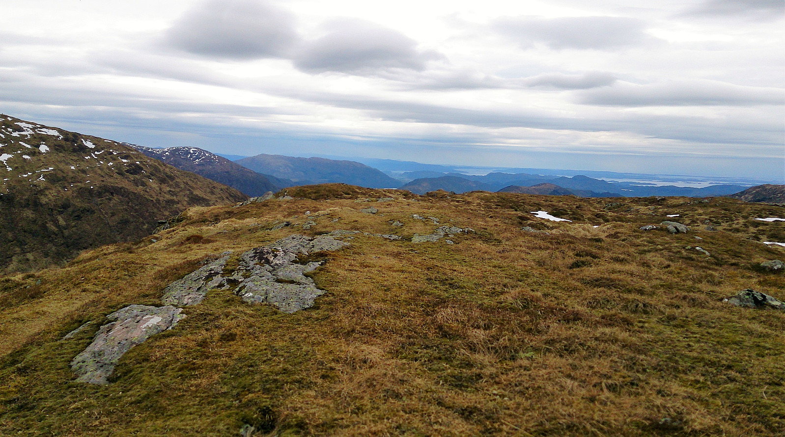
Myrdalsvatnet to Søylevatnet
- Datum:
- 21.05.2017
- Tourcharakter:
- Bergtour
- Tourlänge:
- 4:14h
- Entfernung:
- 12,0km
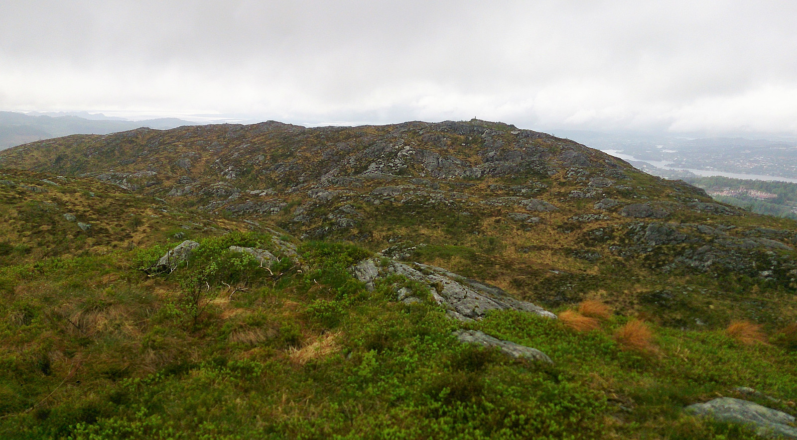 Started by taking the bus to Ulsmåg skole and walking up to Myrdalsvatnet. From there I followed the gravel road north before locating the start of the trail towards Stordalsfjellet . The trail was easy to follow and I quickly arrived at the summit for some nice views, even though the rain and the low-hanging clouds did not help.
I continued along the trail towards Flåfjellet , with the only difficult part being the short, but quite steep, decent by Fjellklovevatnet, where light climbing was required to cross the valley. When ascending on the north side I lost the trail, but had no problems finding my way without it. The summit of Flåfjellet provided even better views than Stordalsfjellet, though again the views would clearly benefit from better weather.
Next, I continued towards Skardalsfjellet . Here the trail reappeared, but that >>>
Started by taking the bus to Ulsmåg skole and walking up to Myrdalsvatnet. From there I followed the gravel road north before locating the start of the trail towards Stordalsfjellet . The trail was easy to follow and I quickly arrived at the summit for some nice views, even though the rain and the low-hanging clouds did not help.
I continued along the trail towards Flåfjellet , with the only difficult part being the short, but quite steep, decent by Fjellklovevatnet, where light climbing was required to cross the valley. When ascending on the north side I lost the trail, but had no problems finding my way without it. The summit of Flåfjellet provided even better views than Stordalsfjellet, though again the views would clearly benefit from better weather.
Next, I continued towards Skardalsfjellet . Here the trail reappeared, but that >>>
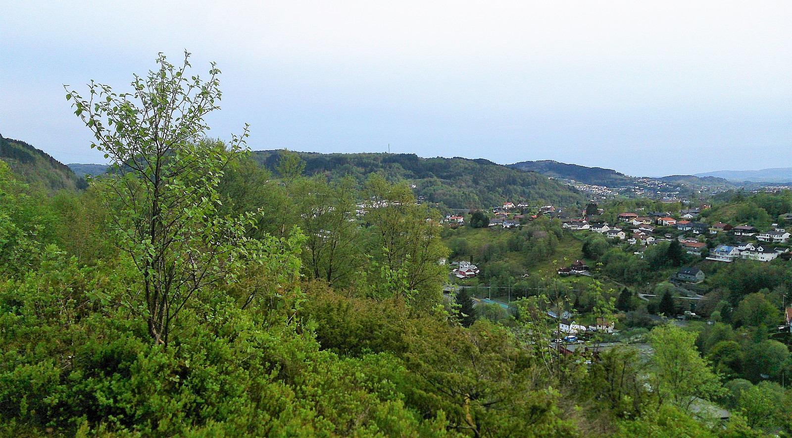
Veten, Leirvågfjellet and Storafjellet
- Datum:
- 20.05.2017
- Tourcharakter:
- Bergtour
- Tourlänge:
- 2:48h
- Entfernung:
- 8,7km
 Started by taking the bus to Krokeide Videregående Skole and walking up Korsnesvegen to where the map indicated a trail in the direction of Moldstigahaugen. The start of the tail was not marked, but the trail itself was marked with small colored wooden tags (see picture). However three colors were used and I had no information about which color corresponded to which goal...
The trail started out as a tractor road that later turned into a trail. As I would later figure out, the trail continues over the hill and reconnects with Korsnesvegen as it comes up from the parking lot. But my plan was to first go via Leirvågfjellet , and I therefore instead followed a weak trail north. This trail quickly disappeared (if it was ever more than an animal track to begin with), and thus getting to the top of Leirvågfjellet >>>
Started by taking the bus to Krokeide Videregående Skole and walking up Korsnesvegen to where the map indicated a trail in the direction of Moldstigahaugen. The start of the tail was not marked, but the trail itself was marked with small colored wooden tags (see picture). However three colors were used and I had no information about which color corresponded to which goal...
The trail started out as a tractor road that later turned into a trail. As I would later figure out, the trail continues over the hill and reconnects with Korsnesvegen as it comes up from the parking lot. But my plan was to first go via Leirvågfjellet , and I therefore instead followed a weak trail north. This trail quickly disappeared (if it was ever more than an animal track to begin with), and thus getting to the top of Leirvågfjellet >>>
Floråsen and Furekampane
- Datum:
- 19.05.2017
- Tourcharakter:
- Bergtour
- Tourlänge:
- 2:52h
- Entfernung:
- 8,1km
 Started by taking the bus to Ulsmåg Skole and walking up Dyngelandsvegen until reaching Dyngelandseidet, which I then followed for ~200 meters while searching for a trail towards Floråsen . I could not find any, and in the end simply started off in what I assumed was the direction of the summit. Getting to the summit was not too difficult, but far from a pleasant experience as it mainly involved fighting with low bushes and trees. Plus lots of cobwebs. There was a trail of sorts when getting through the initial larger trees, but I'm pretty sure this trail is predominantly used by animals. The summit provided no views, and I quickly returned to Dyngelandseidet.
My next goal was Furekampane , and I therefore continued east along the gravel road to Myrdalsvatnet, before following the same road north. I had located >>>
Started by taking the bus to Ulsmåg Skole and walking up Dyngelandsvegen until reaching Dyngelandseidet, which I then followed for ~200 meters while searching for a trail towards Floråsen . I could not find any, and in the end simply started off in what I assumed was the direction of the summit. Getting to the summit was not too difficult, but far from a pleasant experience as it mainly involved fighting with low bushes and trees. Plus lots of cobwebs. There was a trail of sorts when getting through the initial larger trees, but I'm pretty sure this trail is predominantly used by animals. The summit provided no views, and I quickly returned to Dyngelandseidet.
My next goal was Furekampane , and I therefore continued east along the gravel road to Myrdalsvatnet, before following the same road north. I had located >>>
Dyngelandsåsen from Midtunlia
- Datum:
- 15.05.2017
- Tourcharakter:
- Bergtour
- Tourlänge:
- 1:33h
- Entfernung:
- 5,3km
 Started by taking the bus to Midtun and walking up to Midtunlia for the start of the hike. The start of the trail was not marked as far as I could see, but easy to locate in between Midtunlia 25C and 27A. The trail itself was a very positive surprise (see pictures) and made it straightforward to reach the summit of Dyngelandsåsen .
The summit itself had limited views, although several familiar mountains could be spotted in between the trees. I therefore quickly continued towards the lookout point called Tårnnebben , once again along nice trails that were easy to follow. Tårnnebben provided much better views, mainly towards the west, and was definitely worth a visit. I continued south along the trail, which quickly turned west, taking me down to Ulsmåvegen and finally back to the starting point of the hike.
The plan >>>
Started by taking the bus to Midtun and walking up to Midtunlia for the start of the hike. The start of the trail was not marked as far as I could see, but easy to locate in between Midtunlia 25C and 27A. The trail itself was a very positive surprise (see pictures) and made it straightforward to reach the summit of Dyngelandsåsen .
The summit itself had limited views, although several familiar mountains could be spotted in between the trees. I therefore quickly continued towards the lookout point called Tårnnebben , once again along nice trails that were easy to follow. Tårnnebben provided much better views, mainly towards the west, and was definitely worth a visit. I continued south along the trail, which quickly turned west, taking me down to Ulsmåvegen and finally back to the starting point of the hike.
The plan >>>
Dolvik terminal to Lagunen: Feråsen and Sørås
- Datum:
- 14.05.2017
- Tourcharakter:
- Wanderung
- Tourlänge:
- 1:26h
- Entfernung:
- 7,1km
 Started by taking the bus to Dolvik terminal and walking east along what appeared to be the easiest route to Feråsen .
Getting to the summit itself turned out to be more difficult than expected though, as it is more or less inside a private backyard. This made the visit a rather unpleasant experience and I would generally recommend staying away from this one.
I continued east towards the next goal of the day: Sørås . And while this mainly involved a lot of walking along the main road, the summit itself was a positive surprise. But that could just be due to the recent bad experience at Feråsen.
The hike was concluded by walking down to Lagunen for Bybanen back to the city center.
To conclude, an ok walk covering two peaks that most people would not visit if it wasn't for the fact that they are on the Bergen ≥ 50m pf. og ≥ 100 m.o.h. list, >>>
Started by taking the bus to Dolvik terminal and walking east along what appeared to be the easiest route to Feråsen .
Getting to the summit itself turned out to be more difficult than expected though, as it is more or less inside a private backyard. This made the visit a rather unpleasant experience and I would generally recommend staying away from this one.
I continued east towards the next goal of the day: Sørås . And while this mainly involved a lot of walking along the main road, the summit itself was a positive surprise. But that could just be due to the recent bad experience at Feråsen.
The hike was concluded by walking down to Lagunen for Bybanen back to the city center.
To conclude, an ok walk covering two peaks that most people would not visit if it wasn't for the fact that they are on the Bergen ≥ 50m pf. og ≥ 100 m.o.h. list, >>>
Totlandsfjellet, Livarden and Slettegga
- Datum:
- 13.05.2017
- Tourcharakter:
- Bergtour
- Tourlänge:
- 4:58h
- Entfernung:
- 17,3km
 Started by taking the bus to Øvre Totland. Or so I thought. Turned out I had left the bus one stop too early. But after only a couple of hundred meters walking up along Totlandsvegen I reached my planned starting point for the hike.
I continued to the parking lot at Øvre Totland and from there followed an unmarked, but easy to follow trail, along the ridge of Totlandsfjellet , that took me all the way to the summit. Nice views from the summit, but the light rain and the low-hanging clouds did not help of course.
From the summit of Totlandsfjellet I continued towards Livarden , but while the trail was still easy to follow it got significantly wetter and a lot muddier. However, I quickly reached the summit of Livarden and after a short break for some pictures (the rain had started to increase in intensity), I followed >>>
Started by taking the bus to Øvre Totland. Or so I thought. Turned out I had left the bus one stop too early. But after only a couple of hundred meters walking up along Totlandsvegen I reached my planned starting point for the hike.
I continued to the parking lot at Øvre Totland and from there followed an unmarked, but easy to follow trail, along the ridge of Totlandsfjellet , that took me all the way to the summit. Nice views from the summit, but the light rain and the low-hanging clouds did not help of course.
From the summit of Totlandsfjellet I continued towards Livarden , but while the trail was still easy to follow it got significantly wetter and a lot muddier. However, I quickly reached the summit of Livarden and after a short break for some pictures (the rain had started to increase in intensity), I followed >>>
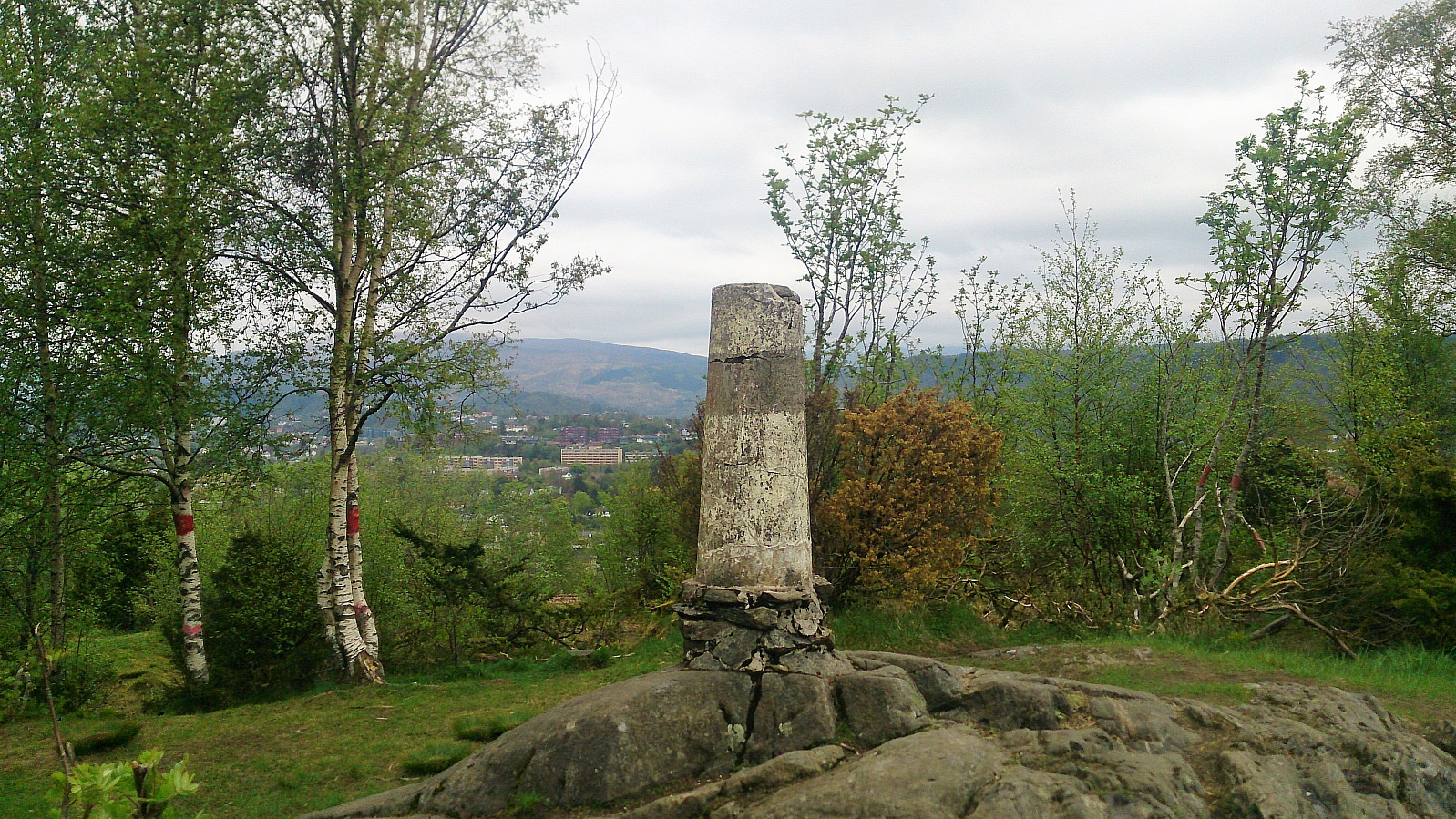
Stendafjellet and Skeisåsen from Lagunen
- Datum:
- 07.05.2017
- Tourcharakter:
- Bergtour
- Tourlänge:
- 2:47h
- Entfernung:
- 9,8km
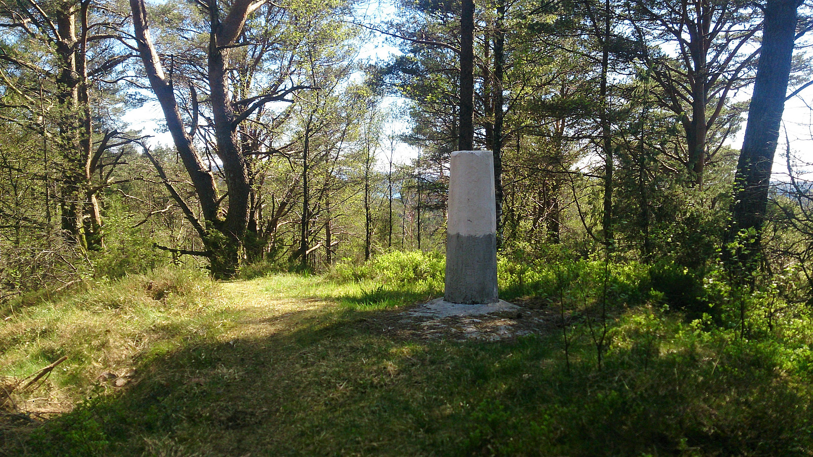 Started by taking Bybanen to Lagunen and walking southeast to Øvre Krohnåsen, following the road and later gravel road towards the summit of Stendafjellet . When getting close to the summit I started looking for trails to the west and found one that took me to a trig marker north of the summit (see picture). I then followed the same trail south, assuming it would take me to the summit. However, I thought I would pass by both summits of Stendafjellet, and therefore left the trail to hunt for the northern summit. This turned out to be in the middle of a quite dense forest with no views and, in my opinion, not really worth a visit. I therefore quickly moved on to the southern summit, which was a lot nicer and had much better views, particularly southwest across Fanafjorden.
From the summit of Stendafjellet >>>
Started by taking Bybanen to Lagunen and walking southeast to Øvre Krohnåsen, following the road and later gravel road towards the summit of Stendafjellet . When getting close to the summit I started looking for trails to the west and found one that took me to a trig marker north of the summit (see picture). I then followed the same trail south, assuming it would take me to the summit. However, I thought I would pass by both summits of Stendafjellet, and therefore left the trail to hunt for the northern summit. This turned out to be in the middle of a quite dense forest with no views and, in my opinion, not really worth a visit. I therefore quickly moved on to the southern summit, which was a lot nicer and had much better views, particularly southwest across Fanafjorden.
From the summit of Stendafjellet >>>
