Archiv - Nach Datum
Archiv - Nach Aktivität
-
Andere Tour (3)
- Kayaking (3)
-
Fahrradtour (108)
- Fahrradtour Straße (83)
- Fahrradtour gemischt (25)
-
Fahrzeugtour (9)
- Autotour (9)
-
Fußtour (1782)
- Bergtour (1054)
- Jogging (1)
- Spaziergang (54)
- Wanderung (673)
-
Skitour (109)
- Langlauf (44)
- Tourenskilauf (65)
Gesammelte Listen
-
Voss ≥ 100m pf.
(96/98)
 97%
97% -
Opptur Hordaland
(143/159)
89%
-
Stasjoner på Bergensbanen
(31/40)
77%
-
Ulvik ≥ 100m pf.
(28/38)
73%
-
Hordaland ≥ 100m pf.
(613/863)
71%
-
Mjølfjell PF > 100m
(21/31)
67%
-
Jondal ≥ 100m pf.
(15/23)
65%
-
Sunnhordland PF >= 100m
(104/186)
55%
-
Dagsturhyttene i Vestland
(33/61)
54%
-
Hordaland: Hardanger PF>=100m
(186/359)
51%
-
Kvinnherad ≥ 100m pf.
(40/79)
50%
-
DNT-hytter i Hordaland
(22/45)
48%
-
Sogndal ≥ 100m pf.
(23/81)
28%
-
Vik i Sogn ≥ 100m pf.
(8/46)
17%
-
DNT-hytter i Sogn og Fjordane
(8/47)
17%
-
Eidfjord ≥ 100m pf.
(7/42)
16%
-
Etne ≥ 100m pf.
(7/51)
13%
-
Ullensvang ≥ 100m pf.
(21/153)
13%
-
Sogn - Sør for Sognefjorden PF>=100m
(17/159)
10%
-
Opptur i Sogn og Fjordane peaks
(17/177)
9%

Lønborg to Bryggen
- Datum:
- 16.11.2025
- Tourcharakter:
- Wanderung
- Tourlänge:
- 1:03h
- Entfernung:
- 5,9km
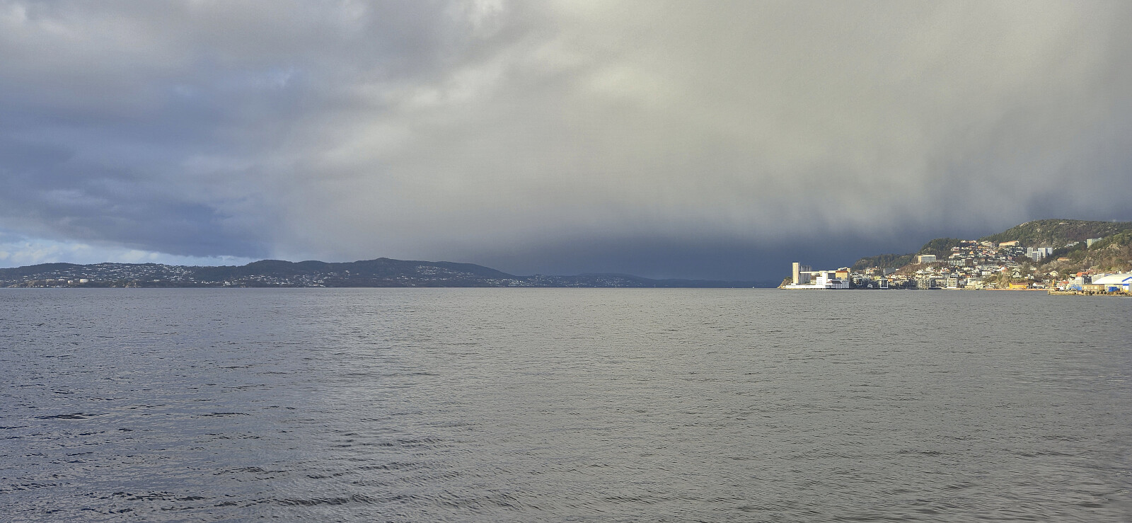 Short Sunday hike during an extended opening between the rain showers.
Klauvaneset to Støbotn via Tellevikafjellet
- Datum:
- 15.11.2025
- Tourcharakter:
- Bergtour
- Tourlänge:
- 2:32h
- Entfernung:
- 7,1km
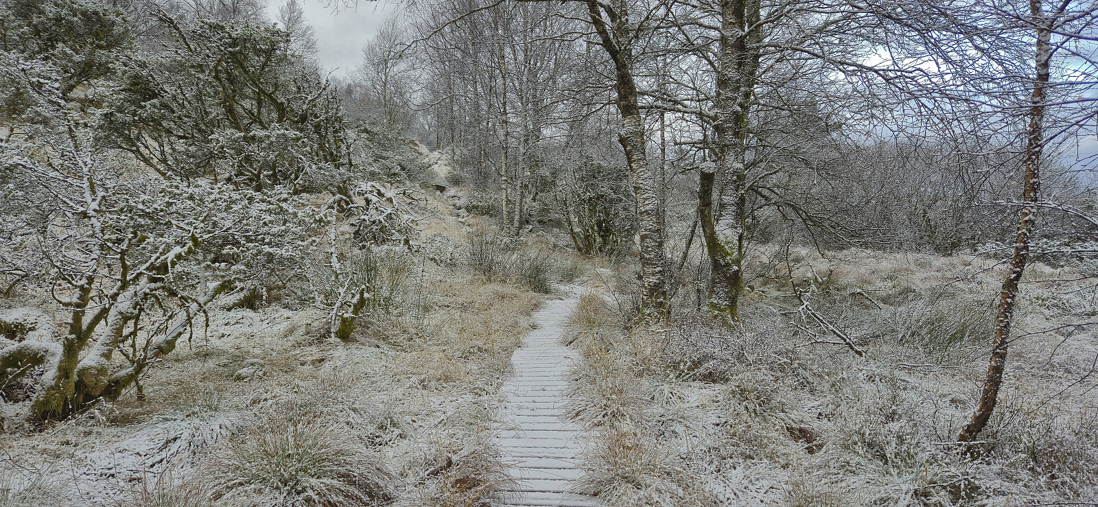 A revisit of Tellevikafjellet via a trail from the north and ending up at Støbotn. The hike started with snow showers and ended with rain.
Olsokfjellet and Damsgårdsfjellet
- Datum:
- 14.11.2025
- Tourcharakter:
- Bergtour
- Tourlänge:
- 2:42h
- Entfernung:
- 7,1km
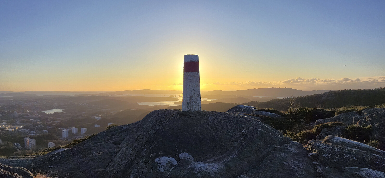 Short afternoon hike with some of my colleagues.
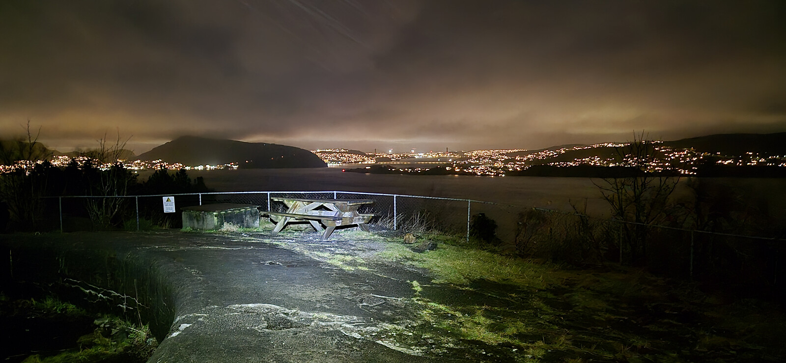
Ørneberget NV and Furukammen
- Datum:
- 13.11.2025
- Tourcharakter:
- Wanderung
- Tourlänge:
- 1:11h
- Entfernung:
- 4,1km
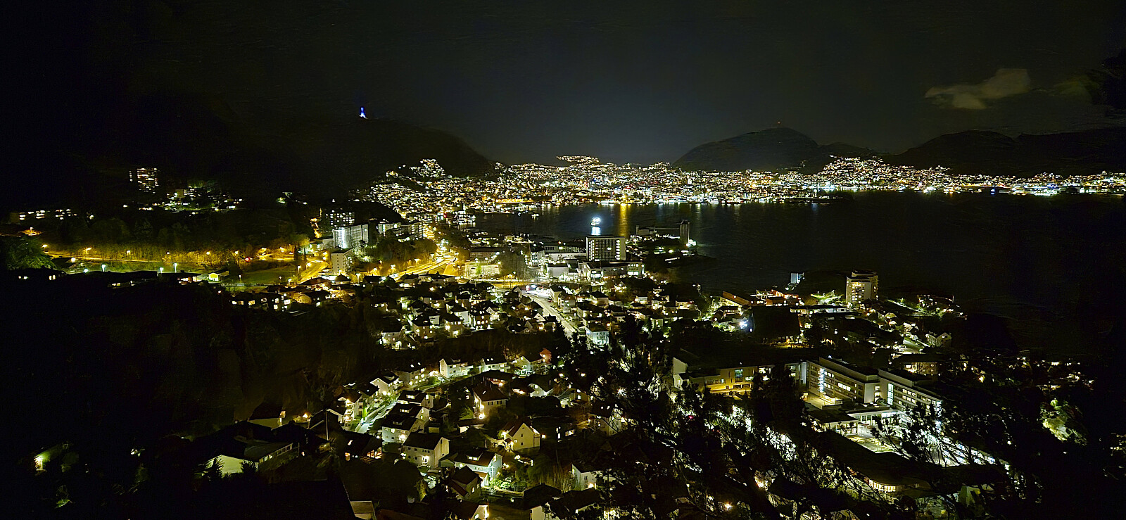 Late local evening hike to see if I could spot the northern lights. No luck, even though the conditions should have been pretty good.
Across Hellen festning
- Datum:
- 09.11.2025
- Tourcharakter:
- Wanderung
- Tourlänge:
- 0:39h
- Entfernung:
- 3,2km
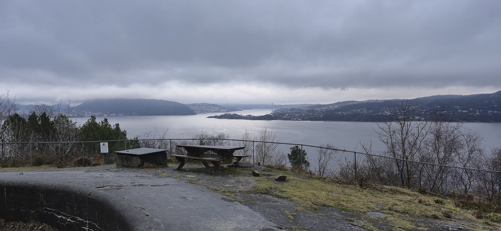 Short local hike on a gray Sunday.
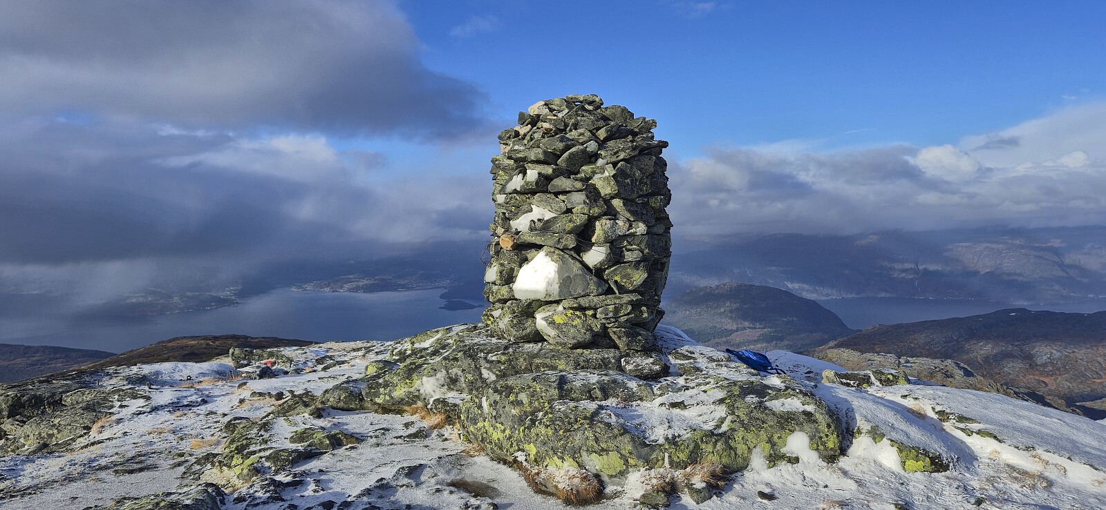
Bunuten and Vatnasetenuten
- Datum:
- 08.11.2025
- Tourcharakter:
- Bergtour
- Tourlänge:
- 7:32h
- Entfernung:
- 22,2km
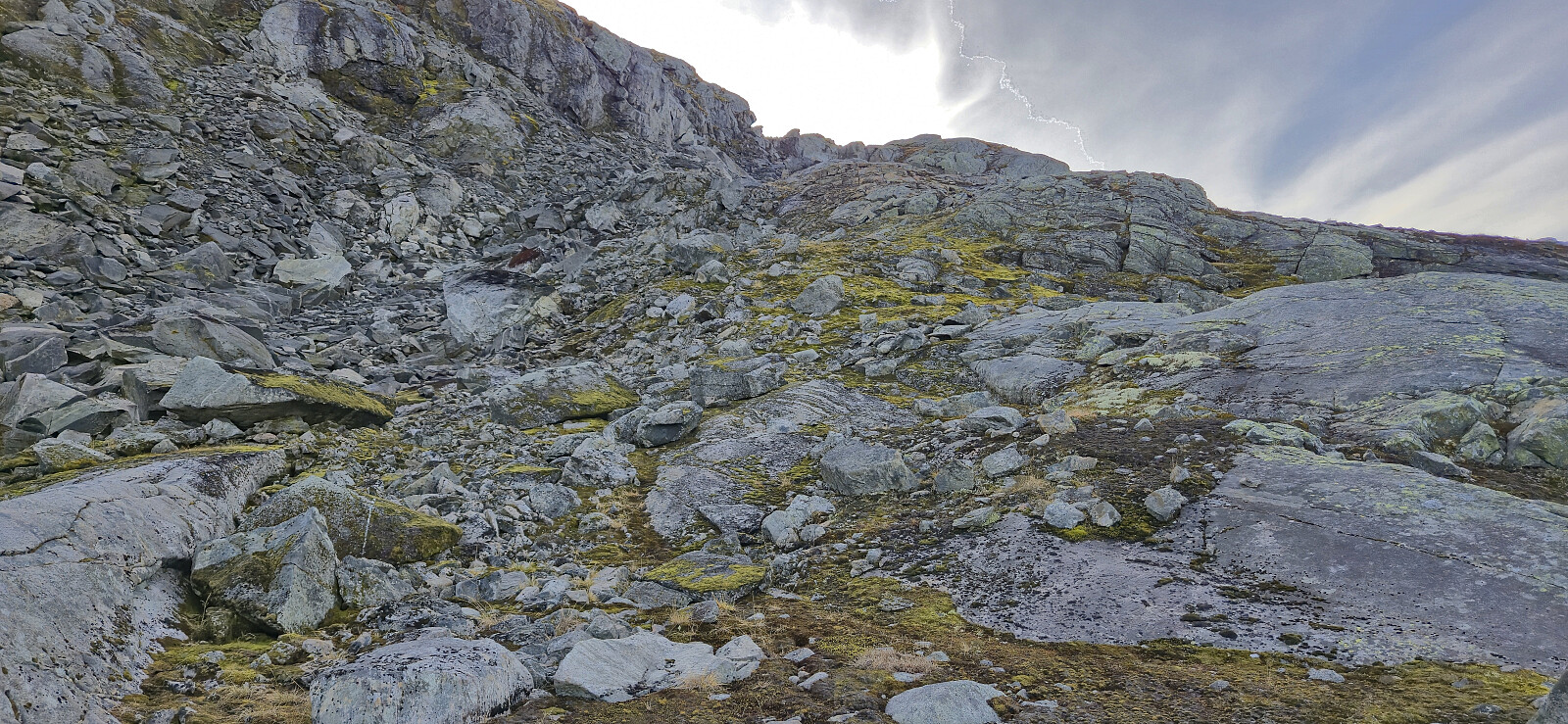 I started by taking an early train from Bergen to Voss and then the bus to Bu terminal just south of Hardangerbroen. Here I could have switched to a connecting bus heading towards Eidfjord, but I did not think of this until it was too late, and in any case it would only have saved me around 1 km along the paved road.
After a short walk east on the separate cycling and walking path, I left the main road and followed a smaller side road via Indre Bu to the start of a tractor road west of Bugjelet. When the tractor road came to an end at a small stream, I easily crossed to the other side and continued on an initially marked trail. The markers soon disappeared though, but the trail was still generally easy follow.
When getting close to the top of the pass, the trail split and I followed the option >>>
I started by taking an early train from Bergen to Voss and then the bus to Bu terminal just south of Hardangerbroen. Here I could have switched to a connecting bus heading towards Eidfjord, but I did not think of this until it was too late, and in any case it would only have saved me around 1 km along the paved road.
After a short walk east on the separate cycling and walking path, I left the main road and followed a smaller side road via Indre Bu to the start of a tractor road west of Bugjelet. When the tractor road came to an end at a small stream, I easily crossed to the other side and continued on an initially marked trail. The markers soon disappeared though, but the trail was still generally easy follow.
When getting close to the top of the pass, the trail split and I followed the option >>>
Across Hellen festning
- Datum:
- 04.11.2025
- Tourcharakter:
- Wanderung
- Tourlänge:
- 0:39h
- Entfernung:
- 3,2km
 Short local evening hike.
Fossen Bratte
- Datum:
- 02.11.2025
- Tourcharakter:
- Spaziergang
- Tourlänge:
- 0:36h
- Entfernung:
- 1,1km
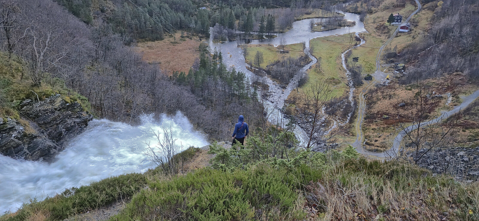 On the way home from our hike to Jonstein , Endre and I made a quick stop to have a closer look at Fossen Bratte .
Jonstein roundtrip from Bottsvatnet
- Datum:
- 02.11.2025
- Tourcharakter:
- Bergtour
- Tourlänge:
- 3:26h
- Entfernung:
- 8,1km
 Endre and I tried to make the most out of a window of nicer weather east of Bergen and decided on Jonstein as our goal. After the drive to Tørvikbygd and the ferry to Jondal we continued up Folgefonnvegen before following the smaller gravel road to the parking lot at Bottsvatnet (or Botsvatn as used on the information poster).
We had considered to also include an ascent of Saksaklepp , but this could already be ruled out given that the road to the glacier was closed for the winter immediately after our exit to Bottsvatnet. After passing a locked barrier we proceeded along the gravel road to Skarvabotnen. Here the road turned into a marked trail that could be easily followed all the way to the summit, with the only challenging being the occasional patches of ice.
Due to low-hanging clouds and a light snow shower, the >>>
Endre and I tried to make the most out of a window of nicer weather east of Bergen and decided on Jonstein as our goal. After the drive to Tørvikbygd and the ferry to Jondal we continued up Folgefonnvegen before following the smaller gravel road to the parking lot at Bottsvatnet (or Botsvatn as used on the information poster).
We had considered to also include an ascent of Saksaklepp , but this could already be ruled out given that the road to the glacier was closed for the winter immediately after our exit to Bottsvatnet. After passing a locked barrier we proceeded along the gravel road to Skarvabotnen. Here the road turned into a marked trail that could be easily followed all the way to the summit, with the only challenging being the occasional patches of ice.
Due to low-hanging clouds and a light snow shower, the >>>
Oppstemten
- Datum:
- 30.10.2025
- Tourcharakter:
- Bergtour
- Tourlänge:
- 1:32h
- Entfernung:
- 5,0km
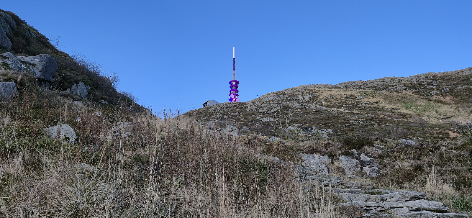 Short hike up Oppstemten with a colleague before heading home from work.
