Archive - Date
Archive - Activity
-
Bike trip (108)
- Bike trip - mixed (25)
- Bike trip - road (83)
-
Drive (9)
- Car drive (9)
-
Other trip (3)
- Kayaking (3)
-
Ski trip (109)
- Backcountry skiing (65)
- Cross-country skiing (44)
- Trip by foot (1782)
Collected lists
-
Voss ≥ 100m pf.
(96/98)
 97%
97% -
Opptur Hordaland
(143/159)
89%
-
Stasjoner på Bergensbanen
(31/40)
77%
-
Ulvik ≥ 100m pf.
(28/38)
73%
-
Hordaland ≥ 100m pf.
(613/863)
71%
-
Mjølfjell PF > 100m
(21/31)
67%
-
Jondal ≥ 100m pf.
(15/23)
65%
-
Sunnhordland PF >= 100m
(104/186)
55%
-
Dagsturhyttene i Vestland
(33/61)
54%
-
Hordaland: Hardanger PF>=100m
(186/359)
51%
-
Kvinnherad ≥ 100m pf.
(40/79)
50%
-
DNT-hytter i Hordaland
(22/45)
48%
-
Sogndal ≥ 100m pf.
(23/81)
28%
-
Vik i Sogn ≥ 100m pf.
(8/46)
17%
-
DNT-hytter i Sogn og Fjordane
(8/47)
17%
-
Eidfjord ≥ 100m pf.
(7/42)
16%
-
Etne ≥ 100m pf.
(7/51)
13%
-
Ullensvang ≥ 100m pf.
(21/153)
13%
-
Sogn - Sør for Sognefjorden PF>=100m
(17/159)
10%
-
Opptur i Sogn og Fjordane peaks
(17/177)
9%

Kattnakken, Mehammarsåto and Grønafjellet
- Date:
- 17.10.2021
- Characteristic:
- Hillwalk
- Duration:
- 6:39h
- Distance:
- 22.3km
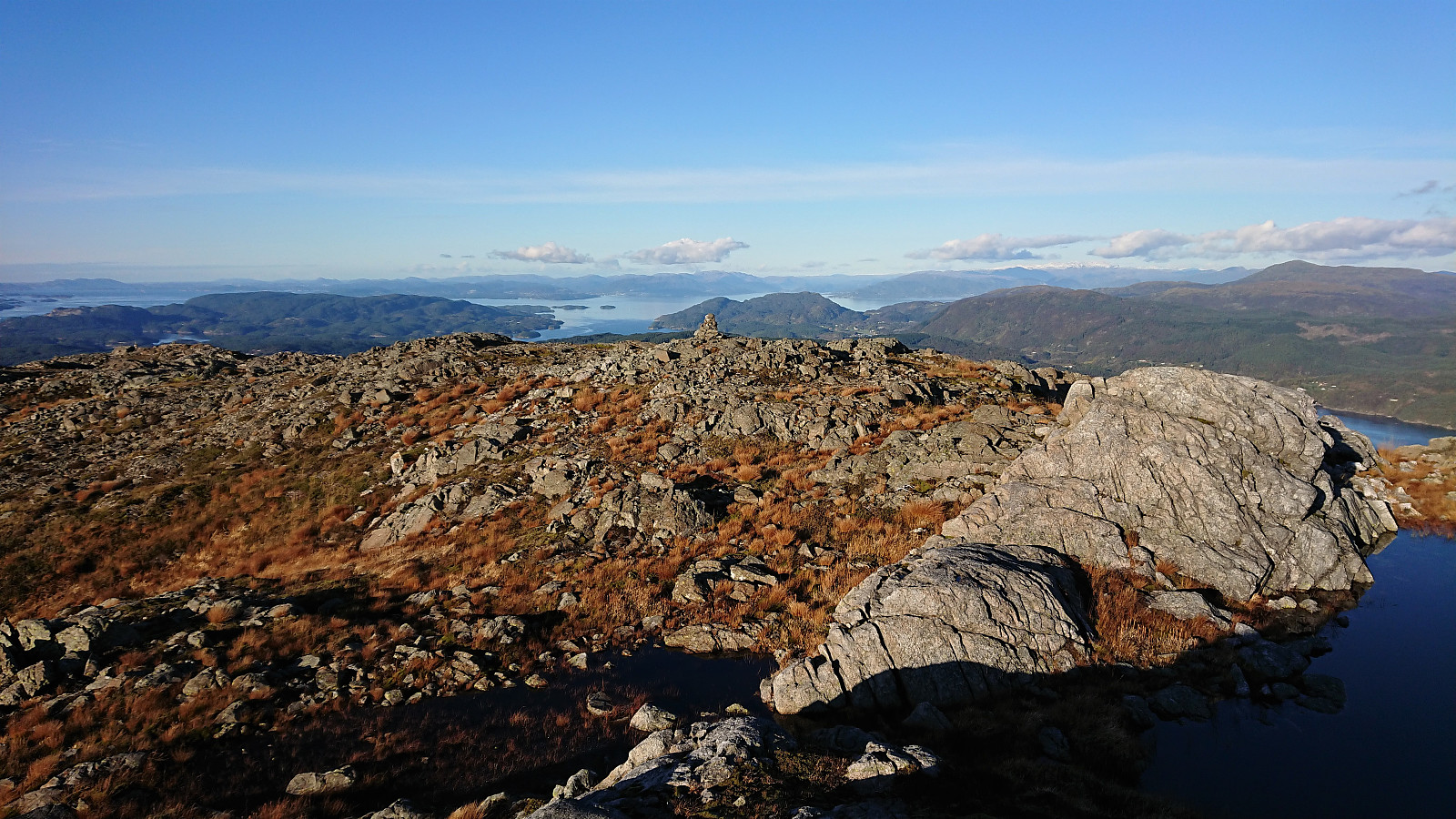 I started by taking the express bus to Stord and getting off at the bus stop called Børtveit (Bortveit on the map). I then proceeded to follow the gravel road up to Svartavatnet where I inspected the map and found a possible shortcut to Kattnakken from the northeast. The plan was to continue southeast along the trail starting from north of Svartavatnet and then follow the overhanging power lines towards the summit. However, I initially missed the trailhead and continued a bit too far on the gravel road. But after an off-trail shortcut I managed to connect with the trail, which was even marked with occasional red markers and I even spotted a red T. It did not seem like a very heavily used trail though.
Shortly after passing underneath the power lines I turned southwest and headed off-trail in the direction >>>
I started by taking the express bus to Stord and getting off at the bus stop called Børtveit (Bortveit on the map). I then proceeded to follow the gravel road up to Svartavatnet where I inspected the map and found a possible shortcut to Kattnakken from the northeast. The plan was to continue southeast along the trail starting from north of Svartavatnet and then follow the overhanging power lines towards the summit. However, I initially missed the trailhead and continued a bit too far on the gravel road. But after an off-trail shortcut I managed to connect with the trail, which was even marked with occasional red markers and I even spotted a red T. It did not seem like a very heavily used trail though.
Shortly after passing underneath the power lines I turned southwest and headed off-trail in the direction >>>
Ørneberget and Furukammen
- Date:
- 12.10.2021
- Characteristic:
- Hillwalk
- Duration:
- 0:49h
- Distance:
- 3.9km
 Short local hike just before sunset.
Tofjellet from Straume
- Date:
- 09.10.2021
- Characteristic:
- Hillwalk
- Duration:
- 5:49h
- Distance:
- 16.2km
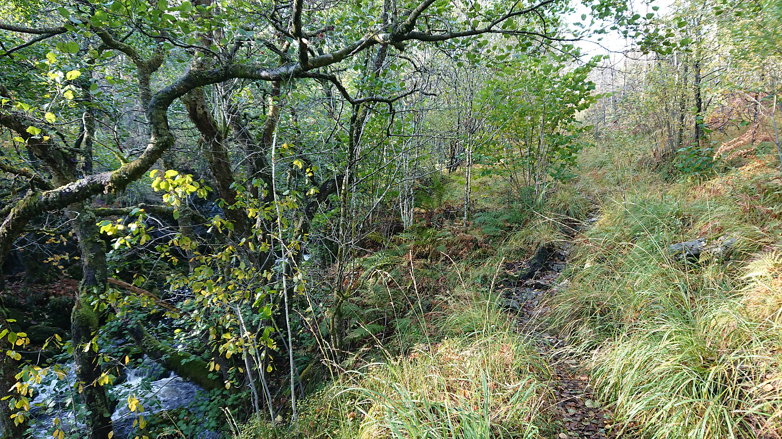
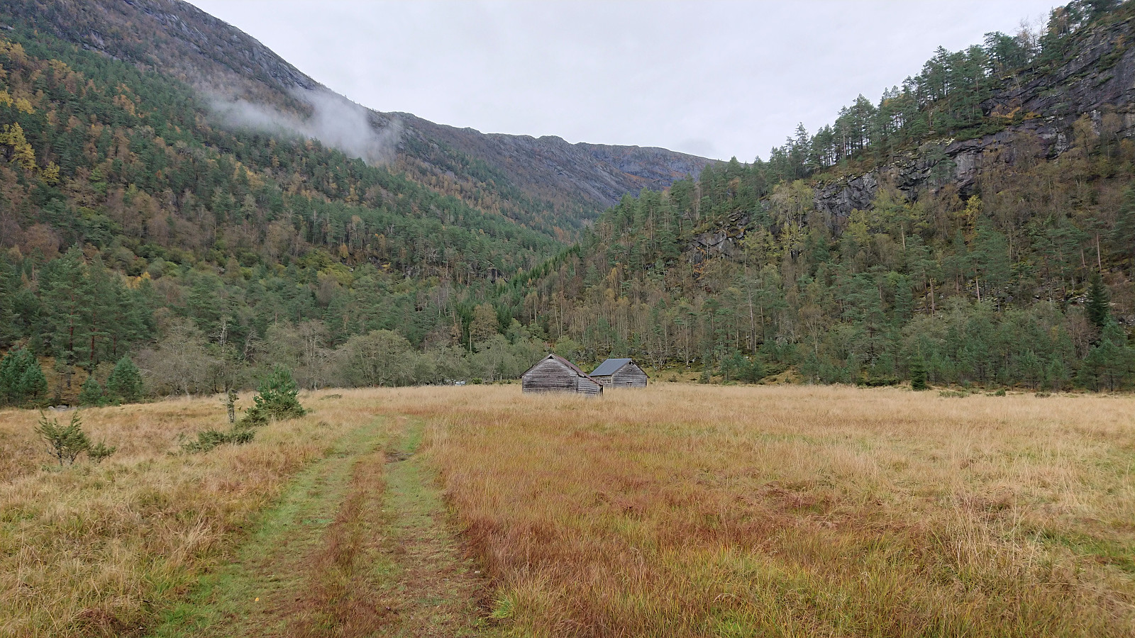 After a detailed study of the weather forecast combined with a search for possible peaks that could be visited in between the seemingly constant string of rain storms, I settled on Tofjellet and took the early morning train to Dale and the connecting bus to Straume. Armed with arntfla (Arnt Flatmo) 's external trip report I started up the tractor road to Nesatræet . Here I decided to try the trail passing by two of the remaining buildings and from there closely following the river on the way to Straumsstølen . The trail was overall easy to follow, but relatively wet at times.
The trail soon merged with the tractor road and within not too long I arrived at Straumsstølen. Or rather, almost at Straumsstølen. There was the small matter of crossing the river. At first I thought I would have to wade across, as the bridge seemed to be missing. However, I thankfully looked >>>
After a detailed study of the weather forecast combined with a search for possible peaks that could be visited in between the seemingly constant string of rain storms, I settled on Tofjellet and took the early morning train to Dale and the connecting bus to Straume. Armed with arntfla (Arnt Flatmo) 's external trip report I started up the tractor road to Nesatræet . Here I decided to try the trail passing by two of the remaining buildings and from there closely following the river on the way to Straumsstølen . The trail was overall easy to follow, but relatively wet at times.
The trail soon merged with the tractor road and within not too long I arrived at Straumsstølen. Or rather, almost at Straumsstølen. There was the small matter of crossing the river. At first I thought I would have to wade across, as the bridge seemed to be missing. However, I thankfully looked >>>
Nedstaheia, Haukheia and Storenuvarden
- Date:
- 02.10.2021
- Characteristic:
- Hillwalk
- Duration:
- 2:29h
- Distance:
- 9.0km
 Ever since my abandoned attempt at ascending Nedstaheia a couple of months earlier, I had been thinking about having another go. This time I did not come by bike though, rather by bus, and the hike therefore started from Arna terminal, from where I followed the river south towards the unmarked trailhead south of Nedstaheia . I thus easily returned to where the map indicates a trail heading towards Nedstaheia, and where my last attempt was abandoned.
As expected, the trail was not easier to see today either, but I am pretty sure there must have been a trail here at some point, perhaps it is just not being used anymore. There were however some weak traces that could be followed and overall it was in the end straightforward to reach the summit, which provided good views in all directions. From the summit, I continued north, partly following a weak >>>
Ever since my abandoned attempt at ascending Nedstaheia a couple of months earlier, I had been thinking about having another go. This time I did not come by bike though, rather by bus, and the hike therefore started from Arna terminal, from where I followed the river south towards the unmarked trailhead south of Nedstaheia . I thus easily returned to where the map indicates a trail heading towards Nedstaheia, and where my last attempt was abandoned.
As expected, the trail was not easier to see today either, but I am pretty sure there must have been a trail here at some point, perhaps it is just not being used anymore. There were however some weak traces that could be followed and overall it was in the end straightforward to reach the summit, which provided good views in all directions. From the summit, I continued north, partly following a weak >>>
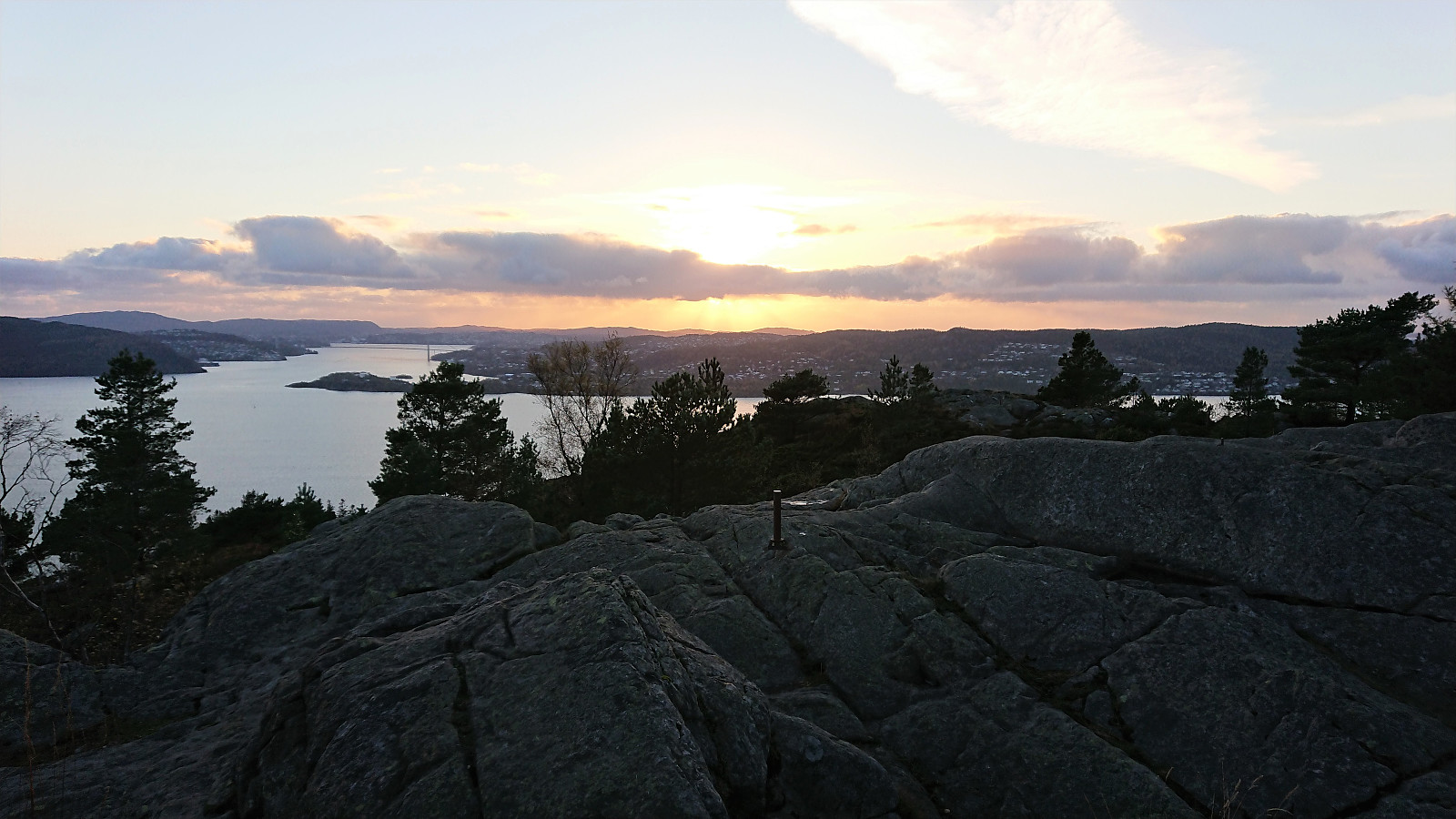
Ørneberget and Hellen festning
- Date:
- 29.09.2021
- Characteristic:
- Hillwalk
- Duration:
- 0:56h
- Distance:
- 4.2km
 Short local evening hike after work.
Orretua and Emanuel Mohns utsikt
- Date:
- 26.09.2021
- Characteristic:
- Hillwalk
- Duration:
- 2:42h
- Distance:
- 7.7km
 Local hike in familiar terrain.
Vesoldo and Slåttenuten - from Tørvik to Norheimsund
- Date:
- 25.09.2021
- Characteristic:
- Hillwalk
- Duration:
- 6:31h
- Distance:
- 22.4km
 I started by taking the bus to Tørvik and getting off at the bus stop called "Heradstveit kryss". At the initial crossroads there were hiking signs pointing in both directions. I went for the southern option, passing through Tørvik and Tveiten, before following a toll road to the parking lot at Perslå . I briefly considered heading southwest to Tveitestølen to ascend Tørvikenuten from the south. But while there was a trail indicated on the map, the hiking information sign at Perslå did not mention this option at all. Not wanting to risk spending most of the ascent searching for a potentially weak trail, I instead went for the safe option and followed the marked trail via Osadal.
The tractor road continued all the way to Finnhellersvatnet, though it looked more like a trail than a road towards the end. From >>>
I started by taking the bus to Tørvik and getting off at the bus stop called "Heradstveit kryss". At the initial crossroads there were hiking signs pointing in both directions. I went for the southern option, passing through Tørvik and Tveiten, before following a toll road to the parking lot at Perslå . I briefly considered heading southwest to Tveitestølen to ascend Tørvikenuten from the south. But while there was a trail indicated on the map, the hiking information sign at Perslå did not mention this option at all. Not wanting to risk spending most of the ascent searching for a potentially weak trail, I instead went for the safe option and followed the marked trail via Osadal.
The tractor road continued all the way to Finnhellersvatnet, though it looked more like a trail than a road towards the end. From >>>
Vedasnerta and Nessteinen from Nes/Mundheimsvegen
- Date:
- 18.09.2021
- Characteristic:
- Hillwalk
- Duration:
- 6:17h
- Distance:
- 18.9km
 Since my trip to Vågenipen and Lukefjellet two weeks earlier , I had wanted to get a closer look at Vedasnerta and Nessteinen on the opposite side of Mundheimsdalen, as they both looked quite dramatic from a distance. When researching how to best visit both summits, I came across a route description at ut.no that looked very promising as it indicated a marked trail all the way to the summit of Nessteinen: https://ut.no/turforslag/119653/nessteinen . The suggestion did not mention Vedasnerta at all, but I assumed that the short off-trail ascent from Vatnadalsvatnet (in the valley between Nessteinen and Vedasnerta) would not be too difficult.
I started by taking the bus from Bergen to Mundheim. Here I switched to a connecting bus heading for Norheimsund, which I only stayed on for two stops before getting off at the bus stop called Teigland right next to the start of the tractor road indicated on the route at >>>
Since my trip to Vågenipen and Lukefjellet two weeks earlier , I had wanted to get a closer look at Vedasnerta and Nessteinen on the opposite side of Mundheimsdalen, as they both looked quite dramatic from a distance. When researching how to best visit both summits, I came across a route description at ut.no that looked very promising as it indicated a marked trail all the way to the summit of Nessteinen: https://ut.no/turforslag/119653/nessteinen . The suggestion did not mention Vedasnerta at all, but I assumed that the short off-trail ascent from Vatnadalsvatnet (in the valley between Nessteinen and Vedasnerta) would not be too difficult.
I started by taking the bus from Bergen to Mundheim. Here I switched to a connecting bus heading for Norheimsund, which I only stayed on for two stops before getting off at the bus stop called Teigland right next to the start of the tractor road indicated on the route at >>>
Heinakken and Kjerringefjellet
- Date:
- 12.09.2021
- Characteristic:
- Hillwalk
- Duration:
- 2:50h
- Distance:
- 7.4km
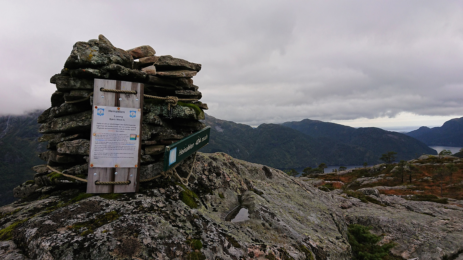 After our failure at obtaining any views at all from Matrenipa , me and Fjellsamleren (Endre Myrdal Olsen) did not give up, got back in the car, and drove to the valley in between Heinakken and Kjerringefjellet . Here we found parking on the side of the road, right next to the marked trailhead for Heinakken, and proceeded to follow the marked trail (quite wet at times, but otherwise easy to follow) all the way to the large cairn south of the summit, were we finally escaped the fog and were rewarded by excellent panoramic views across Masfjorden.
From the large cairn we shortly retraced out steps before making the final ascent to the summit of Heinakken from the southeast. No trails to the summit, but reaching it did not provide any difficulties. Great views from the summit as well, but if visiting Heinakken it is clearly recommended to also make the short detour >>>
After our failure at obtaining any views at all from Matrenipa , me and Fjellsamleren (Endre Myrdal Olsen) did not give up, got back in the car, and drove to the valley in between Heinakken and Kjerringefjellet . Here we found parking on the side of the road, right next to the marked trailhead for Heinakken, and proceeded to follow the marked trail (quite wet at times, but otherwise easy to follow) all the way to the large cairn south of the summit, were we finally escaped the fog and were rewarded by excellent panoramic views across Masfjorden.
From the large cairn we shortly retraced out steps before making the final ascent to the summit of Heinakken from the southeast. No trails to the summit, but reaching it did not provide any difficulties. Great views from the summit as well, but if visiting Heinakken it is clearly recommended to also make the short detour >>>
Matrenipa
- Date:
- 12.09.2021
- Characteristic:
- Hillwalk
- Duration:
- 1:38h
- Distance:
- 3.9km
 On the drive home to Bergen from our day of wet hikes with no views in Masfjorden (see Kyrkjehovda , Vardegga from Fossåskaret , Snaueggi - an unplanned roundtrip and Ølveshovda ) me and Fjellsamleren (Endre Myrdal Olsen) could not help but note the excellent weather forecasts for the next day, i.e. warm and sunny, and thus agreed to have another joint hike, with the hope that maybe we could actually see something from one of the summits this time around.
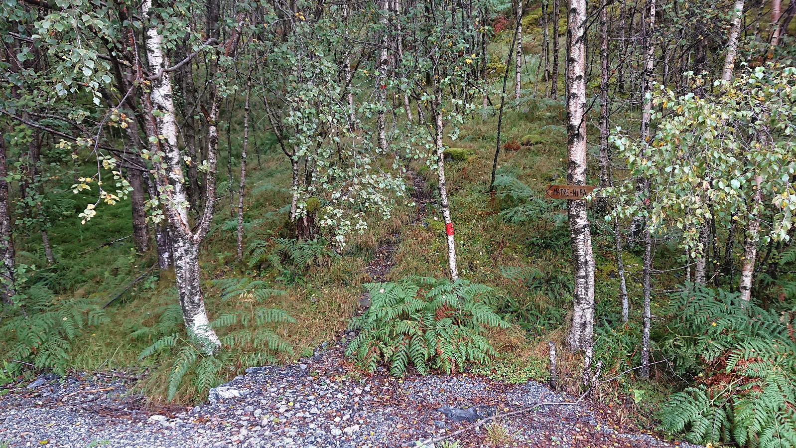
We decided on three summits in Masfjorden and met up the next day for the drive to Matre and the parking lot west of Matrenipa . On the drive there we however could not help but notice that, except for it not raining, the weather looked very similar to the day before with the now familiar fog hiding most of the mountain tops. Hopefully that today it would at least partly clear up we started on the marked trail to Matrenipa.
The trail was very wet but overall easy to follow and we >>>
On the drive home to Bergen from our day of wet hikes with no views in Masfjorden (see Kyrkjehovda , Vardegga from Fossåskaret , Snaueggi - an unplanned roundtrip and Ølveshovda ) me and Fjellsamleren (Endre Myrdal Olsen) could not help but note the excellent weather forecasts for the next day, i.e. warm and sunny, and thus agreed to have another joint hike, with the hope that maybe we could actually see something from one of the summits this time around.
We decided on three summits in Masfjorden and met up the next day for the drive to Matre and the parking lot west of Matrenipa . On the drive there we however could not help but notice that, except for it not raining, the weather looked very similar to the day before with the now familiar fog hiding most of the mountain tops. Hopefully that today it would at least partly clear up we started on the marked trail to Matrenipa.
The trail was very wet but overall easy to follow and we >>>
