Arkiv - dato
Arkiv - aktivitet
-
Annen tur (3)
- Kajakkpadling (3)
- Fottur (1782)
-
Kjøretur (9)
- Biltur (9)
-
Skitur (109)
- Fjellskitur (65)
- Langrennstur (44)
-
Sykkeltur (108)
- Blandet sykling (25)
- Gatesykling (83)
Lister jeg samler etter
-
Voss ≥ 100m pf.
(96/98)
 97%
97% -
Opptur Hordaland
(143/159)
89%
-
Stasjoner på Bergensbanen
(31/40)
77%
-
Ulvik ≥ 100m pf.
(28/38)
73%
-
Hordaland ≥ 100m pf.
(613/863)
71%
-
Mjølfjell PF > 100m
(21/31)
67%
-
Jondal ≥ 100m pf.
(15/23)
65%
-
Sunnhordland PF >= 100m
(104/186)
55%
-
Dagsturhyttene i Vestland
(33/61)
54%
-
Hordaland: Hardanger PF>=100m
(186/359)
51%
-
Kvinnherad ≥ 100m pf.
(40/79)
50%
-
DNT-hytter i Hordaland
(22/45)
48%
-
Sogndal ≥ 100m pf.
(23/81)
28%
-
Vik i Sogn ≥ 100m pf.
(8/46)
17%
-
DNT-hytter i Sogn og Fjordane
(8/47)
17%
-
Eidfjord ≥ 100m pf.
(7/42)
16%
-
Etne ≥ 100m pf.
(7/51)
13%
-
Ullensvang ≥ 100m pf.
(21/153)
13%
-
Sogn - Sør for Sognefjorden PF>=100m
(17/159)
10%
-
Opptur-topper i Sogn og Fjordane
(17/177)
9%

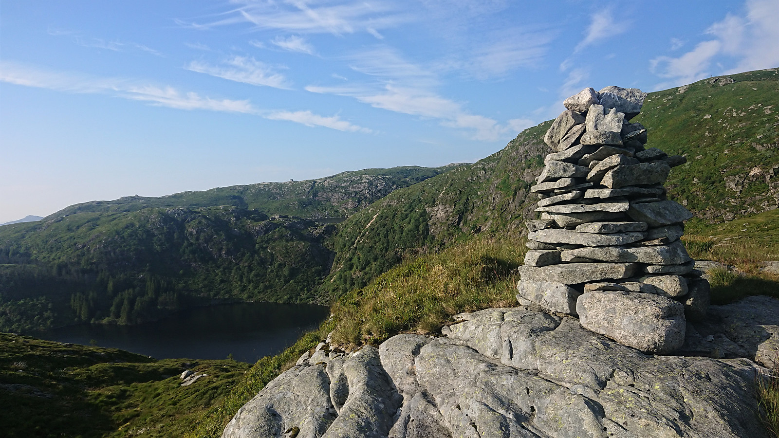
Furefjellet from Åreiddalen/Finnåsvatnet
- Dato:
- 21.07.2021
- Turtype:
- Fjelltur
- Turlengde:
- 0:41t
- Distanse:
- 2,0km
 After descending from Siggjo (see separate trip report here ), I cycled about 300 meters north to the unmarked trailhead for Furefjellet . Here I again left the bike behind and continued on foot along a rough tractor road, i.e. bringing the bike was clearly not an option.
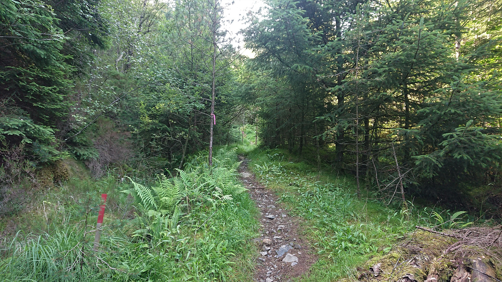
After twice crossing an electric fence set up to keep the cows from wandering off, I easily located the marked trail for Furefjellet where it departed from the tractor road. The trail was marked with the now familiar wooden sticks tipped with red paint and also the pink ribbons. In fact, the markers had been there all the way from when the first crossing of the electric fence.
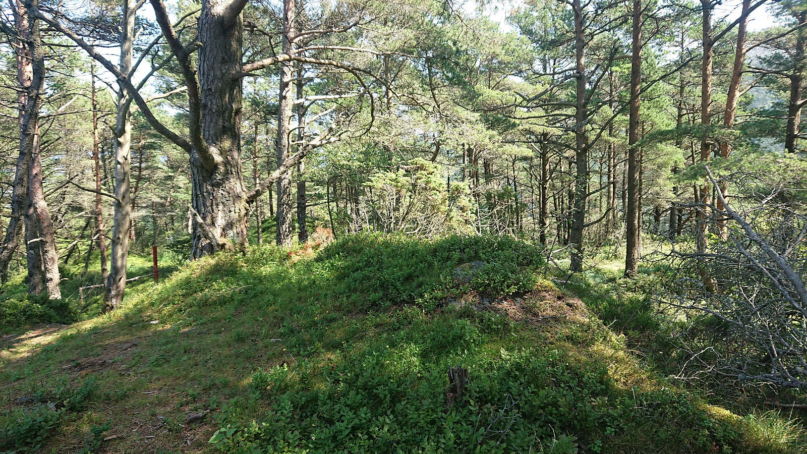
While the low vegetation was partially hiding the trail at times, it was overall easy to follow and made it straightforward to reach the summit. The summit itself was not marked, although I did discover >>>
After descending from Siggjo (see separate trip report here ), I cycled about 300 meters north to the unmarked trailhead for Furefjellet . Here I again left the bike behind and continued on foot along a rough tractor road, i.e. bringing the bike was clearly not an option.
After twice crossing an electric fence set up to keep the cows from wandering off, I easily located the marked trail for Furefjellet where it departed from the tractor road. The trail was marked with the now familiar wooden sticks tipped with red paint and also the pink ribbons. In fact, the markers had been there all the way from when the first crossing of the electric fence.
While the low vegetation was partially hiding the trail at times, it was overall easy to follow and made it straightforward to reach the summit. The summit itself was not marked, although I did discover >>>
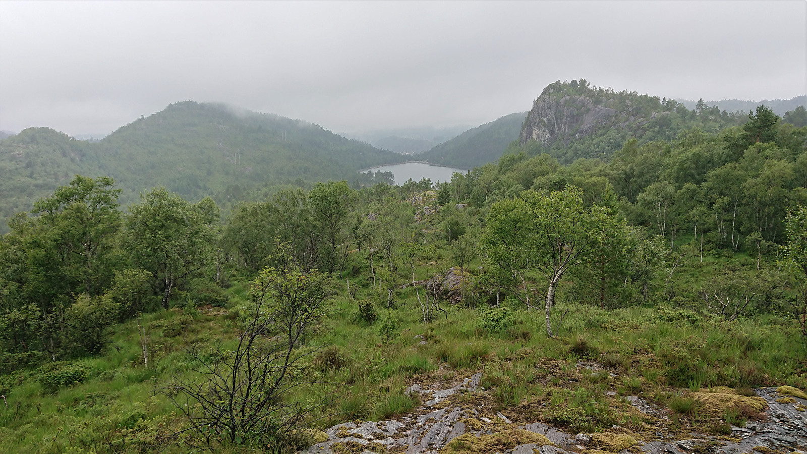
Siggjo from Åreiddalen/Finnåsvatnet
- Dato:
- 21.07.2021
- Turtype:
- Fjelltur
- Turlengde:
- 2:15t
- Distanse:
- 5,8km
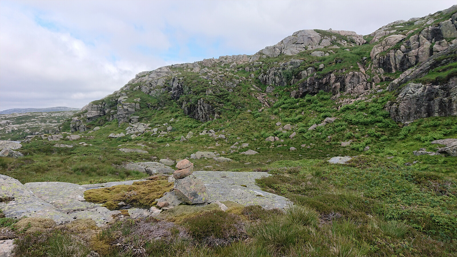
 After cycling from Rubbestadneset to the unmarked trailhead for Siggjo in the valley between Siggjo and Furefjellet , I left the bike behind and continued towards the summit on foot following a trail marked with wooden sticks tipped with red paint. (At the start the trail was also marked with pink ribbons, but these soon departed from the main trail, and the one indicated on the map, and I continued following the wooden sticks.)
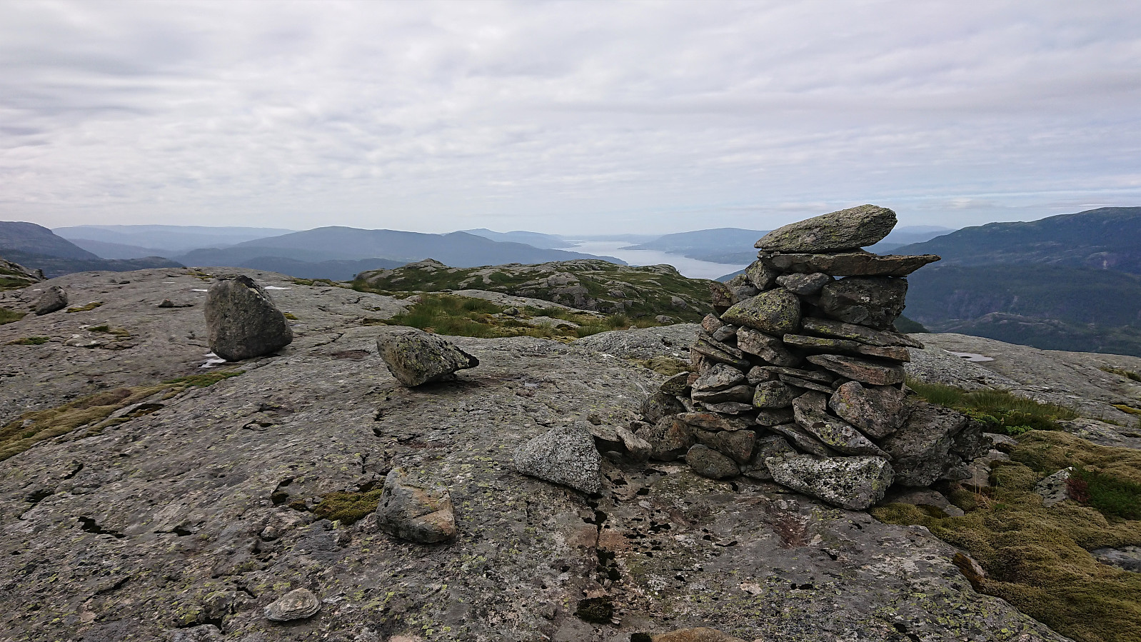
The trail was easy to follow as it winded its way up to the summit, which was therefore reached without any difficulties. Especially the last part was very nice, i.e. when getting above the tree line with the views greatly improving. As expected, the panoramic view from the summit was spectacular with unobstructed views in all directions. After a short break, and lots of pictures, I descended along the same route.
After cycling from Rubbestadneset to the unmarked trailhead for Siggjo in the valley between Siggjo and Furefjellet , I left the bike behind and continued towards the summit on foot following a trail marked with wooden sticks tipped with red paint. (At the start the trail was also marked with pink ribbons, but these soon departed from the main trail, and the one indicated on the map, and I continued following the wooden sticks.)
The trail was easy to follow as it winded its way up to the summit, which was therefore reached without any difficulties. Especially the last part was very nice, i.e. when getting above the tree line with the views greatly improving. As expected, the panoramic view from the summit was spectacular with unobstructed views in all directions. After a short break, and lots of pictures, I descended along the same route.
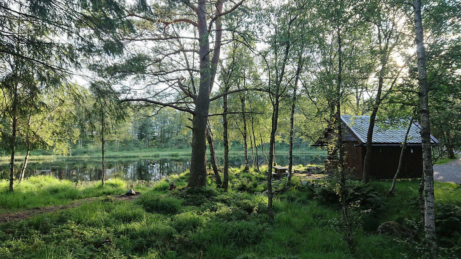
Båtevassfjellet from Einestranda
- Dato:
- 19.07.2021
- Turtype:
- Fjelltur
- Turlengde:
- 4:55t
- Distanse:
- 14,5km
 I started by taking the bus (or rather buses, four in total) to Einestranda. Here I managed to get off one stop too early. I think I can be excused by the fact that this particular stop, while having its own bus stop sign, does not appear in the list of bus stops at skyss.no. In any case, it was only a short 250 meters walk to the correct stop.
Next, the unmarked trailhead for Båtevassfjellet was easily located just before crossing the river at Einestranda. The trail itself however was marked, and the first trail marker could be spotted from the trailhead. After a short detour following some trail markers on the north/west side of the river, I retraced my steps and crossed the river via a concrete bridge, and quickly picked up the trail markers on the other side. From there on the trail was overall easy to >>>
I started by taking the bus (or rather buses, four in total) to Einestranda. Here I managed to get off one stop too early. I think I can be excused by the fact that this particular stop, while having its own bus stop sign, does not appear in the list of bus stops at skyss.no. In any case, it was only a short 250 meters walk to the correct stop.
Next, the unmarked trailhead for Båtevassfjellet was easily located just before crossing the river at Einestranda. The trail itself however was marked, and the first trail marker could be spotted from the trailhead. After a short detour following some trail markers on the north/west side of the river, I retraced my steps and crossed the river via a concrete bridge, and quickly picked up the trail markers on the other side. From there on the trail was overall easy to >>>
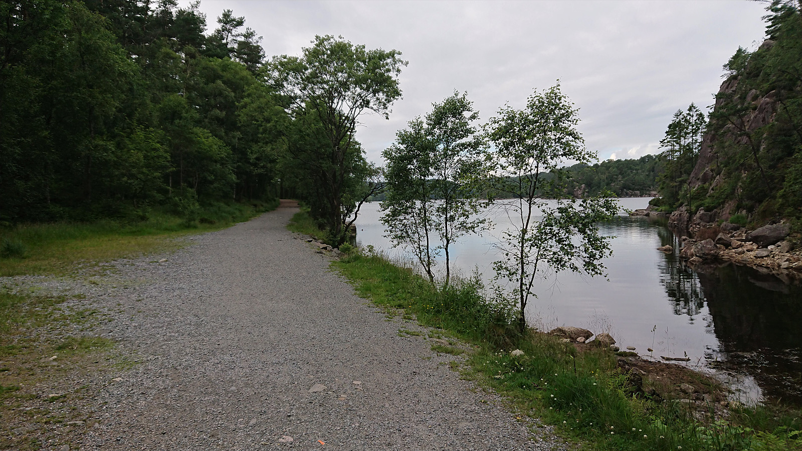
Vestrefjellet and Snjonipa roundtrip from Tyssebotn
- Dato:
- 16.07.2021
- Turtype:
- Fjelltur
- Turlengde:
- 8:22t
- Distanse:
- 24,5km
 I started by taking the first bus to Tyssebotn on a Friday morning, where I was the only passenger on both the bus and the ferry from Breistein to Valestrand. From Tyssebotn, I walked along the road to the trailhead for Gammersvik south of Kleiveland. I proceeded to follow this unmarked but easy to follow trail to Vaultjørna. After a quick visit to Vaulelvbrua to check that both it and the trail on the other side was there and of ok quality (as it would be quite important when later returning along that route), I backtracked about 100 meters to a trail/deer track I had noticed just after crossing the small stream north of Vaultjørna.
By following this track, I easily ascended the initial steep section on my way northeast towards Vestrefjellet . The track however soon more or less disappeared, and I was left making >>>
I started by taking the first bus to Tyssebotn on a Friday morning, where I was the only passenger on both the bus and the ferry from Breistein to Valestrand. From Tyssebotn, I walked along the road to the trailhead for Gammersvik south of Kleiveland. I proceeded to follow this unmarked but easy to follow trail to Vaultjørna. After a quick visit to Vaulelvbrua to check that both it and the trail on the other side was there and of ok quality (as it would be quite important when later returning along that route), I backtracked about 100 meters to a trail/deer track I had noticed just after crossing the small stream north of Vaultjørna.
By following this track, I easily ascended the initial steep section on my way northeast towards Vestrefjellet . The track however soon more or less disappeared, and I was left making >>>
Ørneberget and Rognåsen
- Dato:
- 12.07.2021
- Turtype:
- Fjelltur
- Turlengde:
- 1:22t
- Distanse:
- 6,1km
 Local evening hike.
Four small hills south of Småvatnet and Storavatnet
- Dato:
- 11.07.2021
- Turtype:
- Fjelltur
- Turlengde:
- 2:31t
- Distanse:
- 8,5km
 On a hike with the main objective of visiting Grønabrekka , a recent addition to the Alle topper i Bergen list, I took the opportunity to explore the area south of Småvatnet and Storavatnet. This resulted in visiting three additional small hills, all with their own name, namely Myraskjena , Mathopsskjenet and Storhaugen , each now added as its own PB-element. To my surprise, all four summits, except for Storhaugen (which only required a very short off-trail detour), could be reached simply by following the many trails in the area, which were overall of good quality (even those not indicated on the map). This made for a much nicer hike than expected, despite the relatively limited views from most of the summits.
Update: two additional small hills that I happened to visited were later added (not by me) as their own PB-elements, namely N for Medhaugsflaten and NØ for Ytste Rotatjørna .
On a hike with the main objective of visiting Grønabrekka , a recent addition to the Alle topper i Bergen list, I took the opportunity to explore the area south of Småvatnet and Storavatnet. This resulted in visiting three additional small hills, all with their own name, namely Myraskjena , Mathopsskjenet and Storhaugen , each now added as its own PB-element. To my surprise, all four summits, except for Storhaugen (which only required a very short off-trail detour), could be reached simply by following the many trails in the area, which were overall of good quality (even those not indicated on the map). This made for a much nicer hike than expected, despite the relatively limited views from most of the summits.
Update: two additional small hills that I happened to visited were later added (not by me) as their own PB-elements, namely N for Medhaugsflaten and NØ for Ytste Rotatjørna .
Stemhaugen ved Liavatnet
- Dato:
- 08.07.2021
- Turtype:
- Fjelltur
- Turlengde:
- 0:59t
- Distanse:
- 3,8km
 Short and wet evening hike for a visit of Stemhaugen ved Liavatnet . While there perhaps are some weak trails/tracks, I mainly ended up finding my own way, and in any case the summit was reached without any difficulties. Nice views across Liavatnet, although I'm pretty sure most hikers will not really see the point of ascending this small hill. After descending, I also included a walk along Liavatnet.
Nord for Storhovden from Bjørndalsbakken
- Dato:
- 06.07.2021
- Turtype:
- Fjelltur
- Turlengde:
- 0:57t
- Distanse:
- 3,9km
 Short hike after work to visit Nord for Storhovden . After a short walk along the gravel road south of Tennebekktjørna, I turned south on an unmarked trail taking me dangerously close to the three-eyed monster of Kanadaskogen that Helwig discovered late last year. I therefore turned west and instead followed various trails/deer tracks towards the summit of Nord for Storhovden. Better views from the summit than expected, but I would still assume that this location does not see many visitors. From the summit I followed other deer tracks back to the gravel road, where the plan had been to also include a visit of Stemhaugen . But when the size and amount of raindrops started increasing, I instead ended up running back to the bus stop in order to not get too wet. As soon as I got on the bus the rain however stopped, but by then I had already decided to leave Stemhaugen >>>
Stemmevatnet and Spåkevatnet
- Dato:
- 03.07.2021
- Turtype:
- Fjelltur
- Turlengde:
- 3:15t
- Distanse:
- 9,9km
 A hike with the main goal of visiting Ullberget , but also exploring other minor peaks in the area around Stemmevatnet and Spåkevatnet as possible additions to the Alle topper i Bergen list. I started by taking the bus the stop called Bjørkhaug and from there followed a tractor road, that soon turned into a trail, taking me up to Stemmevatnet. Here I made a quick visit of Stemhaugen , which could be reached by a trail and provided a very nice view across Stemmevatnet.
Though not indicated on the map, the trail continued south across the summit of Stemhaugen and I soon connected with the main trail to the old discontinued shooting range. I then made a short off-trail detours to the summits of Olderhaugen (32V 304406 6705908) and Litlesåta (32V 304488 6705700), neither of which provided much in terms of views, and while maybe fulfilling >>>
A hike with the main goal of visiting Ullberget , but also exploring other minor peaks in the area around Stemmevatnet and Spåkevatnet as possible additions to the Alle topper i Bergen list. I started by taking the bus the stop called Bjørkhaug and from there followed a tractor road, that soon turned into a trail, taking me up to Stemmevatnet. Here I made a quick visit of Stemhaugen , which could be reached by a trail and provided a very nice view across Stemmevatnet.
Though not indicated on the map, the trail continued south across the summit of Stemhaugen and I soon connected with the main trail to the old discontinued shooting range. I then made a short off-trail detours to the summits of Olderhaugen (32V 304406 6705908) and Litlesåta (32V 304488 6705700), neither of which provided much in terms of views, and while maybe fulfilling >>>
Såtene and Rundemanen
- Dato:
- 30.06.2021
- Turtype:
- Fjelltur
- Turlengde:
- 3:08t
- Distanse:
- 13,1km
 Evening hike with the main objective of visiting Såtene . I also included a quick visit of Rundemanen and the ruin of Ladehytte that Kjell51 (Kjell Øijorden) recently discovered at the northern end of Lille Tindevatnet .
