Archive - Date
Archive - Activity
-
Bike trip (108)
- Bike trip - mixed (25)
- Bike trip - road (83)
-
Drive (9)
- Car drive (9)
-
Other trip (3)
- Kayaking (3)
-
Ski trip (109)
- Backcountry skiing (65)
- Cross-country skiing (44)
- Trip by foot (1782)
Collected lists
-
Voss ≥ 100m pf.
(96/98)
 97%
97% -
Opptur Hordaland
(143/159)
89%
-
Stasjoner på Bergensbanen
(31/40)
77%
-
Ulvik ≥ 100m pf.
(28/38)
73%
-
Hordaland ≥ 100m pf.
(613/863)
71%
-
Mjølfjell PF > 100m
(21/31)
67%
-
Jondal ≥ 100m pf.
(15/23)
65%
-
Sunnhordland PF >= 100m
(104/186)
55%
-
Dagsturhyttene i Vestland
(33/61)
54%
-
Hordaland: Hardanger PF>=100m
(186/359)
51%
-
Kvinnherad ≥ 100m pf.
(40/79)
50%
-
DNT-hytter i Hordaland
(22/45)
48%
-
Sogndal ≥ 100m pf.
(23/81)
28%
-
Vik i Sogn ≥ 100m pf.
(8/46)
17%
-
DNT-hytter i Sogn og Fjordane
(8/47)
17%
-
Eidfjord ≥ 100m pf.
(7/42)
16%
-
Etne ≥ 100m pf.
(7/51)
13%
-
Ullensvang ≥ 100m pf.
(21/153)
13%
-
Sogn - Sør for Sognefjorden PF>=100m
(17/159)
10%
-
Opptur i Sogn og Fjordane peaks
(17/177)
9%

Fagerdalsskaret and Ørneberget
- Date:
- 10.12.2020
- Characteristic:
- Hillwalk
- Duration:
- 1:04h
- Distance:
- 4.5km
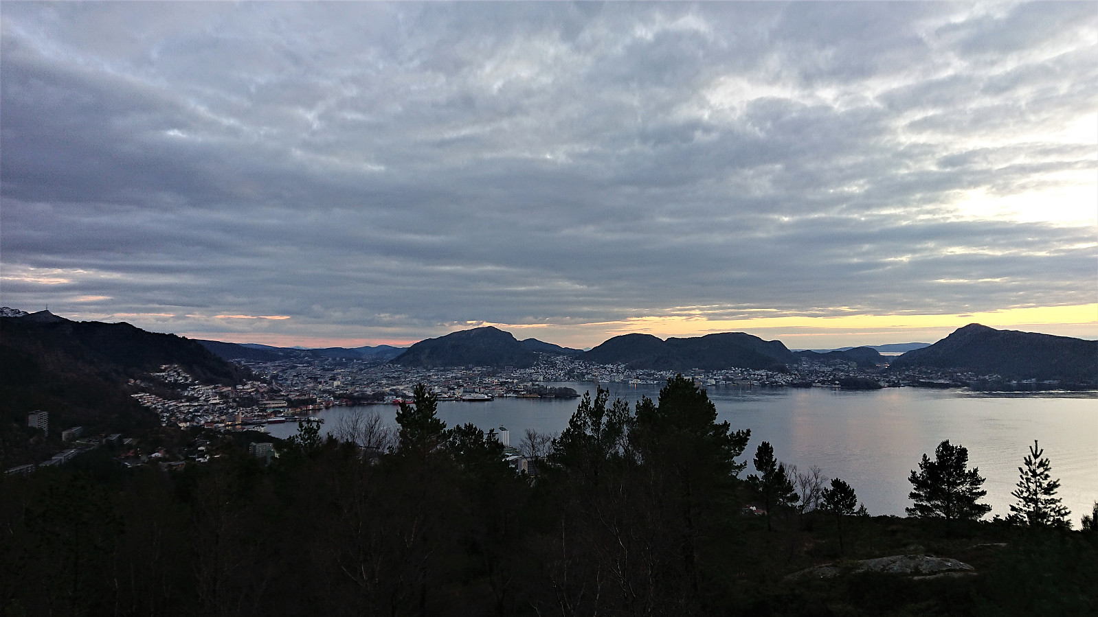
 Short local hike before it got dark.
Ørneberget, Rognåsen and Håmanen
- Date:
- 09.12.2020
- Characteristic:
- Hillwalk
- Duration:
- 1:49h
- Distance:
- 8.2km
 Left the home office early for a short local hike before it got too dark.
Hetlebakksåta and Birkelandsnipa from Ervika
- Date:
- 05.12.2020
- Characteristic:
- Hillwalk
- Duration:
- 4:43h
- Distance:
- 17.9km
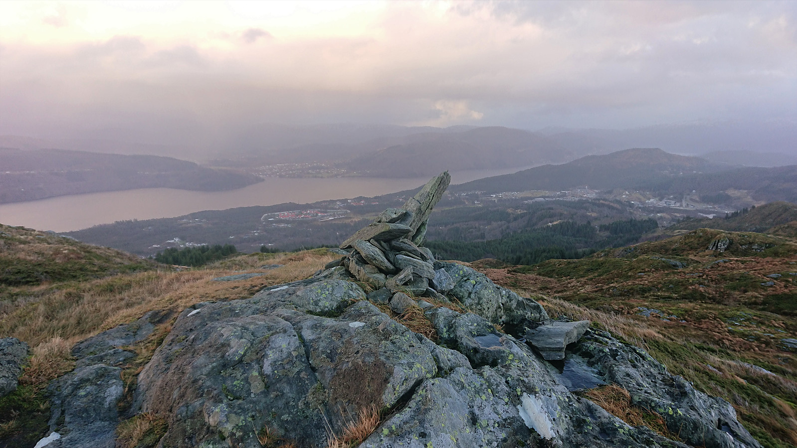
 A revisit of Hetlebakksåta and Birkelandsnipa but this time starting from Ervika, or rather from the final bus stop at Breistein, and visiting both peaks on the same hike. The marked trailhead at the start of Ervikskaret was easily located. However, when the trail split into a blue trail and an orange trail, I first began on the orange trail, but quickly returned and followed the blue trail instead as it seemed to head more in the direction I wanted to go.
When reaching the top of Ervikskaret, I made a quick detour to Erviknipa before completing the ascent to Breisteinsåta and onwards to Hetlebakksåta . From Hetlebakksåta I followed the unmarked trail down to Hetlebakka, making a quick stop at the small hill of Svartafjellet on the way.
Upon reaching Hetlebakka, I followed in the footsteps of samasplund (Sam Asplund) and thus made a short detour via the smaller ridge northeast of Birkelandsnipa >>>
A revisit of Hetlebakksåta and Birkelandsnipa but this time starting from Ervika, or rather from the final bus stop at Breistein, and visiting both peaks on the same hike. The marked trailhead at the start of Ervikskaret was easily located. However, when the trail split into a blue trail and an orange trail, I first began on the orange trail, but quickly returned and followed the blue trail instead as it seemed to head more in the direction I wanted to go.
When reaching the top of Ervikskaret, I made a quick detour to Erviknipa before completing the ascent to Breisteinsåta and onwards to Hetlebakksåta . From Hetlebakksåta I followed the unmarked trail down to Hetlebakka, making a quick stop at the small hill of Svartafjellet on the way.
Upon reaching Hetlebakka, I followed in the footsteps of samasplund (Sam Asplund) and thus made a short detour via the smaller ridge northeast of Birkelandsnipa >>>
Ørneberget, Rognåsen and Håmanen
- Date:
- 29.11.2020
- Characteristic:
- Hillwalk
- Duration:
- 2:58h
- Distance:
- 8.4km
 Local hike in slightly better weather than expected.
Setervatnet roundtrip
- Date:
- 28.11.2020
- Characteristic:
- Hillwalk
- Duration:
- 1:42h
- Distance:
- 4.7km
 Short roundtrip in increasing amounts of rain.
Skagen, Håkeberget and Veten
- Date:
- 22.11.2020
- Characteristic:
- Hillwalk
- Duration:
- 3:35h
- Distance:
- 15.7km
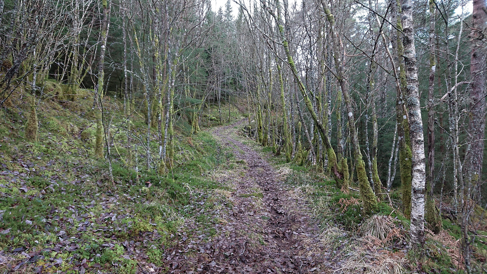
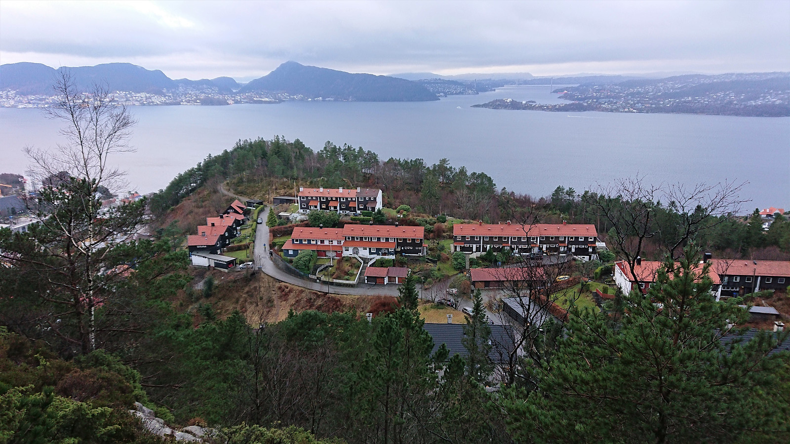
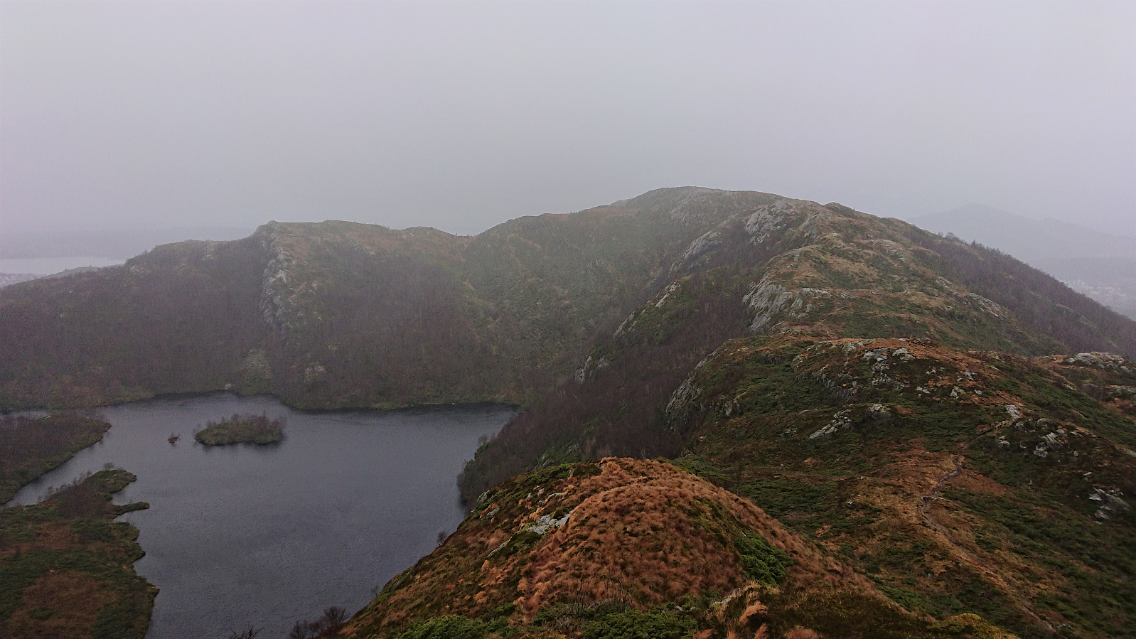
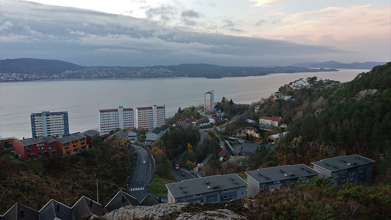
 Another hike in Åsane with the main goal of visiting Håkeberget . A minor peak I had passed several times but never bothered to go to the actual summit. Strong winds today as well, almost making it difficult to stand upright at the summit of Veten . I went for a slightly unusual descent from Veten, which was an interesting alternative to the normal route, but as can be seen from the GPS-track it was clearly not a shortcut. My choice to stay on the right-hand side of the fence towards the end did not help though, and resulted in an extra detour.
Hellemyrstien and Håmanen
- Date:
- 21.11.2020
- Characteristic:
- Hillwalk
- Duration:
- 2:19h
- Distance:
- 7.6km
 Local hike in strong winds.
Furukammen and Ørneberget
- Date:
- 14.11.2020
- Characteristic:
- Hillwalk
- Duration:
- 1:24h
- Distance:
- 5.3km
 Short local hike in light rain.
Fagerdalsskaret and Furukammen
- Date:
- 09.11.2020
- Characteristic:
- Hillwalk
- Duration:
- 0:46h
- Distance:
- 3.3km
 Short local hike after work.
Dystingen and Flatafjellet
- Date:
- 08.11.2020
- Characteristic:
- Hillwalk
- Duration:
- 3:53h
- Distance:
- 7.8km
 We parked outside Fosse Kraftverk and from there walked 100 meters west along the road to the marked trailhead for Dystingen . The marked trail was relatively steep, especially at the start, and contained lots of wet sections, but could overall be followed without any issues.
As the trail turned west towards the summit of Dystingen, I made an off-trail detour to Flatafjellet on my own, before we later reunited at the summit of Dystingen. My route to Flatafjellet did not provide any challenges, perhaps with the exception of trying to locate the exact summit, as Flatafjellet definitely lives up to its name. As far as I could tell, there are two competing summits, so I visited both just to be sure.
From Flatafjellet, I returned along more or less the same route to the marked trail to Dystingen. Upon reconnecting with >>>
We parked outside Fosse Kraftverk and from there walked 100 meters west along the road to the marked trailhead for Dystingen . The marked trail was relatively steep, especially at the start, and contained lots of wet sections, but could overall be followed without any issues.
As the trail turned west towards the summit of Dystingen, I made an off-trail detour to Flatafjellet on my own, before we later reunited at the summit of Dystingen. My route to Flatafjellet did not provide any challenges, perhaps with the exception of trying to locate the exact summit, as Flatafjellet definitely lives up to its name. As far as I could tell, there are two competing summits, so I visited both just to be sure.
From Flatafjellet, I returned along more or less the same route to the marked trail to Dystingen. Upon reconnecting with >>>
