Arkiv - dato
Arkiv - aktivitet
-
Annen tur (3)
- Kajakkpadling (3)
- Fottur (1782)
-
Kjøretur (9)
- Biltur (9)
-
Skitur (109)
- Fjellskitur (65)
- Langrennstur (44)
-
Sykkeltur (108)
- Blandet sykling (25)
- Gatesykling (83)
Lister jeg samler etter
-
Voss ≥ 100m pf.
(96/98)
 97%
97% -
Opptur Hordaland
(143/159)
89%
-
Stasjoner på Bergensbanen
(31/40)
77%
-
Ulvik ≥ 100m pf.
(28/38)
73%
-
Hordaland ≥ 100m pf.
(613/863)
71%
-
Mjølfjell PF > 100m
(21/31)
67%
-
Jondal ≥ 100m pf.
(15/23)
65%
-
Sunnhordland PF >= 100m
(104/186)
55%
-
Dagsturhyttene i Vestland
(33/61)
54%
-
Hordaland: Hardanger PF>=100m
(186/359)
51%
-
Kvinnherad ≥ 100m pf.
(40/79)
50%
-
DNT-hytter i Hordaland
(22/45)
48%
-
Sogndal ≥ 100m pf.
(23/81)
28%
-
Vik i Sogn ≥ 100m pf.
(8/46)
17%
-
DNT-hytter i Sogn og Fjordane
(8/47)
17%
-
Eidfjord ≥ 100m pf.
(7/42)
16%
-
Etne ≥ 100m pf.
(7/51)
13%
-
Ullensvang ≥ 100m pf.
(21/153)
13%
-
Sogn - Sør for Sognefjorden PF>=100m
(17/159)
10%
-
Opptur-topper i Sogn og Fjordane
(17/177)
9%

Ørneberget and Furukammen
- Dato:
- 08.08.2022
- Turtype:
- Fjelltur
- Turlengde:
- 0:53t
- Distanse:
- 3,9km
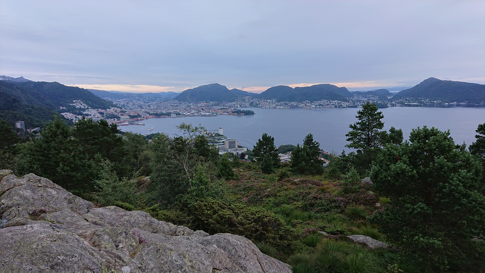 Short local evening hike after the first day back at work after the summer holiday.
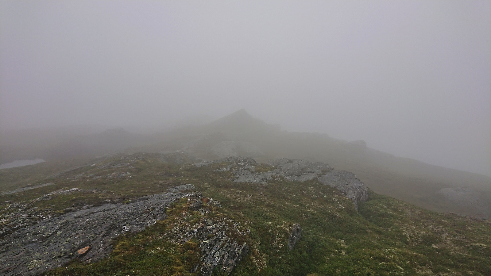
Daurmålsegga from Oma via Raudkleiv
- Dato:
- 05.08.2022
- Turtype:
- Fjelltur
- Turlengde:
- 3:42t
- Distanse:
- 13,2km
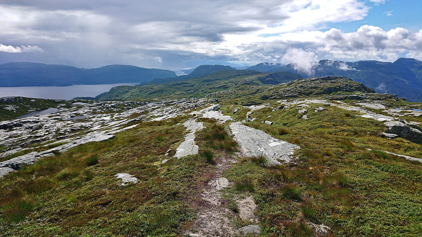 After two unsuccessful attempts at joining a DNT -organized hike across Daurmålsegga from Bolstad to Mundheimsdalen, once cancelled due to bad weather and once COVID restrictions got in the way, I decided to not wait any longer and go ahead on my own. Following the whole ridge would however not be possible and I would instead simply start from Oma and return the same way.
I started by taking the bus to Oma and following the road up to the trailhead at Halvgjenge p-plass , from where I followed the standard marked route via Raudkleiv to the summit of Daurmålsegga. Tractor road almost all the way to Raudkleiv and an easy to follow trail from there all the way to the top, with only a small bit of easy scrambling to reach the summit cairn.
As got to the summit a dense fog had appeared and thus there were next to no views. I decided to wait >>>
After two unsuccessful attempts at joining a DNT -organized hike across Daurmålsegga from Bolstad to Mundheimsdalen, once cancelled due to bad weather and once COVID restrictions got in the way, I decided to not wait any longer and go ahead on my own. Following the whole ridge would however not be possible and I would instead simply start from Oma and return the same way.
I started by taking the bus to Oma and following the road up to the trailhead at Halvgjenge p-plass , from where I followed the standard marked route via Raudkleiv to the summit of Daurmålsegga. Tractor road almost all the way to Raudkleiv and an easy to follow trail from there all the way to the top, with only a small bit of easy scrambling to reach the summit cairn.
As got to the summit a dense fog had appeared and thus there were next to no views. I decided to wait >>>
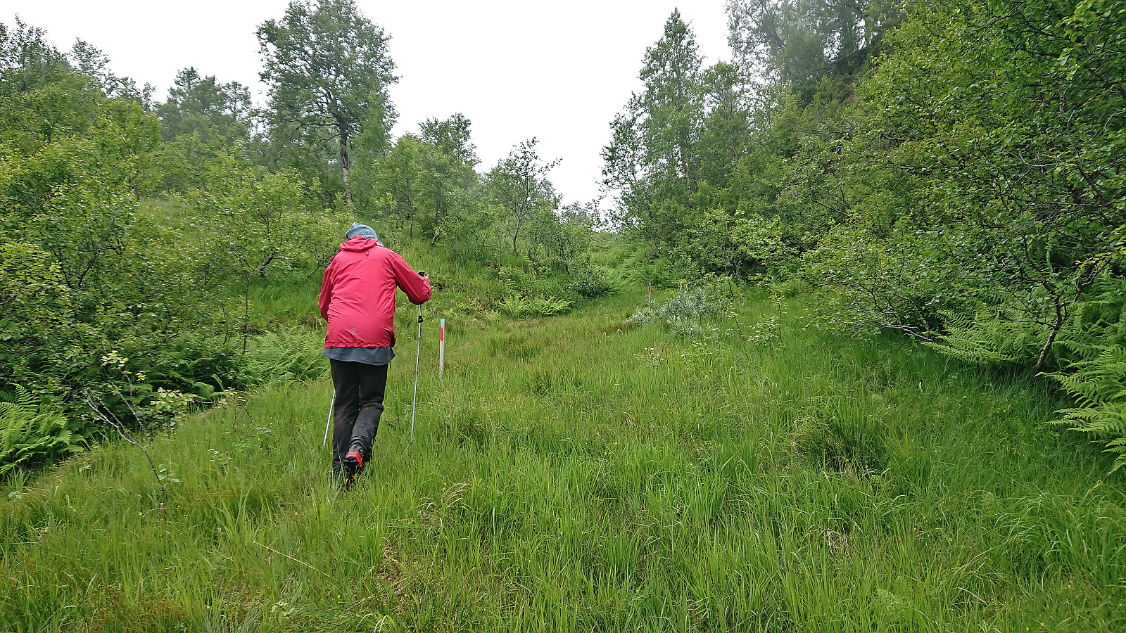
Midtnakken, Gjesfjellet and Snøya
- Dato:
- 01.08.2022
- Turtype:
- Fjelltur
- Turlengde:
- 8:10t
- Distanse:
- 19,6km
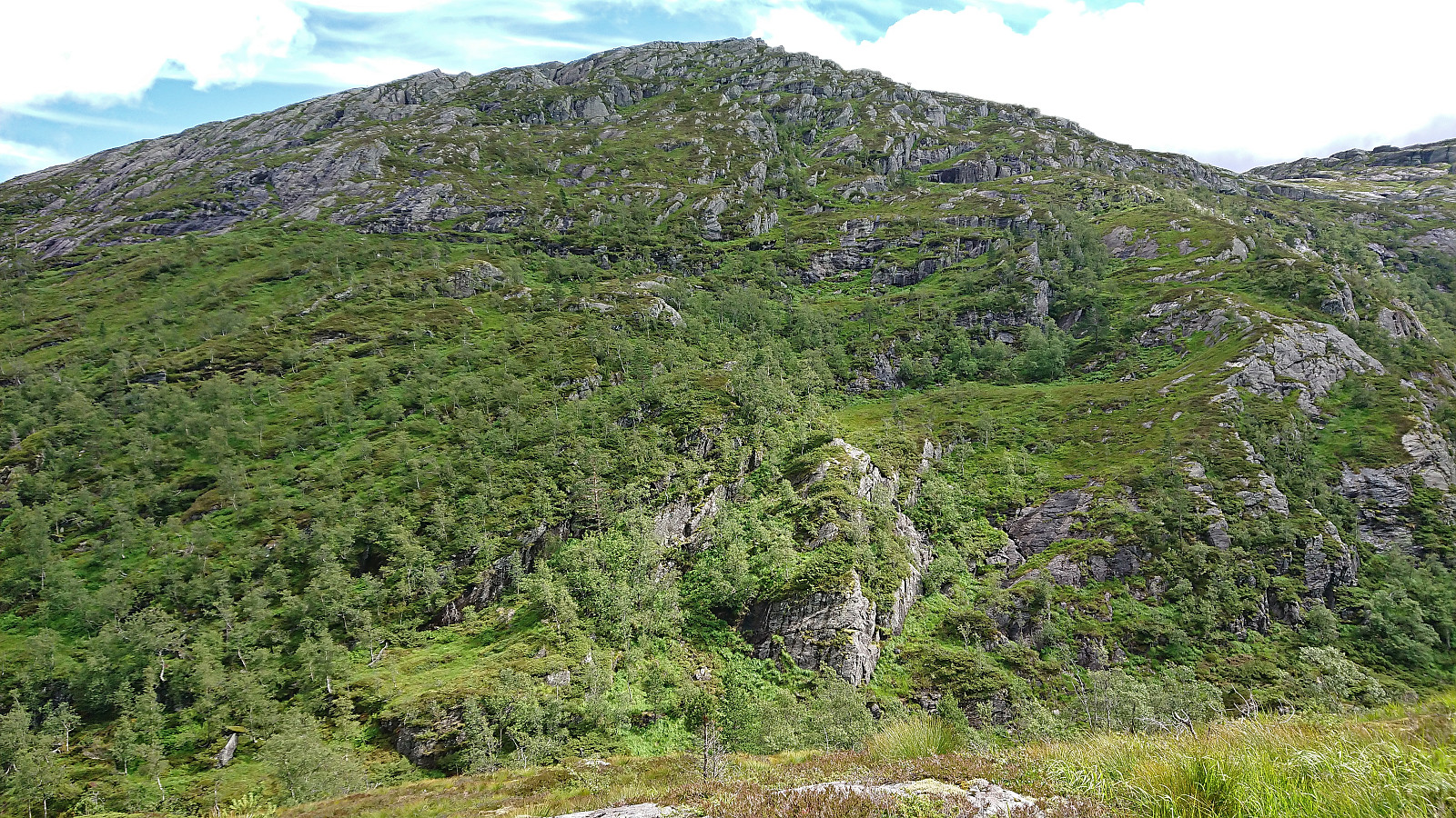 I started by taking the bus to Eidslandet and walking up to the marked trailhead for Eidsstølen that I had used for my earlier hike to Toppfjellet . While the trail quality had not improved since my last visit, the trail was simply now hidden under tall grasses and ferns instead of snow, and it was still not always straightforward to locate the next red marker, the marked trail did make it relatively straightforward to get to Eidsstølen. It does however involve first ascending to the plateau south of Eidsnova before later descending down to the cabin.
From Eidsstølen I turned west and headed off-trail to the extended north-south ridge of Salsfjellet. Ascending to the ridge was overall straightforward, although there may be more direct routes, and I quickly passed over Nordrenakken on my way to the highest point of the ridge at Midtnakken . >>>
I started by taking the bus to Eidslandet and walking up to the marked trailhead for Eidsstølen that I had used for my earlier hike to Toppfjellet . While the trail quality had not improved since my last visit, the trail was simply now hidden under tall grasses and ferns instead of snow, and it was still not always straightforward to locate the next red marker, the marked trail did make it relatively straightforward to get to Eidsstølen. It does however involve first ascending to the plateau south of Eidsnova before later descending down to the cabin.
From Eidsstølen I turned west and headed off-trail to the extended north-south ridge of Salsfjellet. Ascending to the ridge was overall straightforward, although there may be more direct routes, and I quickly passed over Nordrenakken on my way to the highest point of the ridge at Midtnakken . >>>
Kulten
- Dato:
- 31.07.2022
- Turtype:
- Fjelltur
- Turlengde:
- 0:46t
- Distanse:
- 2,4km
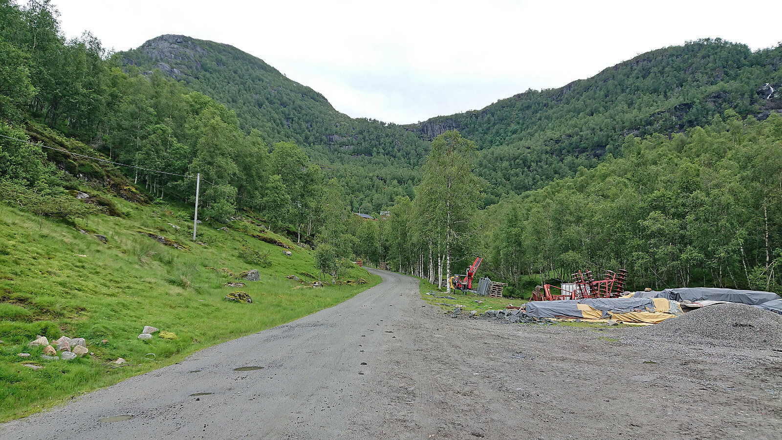 After visiting Storhaug and Nesheimsnipa , me and petter (Petter Bjørstad) drove the short distance to Yksendalen for our final short hike of the day. We parked at a gravel-covered area next to the road before getting up to the houses in Yksendalen and from there followed the road towards the houses in search of the newly marked trail that GeirL (Geir Lie) mentioned in his trip report from almost ten years ago . We could not find any traces of this trail though and were left making our own way largely following the outskirts of a field. Shortly after leaving the field, we did however spot the first red trail markers and soon we were on a marked trail that could be followed all the way to the summit. The summit provided much better views than expected, and after a couple of pictures we returned along the same way, once again failing to find the start/end of the trail mentioned by Geir. Maybe >>>
Nesheimsnipa from Bergo
- Dato:
- 31.07.2022
- Turtype:
- Fjelltur
- Turlengde:
- 2:51t
- Distanse:
- 7,8km
 After our visit of Storhaug , me and petter (Petter Bjørstad) drove the short distance to Bergo, where I had come across information that there was supposed to be a marked trail that would take us all the way to the top of Nesheimsnipa , or Blånipa as it is also referred to. This trail is also being used as part of an uphill race called Gygrakjeften Opp . Finally, I noticed that Vaksdal turlag was organizing a hike to Nesheimsnipa using the same trail a couple of weeks later. Hence the trail could not be all that bad.
We therefore parked at a small parking lot next to Eksingsdalen skule opposite a football field. From there we walked less than 200 meters west along the road to the unmarked trailhead (or rather on closer inspection there was one partly hidden blue trail marker, but no sign). Here we started up the short tractor road, followed the outskirts of the field north and passed through a gate where the marked trail began. The trail was >>>
After our visit of Storhaug , me and petter (Petter Bjørstad) drove the short distance to Bergo, where I had come across information that there was supposed to be a marked trail that would take us all the way to the top of Nesheimsnipa , or Blånipa as it is also referred to. This trail is also being used as part of an uphill race called Gygrakjeften Opp . Finally, I noticed that Vaksdal turlag was organizing a hike to Nesheimsnipa using the same trail a couple of weeks later. Hence the trail could not be all that bad.
We therefore parked at a small parking lot next to Eksingsdalen skule opposite a football field. From there we walked less than 200 meters west along the road to the unmarked trailhead (or rather on closer inspection there was one partly hidden blue trail marker, but no sign). Here we started up the short tractor road, followed the outskirts of the field north and passed through a gate where the marked trail began. The trail was >>>
Storhaug via Trefallstølen
- Dato:
- 31.07.2022
- Turtype:
- Fjelltur
- Turlengde:
- 1:49t
- Distanse:
- 5,0km
 A return to Trefall in Eksingedalen with Petter , this time to visit the final three summits Petter had left in Vaksdal. First up was Storhaug , a peak we had passed close by on two previous occasions but not had the time to ascend. We found parking next to the road just across the bridge from the marked trailhead and followed the steep marked trail up to Trefallstølen . Here we turned west and headed off-trail into the thickening fog in the direction of the summit. The large cairn was reached without any issues, although due to the fog we cannot comment much with regards to the views. We did however spot what appeared to be a slightly higher small hill just to the south of the cairn, and later checks via hoydedata.no indeed confirmed that this spot was a tiny bit higher. It was also marked by a metal trig bolt. Satisfied >>>
Bergesfjellet
- Dato:
- 28.07.2022
- Turtype:
- Fjelltur
- Turlengde:
- 0:31t
- Distanse:
- 1,5km
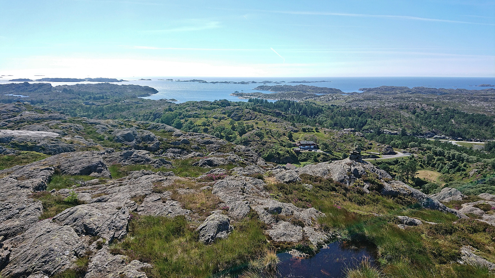 After visiting Mørkadalsfjellet and Gåsafjellet , it was now time for the final ascent of the day: Bergesfjellet . I again left my bike at the marked trailhead and followed the trail northeast. First along a low stone fence next to a field, then across the field and through a gate, before staring the steep but short ascent. Within 15 minutes I arrived at the trig marker at the summit and could briefly enjoy the excellent views before quickly starting my descent along the same route. I had a boat to catch back at Rubbestadneset after all !
Gåsafjellet from Vedvikevatnet
- Dato:
- 28.07.2022
- Turtype:
- Fjelltur
- Turlengde:
- 1:11t
- Distanse:
- 3,9km
 After leaving the bike behind at the unmarked trailhead for Gåsafjellet , I continued on foot along a grass-covered tractor road taking me to northwest of Sætradalstjørna. While there had been a couple of red markers on trees next to the tractor road, the trail here first seemed to come to an end. But after a bit of searching I spotted one more red marker to the southwest and soon another would appear as well. There was even a relatively clear trail that could be followed. This would however not last long, and soon I was left finding my own way towards the summit.
Plenty of small hills at the summit area, some of them with their own small cairns, but the highest one was easy to spot. Or at least I thought so until standing on top of it and starting to wonder if the one just to the north could potentially be slightly higher? >>>
After leaving the bike behind at the unmarked trailhead for Gåsafjellet , I continued on foot along a grass-covered tractor road taking me to northwest of Sætradalstjørna. While there had been a couple of red markers on trees next to the tractor road, the trail here first seemed to come to an end. But after a bit of searching I spotted one more red marker to the southwest and soon another would appear as well. There was even a relatively clear trail that could be followed. This would however not last long, and soon I was left finding my own way towards the summit.
Plenty of small hills at the summit area, some of them with their own small cairns, but the highest one was easy to spot. Or at least I thought so until standing on top of it and starting to wonder if the one just to the north could potentially be slightly higher? >>>
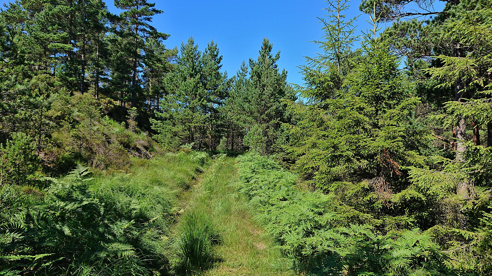
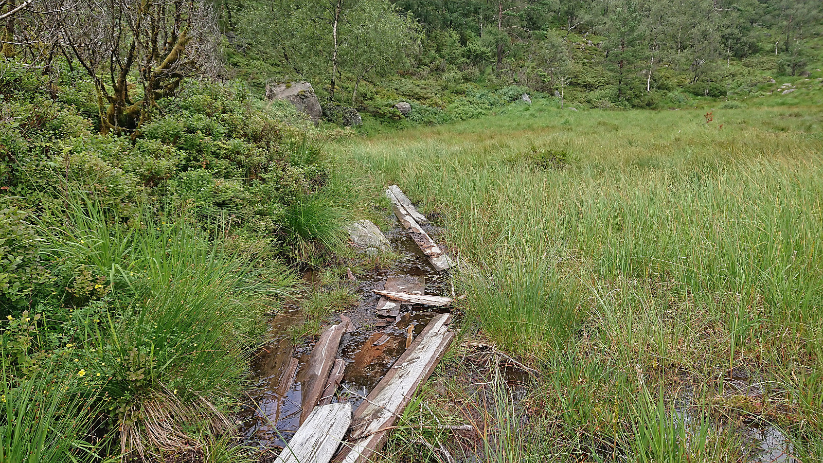
Mørkadalsfjellet
- Dato:
- 28.07.2022
- Turtype:
- Fjelltur
- Turlengde:
- 1:01t
- Distanse:
- 3,7km
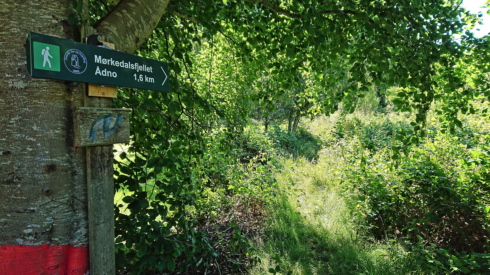 After leaving my bike behind at the marked trailhead , I continued on foot along the trail to Mørkadalsfjellet . First a short stretch through a forest and along a stone fence, before the terrain opened up and the summit could be spotted in the distance. Plenty of wet and muddy sections along the way, but thanks to lots of wooden objects of different types and sizes covering the worst parts of the trail I managed to stay relatively dry and mud-free even though I was only wearing sneakers. The summit provided excellent panoramic views, explaining why it previously had been used as an observation station for the Norwegian coast guard. After a couple of pictures I returned along the same route.
Vardefjellet and Kalnesnuten from Mjanger
- Dato:
- 27.07.2022
- Turtype:
- Fjelltur
- Turlengde:
- 4:26t
- Distanse:
- 12,3km
 I started by taking the bus to Mjanger and got off at the stop "Mjanger, vest". After a short walk along the road in between the houses I passed through a gate and continued north on a tractor road that later turned in to a trail taking me all the way to Mjangerssetret . Here there was a trail sign for Hellebergsåta, but even though there were a couple of trail markers early on, the trail quickly disappeared and I was left finding my own way.
Before arriving at Hellebergsåta, it started to rain and the low-hanging clouds started looking more like fog. I could therefore not yet spot the main goal of the day to the northeast, namely Vardefjellet . Båthaugen could however be located and I headed there first. Note that basically every small hill in this area seemed to contain its own cairn, hence finding the right >>>
I started by taking the bus to Mjanger and got off at the stop "Mjanger, vest". After a short walk along the road in between the houses I passed through a gate and continued north on a tractor road that later turned in to a trail taking me all the way to Mjangerssetret . Here there was a trail sign for Hellebergsåta, but even though there were a couple of trail markers early on, the trail quickly disappeared and I was left finding my own way.
Before arriving at Hellebergsåta, it started to rain and the low-hanging clouds started looking more like fog. I could therefore not yet spot the main goal of the day to the northeast, namely Vardefjellet . Båthaugen could however be located and I headed there first. Note that basically every small hill in this area seemed to contain its own cairn, hence finding the right >>>
