Ullstinden (31.07.2012)


| Ascents | Sørvestre Ullstinden (1,078m) | 31.07.2012 18:00 |
|---|
monakaup (Mona Kaupang), one of the friends I had made from an FSG trip happened to have a whole day off - and both of us were keen to make the most of it if weather permitted. As things turned out, a load of rain was forecasted during the daytime, and rather than go out and deliberately get wet we chose to postpone a trip until the evening, when dry weather was supposed to come along. Our choice of mountain was Ullstinden, probably quite a popular winter peak and also a summer one because it is a Ti på Topp trip, although it is not the true summit of Ullstinden which is the recommended Ti på Topp route but the south-west summit. Well, it was good enough for us, and provided about 10km of walking up and down. Perfect for an evening. Depressingly though, when we met up at the Joker on Dramsveien, it was pretty wet and rainy, and most of the mountains were hidden by fog. Anyway, it was a good thing that Mona was in a more upbeat mood than I was because she was still quite hopeful that the dry weather would come along as forecasted, even if it did mean perhaps starting the route in the rain. Fortunately, the 45-minute drive around to the starting point at Snarbyeidet seemed to be sufficient time to allow the rain to stop, and we were really lucky that when we actually got out of the car we didn't really need the waterproof jackets at all. There was one other car parked up at the car park, so I assumed we wouldn't be having much company on this trip!

The lower part of the trail crosses a myrområdet, and it was a bit soggy to walk in from time to time but overall with proper walking boots on it wasn't too unpleasant. A nice surprise too was that there was very little in the way of thick forests to hike trhough before we got above the tree line, so we were soon out on open mountainside and had some views over the valley to the south and east very quickly. Despite the amount of rain that had fallen during the course of the previous week, we found the path to be very sturdy - it was soft ground but not muddy or rocky. Good for the knees and for making good speed upwards. Even though it was still overcast, we could see some very small patches of blue sky gradually growing in size to the south as the time passed by....... the temperature was comfortable enough to hike in just a vest top, and there was very little wind to chill us either. So it felt like conditions were pretty much perfect for a trip after all - and I was glad I'd not stayed at home simply because we saw rain outside!
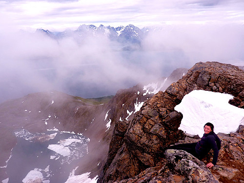
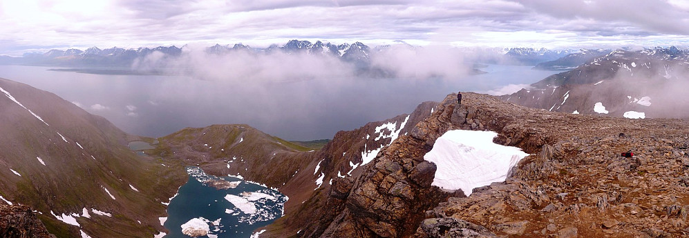
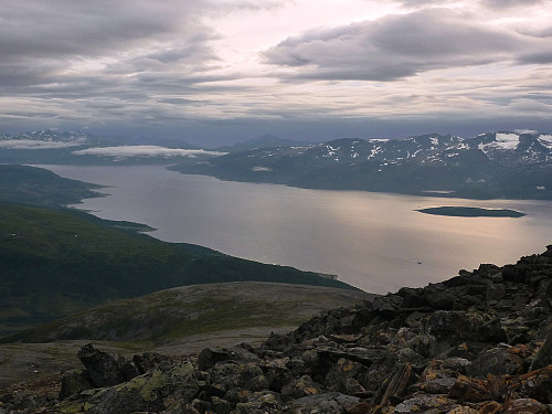
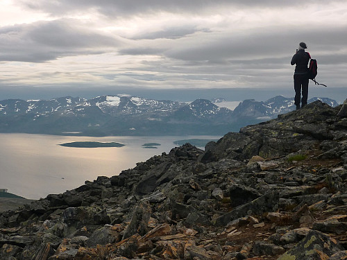
At about 550m we bumped into two older ladies who were going back down, and they had many favourable things to say about the trip, so we really did have some great stuff to look forward to. Shortly after our meeting with them though, it turned a bit windier and colder, so we pulled on a jacket shortly after reaching a slight plateau in the river valley below Svarthamartinden. From there the route bears a bit more to the north to ascend the south-west facing slopes of Ullstinden. Around that time we started to get some really stunning views of the Lyngen peninsula, with only thin bands of cloud and fog passing by which slightly obscured our view of the mountains.
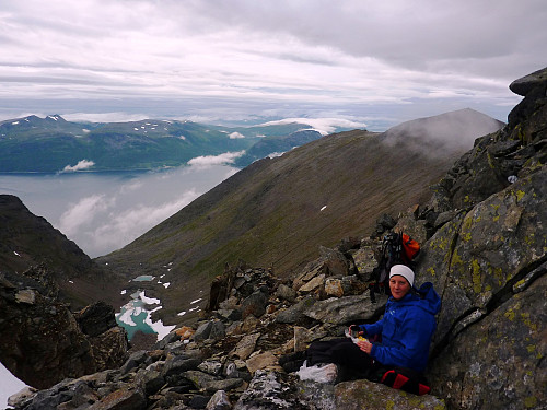
It was a fairly steady ascent on an obvious path all the way from there up to the summit, which we reached at about 8.30pm - upon reaching the north-eastern edge of the summit ridge we were greeted with some very surprising views of Storelvvatna which sat far down below the steep face of the the mountain. I don't think either of us were expecting such a sheer plunge down to the lake below! At this point Mona decided to tell me she had a fear of big drops........It was really cool though, because there were still some humongous blocks of ice floating around in the lake which hadn't yet thawed out, and they were impressive to look at.
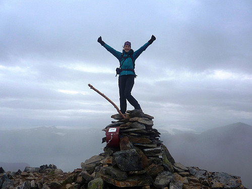
After taking the necessary summit shots, with the giants of the Lyngen alps as our background, we found a slightly more sheltered spot below the top to have some bread and hot drinks. It was really refreshing to be out for the third time in the week and enjoying yet more mountains in another different corner of the Troms kommune. But I have yet to visit Lyngen, so this trip was like being one step closer! Mona was getting a little cold after we'd sat down about 15 minutes, so we decided not to hang around.
The idea was that if we stayed up long enough that the blue sunny skies which had been promised by yr.no would soon come along and make our views even more impressive than they already were. I think it ended up being a good call to not linger though, because if anything, there was more fog on the summit after we'd descended, although for the whole hike we didn't experience a single drop of rain, and I think that was more pleasing than getting clear skies. The descent was really quick. It took us half the time of the ascent, and we were back at the car park within 1 hr and 15 minutes, most of which I attribute to the nice surface we had for walking on. Good timing that was too, because on the drive home to Hamna, some drops of rain started to fall again..............



User comments