Synnøvjordtinden (15.08.2012)


| Bestigninger | Synnøvjordtinden (783moh) | 15.08.2012 |
|---|
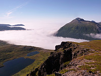
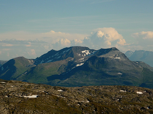
I took this peak as an afternoon trip, with the hope that the path which I'd seen marked on the map also existed on the ground as well! It was also the second day of low-level fog which had pretty much engulfed the whole of Tromsøya, but higher up above about 300m, it was bright and clear. So, a mountain hike seemed like the perfect way to escape the dull and cool fog below and get some warm sunshine up high. Synnøvjordtinden is also located at the western end of Kattfjord, almost directly opposite Vasstinden across Nordfjorden, and I was keen to see Vasstinden from a different perspective, simply because I had such good memories of the evning trip I'd taken there a few weeks earlier. Anyway, quite helpfully as I was driving along the road through Synnøvjorda I noticed a red arrow at the side of the road. It happened to be pointing up the hillside when I was looking out for some sort of trace of a path, so I took this as an indication of the path I was anticipating to hike up and promptly pulled into the layby to park up my car. I was a bit sceptical of the path to begin with, because it didn't look very well mainained and was a little hard to follow, but pretty soon it ascended rapidly up through the forest, beside a stream and I found it surprisingly well marked. Not marked by red rocks or posts or anything like that, but it was an obvious trail which led all the way up to Litle Synnøvjordvatnet - by the time I reached this point the top of the fog had been left behind and I was well out into beautiful warm sunshine. From here, the route marked on the map took me up the hillside in a north-easterly direction on easy terrain. It was mainly scrub interspersed with rocks, so I actually found it perfect for walking on. To the north-west, there were ever-improving views of Vasstinden and Nordfjordtinden, although the afternoon sunlight wasn't quite as thrilling as a good sunset sky...... Quite soon, after about 750m bearing to the north-east, I took straight up the broad ridge in a south-easterly direction which led straight ahead to the top of Synnøvjordtinden a few kilometers later.
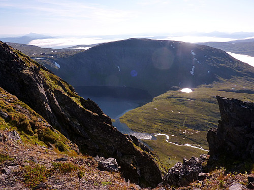
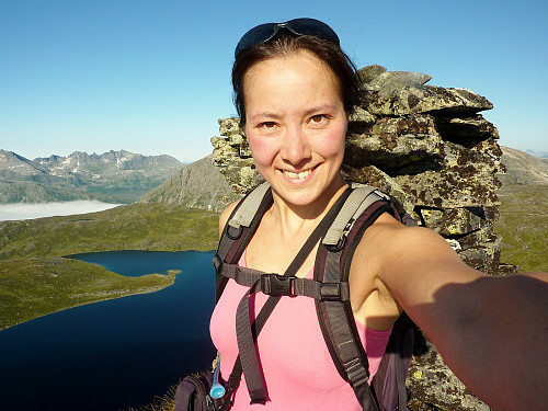
What followed was quite a pleasant route which went alongside the steeper south-western side of the peak, offering good views all the way across to Senja, but there was nothing particularly exciting about the walk. At the summit there was a very large cairn/varden, and actually quite a nice panorama. I think it would have made a better trip later in the day when the sun was at a different position in the sky. But anyway, it had been good to get some exercise in my legs and make the most of the temperature inversion which had created so much fog down low.
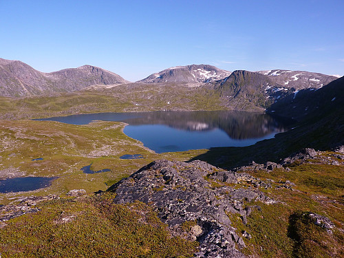
The descent back down towards Synnøvjorda proved to be somewhat more exciting than I'd intended; I had been quite happily following the broad ridge back down to where I thought I should bear southwest again towards Litle Synnøvjordvatnet, but probably not concentrating very much. In the distance, to the left of my eye I had notice a lake, but it seemed alot further away than I expected the lake I was heading for. Nevertheless, I assumed that was because I had gone too far down the ridge and not took the other direction early enough. What actually happened was that I had seen one end of a different lake - Store Synnøvjordvatnet, and I mistook it to be the one I should be walking towards because Litle Synnøvjordvatnet had been covered up by the fog, which had ascended slightly since I'd began the walk.
To cut a long story short, I made the wrong decision to head straight towards the wrong lake, which involved clambering over numerous boulders and tall bushes in the process, none of which I enjoyed! I only realised it was the wrong lake when I saw another smaller one below me, just as the fog thinned out a little to allow me to see just glimpses of the Litle Synnøvjordvatnet I should have been walking down to, but by this time I couldn't actually be bothered to re-trace my route back up to where I was before I decided to go cross-country and head for the wrong lake! Eventually I took a deep breath and mentally prepared myself for what I could see was an awkward and tedious way straight down the mountainside to the edge of the water, most of which consisted of trees, thick bushes and big rocks which I couldn't see because they were hidden by thick bushes. It was perfect ground for twisting or breaking your ankle if you weren't careful! But after about 20 minutes I reached the edge of the lake, which was damp and boggy to walk alongside, but on a positive note, it served as a good handrail to lead me back to the far end of the lake where the path through the forest should have been. Fortunately, this plan worked - and I was very glad too because the visibility was very poor again at the lake as a result of the thick fog. But now I'd re-located the path, I could at least feel a little bit relieved that I was back on the right track again to get me back down through the forest and to the car!
It had started off as an unexciting but pleasant hike, but ended as an exhausting one because of my one error in mistaking a lake for another one which I had lost sight of. It just goes to show how much you need to concentrate even in what appears to be great weather!



Kommentarer