Archive - Date
Archive - Activity
-
Climbing (43)
- Alpine climbing (31)
- Ice climbing (3)
- Mixed climbing (1)
- Sport climbing (3)
- Via ferrata (1)
-
Other trip (5)
- Expedition (5)
-
Other winter trip (5)
- Snowshoe trip (5)
-
Ski trip (449)
- Backcountry skiing (4)
- Cross-country skiing (2)
- Randonnée/Telemark (441)
-
Trip by foot (507)
- Alpine trip (47)
- Hike (196)
- Hillwalk (205)
- Jogging (4)
- Walk (55)
Peakbook-Friends
Baruntse
- Date:
- 30.10.2011
- Characteristic:
- Expedition
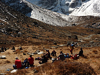
 After having summited Mera Peak and spent the night at Kongme Dingma with a good meal and cake for dessert, we were mostly ready to continue towards Baruntse. I had hoped that the sore throat and cold-like symptoms I had from Mera Peak high camp would have disappeared when I woke up this morning but unfortunately that wasn’t the case and I was feeling just as wiped out and generally not-in-form as the previous day. Fortunately the approach to the next camp at Five Lakes wasn’t going to be the world’s most exhausting day of walking. The route basically followed the Honku river valley northwards with some impressive and huge mountainsides on both the west and east sides (although I don’t remember what the names of these peaks are). We had a very laid-back lunch around halfway to the next camp >>>
Mera Peak
- Date:
- 17.10.2011
- Characteristic:
- Alpine trip
 I joined a trip to Mera Peak and Baruntse which was organized by a UK-based company. Since I was travelling from Tromsø, I joined the rest of the group in Kathmandu after having taken a rather long route (Tromsø-Oslo-Bangkok-Kathmandu) with Thai Airways. We were a group of 9 people plus two trip leaders, Mark and Paddy – both of whom turned out to be ultra friendly and had a good sense of humour.
17th October 2011: In Lukla
The first part of the trip was the approach to Mera Peak, which involved an early morning flight into Lukla situated at 2800m. We should have been walking to our next camp at Poyan after arriving in Lukla, but since there was some delay in getting the expedition equipment from Kathmandu to Lukla, we ended up spending a night in Lukla and generally relaxing. What I was >>>
Blåtinden (den Sovende Soldat)
- Date:
- 24.09.2011
A stable spell of weather during the week that my sister was visiting meant that we really had to get out onto another mountain and make the most of the beautiful sunshine and cloudless skies. Took the 45 minute drive down through Lavangsdalen to Skogvoll and parked up just close to the start of the footpath. Brilliant views out over Balsfjord all the way up through the forest and out onto the grass. Quite a lot of other hikers out on this nice day. Got stunning views out to the Lyngen Alps after getting onto the upper section of the mountain. Quite steep in places but no scrambling was needed, which was good because my sister didn't like too much exposure! Path was easy to follow, and the view to Andersdaltinden, Svartnestinden and Sultindan were very impressive too. Had a spot of lunch at >>>
Tromsdalstinden
- Date:
- 22.09.2011
My sister was visiting me from the UK during this week, so I thought Tromsdalstinden would be a nice mountain hike to introduce her to the wonderful landscape around Tromsø. We parked up in Tromsdalen and walked the few kilometers along the track until reaching the point where the path crossed over the river and onto the northern shoulder of the mountain. From here it was a lovely hike through some sparse woodland and then out onto the scrub above. Colours were immense - very autumnal and lots of mixtures of green, brown, gold and a bright blue sky above us! Couldn't have picked a more perfect day to go sightseeing outdoors! Caught a bit of cold wind while ascending the steeper part of the ridge, but this dropped away soon, and we had at most a small breeze for the rest of the ridge to the >>>
Store Blåmannen
- Date:
- 11.09.2011
I had seen Store Blåmannen from Storkjølen the week before our trip, and could not help but notice how striking this mountain was. It was therefore on my 'to-do' list next time! My friend Pernilla joined me for the tour, and we drove over to Kvaløya in the late morning because the weather had been very cloudy and a bit damp, but the forecast suggested drier and sunny weather towards the late afternoon. So we parked at the bottom of the mountain by Kaldfjord and set off shortly after midday, although it was not possible yet to see the summit! After getting above the treeline and onto the slabby rock above, the clouds began to break up and soon we got some views of the highest peaks popping out over the cloud base. The scramble was quite pleasant, and there were lots of interesting things to >>>
Ben Lawers traverse
- Date:
- 21.04.2011
Superb route in superb weather. 1600m of ascent and 16 miles if you go down all the way to the road at the bottom instead of taking the high path ....... A bit of tricky down climbing on An Stuc, but done in dry weather it poses not too many difficulties unless you hate exposure and some delicate footwork! I saw only 4 people in the whole day, and 2 were going to turn back before decsending An Stuc, but I managed to persuade them to carry on and do the whole route, so I ended up having some company for the rest of the route. Highly recommend this lovely traverse of all 5 munros; its highland walking at its absolute bestest!!


