Archive - Date
Archive - Activity
-
Climbing (43)
- Alpine climbing (31)
- Ice climbing (3)
- Mixed climbing (1)
- Sport climbing (3)
- Via ferrata (1)
-
Other trip (5)
- Expedition (5)
-
Other winter trip (5)
- Snowshoe trip (5)
-
Ski trip (449)
- Backcountry skiing (4)
- Cross-country skiing (2)
- Randonnée/Telemark (441)
-
Trip by foot (507)
- Alpine trip (47)
- Hike (196)
- Hillwalk (205)
- Jogging (4)
- Walk (55)
Peakbook-Friends


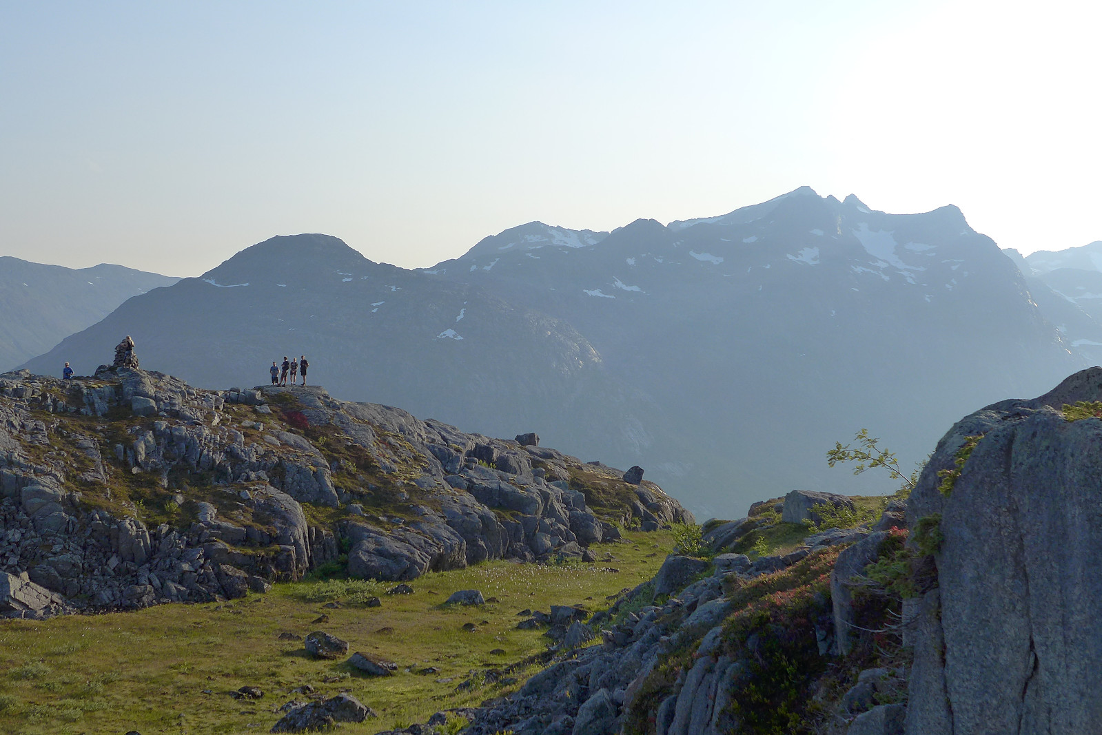
Blåtinden
- Date:
- 12.09.2021
- Characteristic:
- Hillwalk
- Duration:
- 4:17h
- Distance:
- 11.9km
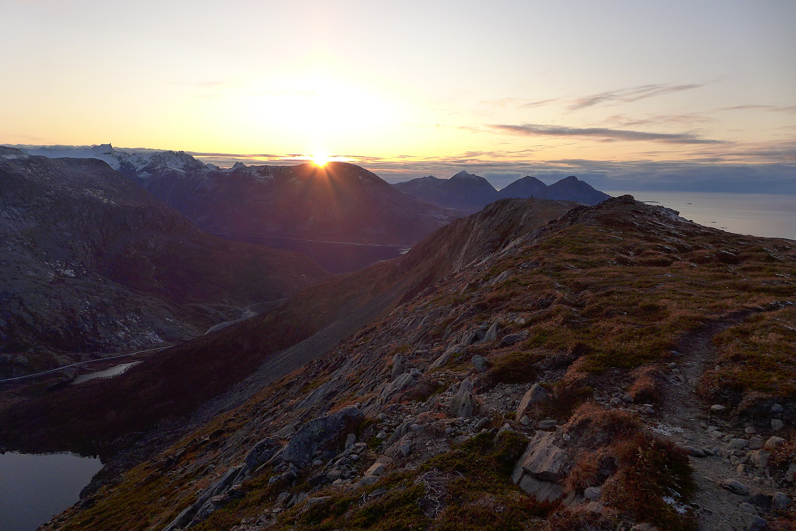
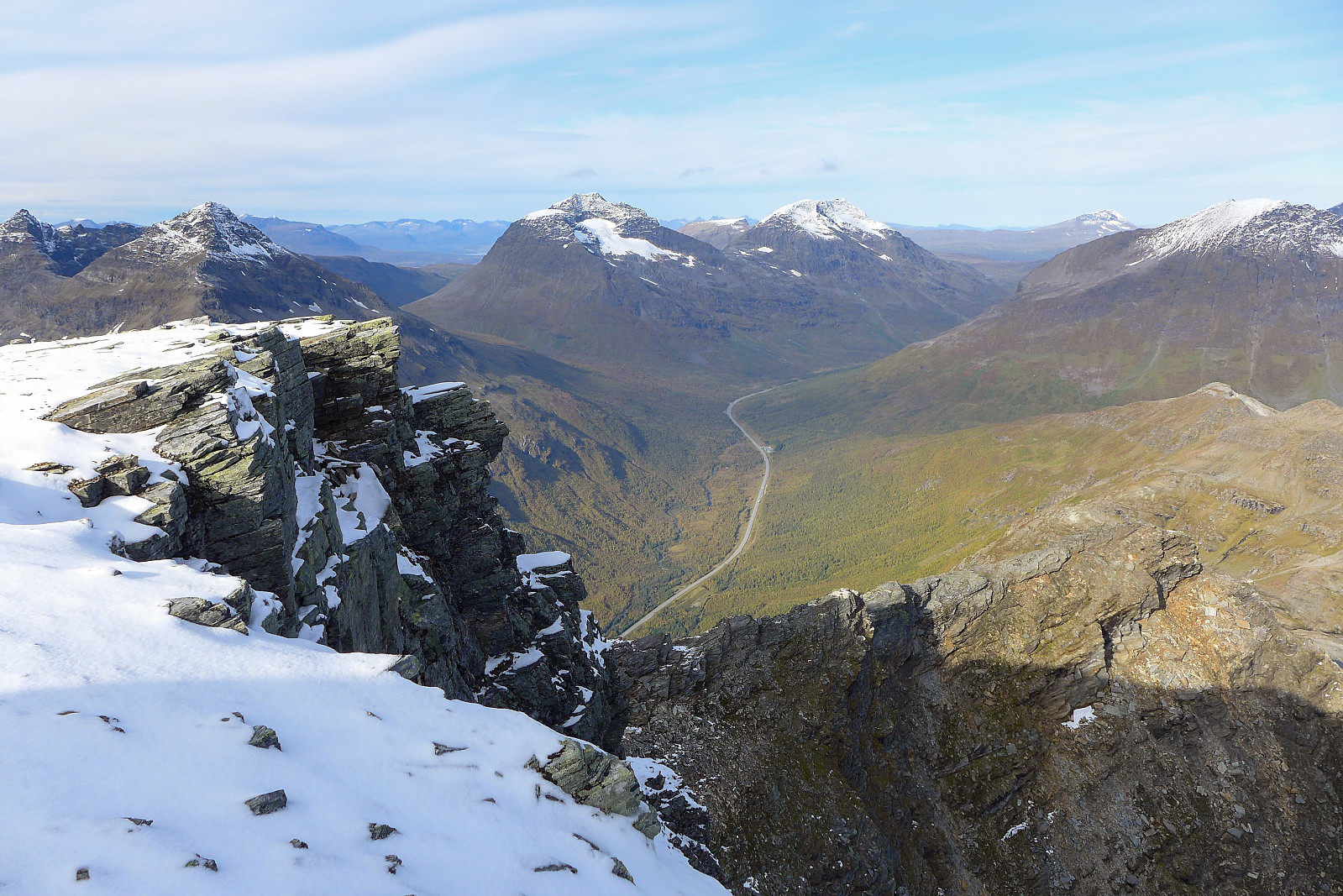 Første dag på lenge siden vi fikk en ordentlig finværsdag med strålende sol og blå himmel. Hadde egentlig tenkt å ga en tur på Tromsdalstinden siden jeg mistenkte at bakken kom til å bli ganske vannmettet i lavlandet (Tromsdalstinden har en god sti) men Kamila var mindre gira på den. Til slutt endte det opp med en kompromiss og vi gikk en tur på gode gamle Blåtinden. Det viste seg å være et godt valg (selv om vi begge ble våte på beina) og vi fikk nyte en herlig dag på tur i lag. Takk for turen Kamila :-)
Husfjellet
- Date:
- 07.08.2021
- Characteristic:
- Hillwalk
- Duration:
- 2:27h
- Distance:
- 8.8km
 Ettermiddagstur med Renate etter å ha vært på Breidtind tidligere på dagen. Sist gang jeg gikk en tur på Husfjellet var for 9 år siden og jeg hadde nok glemt hvor mye vann ligger i myrområdet sør for Litje-brusen. Heldigvis har det kommet noen planker som man kan gå på for å unngå å bli helt våt på beina, men likevel synes jeg at det var vanvittig mye gjørme akkurat der. Kjipt! Resten av turen opp til toppen var ikke så spennende men utsikten over Steinfjorden var upåklagelig ihvertfall. En fin trøst etter å ha blitt plaget av svartfluer og gjørme i ca. 1t 15m. Tviler på om jeg hadde giddet å gå en tur på Husfjellet igjen.......men takk for en flott dag på tur Renate!
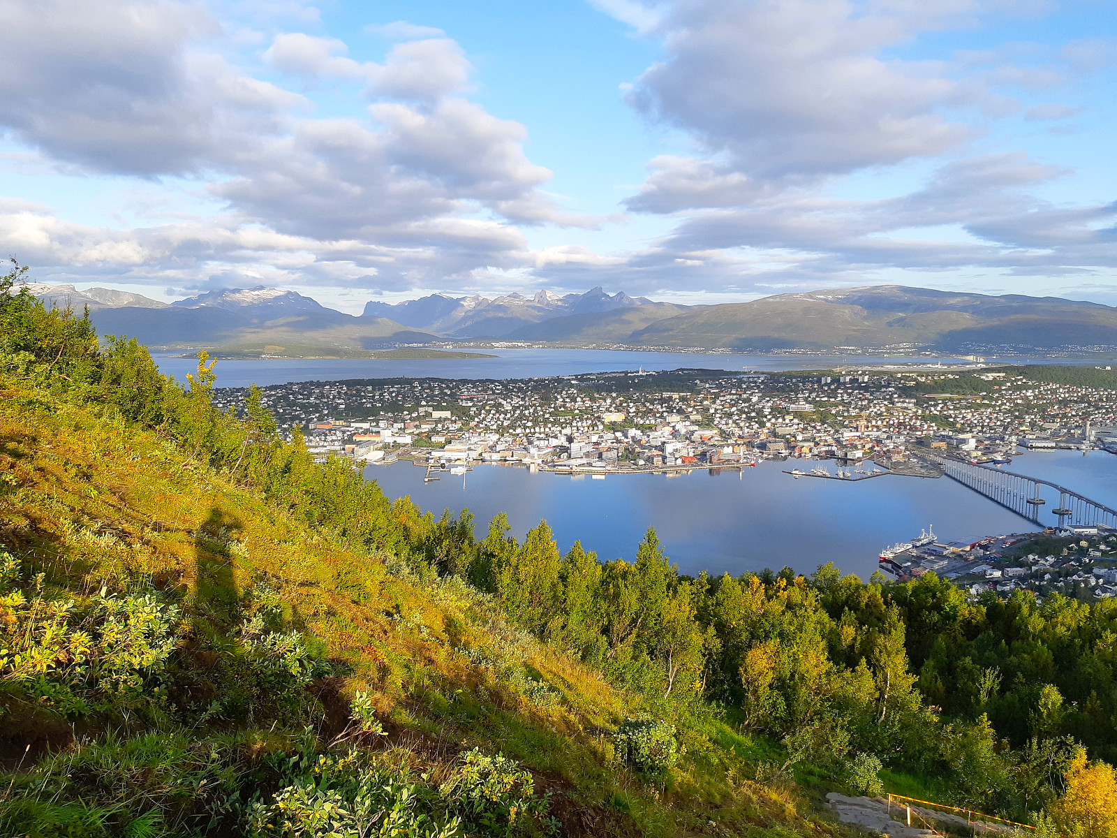
Fløya
- Date:
- 26.10.2019
- Characteristic:
- Hillwalk
 Liten tur med Johanna, Kamila og Kamilas venninne Kasia etter lunsj. Det blåste godt i høyden så det ble en ganske kjølig opplevelse med dessverre litt for mange pauser etter min smak..
Fløya
- Date:
- 16.10.2019
- Characteristic:
- Hillwalk
- Duration:
- 1:59h
- Distance:
- 6.7km
 Etterjobbtur. Vakkert som det alltid er her :)
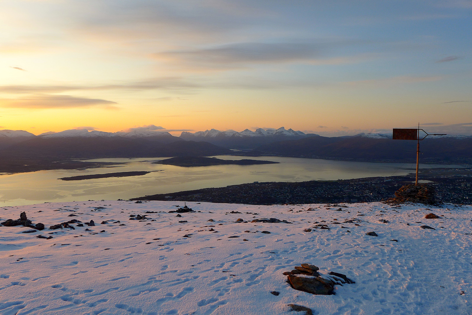
Brattfjellet
- Date:
- 15.10.2019
- Characteristic:
- Hillwalk
- Duration:
- 1:30h
- Distance:
- 5.6km
 Flott etterjobbtur. Jeg rakk akkurat å se solnedgangen på toppen før sola gikk bak noen fjell helt ytterst på kysten. Traff noen stakkars tyske turister på parkeringen som hadde problemer med leiebilen (tror batteriet hadde dødt) så kvinnen fikk sitte på med meg til flyplassen som var noe varmere å vente i mens partneren måtte vente med hybridbilen som var helt fri for strøm i uviss tid. Det var -1 grader ute...
Fløya
- Date:
- 09.10.2019
- Characteristic:
- Hillwalk
 Utrolig vakker etterjobbtur og fine forhold for å gå fortsatt med kun joggesko. Glemte å spore turen.
Buren
- Date:
- 02.10.2019
- Characteristic:
- Hillwalk
- Duration:
- 2:19h
- Distance:
- 7.2km
 Etterjobbtur i friskt vær. Heldigvis ble det delvis frosset gjørme på vei opp Skålhammaren denne gangen, så det var fine forhold for å gå der og helt snøfritt i topphenget. Stor forskjell på forholdene sammenlignet med forrige uka :)
Buren
- Date:
- 10.09.2019
- Characteristic:
- Hillwalk
- Duration:
- 2:14h
- Distance:
- 7.0km
 Førjobbtur i flott høstvær og 50. gang på dette fine fjellet :) Ser frem til de neste 50 turene dit...
Fløya
- Date:
- 03.09.2019
- Characteristic:
- Hillwalk
- Duration:
- 1:16h
- Distance:
- 5.9km
 Førjobbtur med start kl.07.15 fra parkeringa. Fin temperatur :)
Buren
- Date:
- 28.08.2019
- Characteristic:
- Hillwalk
- Duration:
- 2:04h
- Distance:
- 7.1km
 Hadde blitt forkjølet i starten av uka, så det ble en tung tur i dag. Men det var varmt og fint så det gjorde det lett å komme seg ut på tur :) Neste tur til Buren blir 50. gang der!

