Archiv - Nach Datum
Archiv - Nach Aktivität
-
Andere Tour (5)
- Expedition (5)
-
Andere Wintertour (5)
- Schneeschuhtour (5)
-
Fußtour (507)
- Bergtour (205)
- Hochtour (47)
- Jogging (4)
- Spaziergang (55)
- Wanderung (196)
-
Klettern (43)
- Alpinklettern (31)
- Eisklettern (3)
- Klettersteig (1)
- Mixed-Klettern (1)
- Sportklettern (3)
-
Skitour (449)
- Langlauf (2)
- Randonnée/Telemark (441)
- Tourenskilauf (4)
Peakbookfreunde


Allalinhorn - Hohlaubgrat
- Datum:
- 03.09.2023
- Tourcharakter:
- Hochtour
- Tourlänge:
- 6:05h
- Entfernung:
- 5,8km
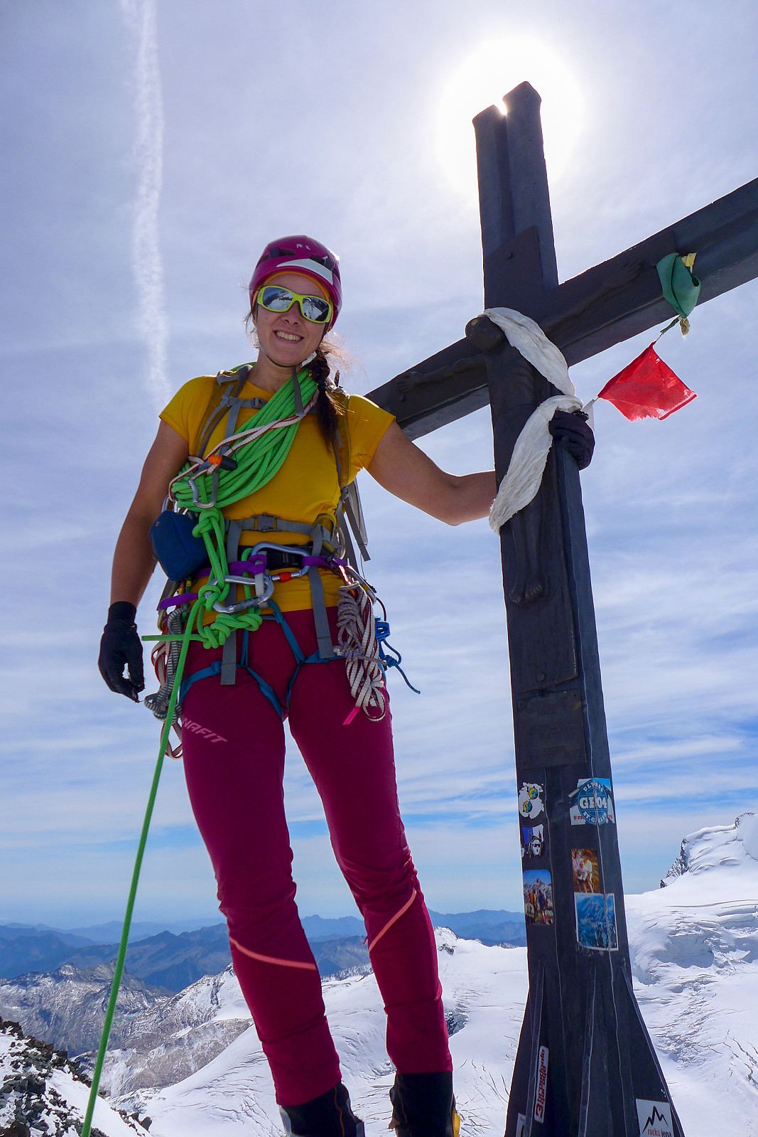 Klarte å rekke en siste fjelltur før hjemreise og det ble en chill dag på Allalinhorn via sin nordøstrygg, kjent også som Hohlaubgrat. Jeg hadde gått denne ruten før for 9 år siden med en fjellguide, i 2014 men jeg husker den som en ganske enkel tur og tenkte det kunne vært et greit turmål å prøve meg på igjen. Fikk med meg Nathan, og både Anna og Dev ble med så vi klatret som 2 taulag. Tok bussen fra Saas Almagell kl0630 på en ellers stille og fin søndagsmorgen men endte opp i kø for å ta heisen opp til Felskinn pga en invasjon av tenåringer som hadde skitrening oppe i løypene. Heldigvis tok det ikke lang tid før vi fikk plass på Mittelallalintoget og vi ble satt på Hohlaubstasjonen omtrent halvveis mellom Felskinn og Mittelallalin (man må be om å komme av her før >>>
Weissmies
- Datum:
- 01.09.2023
- Tourcharakter:
- Hochtour
- Tourlänge:
- 13:50h
- Entfernung:
- 13,3km
 Været i starten av uka var mye preget av nordavind, uvanlig kaldt vær og mye nedbør, som til slutt endte opp med opp mot 1m nysnø på de høyeste toppene og det snødde helt ned til Saas Grund på 1600m (!), noe som førte til at SLF utstedet et skredvarsel. Uansett, det var på en måte flaks for de 12 deltakerne i gruppe 1, meg selv inkludert - som skulle ha trening i bl.a redning fra bresprekk disse to dagene når været var på sitt dårligste. Det var også uflaks at været var såpass dårlig at vi ikke fikk komme oss opp i høyden for å trene i på en ordentlig bre. Etter treningen var noen av oss ganske gira på en tur opp sørryggen på Weissmies, en alpintur som er vanligvis ganske enkel med opp mot grad 2 klyving og ingen bre som må krysses. Jeg har gått denne ruten et par >>>
Jegihorn
- Datum:
- 25.08.2023
- Tourcharakter:
- Wanderung
- Tourlänge:
- 3:30h
- Entfernung:
- 5,6km
 Back in the Saas valley for the Alpine Club (UK) aspirants meet. Went up the Jegihorn to make a start in getting acclimatised (again) and stretch the legs after a long day travelling the previous day. Had a nice surprise on the summit when Jamie Holding turned up with 2 guests. He had led the trip to Ama Dablam 5 years ago and I'd not seen him since leaving base camp! Good to catch up with him before going back down.
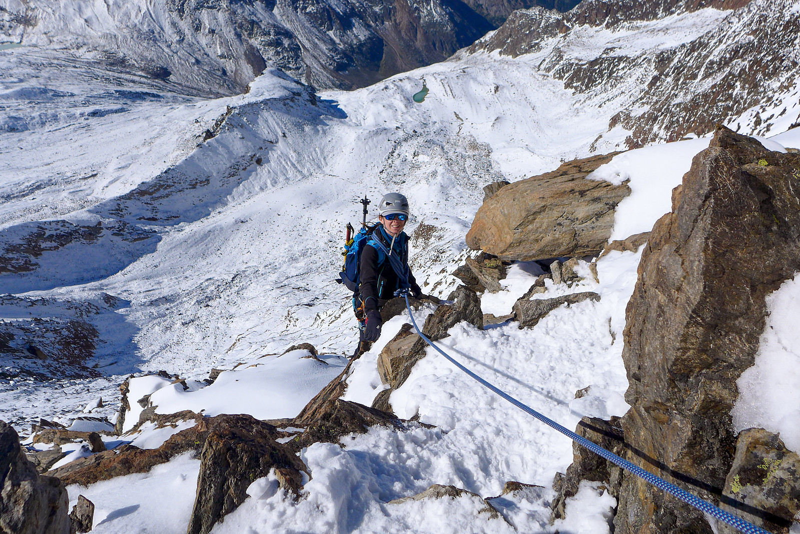
Dom
- Datum:
- 03.07.2023
- Tourcharakter:
- Hochtour
- Tourlänge:
- 13:38h
- Entfernung:
- 16,1km
 Following a couple of days of bad weather, it looked like we would be getting a couple of days of good weather again for the final week of the holiday. As I now only had two more summits to go to complete the 50 principal 4000m peaks of the Alps it was basically a toss up between the Dom and the Aiguille Blanche de Peuterey. I’d been following the weather forecast for the respective peaks rather closely and had come to the conclusion that the weather would be better further east at the start of the this final week, with apparently more sun and less wind forecasted for the Dom than on for example the Tour Ronde, which was the closest peak I could find to the Aiguille Blanche de Peuterey in the meteoblue database. I’d earlier hoped that the Taschhorn-Dom traverse would be a possibility this >>>
Nordend
- Datum:
- 24.06.2023
- Tourcharakter:
- Hochtour
- Tourlänge:
- 10:10h
- Entfernung:
- 11,0km
 Nordend is one of the 50 major 4000m summits listed in Martin Moran’s guidebook to the 4000m peaks of the Alps, despite having a prominence of less than 100m, so it was on my to-do list for this summer even though given the choice I’d rather have done a ski-assisted ascent much like I’d done on the Dufourspitze a couple of years earlier. After almost an entire week of strong gales and a storm depositing new snow up high I’d originally wanted to use the new weather window to go and climb the Kuffner Arete on Mont Maudit, but since both the Torino and Cosmiques huts were full for friday and saturday night, we ended up heading to Nordend first since there was still many availabe beds in the Monte Rosa hut, which had literally just opened for the summer season. We drove over to Zermatt >>>
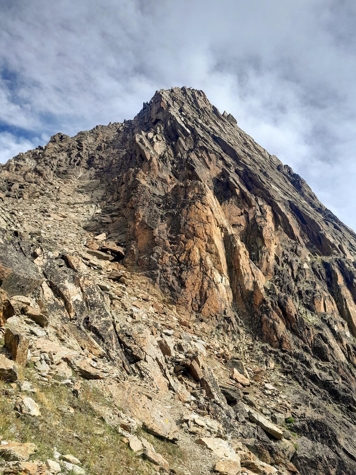
Lagginhorn
- Datum:
- 15.06.2023
- Tourcharakter:
- Wanderung
- Tourlänge:
- 6:50h
- Entfernung:
- 8,6km
 I had planned to head up the Lagginhorn for acclimatisation quite far in advance, and so booked a place in the Weissmies hut before I'd even left Norway. It was quite lucky then that I'd struck a nice weather window this week. Had a nice relaxing walk up to the hut on the wednesday, and was welcomed by the hut guardian Roberto just as I arrived and for some reason he already seemed to know who I was. When I asked how, he replied that I was the only person booked to stay at the hut that night - a bit of a novelty! As the day went on, another group of 3 (one guide and two Swiss guests) turned up, so I wasn't eating dinner alone that evening, but I did get an entire empty dormitory for myself ;-) Had a great night's sleep until 4am the following morning, then had a relaxed breakfast. The other >>>
Jegihorn
- Datum:
- 12.06.2023
- Tourcharakter:
- Wanderung
- Tourlänge:
- 4:00h
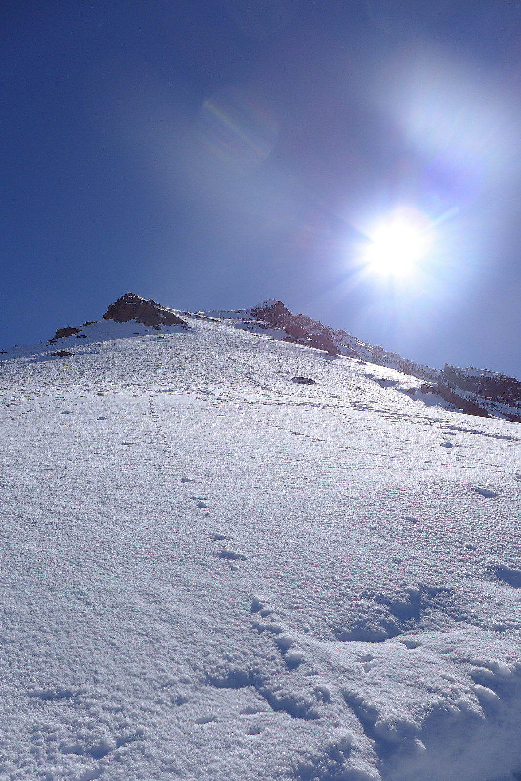
 Første dag i Saas Grund etter en lang reise sørover fra Tromsø. Tok gondolen opp til Kreuzboden og gikk opp mot Jegihorn for å få meg en liten akklimatiseringstur. Var fint vær og godt å se et ordentlig snødekke på de fleste fjellene! For en gangs skyld så Lagginhorn ganske spennende ut, mesteparten av vestryggen var snødekt og det var et pent spor som strakk seg langs hele vestryggen :-) Fulgte blå/hvit skilting oppover og tok mange pauser underveis. Kroppen kjente på at den hadde blitt transportert ganske raskt fra havnivå til over 3000 moh! Det lå en del snø på ruten som gjorde det litt mer tidkrevende men den var stort sett fast and fint å gå på, ihvertfall i 10-11 tiden (var betydelig bløtere på turen ned). Angret litt på at jeg tok gåstavene opp til toppen da de >>>

