Archiv - Nach Datum
Archiv - Nach Geografie
Peakbookfreunde


Gesammelte Listen
-
Sukkertoppen topper
(90/112)
 80%
80% -
Møre og Romsdal ≥ 500m pf.
(104/161)
64%
-
Møre og Romsdal kommunetopper
(14/24)
58%
-
Sunnmøre ≥ 100m pf.
(293/531)
55%
-
2000m 30m pf. fastlandet
(99/227)
43%


Lidaveten
- Datum:
- 20.12.2013
- Tourcharakter:
- Wanderung
- Tourlänge:
- 1:34h
- Entfernung:
- 4,4km
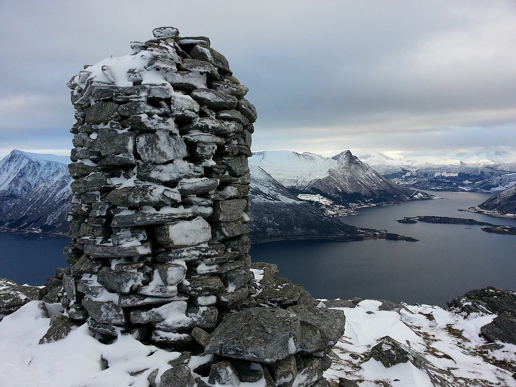
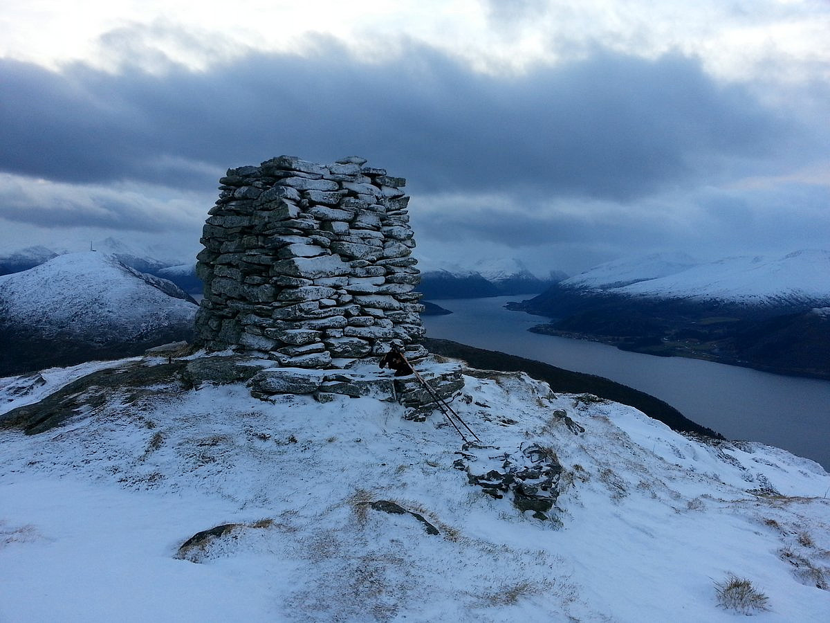 Jeg tok meg en lett fjelltur før en strabasiøs affære med jule-handel i Ørsta. Varden har gått igjennom en totalforandring når man sammenligner med de andre bildene her på peakbook.
Klikk her for å se samtlige bilder fra turen
Jeg tok meg en lett fjelltur før en strabasiøs affære med jule-handel i Ørsta. Varden har gått igjennom en totalforandring når man sammenligner med de andre bildene her på peakbook.
Klikk her for å se samtlige bilder fra turen
Breiddalseggi
- Datum:
- 18.12.2013
- Tourcharakter:
- Randonnée/Telemark
- Tourlänge:
- 2:49h
- Entfernung:
- 8,6km
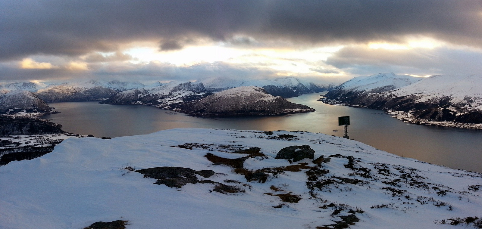
 Det var litt ufyselig å åpne bildøra i den sterke vinden på Strynefjellet, noe som medførte et inferno av snødrev inn i bilen. Men jeg hadde allerede krysset dørstokken hjemme, så da måtte jeg vel klare å komme meg ut av bilen også. Jeg spente på meg skiene og tok sikte på syd-ryggen av Breiddalseggi. Stedvis var snøen helt avblåst, men jeg fant en grei passasje oppover. Forøvrig var det mye vindpakket snø og til dels krevende gjennomslagsføre. Skistavene med altfor små trinser gikk helt til bunns flere ganger, noe som gjorde det vanskelig å holde balansen i den sterke vinden.
Men med tiden til hjelp, kom jeg meg greit til topps av Breiddalseggi. Den kalde vinden medførte at jeg fikk numne fingertupper etter et par bilder med mobiltelefonen. Det fristet derfor ikke å ta >>>
Det var litt ufyselig å åpne bildøra i den sterke vinden på Strynefjellet, noe som medførte et inferno av snødrev inn i bilen. Men jeg hadde allerede krysset dørstokken hjemme, så da måtte jeg vel klare å komme meg ut av bilen også. Jeg spente på meg skiene og tok sikte på syd-ryggen av Breiddalseggi. Stedvis var snøen helt avblåst, men jeg fant en grei passasje oppover. Forøvrig var det mye vindpakket snø og til dels krevende gjennomslagsføre. Skistavene med altfor små trinser gikk helt til bunns flere ganger, noe som gjorde det vanskelig å holde balansen i den sterke vinden.
Men med tiden til hjelp, kom jeg meg greit til topps av Breiddalseggi. Den kalde vinden medførte at jeg fikk numne fingertupper etter et par bilder med mobiltelefonen. Det fristet derfor ikke å ta >>>
Helgehornet
- Datum:
- 21.11.2013
- Tourcharakter:
- Wanderung
- Tourlänge:
- 1:36h
- Entfernung:
- 4,0km
 Jeg kjørte opp til skytebana i Sollidalen. Veien var ikke brøyta men det skal mer til enn 10-15 cm med nysnø for å stoppe en Ford Mondeo. Jeg parkerte bilen ved skytebana og fant et tur-skilt hvor det var skrevet Helgehornet. Det var til og med spor i nysnøen, en lokal turgåer hadde nemlig brøytet løype for meg. Perfekt tenkte jeg, og husket den problematiske starten på Blåtind - bommet på stien tidligere idag.
Det var flott julestemning oppover skogen. Jeg kom etterhvert over skoggrensa og utsikten mot Sunnmørsalpene var fabelaktig. Her var det lite å klage på, med unntak av at jeg tråkket gjennom flere dype hull i snøen/terrenget, noe det fort kan bli beinbrudd av hvis man ikke er påpasselig.
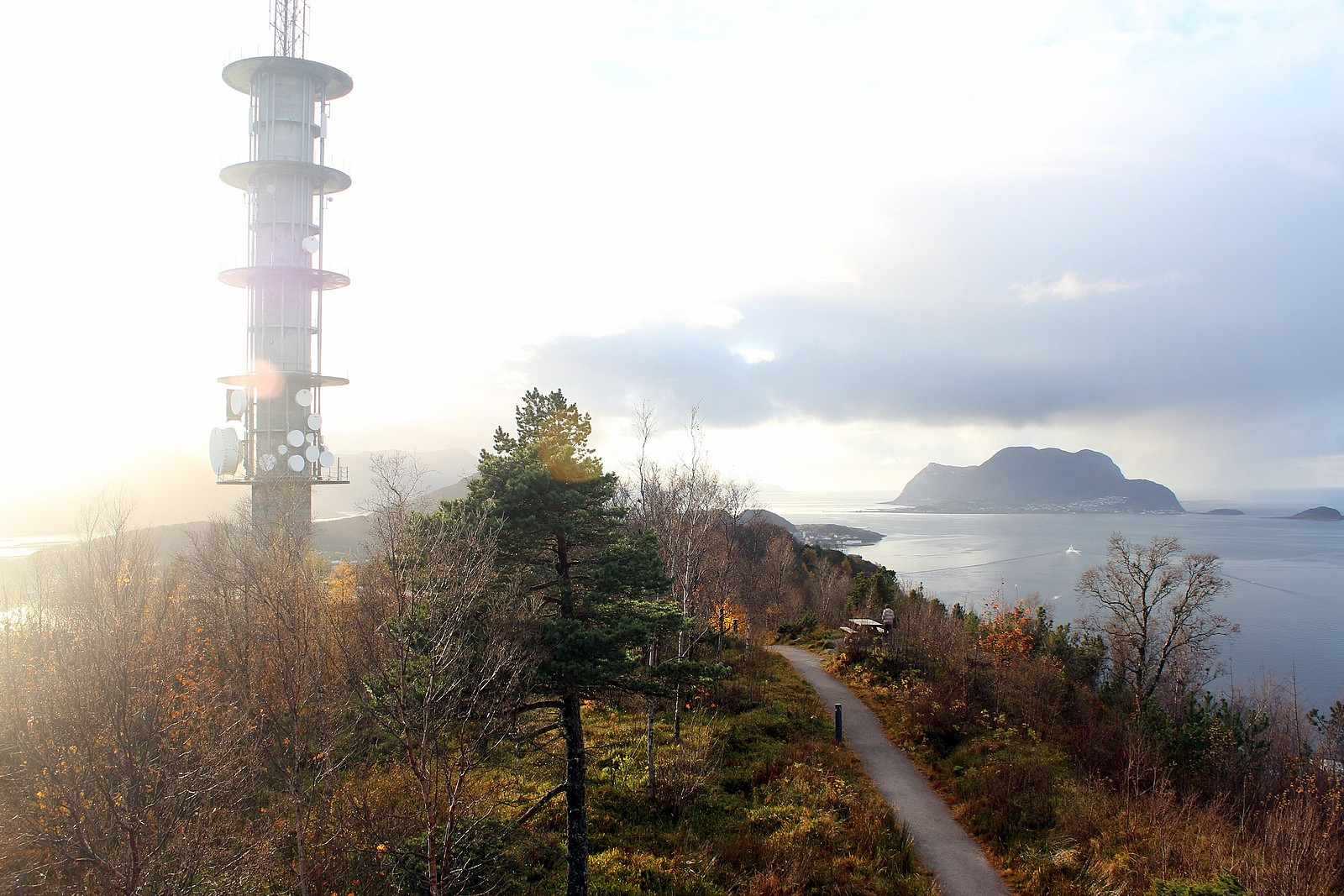
På toppen av Helgehornet er det en stor mast og en bygning å søke ly bak hvis det er mye vind. Men idag var >>>
Jeg kjørte opp til skytebana i Sollidalen. Veien var ikke brøyta men det skal mer til enn 10-15 cm med nysnø for å stoppe en Ford Mondeo. Jeg parkerte bilen ved skytebana og fant et tur-skilt hvor det var skrevet Helgehornet. Det var til og med spor i nysnøen, en lokal turgåer hadde nemlig brøytet løype for meg. Perfekt tenkte jeg, og husket den problematiske starten på Blåtind - bommet på stien tidligere idag.
Det var flott julestemning oppover skogen. Jeg kom etterhvert over skoggrensa og utsikten mot Sunnmørsalpene var fabelaktig. Her var det lite å klage på, med unntak av at jeg tråkket gjennom flere dype hull i snøen/terrenget, noe det fort kan bli beinbrudd av hvis man ikke er påpasselig.
På toppen av Helgehornet er det en stor mast og en bygning å søke ly bak hvis det er mye vind. Men idag var >>>
Blåtind - bommet på stien
- Datum:
- 21.11.2013
- Tourcharakter:
- Wanderung
- Tourlänge:
- 2:45h
- Entfernung:
- 7,6km
 Statens Kartverk har tegnet inn en tydelig sti fra boligfeltet i Indre Haddal, derfor kastet jeg ikke bort noe tid på å studere turbeskrivelser. Først måtte jeg snike meg over en privat tomt øverst i boligfeltet, deretter kløv jeg over et gjerde for å komme opp til utmarka. Jeg begynte å krysse frem og tilbake i utmarka, uten å finne stien som var tegnet inn på kartet. Har dette hendt før? Joda, Statens Kartverk er MEGET UNØYAKTIGE når det gjelder stier, dette har jeg erfart mange ganger før. Men tar jeg lærdom av det? Nei......
Jeg fant ikke stien før jeg var på oversiden av en kraftlinje, og da hadde jeg rotet rundt i den helvetes utmarka i ca 30 minutt. Skikkelig bomstart mao.
Det ble mer og mer snø jo høyere opp jeg kom, så jeg brukte mer tid enn kalkulert. Jeg klarte >>>
Statens Kartverk har tegnet inn en tydelig sti fra boligfeltet i Indre Haddal, derfor kastet jeg ikke bort noe tid på å studere turbeskrivelser. Først måtte jeg snike meg over en privat tomt øverst i boligfeltet, deretter kløv jeg over et gjerde for å komme opp til utmarka. Jeg begynte å krysse frem og tilbake i utmarka, uten å finne stien som var tegnet inn på kartet. Har dette hendt før? Joda, Statens Kartverk er MEGET UNØYAKTIGE når det gjelder stier, dette har jeg erfart mange ganger før. Men tar jeg lærdom av det? Nei......
Jeg fant ikke stien før jeg var på oversiden av en kraftlinje, og da hadde jeg rotet rundt i den helvetes utmarka i ca 30 minutt. Skikkelig bomstart mao.
Det ble mer og mer snø jo høyere opp jeg kom, så jeg brukte mer tid enn kalkulert. Jeg klarte >>>
Veikulnatten
- Datum:
- 15.11.2013
- Tourcharakter:
- Wanderung
- Tourlänge:
- 2:17h
- Entfernung:
- 9,6km