Innledning
Kommunetopp i Nord-Aurdal kommune.
Atkomst
Vinter
Tips og diverse
Bilder

Sett fra Jomfruslettfjellet i sør i november.
Panorama-video fra toppen en sommerdag:
Startsteder
Eksterne lenker
Litteratur og kilder
Flere bilder
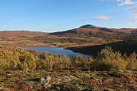 © Anja Prestvik |
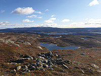 © Marius Meland |
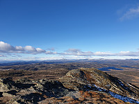 © Marius Meland |
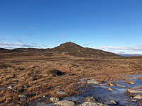 © Marius Meland |
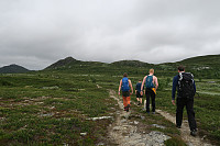 © Fredrik Gedde-Dahl |
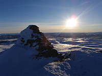 © Svein Eirik Aune |
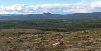 © Hans Thorvald Nygaard |
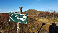 © Ånund Sigurd Kvambekk |
Turrapporter
- 16.10.2025 - Djuptjernkampen - vinter på gang, skrevet av Atomsilda
- 19.09.2025 - Djuptjernkampen og Solskiva, skrevet av Atomsilda
- 21.07.2025 - Røssj og Djup med Marit og Helge, skrevet av repelo
- 12.07.2025 - Topptrimmen Røssjøkollane, skrevet av AndersNM
- 12.07.2025 - Røssjøkollane og Djuptjernkampen, skrevet av anneg
- 14.06.2025 - Topptrim Røssjøkollane, og Djuptjernskampen, skrevet av repelo
- 08.04.2025 - Nydelig mot Djuptjernkampen, skrevet av Atomsilda
- 11.06.2024 - Djuptjernkampen og Røssjøkollane, skrevet av Atomsilda
- 28.08.2023 - Djuptjernkampen og Skjellbreidskampen, skrevet av Line
- 08.07.2023 - Djuptjernkampen, skrevet av Atomsilda
- 07.03.2023 - Med fjellski til Djupjernkampen, skrevet av Atomsilda
- 12.11.2022 - Djuptjernkampen, skrevet av Atomsilda
- 22.07.2022 - Djuptjernskampen, topptrim, skrevet av repelo
- 14.06.2022 - Gjørmetur i regn til Djuptjernkampen, skrevet av TRefsnes
- 14.09.2021 - Djuptjernskampen og Røssjøkoller, skrevet av repelo
- 03.08.2021 - Djuptjernkampen og ringsrudåsen, skrevet av Vebjørn93
- 13.09.2020 - Djuptjernkampen - kommunetopp i Nord-Aurdal, skrevet av Dag1
- 13.09.2020 - Idyllisk høsttur til Nord-Aurdals høyeste, skrevet av Fjellsamleren
- 29.08.2020 - Kommunetopp - Djuptjernkampen 1325m, Nord-Aurdal, Innlandet, skrevet av josokbakke
- 29.08.2020 - Djuptjernkampen-en flott runde, skrevet av Atomsilda
- 18.07.2020 - Djuptjernkampen, høyest i Nord-Aurdal, skrevet av gedded
- 22.06.2020 - Fjelltur i Langsua nasjonalpark, skrevet av Furusethmotorsport
- 07.04.2020 - Djuptjernkampen, skrevet av alexw
- 06.09.2019 - Langtur med overnatting i Tapptjerndalen, skrevet av MarianneB
- 14.06.2019 - Kremtoppjakt til Djuptjernkampen og Skriulægerknatten, skrevet av Olepetter
- 11.10.2018 - Djuptjernkampen, Topptrimmen, skrevet av sinyg
- 14.09.2018 - Djuptjernkampen, skrevet av FjellEggen
- 02.09.2018 - Djuptjernkampen, skrevet av NJK500
- 05.08.2018 - Topptrim Djuptjernskampen, skrevet av repelo
- 10.06.2018 - Topptrimmen i Gausdal - tre topper, skrevet av anneg
- 09.06.2018 - Telttur med Tind i Langsua nasjonalpark, skrevet av Hannes
- 20.11.2017 - Djuptjernkampen, Nord-Aurdal, skrevet av Elementmannen
- 13.08.2017 - Topptrimturer i Gausdal Vestfjell, skrevet av anneg
- 18.07.2017 - Djuptjernkampen, Topptrimmen, skrevet av sinyg
- 14.07.2017 - Djuptjernskampen, topptrim, skrevet av repelo
- 06.10.2016 - Djuptjernkampen Kommunetopp i Nord-Aurdal, skrevet av aask
- 26.09.2016 - Djuptjernkampen (Nord-Aurdal) m/Ole-Petter, skrevet av knutsverre
- 24.07.2016 - Tur til Djuptjernkampen - med sjelden flora, skrevet av Stigun
- 04.07.2016 - Røssjøkollane og Djuptjernskampen, skrevet av KristineL
- 04.07.2016 - Røssjøkollane og Djuptjernskampen, skrevet av Hansi
- 07.05.2016 - Vårskitur i varmt vær, skrevet av anneirik
- 07.05.2016 - Ein av dei siste skiturane i år, skrevet av bakken59
- 07.11.2015 - Kinnkjølen og Djuptjernkampen, skrevet av arne
- 25.10.2015 - Djuptjernkampen, skrevet av mortenh
- 25.10.2015 - Djuptjernkampen med Helgesen, skrevet av bergtatt
- 18.10.2015 - Djupkjernkampen, skrevet av grolyseng
- 18.10.2015 - Djuptjernkampen, skrevet av marius
- 18.10.2015 - Djuptjernkampen, skrevet av Herman
- 16.10.2015 - Djuptjernkampen, Solskiva og vardebygging på "Lilleviseren", skrevet av Olepetter
- 03.10.2015 - Førstemann på toppen!, skrevet av Sjutten
- 03.04.2015 - Fullmånetur til Djuptjernskampen :), skrevet av venkekristin
- 20.02.2015 - Vindfullt på Djuptjernkampen, skrevet av Olepetter
- 21.07.2014 - Topptrimmen 2014 Djuptjernkampen, skrevet av sinyg
- 12.07.2014 - Djuptjernkampen og Spåtind, skrevet av haky
- 18.10.2013 - Djuptjernskampen og Skjelbreia, skrevet av repelo
- 18.10.2013 - Skjelbreidskampen og Djuptjernskampen, skrevet av Hansi
- 02.10.2013 - Djuptjernkampen, skrevet av linntherese
- 24.08.2013 - Djuptjernkampen - Nord-Aurdal, 117/404, skrevet av Sola19
- 21.08.2013 - Djuptjernkampen, skrevet av NJK500
- 27.07.2013 - Årets første bad, skrevet av LivogKristen
- 12.07.2013 - Hugs fjellsko, skrevet av bergteken
- 28.06.2013 - 81 Nord-Aurdal: Djuptjernkampen, skrevet av morsor
- 10.08.2012 - Kosetopp, skrevet av AnneliH
- 02.08.2012 - Djuptjernkampen, skrevet av Tomis
- 16.07.2012 - Djuptjernskampen, skrevet av Hansi
- 16.07.2012 - Djuptjernskampen 16/7 2012, skrevet av repelo
- 29.11.2011 - Her kommer vintern, skrevet av Esau
- 16.10.2011 - Flott rundtur nord for Lenningen, skrevet av 19topper
- 20.07.2011 - Flott fjellområde, skrevet av Annar
- 13.06.2011 - Djuptjernkampen-flott tur i lett terreng, skrevet av Atomsilda
- 13.03.2010 - Djuptjernkampen og Ringsrudåsen, skrevet av 500fjell
- 31.01.2009 - Årets første kommunetopp, skrevet av Sea2Summit
- 05.07.2008 - Djuptjernkampen, skrevet av TERJES
- 26.10.2007 - Djuptjernkampen, skrevet av Olepetter
- 02.07.2007 - Lett terreng innover., skrevet av innerdal
- 31.07.2006 - På jobb i Hallingdal, men til fjells også..., skrevet av JoSo
- 17.07.2005 - Lett og fin tur, skrevet av bigmob
- 27.05.2005 - Kommunetopptur til nedre Oppland, skrevet av Snilen
- 05.08.2002 - Tronhus - Grytsetra 5/8 2002., skrevet av repelo
- 26.08.1973 - Djuptjernkampen 26/8 1973, skrevet av repelo





Kommentarer