
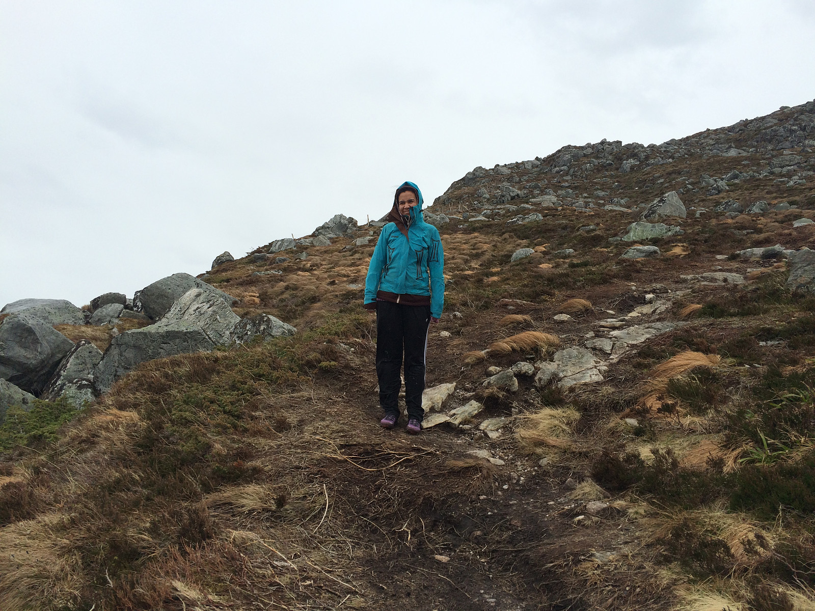
With my daughter Sol to the summit of Mount Storhornet (26.03.2016)

Skrevet av Solan (Atle Solholm)

| Startsted | Hestevika (5moh) |
|---|---|
| Sluttsted | Hestvika (5moh) |
| Turtype | Fottur |
| Turlengde | 2t 44min |
| Distanse | 6,8km |
| Høydemeter | 579m |
| GPS |
|
| Bestigninger | Storhornet (497moh) | 26.03.2016 12:24 |
|---|
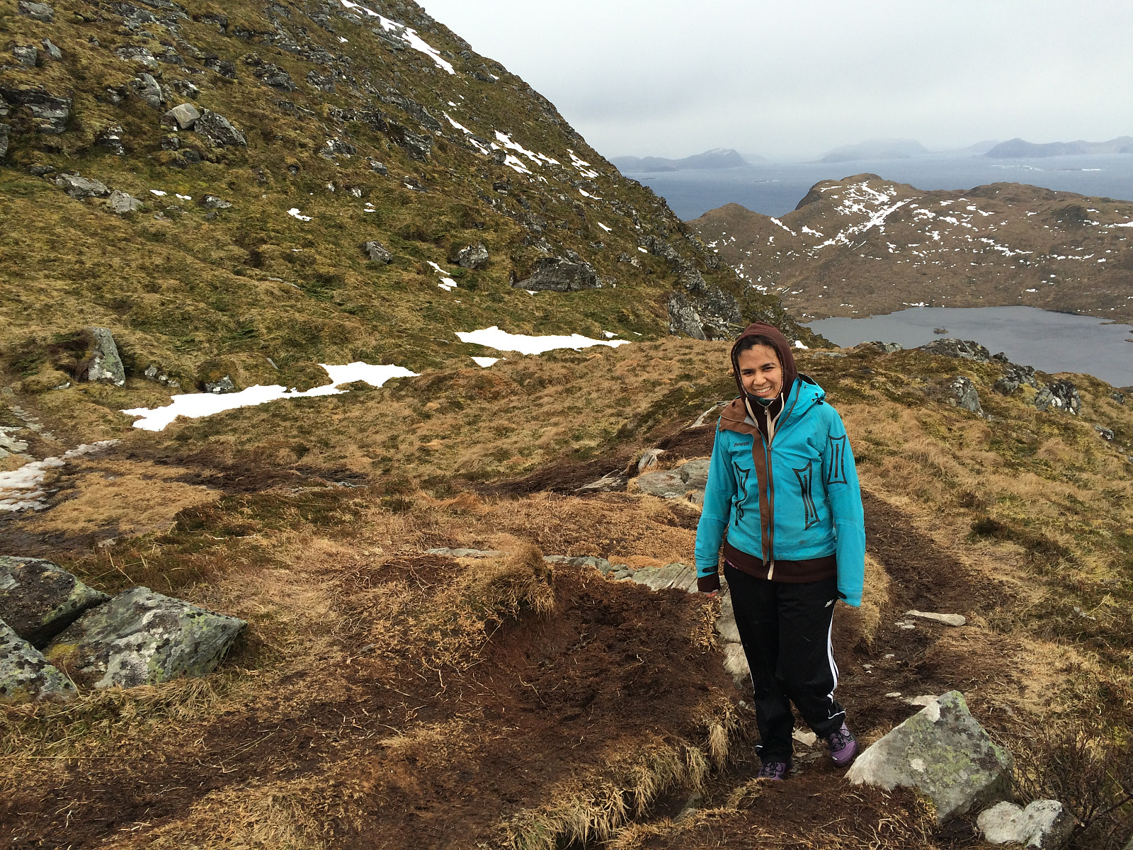
As on multiple other occasions, I ascended the summit of Storhornet, the highest peak on the mountain of the island Godøy, in Giske Municipality, in Møre & Romsdal County on the west coast of Norway. I have frequently climbed this mountain alone, but on several occasions I've also climbed the mountain along with one of my children; and on this day it was my oldest daughter Sol who joined me for the hike. We parked our car on the parking lot in Hestvika [i.e. The Horse's Bay], and started out from there. This parking place is spacious, and it's free of charge, so I recommend it to anyone who's planning to do this hike. The trail up the north face of the mountain starts about 100 meters from the parking lot. There is a combined pedestrian and bicycle lane on the other side of the road, and you just follow this till you get to a sheep gate, where a sign will tells you the trail up to the summit of Storhornet starts here. You actually don't have to open the gate to get through, as it has been provided with a ladder that you may use to climb above it. The trail then takes a somewhat oblique course up the mountain side, but its frequently used by locals as well as tourists, hence the trail is visible all the way up to the plateau on which Lake Alnesvatnet is located, and you can't miss it.
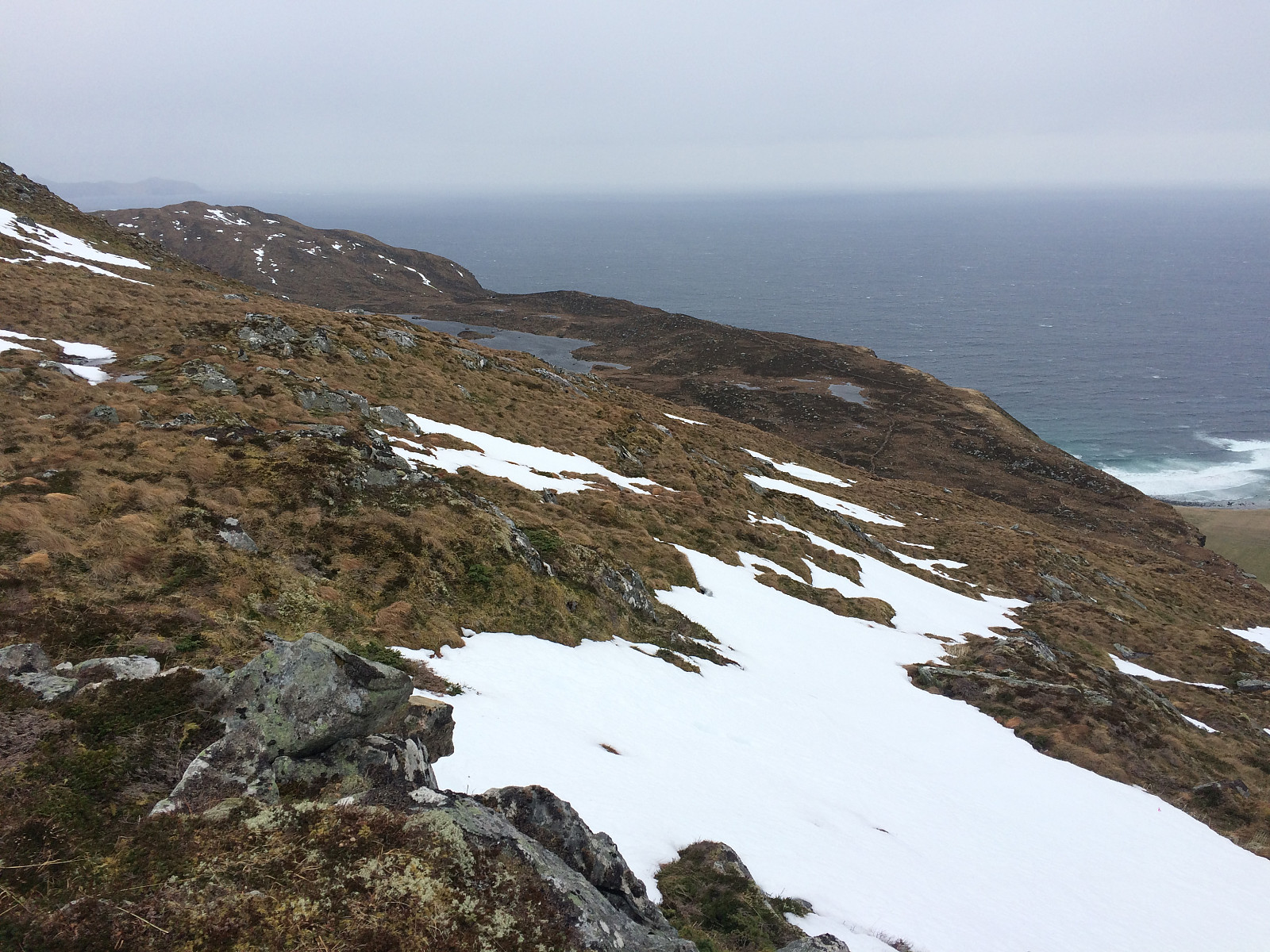
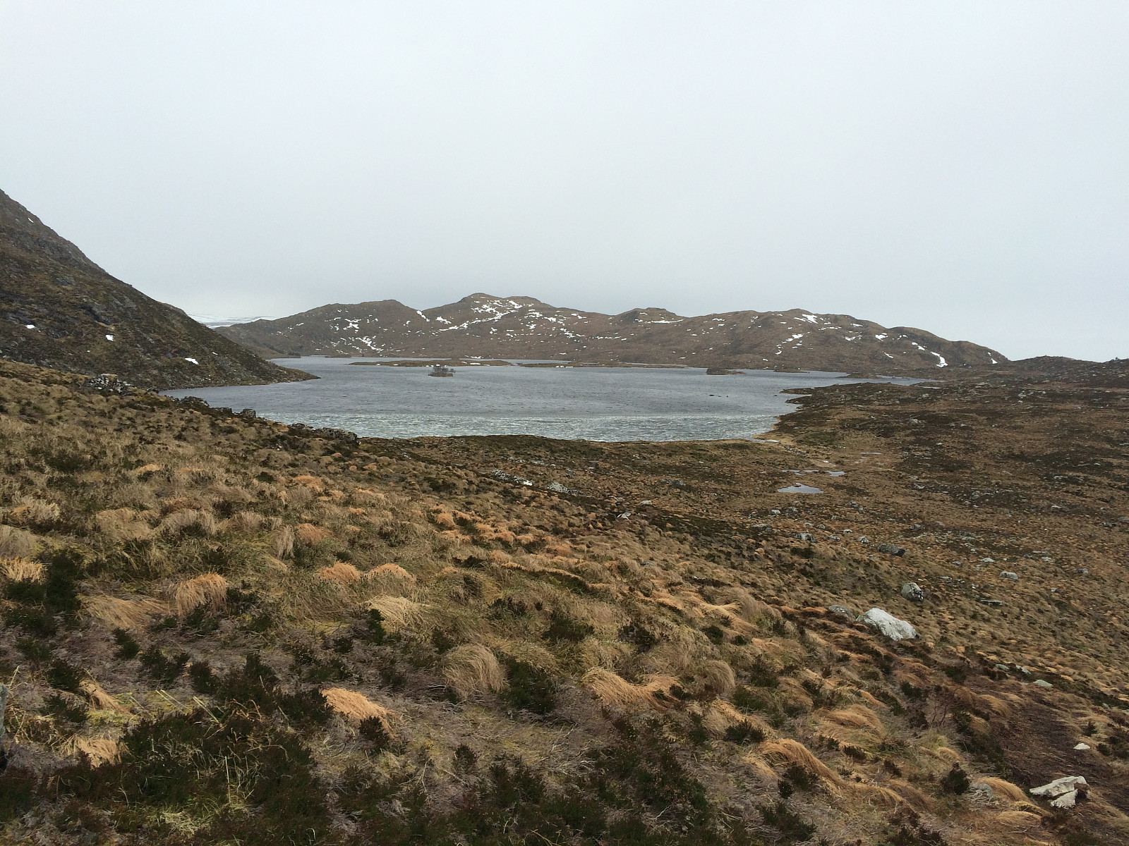
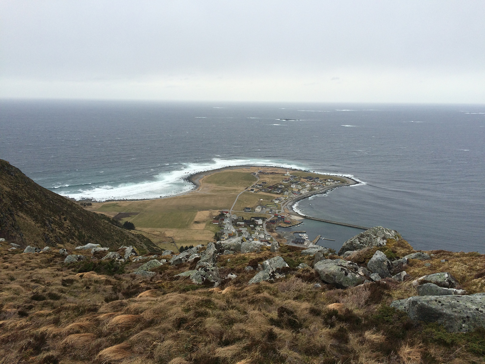
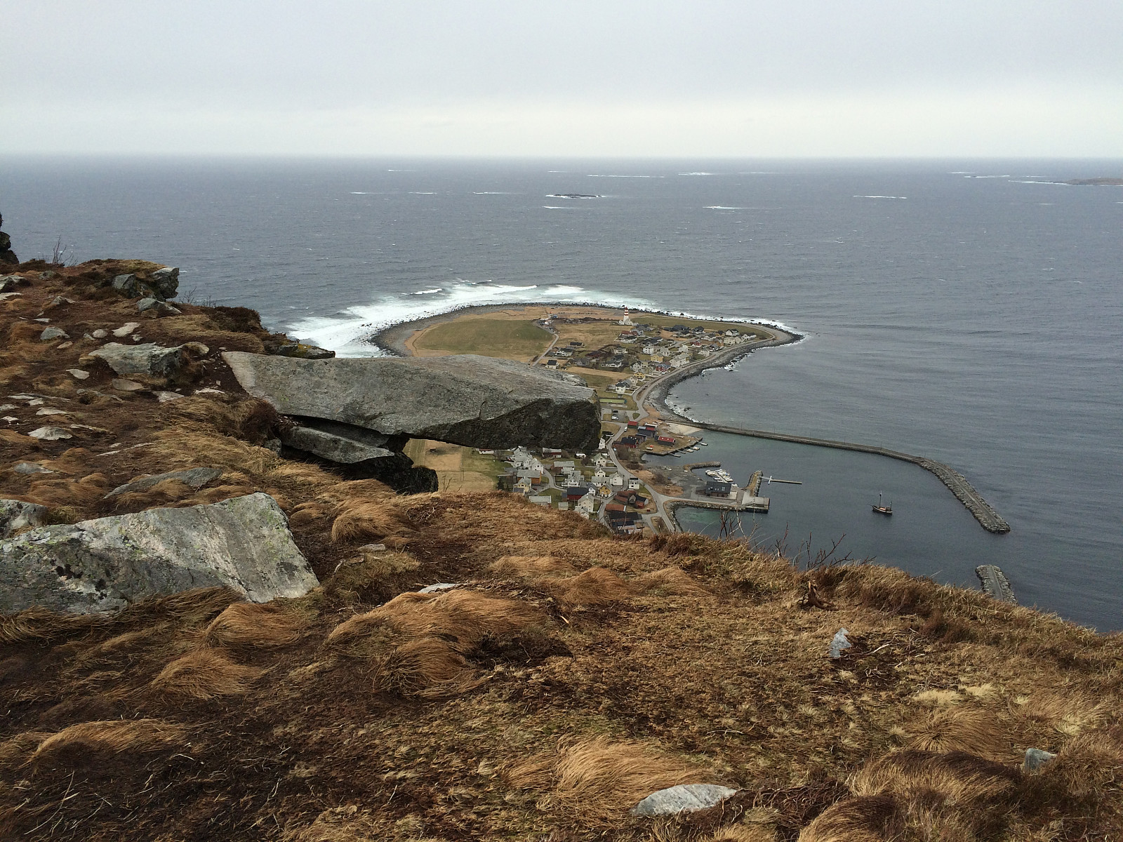
The lake Alnesvatnet, which derives its name from Alnes, the headland or promontory beneath it [nes in Norwegian means promontory]; is ideally located for the inhabitants living on the four main islands of this municipality. The lake provides the entire community with potable water, and situated at an elevation of 254 m.a.m.s.l., you don't even need a pump station to get the water into every inhabited house on these islands. The lake is beautiful with a number of small islets (and especially so during summer, when the vegetation on the islets is green); and if you havent been there, it's absolutely worth the effort to go all the way up to the shores of the lake just to have a look. If you don't care about seeing the lake from a close range, however, there is an alternative trail that you'll find by taking left shortly before you reach the plateau (see our GPS tracking). Next, follow the edge of the plateau in eastward direction (there's one trail along the edge, and another closer to the northern shore of the lake). As you reach the end of the plateau, there's a creek, called Kvernhuselva [i.e. The Mill House River] emerging from the lake, and eventually forming a little waterfall where it tumbles down the cliff at the edge along which you're walking. Shortly after the waterfall, there's a large stone, called Johan Skytt, protruding from the mountain side. You do get a spectacular photo if you have someone "shoot" you standing on the stone, with the promontory of Alnes with its famous lighthouse in the background; but be careful, because a fall from that stone will most likely be your last, hence at least don't walk onto it on a windy day (which is quite often the case on these islands).
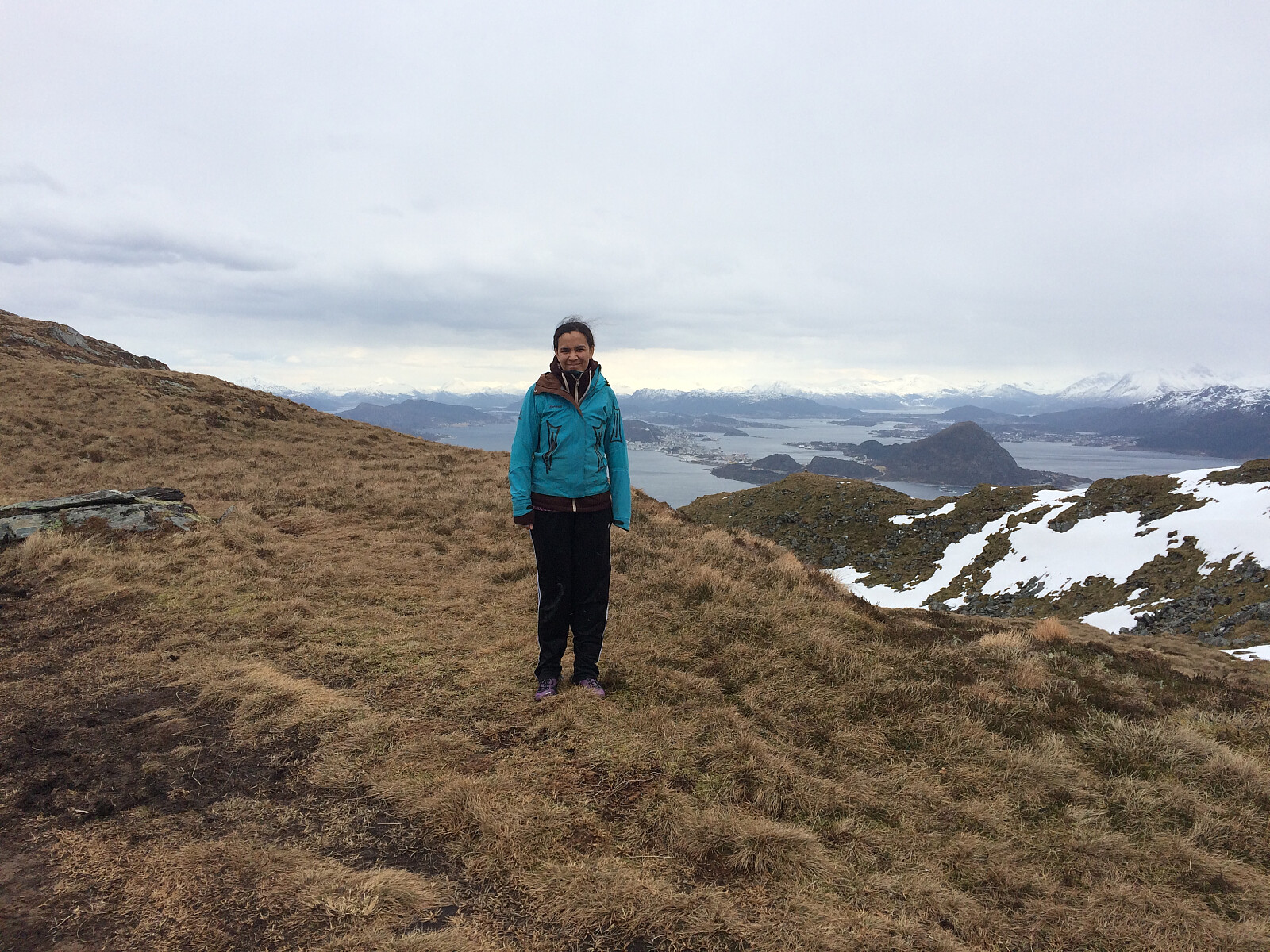
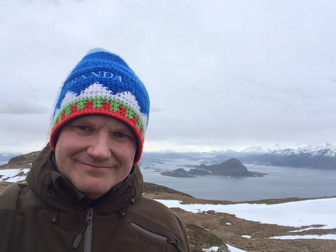
After you've passed the spectacular stone, you arrive at a mountain ridge that goes in north-south direction, and which takes you up to the higher parts of this mountain (i.e. the summits of Storhornet and Sloktindane) if you follow the ridge southwards. Halfway up along this ridge, the trail does divide in two. The shortest and quickest way to get up to Storhornet (the highest of the peaks) is to take the right trail, whereas if you want to go to Sloktindane and the smaller lake "Litlevatnet", you should take the left trail. My daughter and I chose the right trail, and a few minutes later we were at the summit of Mount Storhornet (see pictures). For our return down to the car we chose pretty much the same trail as we had done for the ascent, though we did actually take the alternative trail down (the one going to Sloktindane), as the one we had used for our ascent was quite muddy and soaked with melt water from the snow that had recently been here; hence we decided to try the other trail for our descent (and it is actually a little bit better and less muddy on days like this). [See GPS-tracking for the details on these trails]. Otherwise we followed the same route for our descent (most of the pictures are actually from our descent, as we were too eager to have a good workout as we were climbing the mountain).


Kommentarer