Archiv - Nach Datum
Archiv - Nach Aktivität
-
Andere Tour (1)
- Kayaking (1)
-
Andere Wintertour (4)
- Schneeschuhtour (4)
-
Fahrradtour (110)
- Fahrradtour Straße (5)
- Fahrradtour gemischt (35)
-
Fußtour (703)
- Bergtour (351)
- Jogging (18)
- Spaziergang (83)
- Wanderung (251)
-
Skitour (3)
- Tourenskilauf (3)
Archiv - Nach Geografie
Peakbookfreunde


Gesammelte Listen
-
Bergen ≥ 50m pf. og ≥ 100 m.o.h.
(87/89)
 97%
97% -
Most dominating tops of the Bergen peninsula
(68/75)
90%
-
Utvalgte topper og turmål i Bergen
(299/339)
88%
-
Alle topper i Bergen
(344/392)
87%
-
Opptur Bergen
(99/113)
87%
-
De syv fjell rundt Bergen
(6/7)
85%
-
Sund ≥ 50m pf.
(14/18)
77%
-
Os ≥ 50m pf.
(25/34)
73%
-
Søyler (fastmerker) i Bergen
(66/100)
66%
-
Fjell ≥ 50m pf.
(21/32)
65%

Ottanosi
- Datum:
- 04.10.2008
- Tourcharakter:
- Bergtour
- Tourlänge:
- 3:00h
- Entfernung:
- 9,8km
 Very nice autumn hike up and down Ottanosi.
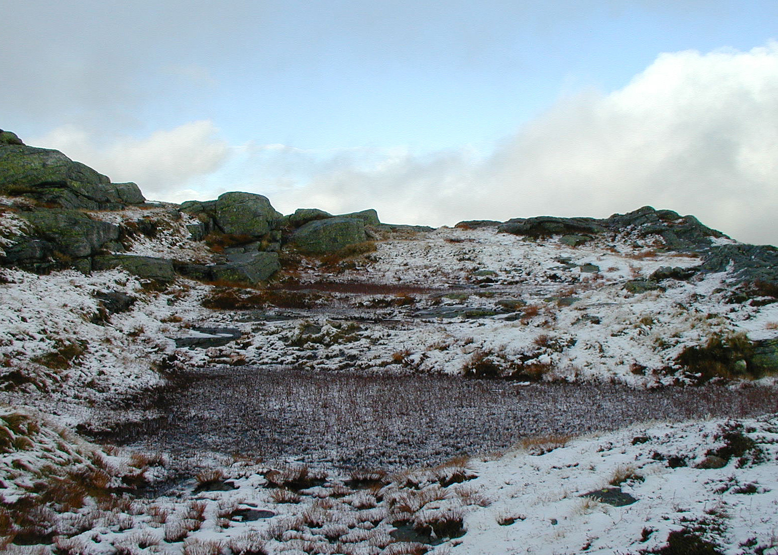
Kista
- Datum:
- 13.09.2008
- Tourcharakter:
- Bergtour
- Tourlänge:
- 3:00h
- Entfernung:
- 8,8km
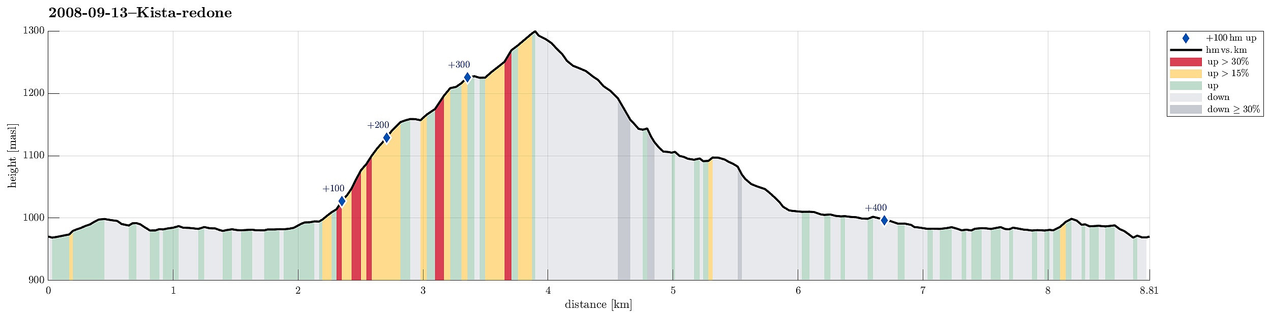 Very nice hike up and down Kista from Haukeli!
Selected photos are available as G+ photo album .
Very nice hike up and down Kista from Haukeli!
Selected photos are available as G+ photo album .
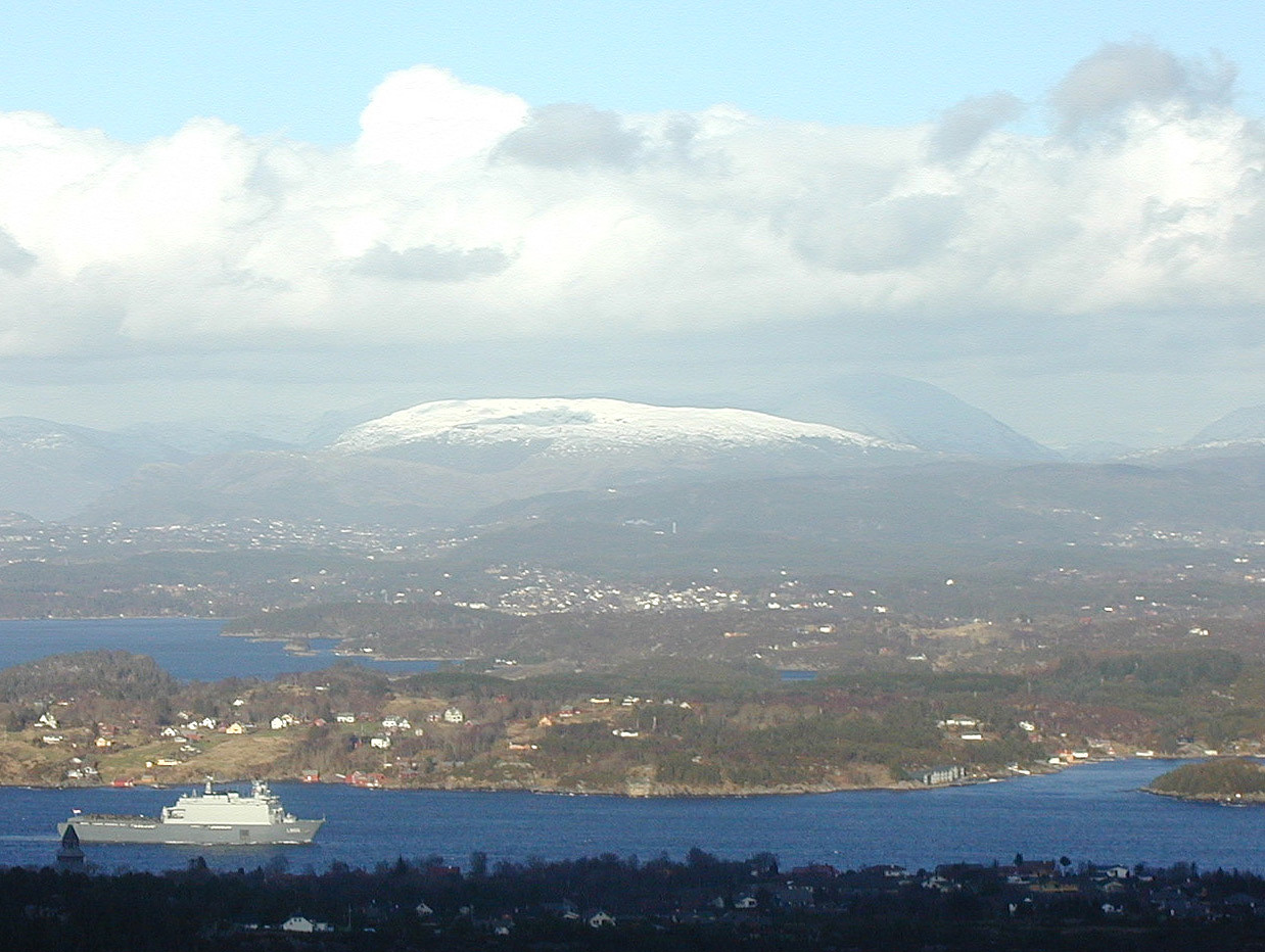
Kattnakken
- Datum:
- 15.04.2008
- Tourcharakter:
- Bergtour
- Tourlänge:
- 3:00h
- Entfernung:
- 10,5km
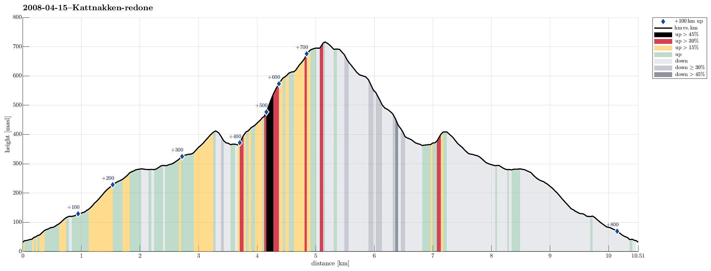 Wonderful tour with quite a bit of snow up and down Kattnakken on Stord.
Førdesveten
- Datum:
- 23.03.2008
- Tourcharakter:
- Bergtour
- Tourlänge:
- 2:00h
- Entfernung:
- 4,6km
 Nice hike up and down Førdesveten.
Eldsfjellet
- Datum:
- 19.01.2008
- Tourcharakter:
- Bergtour
- Tourlänge:
- 2:00h
- Entfernung:
- 3,2km
 Impressive hike (with an intense hail storm!) up and down Eldsfjellet
Liatårnet
- Datum:
- 12.01.2008
- Tourcharakter:
- Bergtour
- Tourlänge:
- 2:00h
- Entfernung:
- 4,8km
 Very nice hike up and down Liatårnet.
Vidden
- Datum:
- 09.08.2007
- Tourcharakter:
- Bergtour
- Tourlänge:
- 5:00h
- Entfernung:
- 13,0km
 Very nice hike over Vidden.
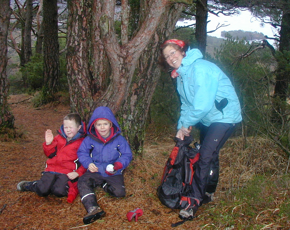
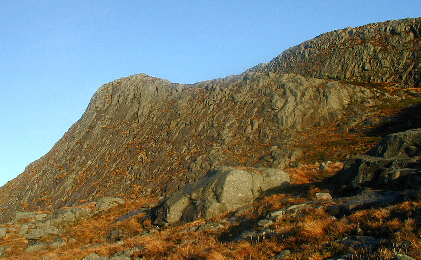
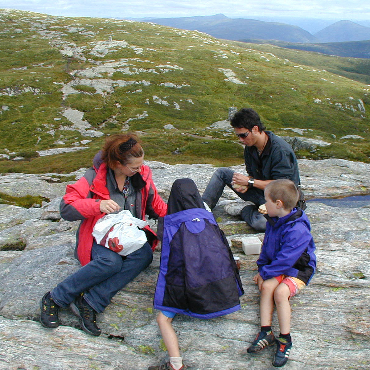
Løvstakken
- Datum:
- 30.06.2007
- Tourcharakter:
- Bergtour
- Tourlänge:
- 2:30h
- Entfernung:
- 6,7km
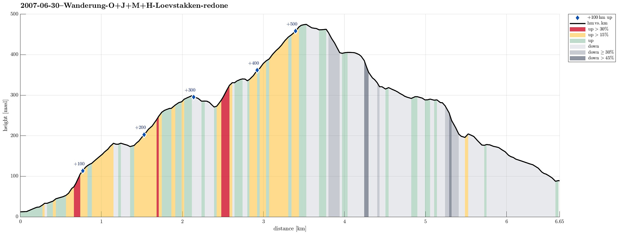 Nice hike over Løvstakken.
Winter excursion to Höllenstein
- Datum:
- 25.12.2006
- Tourcharakter:
- Bergtour
- Tourlänge:
- 3:00h
- Entfernung:
- 8,7km
 This time, we started from Rohrberg and headed eastwards towards Höllensteinberg. In nice winter weather, we ascended to the heights around J.-Schöffel-Hütte and continued via Kreuzsattel towards Höllensteinberg. Instead of directly ascending to its top right away, we first surrounded it and got up to the top from the east. We then continued in western direction, making use of some simple sledges that we had brought along (this turned out to be way more dangerous than anticipated, due to the steep descent from Höllenstein!). After having returned to Kreuzsattel, we followed the Nordalpenweg down into the direction of Sittendorf/Wildegg. Once we were down to the Sparbach, we crossed it and ascended again (via Hausberg) into order to get over and back to Rohrberg.
See also the related >>>
This time, we started from Rohrberg and headed eastwards towards Höllensteinberg. In nice winter weather, we ascended to the heights around J.-Schöffel-Hütte and continued via Kreuzsattel towards Höllensteinberg. Instead of directly ascending to its top right away, we first surrounded it and got up to the top from the east. We then continued in western direction, making use of some simple sledges that we had brought along (this turned out to be way more dangerous than anticipated, due to the steep descent from Höllenstein!). After having returned to Kreuzsattel, we followed the Nordalpenweg down into the direction of Sittendorf/Wildegg. Once we were down to the Sparbach, we crossed it and ascended again (via Hausberg) into order to get over and back to Rohrberg.
See also the related >>>
Höllenstein
- Datum:
- 29.10.2005
- Tourcharakter:
- Bergtour
- Tourlänge:
- 4:00h
- Entfernung:
- 6,8km
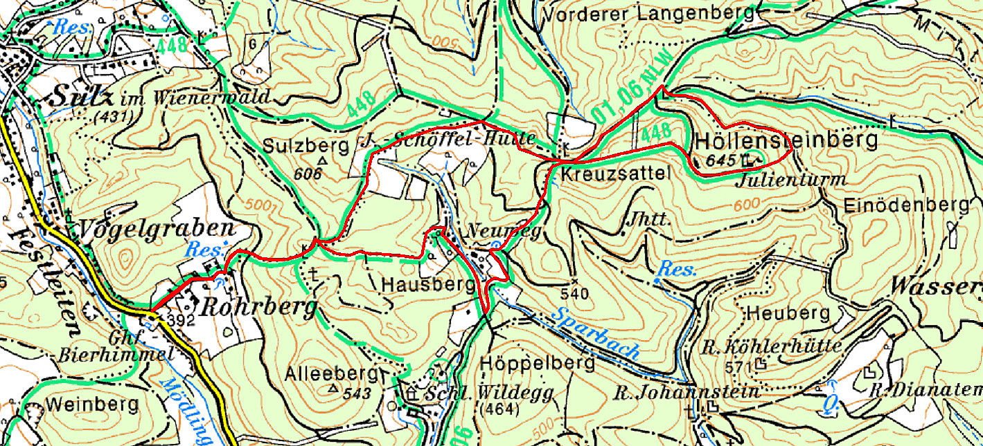
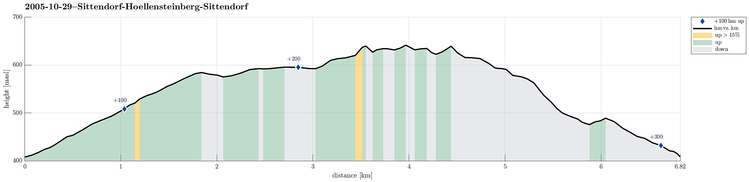 We started near Sittendorf (on Wildeggerstrasse) and started with an ascent into northwestern direction, passing by Alleeberg in the beginning. We then connected to the Mödlinger Rundwanderweg (via some nice heights), before we ascended to the Höllenstein as the top-goal of this day. From there, we first followed the path back which we had taken there, until we met the Nordalpenweg, which we then took down to get back to where we had started.
See also the related FB-page Hiking around Bergen, Norway .
We started near Sittendorf (on Wildeggerstrasse) and started with an ascent into northwestern direction, passing by Alleeberg in the beginning. We then connected to the Mödlinger Rundwanderweg (via some nice heights), before we ascended to the Höllenstein as the top-goal of this day. From there, we first followed the path back which we had taken there, until we met the Nordalpenweg, which we then took down to get back to where we had started.
See also the related FB-page Hiking around Bergen, Norway .
