Archiv - Nach Datum
Archiv - Nach Aktivität
-
Andere Tour (3)
- Kayaking (3)
-
Fahrradtour (108)
- Fahrradtour Straße (83)
- Fahrradtour gemischt (25)
-
Fahrzeugtour (9)
- Autotour (9)
-
Fußtour (1782)
- Bergtour (1054)
- Jogging (1)
- Spaziergang (54)
- Wanderung (673)
-
Skitour (109)
- Langlauf (44)
- Tourenskilauf (65)
Gesammelte Listen
-
Voss ≥ 100m pf.
(96/98)
 97%
97% -
Opptur Hordaland
(143/159)
89%
-
Stasjoner på Bergensbanen
(31/40)
77%
-
Ulvik ≥ 100m pf.
(28/38)
73%
-
Hordaland ≥ 100m pf.
(613/863)
71%
-
Mjølfjell PF > 100m
(21/31)
67%
-
Jondal ≥ 100m pf.
(15/23)
65%
-
Sunnhordland PF >= 100m
(104/186)
55%
-
Dagsturhyttene i Vestland
(33/61)
54%
-
Hordaland: Hardanger PF>=100m
(186/359)
51%
-
Kvinnherad ≥ 100m pf.
(40/79)
50%
-
DNT-hytter i Hordaland
(22/45)
48%
-
Sogndal ≥ 100m pf.
(23/81)
28%
-
Vik i Sogn ≥ 100m pf.
(8/46)
17%
-
DNT-hytter i Sogn og Fjordane
(8/47)
17%
-
Eidfjord ≥ 100m pf.
(7/42)
16%
-
Etne ≥ 100m pf.
(7/51)
13%
-
Ullensvang ≥ 100m pf.
(21/153)
13%
-
Sogn - Sør for Sognefjorden PF>=100m
(17/159)
10%
-
Opptur i Sogn og Fjordane peaks
(17/177)
9%

Radøy: From Kolås to Rimmo
- Datum:
- 13.01.2018
- Tourcharakter:
- Bergtour
- Tourlänge:
- 6:16h
- Entfernung:
- 21,8km
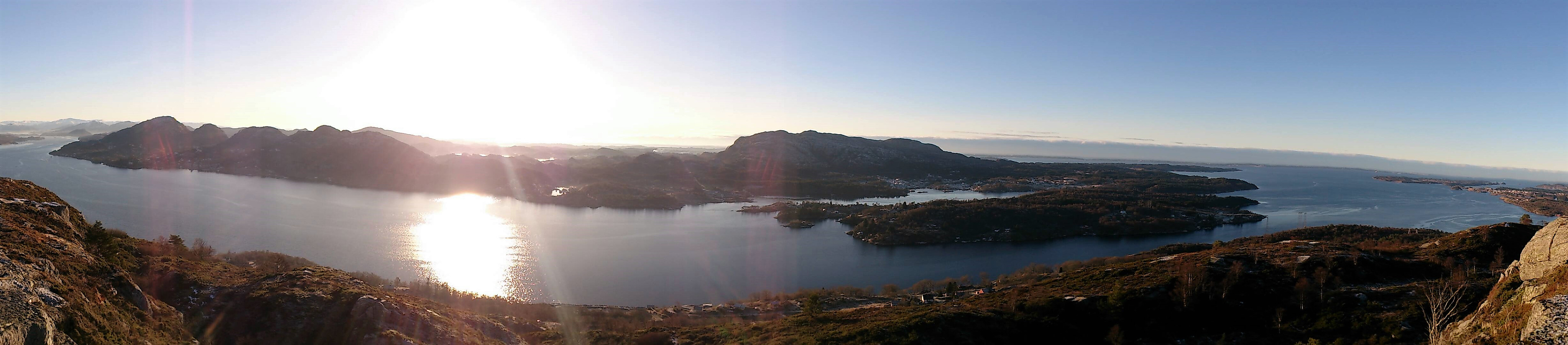 Morkefjellet
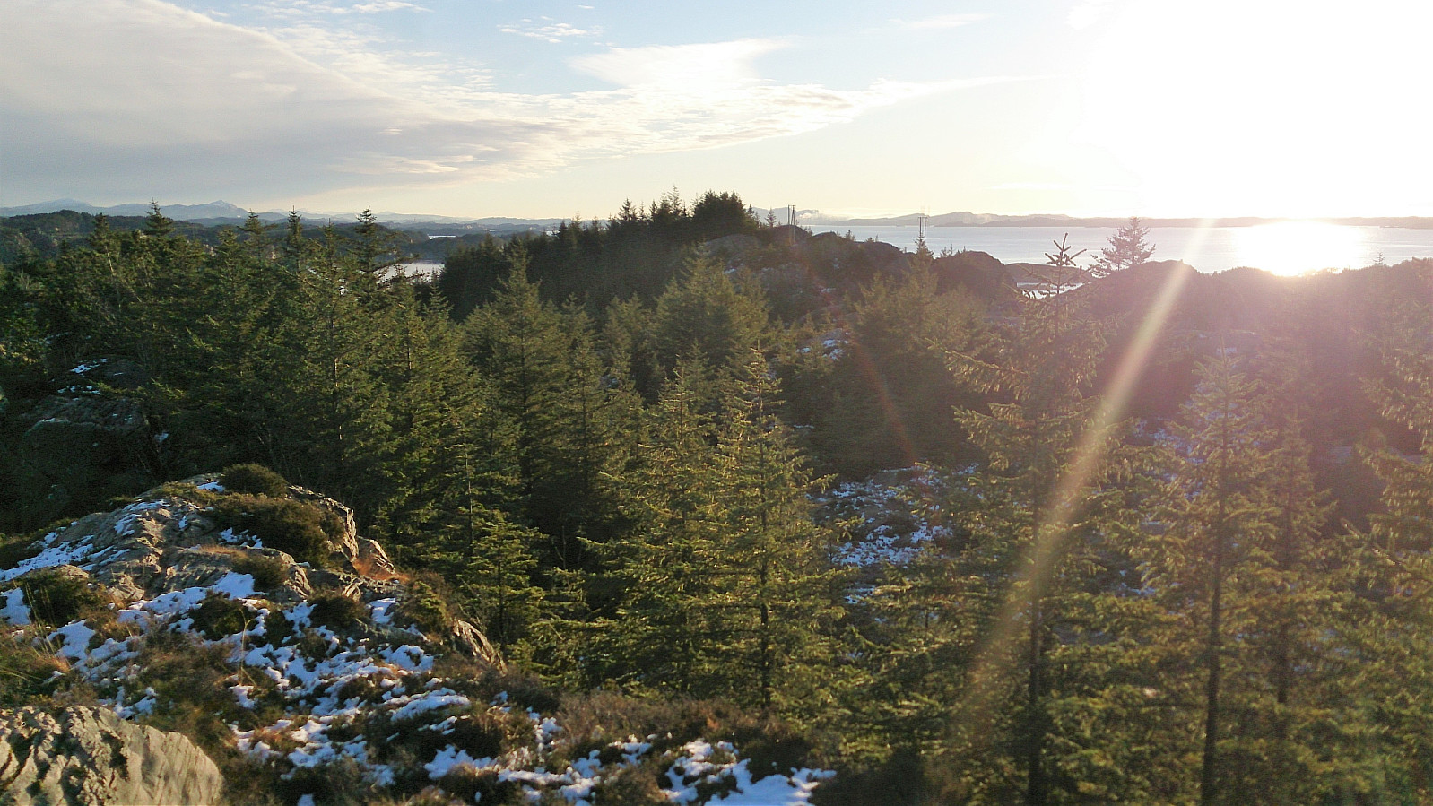
Started by taking the bus to Namntveit (bus stop called Kolås) and from there walking west along the road for a couple hundred meters before leaving the road and heading northeast. This trail was unmarked, but clearly visible from the main road. There was however an information sign stating that I could follow this trail north along the lake all the way to Li.
I followed the trail until locating the sign for Morkefjellet , assuming it would be easy progress towards the summit from here on. However, the trail soon disappeared, and I had to find my own way for a while. I did reconnect with the trail (or perhaps the sign does not accurately indicate where the trail starts?), but the trail was overall very weak until around 150 meters above sea level, were it crossed a fence and then followed a >>>
Morkefjellet
Started by taking the bus to Namntveit (bus stop called Kolås) and from there walking west along the road for a couple hundred meters before leaving the road and heading northeast. This trail was unmarked, but clearly visible from the main road. There was however an information sign stating that I could follow this trail north along the lake all the way to Li.
I followed the trail until locating the sign for Morkefjellet , assuming it would be easy progress towards the summit from here on. However, the trail soon disappeared, and I had to find my own way for a while. I did reconnect with the trail (or perhaps the sign does not accurately indicate where the trail starts?), but the trail was overall very weak until around 150 meters above sea level, were it crossed a fence and then followed a >>>
Langaheia: from Spelhaugen to Nipedalen
- Datum:
- 12.01.2018
- Tourcharakter:
- Bergtour
- Tourlänge:
- 1:13h
- Entfernung:
- 3,8km
 Started by taking the bus to Fyllingsdalsveien (bus stop called Skarphaugen) and from there walked up to Spelhaugen and the start of the gravel road towards Tennebekkstjernet.
Immediately after leaving the car park I turned west, crossing the small wooden bridge and followed the unmarked trail to Langaheia . Normally this would be a very easy summit to get to, but today the trail was full of ice and slippery wet roots.
The summit provided much better views than expected. After returning to the gravel road, the plan was to move quickly to the bus stop in Nipedalen. This ended up taking a bit longer than planned though, as significant sections of the road were packed with ice, requiring extra caution. This did however improve when getting closer to Tennebekkstjernet.
From Nipedalen, I took the bus back to >>>
Started by taking the bus to Fyllingsdalsveien (bus stop called Skarphaugen) and from there walked up to Spelhaugen and the start of the gravel road towards Tennebekkstjernet.
Immediately after leaving the car park I turned west, crossing the small wooden bridge and followed the unmarked trail to Langaheia . Normally this would be a very easy summit to get to, but today the trail was full of ice and slippery wet roots.
The summit provided much better views than expected. After returning to the gravel road, the plan was to move quickly to the bus stop in Nipedalen. This ended up taking a bit longer than planned though, as significant sections of the road were packed with ice, requiring extra caution. This did however improve when getting closer to Tennebekkstjernet.
From Nipedalen, I took the bus back to >>>
Hellen festning and Furukammen
- Datum:
- 07.01.2018
- Tourcharakter:
- Wanderung
- Tourlänge:
- 1:15h
- Entfernung:
- 5,1km
 Short local Sunday evening hike after the rain stopped and the wind died down.
Tellnes skule to Døsjeskiftet
- Datum:
- 06.01.2018
- Tourcharakter:
- Bergtour
- Tourlänge:
- 5:15h
- Entfernung:
- 16,9km
 Started by taking the bus to Tellnes skule. From the bus stop I located the weak trail from the map, which I proceeded to follow west before later turning south and connecting with Nordsjøløypa. The trail was clearly not the most heavily used, but could be easily followed. I missed the crossroads where the trail towards Høgevarden started, but after a couple of meters I connected with the trail, which I then followed almost to the summit, with a shortcut towards the end.
The views were slightly better than expected, but better versions of very similar views can of course be obtained from Liatårnet and Haganesfjellet . After a short stay, I started my descent, this time following the trail all the way to where it connected with Nordsjøløypa. I did not follow the trail all the way back to the bus stop though, but rather followed >>>
Started by taking the bus to Tellnes skule. From the bus stop I located the weak trail from the map, which I proceeded to follow west before later turning south and connecting with Nordsjøløypa. The trail was clearly not the most heavily used, but could be easily followed. I missed the crossroads where the trail towards Høgevarden started, but after a couple of meters I connected with the trail, which I then followed almost to the summit, with a shortcut towards the end.
The views were slightly better than expected, but better versions of very similar views can of course be obtained from Liatårnet and Haganesfjellet . After a short stay, I started my descent, this time following the trail all the way to where it connected with Nordsjøløypa. I did not follow the trail all the way back to the bus stop though, but rather followed >>>
Across Hellen festning after dark
- Datum:
- 04.01.2018
- Tourcharakter:
- Wanderung
- Tourlänge:
- 0:37h
- Entfernung:
- 3,4km
 Short local hike across Hellen festning in the evening after dark.
Hellen festning after dark
- Datum:
- 01.01.2018
- Tourcharakter:
- Wanderung
- Tourlänge:
- 0:25h
- Entfernung:
- 2,2km
 Short local hike across Hellen festning in the evening after dark.
Fagerneset, Hegreneset and Hellen festning
- Datum:
- 31.12.2017
- Tourcharakter:
- Wanderung
- Tourlänge:
- 2:28h
- Entfernung:
- 9,8km
 Last hike of 2017 with local explorations of Fagerneset and Hegreneset, before crossing Furukammen and Hellen festning on the way back to Lønborg.
Kolafjellet from Døsjeskiftet
- Datum:
- 30.12.2017
- Tourcharakter:
- Bergtour
- Tourlänge:
- 3:35h
- Entfernung:
- 13,3km
 Kolafjellet seemed to be one of those small peaks that are not really worth a hike in itself, so I decided to extend the hike a bit to make the overall trip more enjoyable. Started by taking the bus to Døsjeskiftet and following the paved road up to Bildøyvatnet. From there I followed the marked trail across Vardafjell , ending up at Fjell festning. (The wooden trail markers came in very handy as the trail itself was covered with snow. I therefore more or less ended up walking from one marker to the next.)
I continued south along the roads at Fjell festning until reaching the main road. Previous PB trip reports indicated that there was a tractor road further south that could be utilized to make easy progress towards Kolafjellet. I therefore started walking south along the main road in search of this tractor road, >>>
Kolafjellet seemed to be one of those small peaks that are not really worth a hike in itself, so I decided to extend the hike a bit to make the overall trip more enjoyable. Started by taking the bus to Døsjeskiftet and following the paved road up to Bildøyvatnet. From there I followed the marked trail across Vardafjell , ending up at Fjell festning. (The wooden trail markers came in very handy as the trail itself was covered with snow. I therefore more or less ended up walking from one marker to the next.)
I continued south along the roads at Fjell festning until reaching the main road. Previous PB trip reports indicated that there was a tractor road further south that could be utilized to make easy progress towards Kolafjellet. I therefore started walking south along the main road in search of this tractor road, >>>
Oksneskletten - the extended version
- Datum:
- 28.12.2017
- Tourcharakter:
- Bergtour
- Tourlänge:
- 3:22h
- Entfernung:
- 8,9km
 After reading the previous trip reports for Oksneskletten on PB, I concluded that a hike to just the summit would most likely not be the most enjoyable trip (especially given the relatively long travel distance from the Bergen city center). I therefore decided to extend the hike with parts of the Askøy på langs trail to hopefully add some more enjoyable sections.
I therefore started by taking the bus to Merkesvik and from there following the Askøy på langs trail in the southern direction. The marked trailhead was easy to locate from the main road and the trail made it straightforward to progress towards Oksneset.
However, I knew that I had to leave the marked trail to get to the summit of Oksneskletten , but this was easier said than done, as the terrain mainly consisted of trees with thick branches blocking the way or slippery/icy areas with drops >>>
After reading the previous trip reports for Oksneskletten on PB, I concluded that a hike to just the summit would most likely not be the most enjoyable trip (especially given the relatively long travel distance from the Bergen city center). I therefore decided to extend the hike with parts of the Askøy på langs trail to hopefully add some more enjoyable sections.
I therefore started by taking the bus to Merkesvik and from there following the Askøy på langs trail in the southern direction. The marked trailhead was easy to locate from the main road and the trail made it straightforward to progress towards Oksneset.
However, I knew that I had to leave the marked trail to get to the summit of Oksneskletten , but this was easier said than done, as the terrain mainly consisted of trees with thick branches blocking the way or slippery/icy areas with drops >>>
Breiviken and Hellen festning
- Datum:
- 27.12.2017
- Tourcharakter:
- Wanderung
- Tourlänge:
- 1:45h
- Entfernung:
- 6,4km
 Short local hike to test if my phone, and specifically the GPS in my phone, had recovered from the previous hike in the rain.
