Archiv - Nach Datum
Archiv - Nach Aktivität
-
Andere Tour (5)
- Expedition (5)
-
Andere Wintertour (5)
- Schneeschuhtour (5)
-
Fußtour (507)
- Bergtour (205)
- Hochtour (47)
- Jogging (4)
- Spaziergang (55)
- Wanderung (196)
-
Klettern (43)
- Alpinklettern (31)
- Eisklettern (3)
- Klettersteig (1)
- Mixed-Klettern (1)
- Sportklettern (3)
-
Skitour (449)
- Langlauf (2)
- Randonnée/Telemark (441)
- Tourenskilauf (4)
Peakbookfreunde


Finsteraarhorn
- Datum:
- 11.07.2021
- Tourcharakter:
- Hochtour
- Tourlänge:
- 7:15h
- Entfernung:
- 10,5km
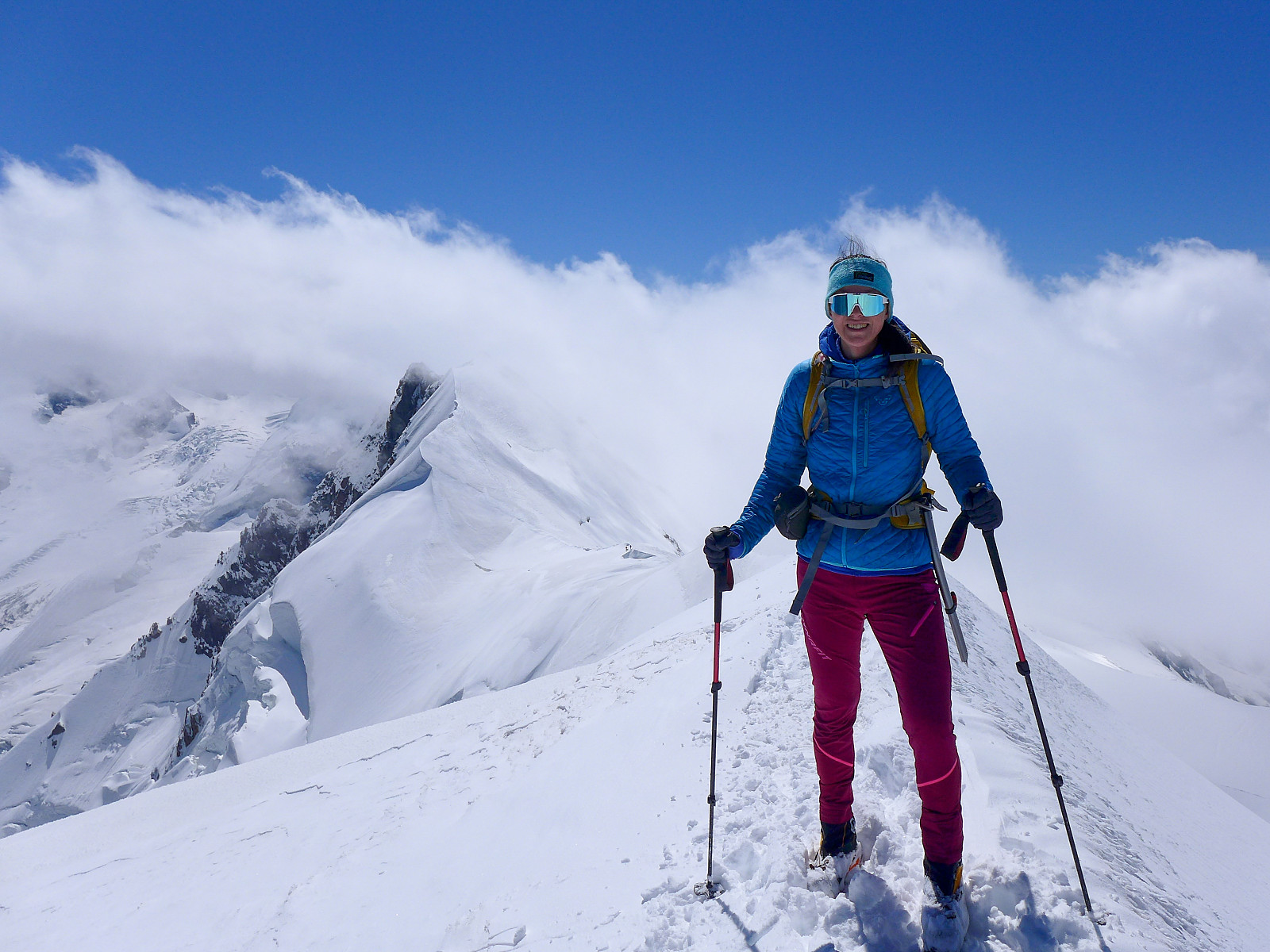
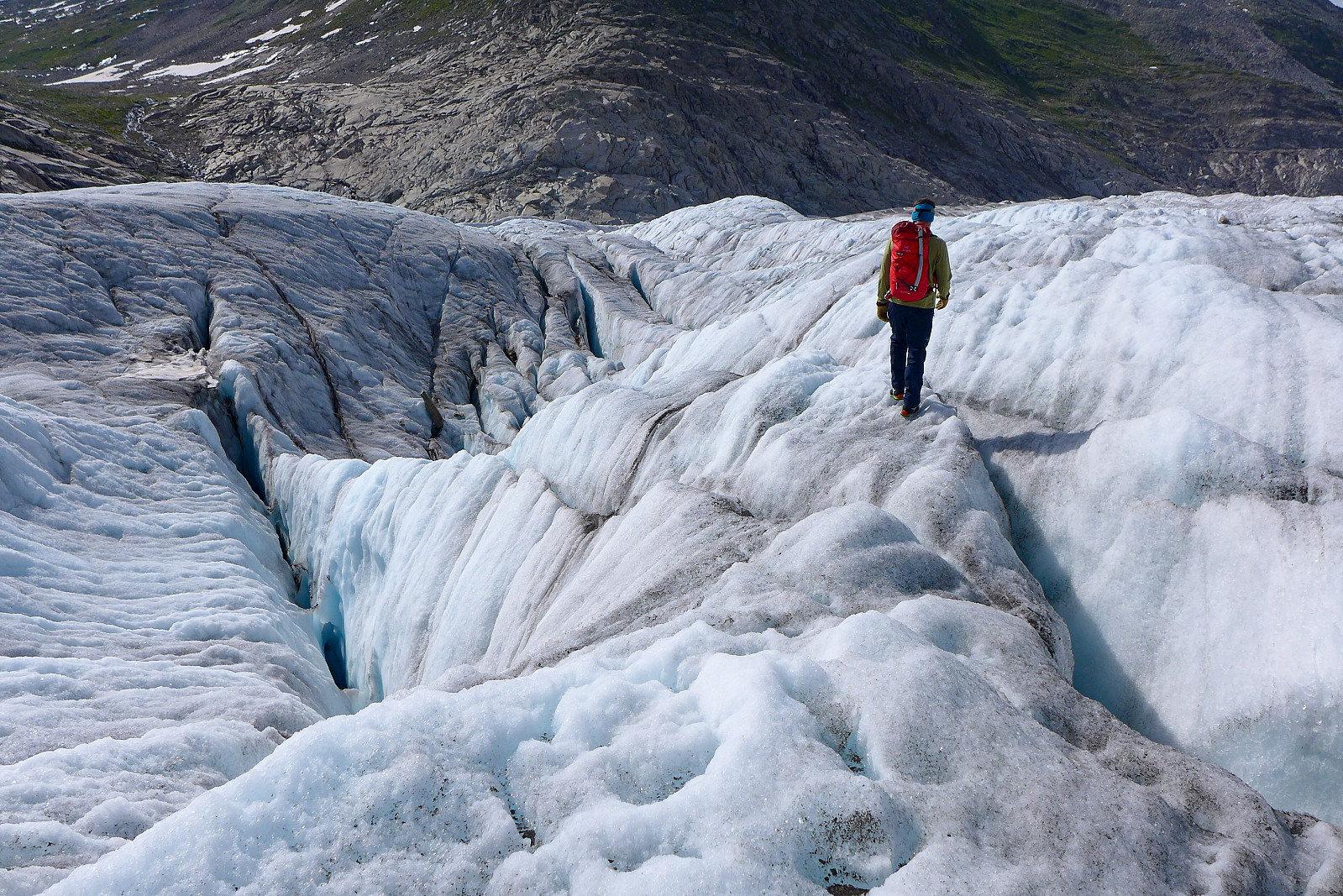 After having been up the Gross Grünhorn & Grunegghorn and walking over to the Finsteraarhorn hut the previous day, the plan was to climb the Finsteraarhorn via the upper southeast ridge (also referred to as the Sudroute in Martin Moran’s guidebook) as it would hopefully provide a more interesting route to the summit compared with the standard route from the Finsteraarhorn hut via the southwest flank and northwest ridge. However, since the entire southeast ridge was still looking very snowy when we checked it out from the summit of the Gross Grunhorn, we ended up changing our plans to do the standard route instead. Moreover, it seemed like there were going to be very few teams doing the normal route anyway, so there wasn’t much chance of it being too busy. Meteoblue had forecasted some early morning fog so I was expecting >>>
Gross Grünhorn & Grunegghorn
- Datum:
- 10.07.2021
- Tourcharakter:
- Hochtour
- Tourlänge:
- 11:07h
- Entfernung:
- 19,9km
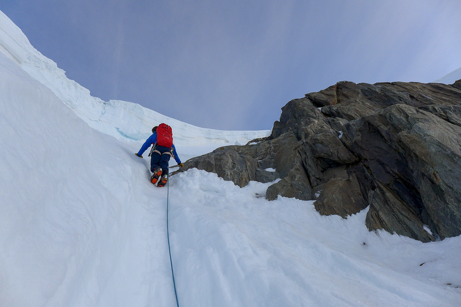 I haven’t spent much time exploring the Bernese Oberland previously, and the only two peaks I’ve climbed there before now – the Eiger and Schreckhorn sit more on the outskirts of the region rather than in the central part of the area. I’d always imagined my next visit to the Bernese Oberland would be on a pair of skis, having heard so much about how big the glaciers are and with rather large distances between the huts and 4000m peaks. Summer 2021 had other plans for me, with each sunny weather window being followed by a new big dump of snow in the mountains, which rendered a lot of steep snow routes avalanche-prone and the usually-dry ridges plastered in snow. However, a new weather window had appeared in the forecast and this time it looked like there might even be 3 full days of sunshine, which >>>
Lyskamm traverse
- Datum:
- 02.07.2021
- Tourcharakter:
- Hochtour
- Tourlänge:
- 11:28h
- Entfernung:
- 26,7km
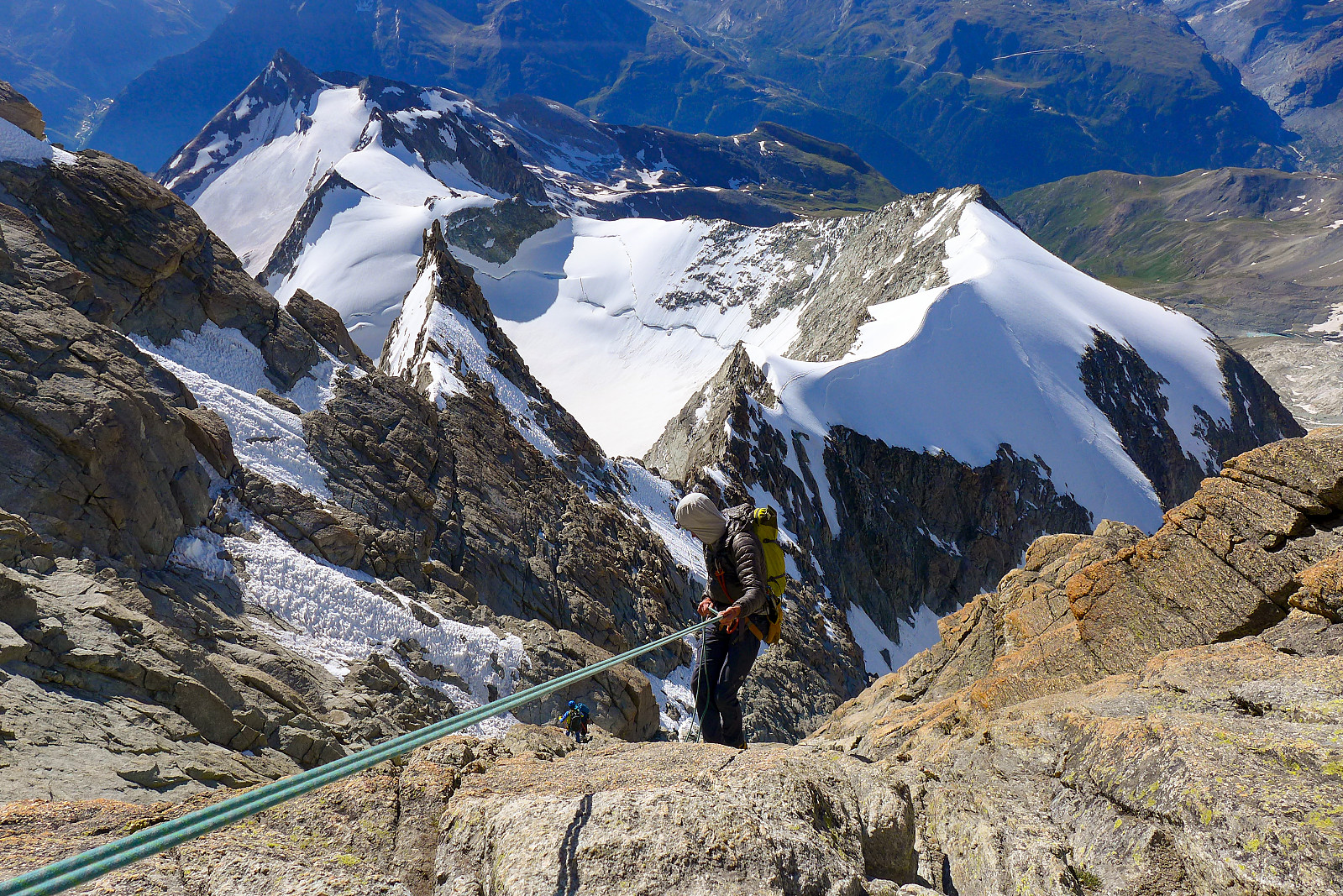
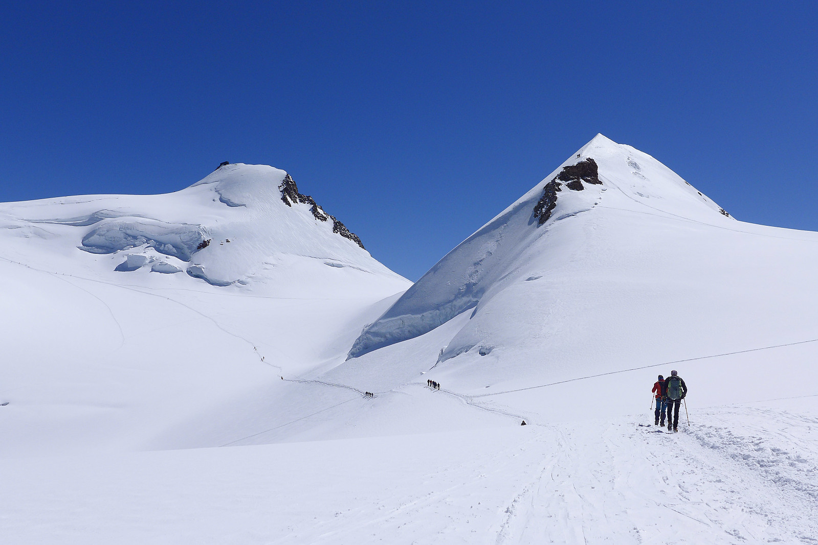 I first came to know about the traverse of Lyskamm during a trip to the Alps in July 2003. The original itinerary for the week had been to climb Castor, Pollux, Lyskamm and the Dufourspitze via the Margherita hut and Zumsteinspitze. In the end the traverse of Lyskamm never happened because the guide I was then climbing with decided it was too windy that day, and we ended up ascending Il Naso (the Nose of Lyskamm) and Vincent Pyramid instead. In hindsight I don’t think I had sufficient alpine mountaineering experience to do the traverse, which is basically a 2km narrow and exposed snow ridge so it was perhaps just a well that we didn’t do it that day. However, since then it has been high on my wishlist of routes to do in the Alps but for some reason or another there has never been the right >>>
Breithorn x 3
- Datum:
- 25.06.2021
- Tourcharakter:
- Wanderung
- Tourlänge:
- 4:34h
- Entfernung:
- 11,6km
 Siste dag med akklimatisering i Zermatt. Kokvarmt på fjellet i dag!
Breithorn x 2
- Datum:
- 23.06.2021
 Tenkte det hadde vært lurt å utnytte det dyre heisbillettet og godværsvinduet og gå to runder på Breithorn ;-)
Breithorn half traverse
- Datum:
- 21.07.2020
- Tourcharakter:
- Alpinklettern
- Tourlänge:
- 4:34h
- Entfernung:
- 7,5km
 After arriving back in Zermatt from the Zinalrothorn , we checked the weather forecasts again to make sure it would still be good weather for the next objectives we had planned to do. Originally the plan had been to head up to the Ayas hut, then traverse both Castor and Lyskamm the following day, spend the night up at the Margherita hut and then do both Nordend and the Dufourspitze on the thursday which was supposed to have the best weather and would have made a nice 3-day outing. Castor and Dufourspitze I had climbed previously, but not Lyskamm or Nordend, so they were still on the "to-do" list. However, since the forecast for the next 2 days were looking less optimal for a big day on exposed snow ridges, we moved onto my backup plan which was to do the Breithorn half traverse, a quick half day >>>
Zinalrothorn
- Datum:
- 20.07.2020
- Tourcharakter:
- Alpinklettern
- Tourlänge:
- 7:45h
- Entfernung:
- 7,1km
 The Zinalrothorn is a pretty cool looking peak, though I personally think its a bit dependent on which angle you see it from. Definitely awesome when viewed from the Ober Gabelhorn though :-) Like last year, I had 10 (fun) days of climbing with British mountain guide Tim Neill to look forward to and the Zinalrothorn seemed like a good option to start off with since neither of us were really well acclimatized to 4000m yet. I was a bit worried that I would have de-acclimatised after a few days of easy hiking in the Saas valley and not really going above 3300m, so it was probably good to be starting with a peak which didn’t have a massive summit day although the walk-in to the Rothorn hut was relatively long. Since I’d expected there to be reduced capacity at the alpine huts this summer, I made a booking >>>
Dent d'Hérens
- Datum:
- 20.07.2019
- Tourcharakter:
- Alpinklettern
- Tourlänge:
- 8:35h
- Entfernung:
- 21,0km
 After returning to Courmayeur from the Torino hut the plan was to stay somewhere in Italy for the night so we could head straight to the Dent d’Herens the following day. We’d initially planned to book some beds at the Prarayer refuge which is about 1 hour along the walk in to the Aosta refuge, but we instead opted to go all the way back to Evolene since most people were away at huts so the chalet would be empty and quiet!! It turned out to be a good choice, at least for me since I woke up the next day feeling very well rested and ready for the 3-hour drive back into Italy and up to the Lago di Place Moulin where the long walk in began. It was another warm and sunny day, in contrast to the clouds that meteoblue had forecasted, so I was somewhat dreading having to do a long walk up to the >>>

