Archiv - Nach Datum
Archiv - Nach Aktivität
-
Andere Tour (5)
- Expedition (5)
-
Andere Wintertour (5)
- Schneeschuhtour (5)
-
Fußtour (507)
- Bergtour (205)
- Hochtour (47)
- Jogging (4)
- Spaziergang (55)
- Wanderung (196)
-
Klettern (43)
- Alpinklettern (31)
- Eisklettern (3)
- Klettersteig (1)
- Mixed-Klettern (1)
- Sportklettern (3)
-
Skitour (449)
- Langlauf (2)
- Randonnée/Telemark (441)
- Tourenskilauf (4)
Peakbookfreunde


Glomtinden
- Datum:
- 29.06.2013
- Tourcharakter:
- Spaziergang
- Tourlänge:
- 2:00h
- Entfernung:
- 5,0km
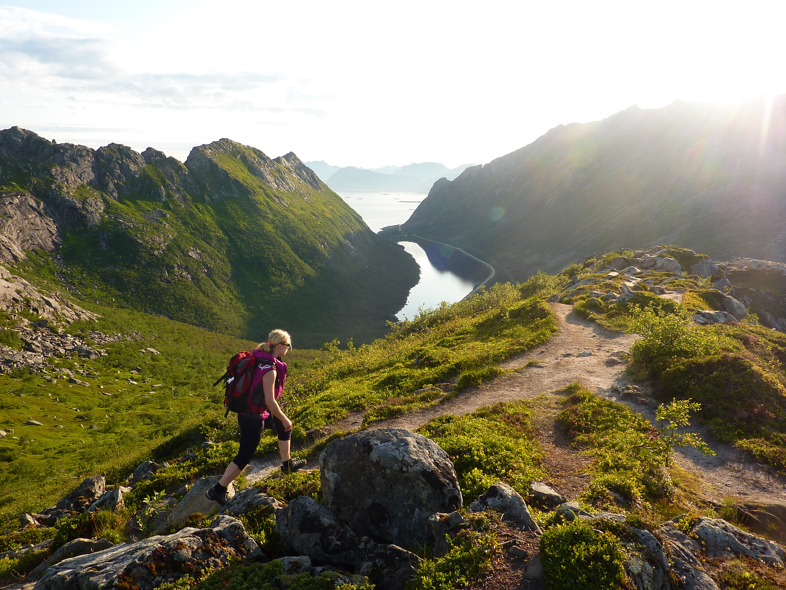 After almost 7 hours of driving from Tromsø to Kalle with Ilona, I was feeling a bit stiff in my legs and had not really thought much about taking a long evening hike. However, we were greeted at the campsite by swarms of mosquitoes and within minutes of putting up our tents we had already dived inside to take shelter from the mygg-attack. So then we had the option of either hiding in our tents for the rest of the beautiful evening or going out for a trip and hoping there would not be any mosquitoes there for company. We took the latter option.
Jan Fredrik had recommended the trip up Glomtinden since it was only a short walk and not very high, and the path was good all the way up. We drove about 10 minutes from Kalle to a parking space by the side of the road towards Rørvik, just after a small >>>
After almost 7 hours of driving from Tromsø to Kalle with Ilona, I was feeling a bit stiff in my legs and had not really thought much about taking a long evening hike. However, we were greeted at the campsite by swarms of mosquitoes and within minutes of putting up our tents we had already dived inside to take shelter from the mygg-attack. So then we had the option of either hiding in our tents for the rest of the beautiful evening or going out for a trip and hoping there would not be any mosquitoes there for company. We took the latter option.
Jan Fredrik had recommended the trip up Glomtinden since it was only a short walk and not very high, and the path was good all the way up. We drove about 10 minutes from Kalle to a parking space by the side of the road towards Rørvik, just after a small >>>
Skadet på Sydalsfjellet
- Datum:
- 23.03.2013
- Tourcharakter:
- Randonnée/Telemark
- Entfernung:
- 7,0km
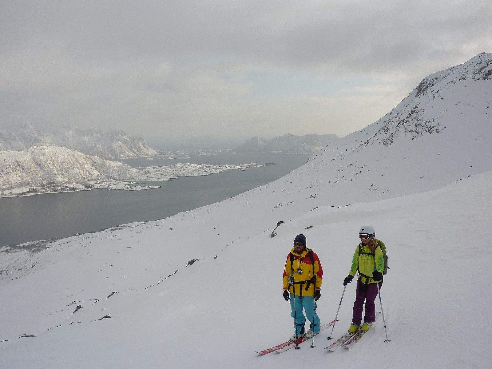
 After having had a short trip on our first day in Lofoten, Aline and I were super-enthusiastic to have a longer ski trip. Sydalsfjellet turned out to be the only ‘full’ topptur option, since the other trips which were being run on the Saturday were either skogskjøring or ski/surf combination. Fortunately both of us managed to get a place on the Sydalsfjellet trip before the sign-up list had filled up. Unfortunately the weather didn’t look all that promising in the beginning of the day when we met up with our guides Marius and Bjørn at 9am at the Henningsvær Bryggehotell. Altogether there were 13 participants on the trip, so it was a relatively large group. Null visibility and light snow was not at all inspirational, but we clambered on board the minibus anyway with a dash of hope that >>>
Stampen
- Datum:
- 22.03.2013
- Tourcharakter:
- Tourenskilauf
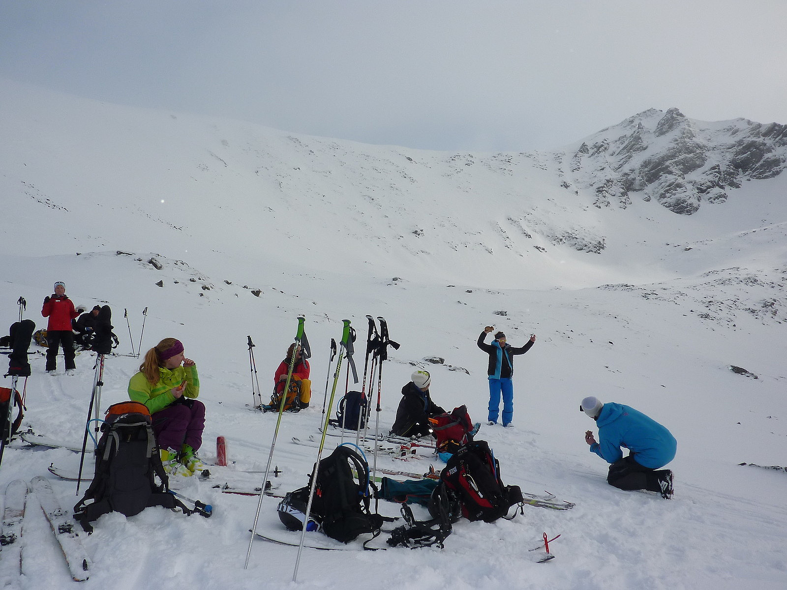
 My first trip of Camp Lofoten with Aline and Siv. We'd expected to be taking a trip to Sautinden, but as things happened we ended up on Stampen instead. The meet-up with the ret of our group and the guides was at 9.00 by the Henningsvær Bryggehotell and the drive to the starting point for the ascent was a scenic 40-minute drive down the E10. And we couldn't have asked for a better welcome with the blue skies and sunshine we got, even if the forecast did hint that it wouldn't be staying like this for very long! The group was around 9 or 10 including our guide Sverre, and we used the first hour or so using the avalanche transceivers in search mode. For us and perhaps one or two others in the group, the practice wasn't new but served as good revision on what we had already learnt on the skredkurs >>>

