Lyderhorn (17.09.2015)

Geschrieben von HHauser (Helwig Hauser)

| Startpunkt | Varden (45m) |
|---|---|
| Endpunkt | Varden (45m) |
| Tourcharakter | Fahrradtour gemischt |
| Tourlänge | 2h 00min |
| Entfernung | 13,0km |
| Höhenmeter | 623m |
| GPS |
|
| Besteigungen | Lyderhorn (396m) | 17.09.2015 |
|---|---|---|
| Besuche anderer PBE | Lyderhornhytten (lokalitet) (396m) | 17.09.2015 |

Trip Summary
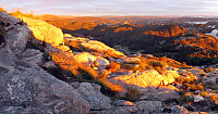
Quick excursion to Lyderhorn: First with the bike along Bjørgeveien and up to the new highway crossing near Liavatnet; then from there, walking, westwards and up in the direction of Grøvledalen (between Skarpafjellet and Lyderhorn). From the saddle, basically right underneath the power lines, then northwards and towards Lyderhorn. After a bit of up and down, the actual ascent to Lyderhorn is steep and nice. Down from Lyderhorn, I first followed the path that connects to Kjøkkelvikveien, further down, in the west of Lyderhorn, but before actually turning right in order to descend towards the west, I turned left (and towards the east), searching a connection to the path that I had taken up. I found my way, but mostly without a path, though. I followed that path I had take up (from Skarpafjellet) until I came to the first saddle, where I turned left, following a narrow and difficult to see path. Soon, I had lost this path and continued without path in the direction of where I had left my bike. I found a way down, even though it was not 100% easy at all times (it had started to get dark, also). Fortunately, I managed to get back to my bike without any problems. From there, it was then straight-forward back. All in all, a nice evening trip with a rewarding ascent to Lyderhorn in almost magic evening light! :-)
Photos
Selected photos are available as Google+ photo album.
Useful Resources
Web page WestCoastPeaks.com provides useful information about Lyderhorn and Ørnafjellet
and also Petter Bjørstad has a page about Lyderhorn.
On Bergentopp 200 there is a page (in Norwegian) about Lyderhorn.


Benutzerkommentare