Archive - Date
Archive - Activity
-
Bike trip (110)
- Bike trip - mixed (35)
- Bike trip - road (5)
-
Other trip (1)
- Kayaking (1)
-
Other winter trip (4)
- Snowshoe trip (4)
- Ski trip (3)
- Trip by foot (703)
Archive - Geography
Peakbook-Friends


Collected lists
-
Bergen ≥ 50m pf. og ≥ 100 m.o.h.
(87/89)
 97%
97% -
Most dominating tops of the Bergen peninsula
(68/75)
90%
-
Utvalgte topper og turmål i Bergen
(299/339)
88%
-
Alle topper i Bergen
(344/392)
87%
-
Opptur Bergen
(99/113)
87%
-
De syv fjell rundt Bergen
(6/7)
85%
-
Sund ≥ 50m pf.
(14/18)
77%
-
Os ≥ 50m pf.
(25/34)
73%
-
Søyler (fastmerker) i Bergen
(66/100)
66%
-
Fjell ≥ 50m pf.
(21/32)
65%

Oksen
- Date:
- 19.07.2014
- Characteristic:
- Hillwalk
- Duration:
- 4:00h
- Distance:
- 10.2km
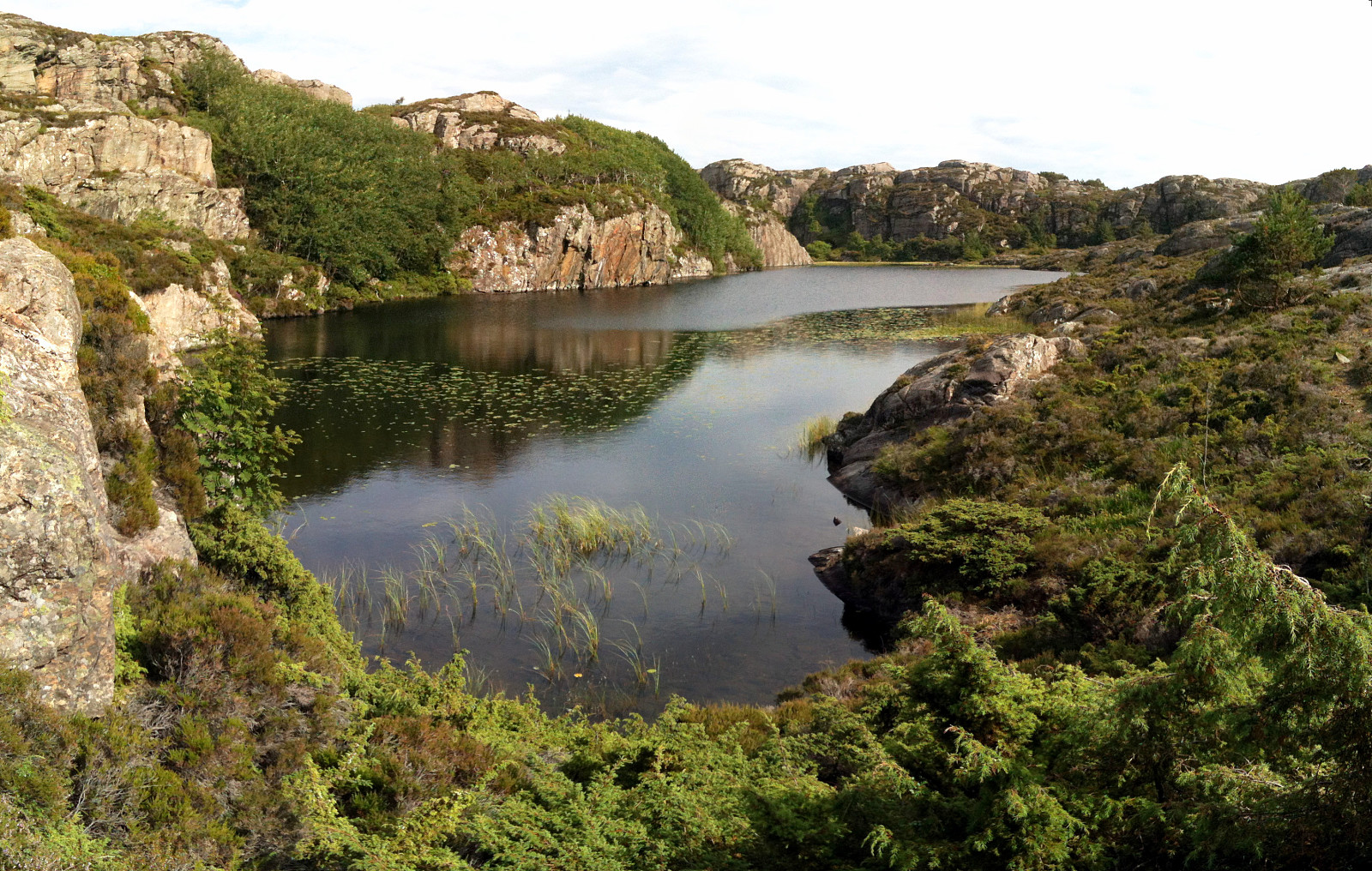
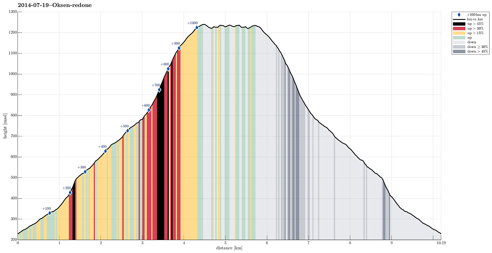 Beautiful tour up and down Oksen -- in fantastic summer weather! :-) We started from the parking place right above Tjoflot (at about 200m above the fjord) and took the (nice!) path via Vindhovden up to Oksen (we made the top, roughly 1000m above the parking place, after about 100mins.). We then continued to Veten and enjoyed the views and a break there! :-) Then back to Tjoflot, more or less the same path.
Selected photos are available as Google photo album .
Beautiful tour up and down Oksen -- in fantastic summer weather! :-) We started from the parking place right above Tjoflot (at about 200m above the fjord) and took the (nice!) path via Vindhovden up to Oksen (we made the top, roughly 1000m above the parking place, after about 100mins.). We then continued to Veten and enjoyed the views and a break there! :-) Then back to Tjoflot, more or less the same path.
Selected photos are available as Google photo album .
Hillefjellet
- Date:
- 13.07.2014
- Characteristic:
- Hike
- Duration:
- 4:00h
- Distance:
- 10.1km
 Someone (Leif Algerøy?) has put really a lot of effort into preparing nice hiking choices on Algrøyna -- wow! :-) The tour to Sandeie is really worth the lengthy approach (driving to Algrøyna)!
Selected photos are available as Google photo album .
Someone (Leif Algerøy?) has put really a lot of effort into preparing nice hiking choices on Algrøyna -- wow! :-) The tour to Sandeie is really worth the lengthy approach (driving to Algrøyna)!
Selected photos are available as Google photo album .
Fedje
- Date:
- 12.07.2014
- Characteristic:
- Hike
- Duration:
- 4:00h
- Distance:
- 12.7km
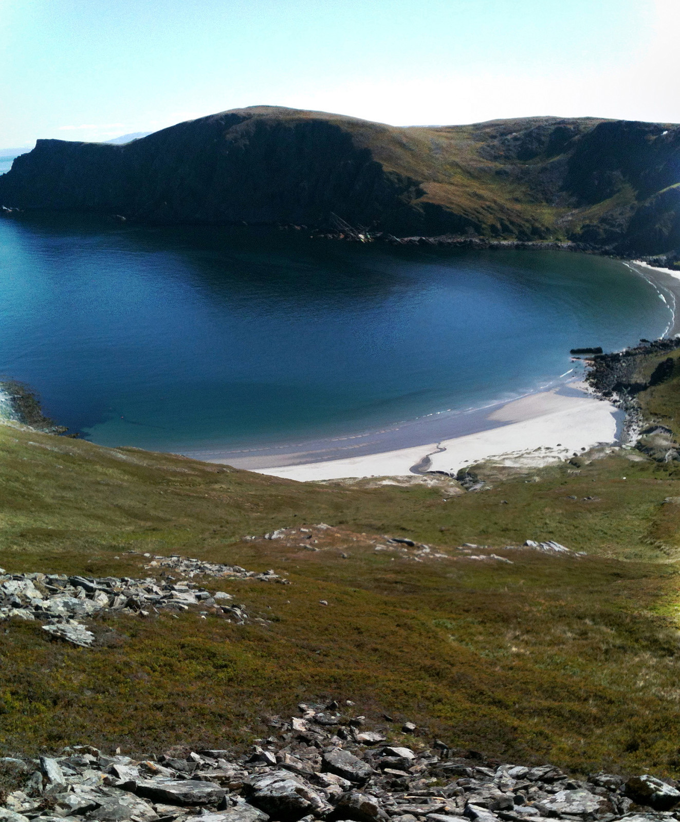
 Nice summer hike around Fedje. The historic site (in the northwest of Fedje) is also quite interesting -- telling from hard times, not too long ago...
Selected photos are available as Google photo album .
Nice summer hike around Fedje. The historic site (in the northwest of Fedje) is also quite interesting -- telling from hard times, not too long ago...
Selected photos are available as Google photo album .
Kjøttvikvarden
- Date:
- 02.07.2014
- Characteristic:
- Hillwalk
- Duration:
- 6:00h
- Distance:
- 16.9km
 Taking the fast ferry from Hammerfest (check the schedule as this ferry is not going equally every day!) to Akkarfjord and hiking from there -- great experience! :-)
Evening excursion from Hammerfest
- Date:
- 01.07.2014
- Characteristic:
- Hillwalk
- Duration:
- 2:00h
- Distance:
- 5.4km
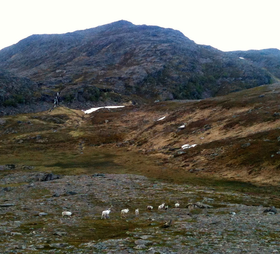 After arriving in Hammerfest quite late this day, I only made a quick and medium-short hike in the hills nearby the city. It was interesting to see, how Hammerfest struggles with all the reindeer around (having built a major fence, not at the least, for example). And, yes, you meet many of them just a "few steps" away from the city...
Note: I found it interesting that I could not find out, whether the tops, which I visited, have any names (and if so, which ones) -- if anyone knows, then please let me know! :-)
After arriving in Hammerfest quite late this day, I only made a quick and medium-short hike in the hills nearby the city. It was interesting to see, how Hammerfest struggles with all the reindeer around (having built a major fence, not at the least, for example). And, yes, you meet many of them just a "few steps" away from the city...
Note: I found it interesting that I could not find out, whether the tops, which I visited, have any names (and if so, which ones) -- if anyone knows, then please let me know! :-)
Skattørfjellet
- Date:
- 27.06.2014
- Characteristic:
- Hillwalk
- Duration:
- 3:00h
- Distance:
- 6.3km
 Starting from Skattøra (right after the bridge to Skjervøya), we first read about some interesting history of Skattøra, before we ascend to Skattørfjellet (no path, partially a bit of climbing and some minor bush war). Fantastic view from the top! :-)
Skogsøytua
- Date:
- 21.06.2014
- Characteristic:
- Hike
- Duration:
- 2:00h
- Distance:
- 4.8km
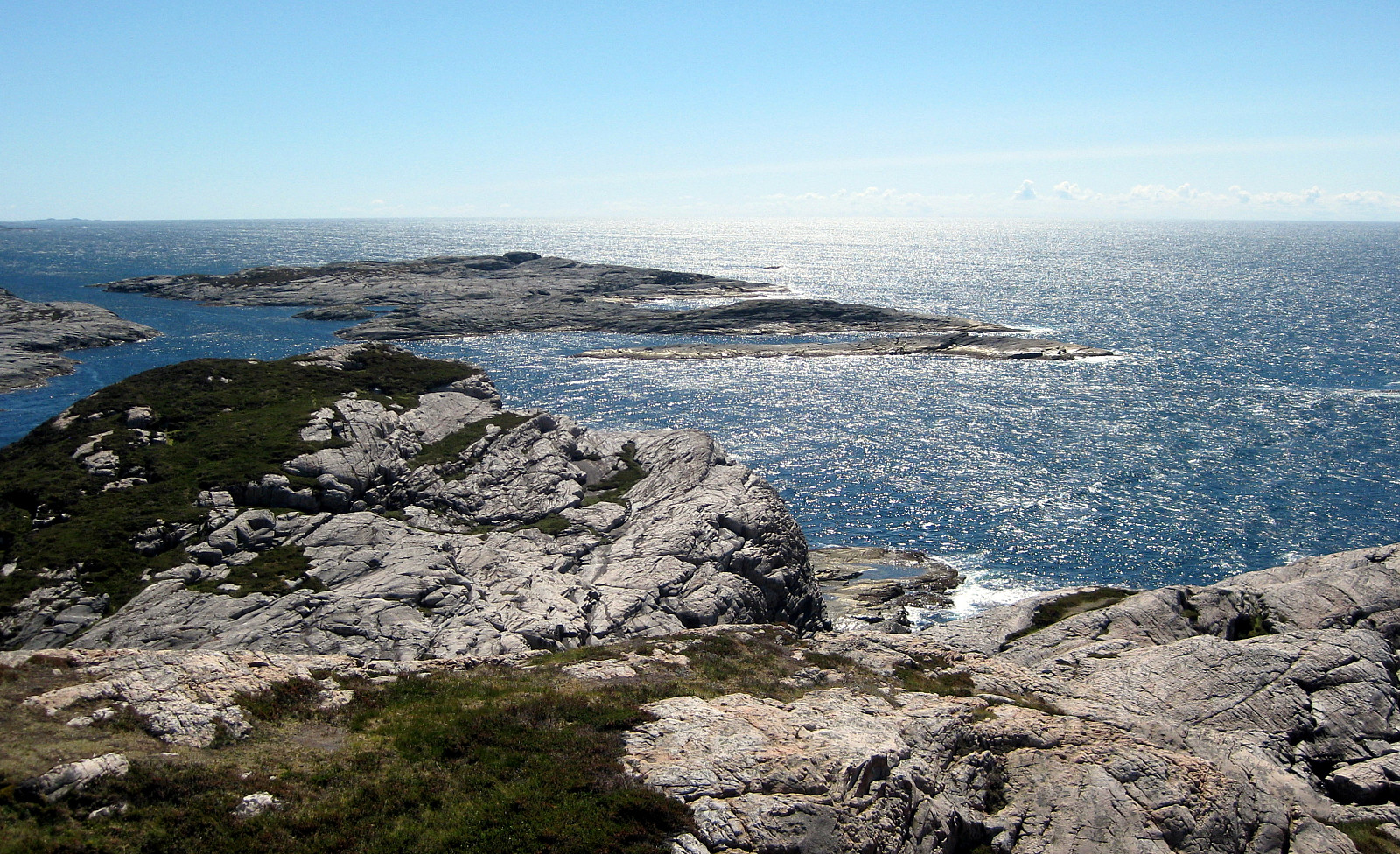 Again and again a nice little hike to the outermost rocks of Øygarden!
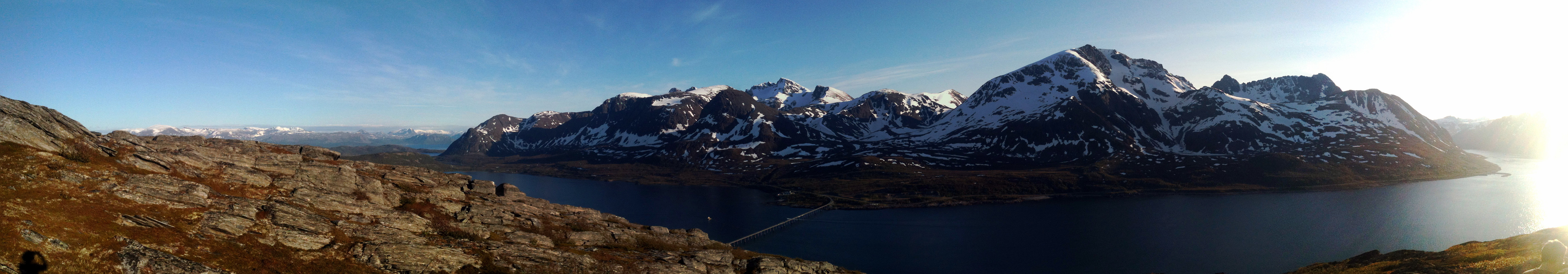
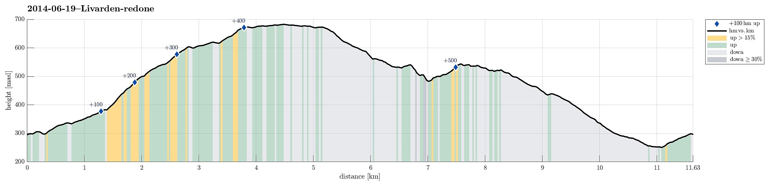
Livarden
- Date:
- 19.06.2014
- Characteristic:
- Hillwalk
- Duration:
- 4:00h
- Distance:
- 11.6km
 Livarden is a nice walk ( from Totland ), especially when walking down later the day (into the evening sun -- if there is any, of course)!
Selected photos are available as Google photo album .
Livarden is a nice walk ( from Totland ), especially when walking down later the day (into the evening sun -- if there is any, of course)!
Selected photos are available as Google photo album .
Sydpolen
- Date:
- 24.05.2014
- Characteristic:
- Hillwalk
- Duration:
- 4:00h
- Distance:
- 11.9km
 Sydpolen from Brekkjedalen is again and again a very nice tour!
Web page WestCoastPeaks.com provides useful information about S. Gullfjellstoppen (Sydpolen)
and also Petter Bjørstad has a useful page about Sydpolen .
Sydpolen from Brekkjedalen is again and again a very nice tour!
Web page WestCoastPeaks.com provides useful information about S. Gullfjellstoppen (Sydpolen)
and also Petter Bjørstad has a useful page about Sydpolen .
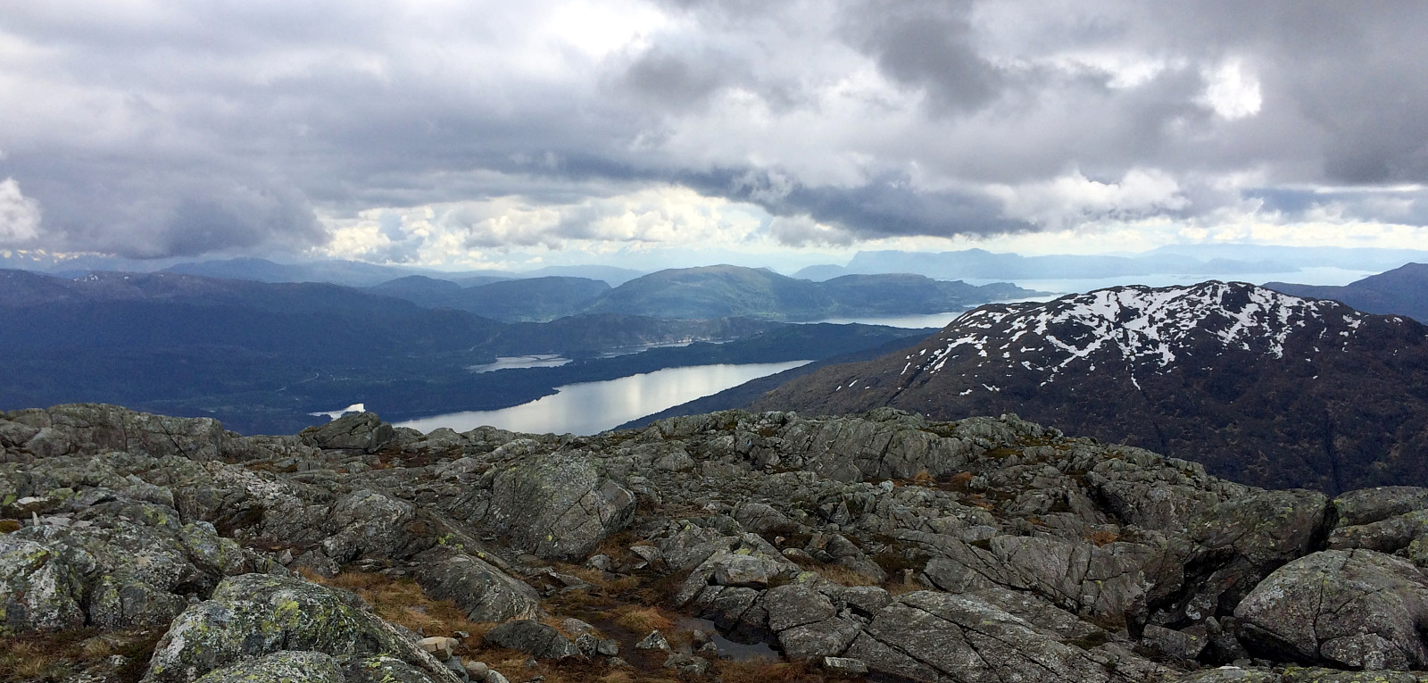
Hananipa
- Date:
- 18.05.2014
- Characteristic:
- Hillwalk
- Duration:
- 4:00h
- Distance:
- 11.2km
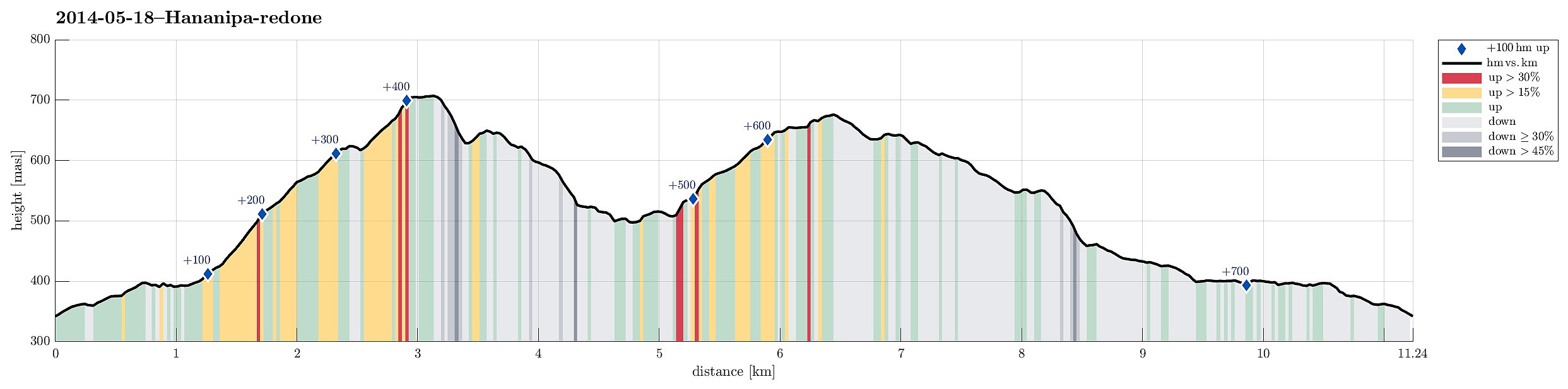 Hananipa from Skulestad (and back via Trollabotshaugen) was a nice round tour in beautiful landscape and with fantastic views over the fjord!
Web page WestCoastPeaks.com provides useful information about Hananipa, Raudnipa, Krånipa, and Raudfjell
and also Petter Bjørstad has a useful page about Hananipa .
Web page UT.no from the Norwegian Trekking Association recommends this hike up and down Hananipa (only part of our hike, though).
Hananipa from Skulestad (and back via Trollabotshaugen) was a nice round tour in beautiful landscape and with fantastic views over the fjord!
Web page WestCoastPeaks.com provides useful information about Hananipa, Raudnipa, Krånipa, and Raudfjell
and also Petter Bjørstad has a useful page about Hananipa .
Web page UT.no from the Norwegian Trekking Association recommends this hike up and down Hananipa (only part of our hike, though).
