Archive - Date
Archive - Activity
-
Climbing (23)
- Alpine climbing (9)
- Sport climbing (11)
- Via ferrata (2)
-
Drive (1)
- Car drive (1)
-
Other winter trip (3)
- Snowshoe trip (3)
-
Ski trip (62)
- Backcountry skiing (3)
- Cross-country skiing (1)
- Randonnée/Telemark (58)
- Trip by foot (137)


Favourite trips
Favourite peaks


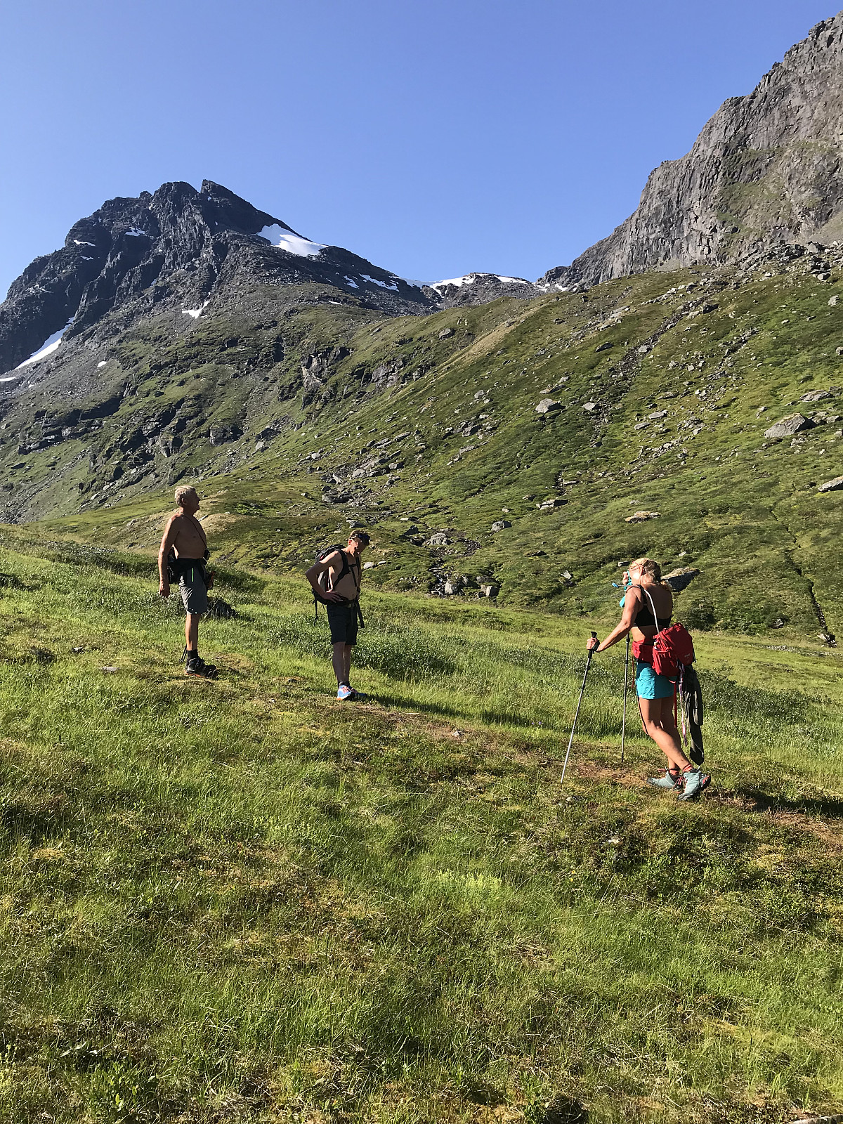
Store Bentsjordtinden
- Date:
- 29.07.2018
- Characteristic:
- Hillwalk
- Distance:
- 8.0km
 Norsk turrapport kan leses hos otto (Otto Lund)
Today we tried a new path up Store Bentsjordtinden. Still really hot up here in Tromsø, ideally we could have started the hike earlier in the day, but as I worked late last night we started around 10am.
We followed a Ti på Topp sign up a steep path through the forrest to begin with. The path was really steep to begin with, but once we reached the end of the tree line, the terrain flattened out and we had a nice view behind us down to the fjord. Nice to be finished with some altitude. The flies were already out in full force as we followed red markers up the mountain. The trail disappears through the grass, but the red markers are easy enough to follow. Once we had climbed to 800moh, we had the top of the mountain in sight. The terrain then started to get a little >>>
Norsk turrapport kan leses hos otto (Otto Lund)
Today we tried a new path up Store Bentsjordtinden. Still really hot up here in Tromsø, ideally we could have started the hike earlier in the day, but as I worked late last night we started around 10am.
We followed a Ti på Topp sign up a steep path through the forrest to begin with. The path was really steep to begin with, but once we reached the end of the tree line, the terrain flattened out and we had a nice view behind us down to the fjord. Nice to be finished with some altitude. The flies were already out in full force as we followed red markers up the mountain. The trail disappears through the grass, but the red markers are easy enough to follow. Once we had climbed to 800moh, we had the top of the mountain in sight. The terrain then started to get a little >>>
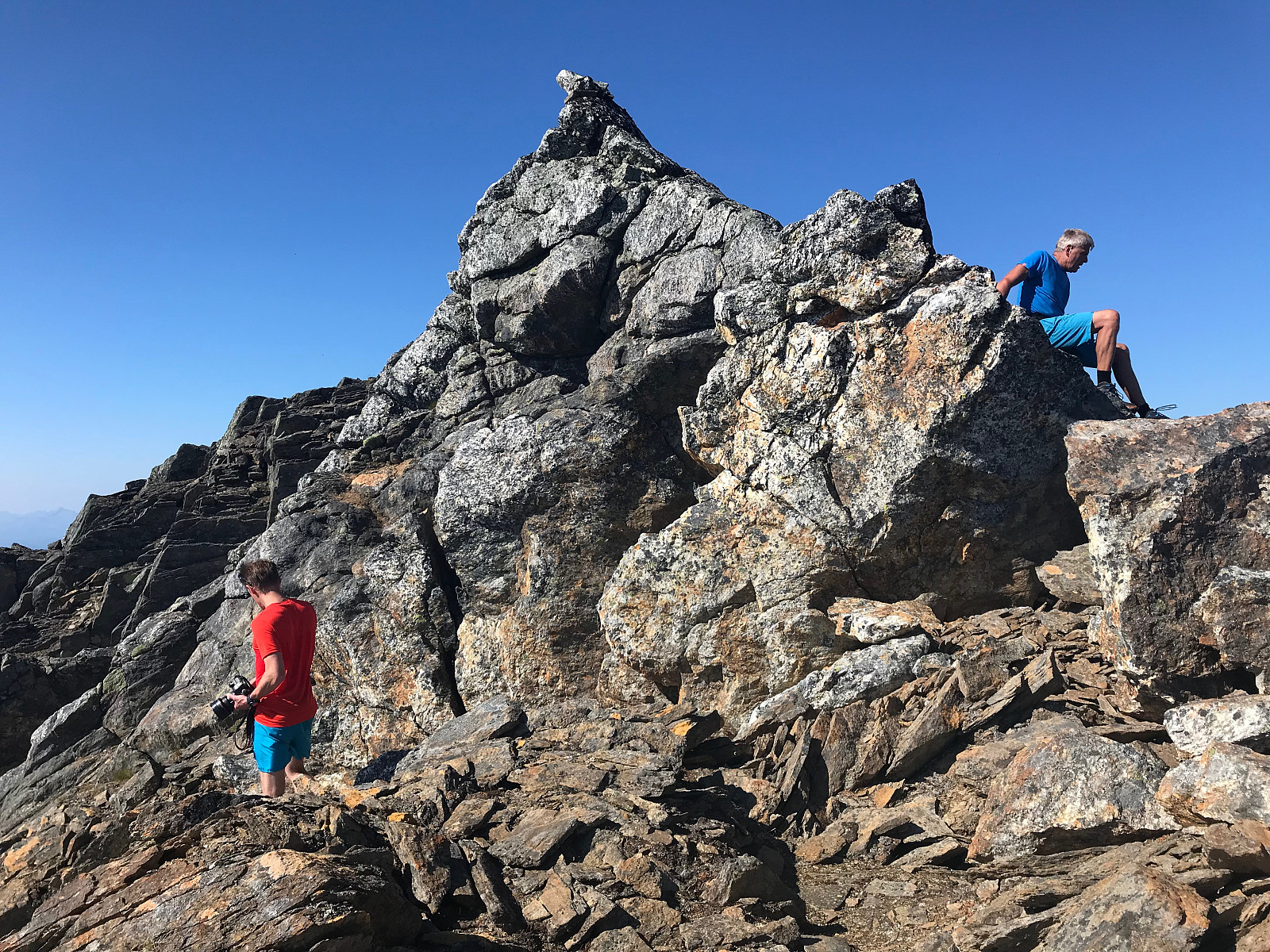
Rasmustinden
- Date:
- 28.07.2018
- Characteristic:
- Trip by foot
- Distance:
- 13.6km
 Norsk tur rapport kan leses hos otto (Otto Lund)
Midnattssol tur til Segla
- Date:
- 24.07.2018
- Characteristic:
- Trip by foot
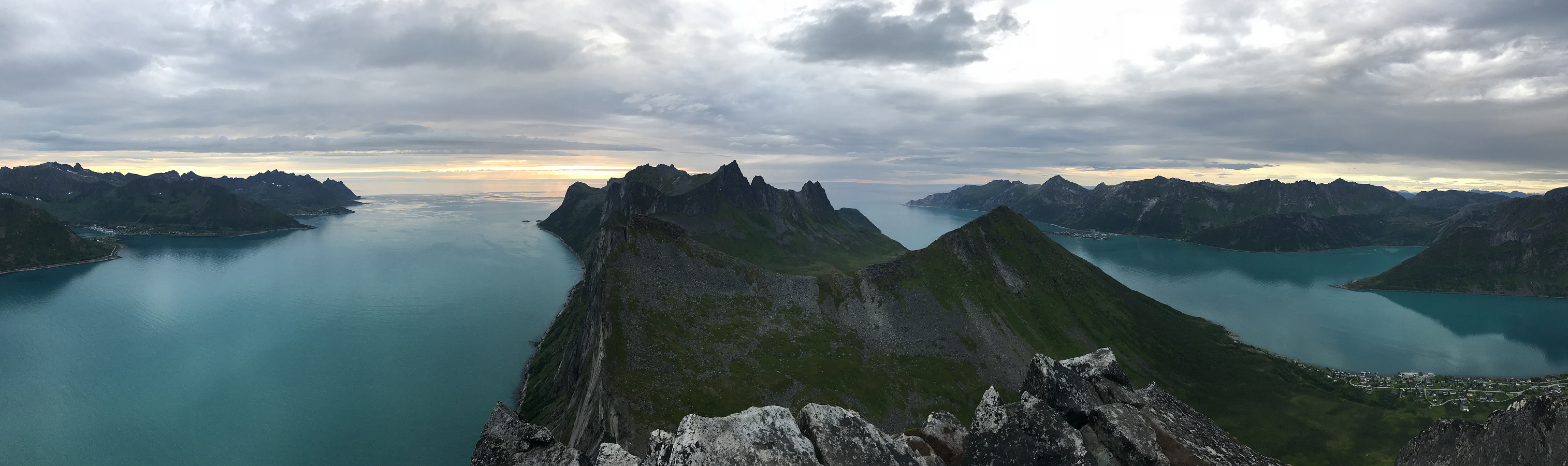 For en utsikt!
Tur rapport kan leses hos uglefisk (Paal Andre Lund)
For en utsikt!
Tur rapport kan leses hos uglefisk (Paal Andre Lund)
Arnøyhøgda
- Date:
- 19.06.2018
- Characteristic:
- Hillwalk
- Distance:
- 13.2km
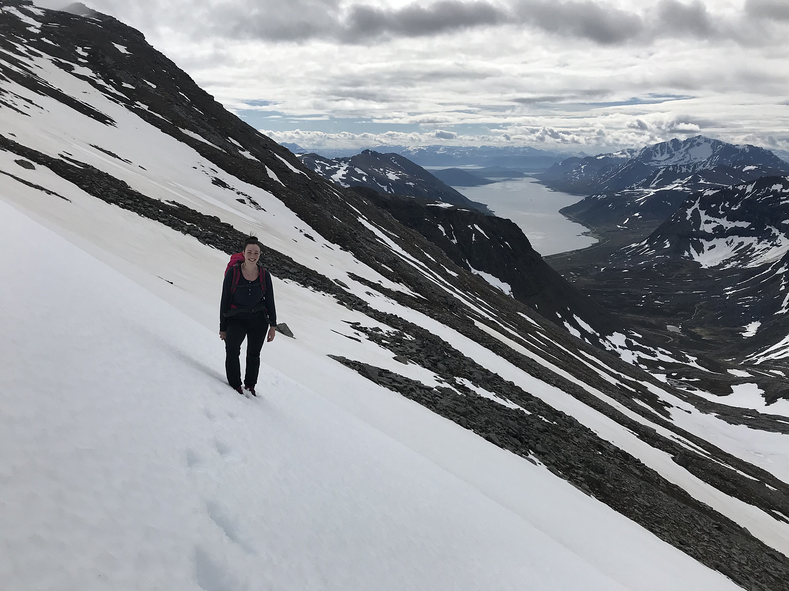 Norsk tur rapport kan leses hos uglefisk (Paal Andre Lund)
What a hike! We took the ferry from Kågan early in the morning and parked at Lauksletta, the left hand side of the Fv347, on Arnøya. We followed a weak path in the valley, on the right hand side of the river, and started gaining elevation pretty quickly. I had done the MSM half marathon 2 days before so my legs were pretty tired, but the views were quickly motivating enough!
We walked past a beautiful waterfall on the left and soon lost the trail. We aimed for the pass which was a little to our left, there was quite a lot of snow still on the mountain which we were happy about as we would save some elevation on the way back! Once we got to the pass (ca. 700moh) we continued upwards to the right, where we could see our goal on the left.
It was mostly snow with >>>
Norsk tur rapport kan leses hos uglefisk (Paal Andre Lund)
What a hike! We took the ferry from Kågan early in the morning and parked at Lauksletta, the left hand side of the Fv347, on Arnøya. We followed a weak path in the valley, on the right hand side of the river, and started gaining elevation pretty quickly. I had done the MSM half marathon 2 days before so my legs were pretty tired, but the views were quickly motivating enough!
We walked past a beautiful waterfall on the left and soon lost the trail. We aimed for the pass which was a little to our left, there was quite a lot of snow still on the mountain which we were happy about as we would save some elevation on the way back! Once we got to the pass (ca. 700moh) we continued upwards to the right, where we could see our goal on the left.
It was mostly snow with >>>

