Archive - Date
Archive - Activity
- Bike trip (2)
-
Climbing (8)
- Alpine climbing (7)
- Mixed climbing (1)
-
Other trip (1)
- Expedition (1)
-
Other winter trip (6)
- Snowshoe trip (6)
-
Ski trip (40)
- Randonnée/Telemark (40)
-
Trip by foot (211)
- Alpine trip (53)
- Hike (65)
- Hillwalk (82)
- Jogging (10)


Collected lists
-
Romsdal ≥ 100m pf.
(131/301)
 43%
43% -
Sunnmøre ≥ 100m pf.
(75/531)
14%
-
Norges 1000 største fjell målt i primærfaktor
(50/1000)
5%

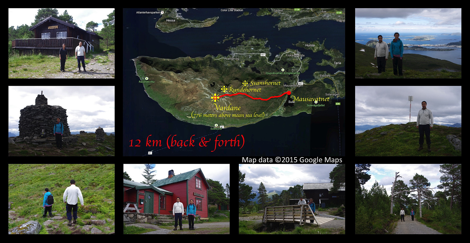
On Three Peaks of Mount Sulafjellet with my Son
- Date:
- 15.08.2015
- Characteristic:
- Hike
- Duration:
- 5:47h
- Distance:
- 16.9km
 I went for a cool trip on mount Sulafjellet along with my son Dag this afternoon. We started out from the parking place by the lake Mausavatnet as we've done on previous occasions, and walked past the well known mountain cabin Rollonhytta up to the mountain peak commonly reffered to as Vardane (776 meters above main sea level), though the real name is actually Tverrfjellet or just Sulafjellet from Sula, the name of the island on which the mountain is located [fjell = mountain]. We thereafter descended from Vardane as we headed towards another peak, Grøthornet, located 650 mamsl. From Grøthornet we descended quite a bit towards the village Langevåg, until we found a rather steep track that could take us up to the mountain peak called Svanshornet (552 mamsl). From Svanshornet we followed another >>>
Hiking Mount Sulafjellet with a son and a daughter.
- Date:
- 08.08.2015
- Characteristic:
- Hike
- Duration:
- 3:44h
- Distance:
- 12.0km
 I had on this day a really nice trip on the mountain Sulafjellet with my oldest son and my oldest daughter, aiming for the peak called Vardane. I also made the very same trip two months and two days earlier with my two sons and my cousin Savanna. On that day we had showers of hail and rain on the trip, and there was still a substantial amount of snow in the track. Even today we had just a very little bit of rain as we started on our descent back down from the mountain, but that didn't last for long; and the temperature was very different from what it was back in the beginning of june...
Hiking to "The Pulpit Rock" in Rogaland County
- Date:
- 03.08.2015
- Characteristic:
- Hike
- Duration:
- 1:18h
- Distance:
- 4.0km
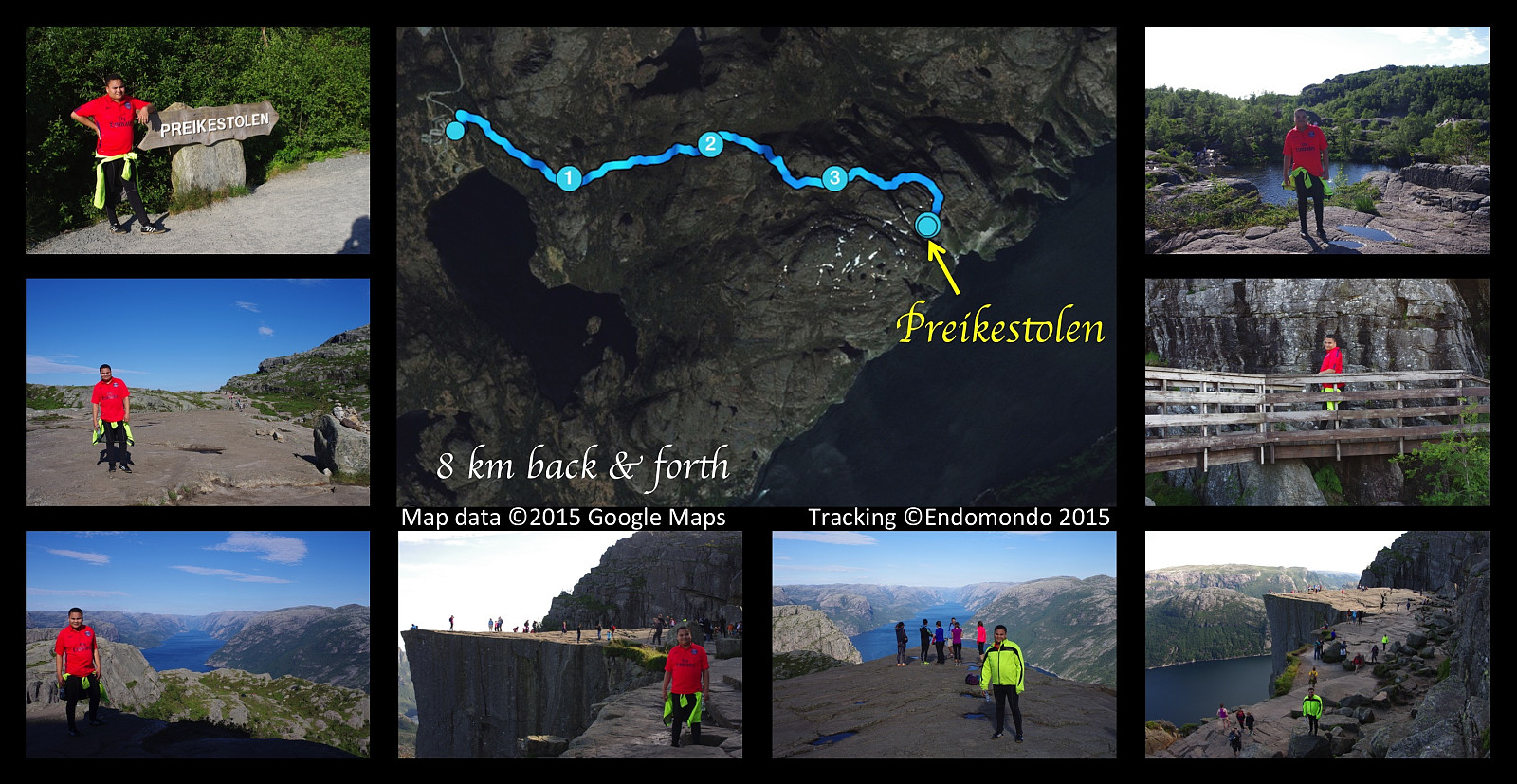 This afternoon I had a nice hike to the mountain plateau called The Pulpit Rock, in Norwegian Preikestolen. Weather was fabulous, it was actually so hot we needed to bring along a bottle of water each. It's a walk of about 4 km only (in each direction) from the parking area. Preikestolen is among the most famous tourist attractions in Norway, and has an estimated number of more than 200.000 visitors per year; hence a rather nice stone track has been made for the hikers, though it is, I have to say, a bit pebbled.
Hiking up Mount Ulriken in Bergen, Norway, with my son.
- Date:
- 02.08.2015
- Characteristic:
- Hillwalk
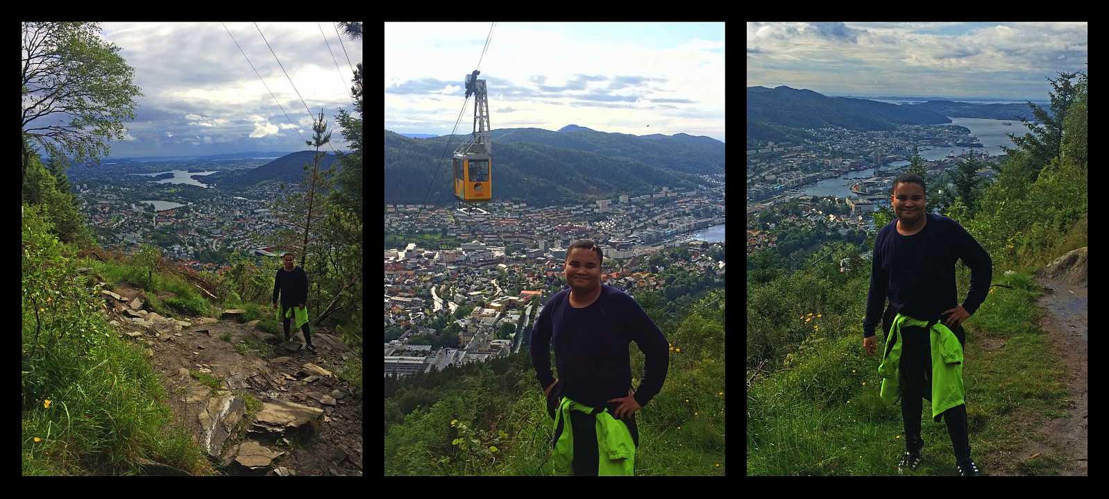 I went hiking on mount Ulriken in Bergen with my son Bror this afternoon. We had a really enjoyable trip, and weather was fairly nice most of the time, though we also had a shower of rain as we were heading back towards our new Bergen apartment. We climbed the mountain using a track just beneath the cable car that ascends the mountain. The lower part of the track goes through forest, and the upper part goes on bare mountain, with heather and moss as the only vegetation. We hiked up to the viewpoint where even the cable car takes the tourists. This isn't actually the highest point of this mountain massif, nor is it even the highest point of the part of the mountain that is known as Mount Ulriken, but it is the best viewpoint for an overview of the city, and it is the point that looks like it >>>
A Different Climb on the Godøy Island and Mount Storehornet
- Date:
- 25.07.2015
- Characteristic:
- Hillwalk
- Duration:
- 6:00h
- Distance:
- 17.8km
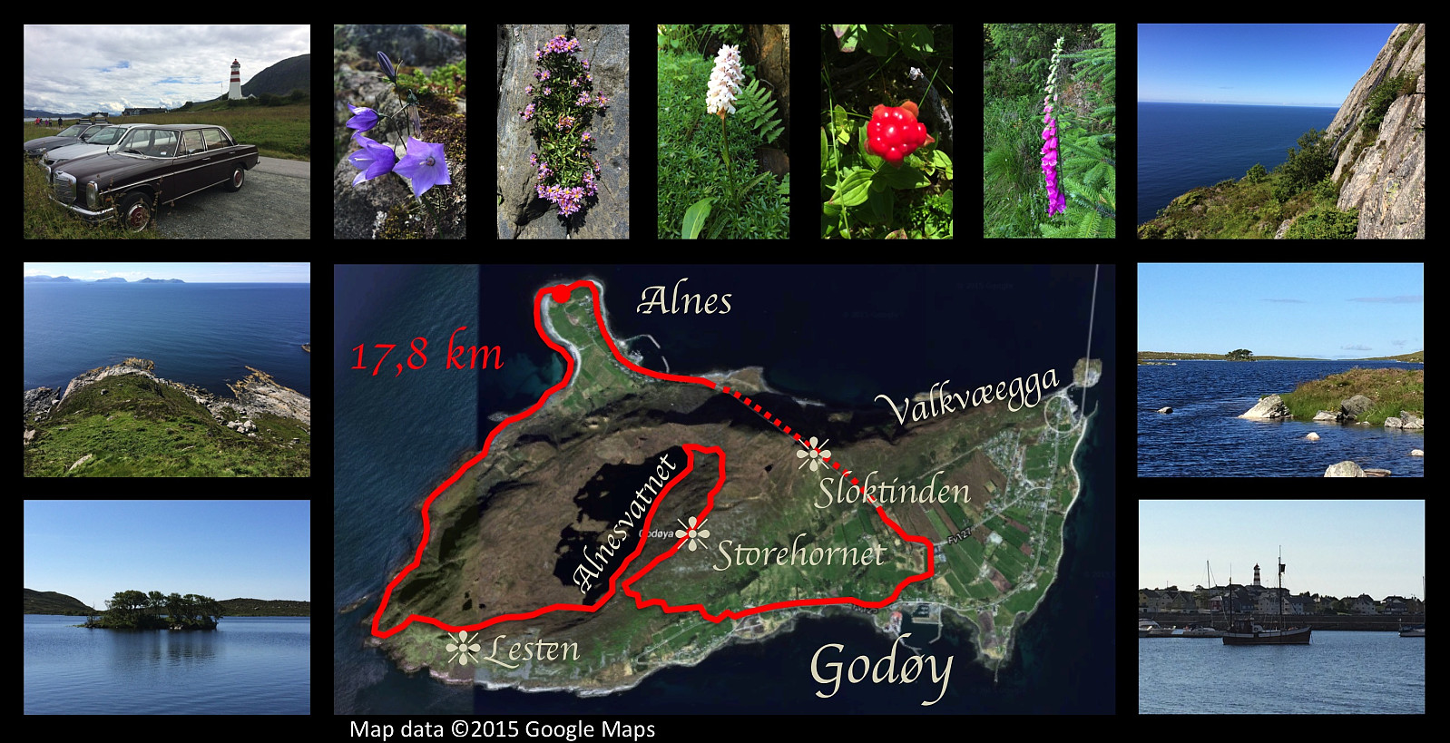 I went exploring the more inaccessible parts of the island Godøy this day. I've been waiting with this particular trip till I was all on my own, in order not to endanger the lives of my kids or my cousins, or anyone else that would like to join me on hiking. I parked my old car close to Alnes Lighthouse, then walked the shore towards the west-most point of the island. From there I climbed up the mountainside to Lestahalsen or Rantane, and then descended to the lake Alnesvatnet. I next walked (and some places climbed) along the eastern shore of the lake, then, from the north end of the lake started climbing towards the top of Storehornet, the highest peak of the island, with its 495 meters above mean sea level. From Storehornet I descended to Djuv, and from Djuv I finally returned to Alnes >>>
Crossing Mount Storhornet on Godøy Island from east to west
- Date:
- 18.07.2015
- Characteristic:
- Hillwalk
- Duration:
- 3:40h
- Distance:
- 8.9km
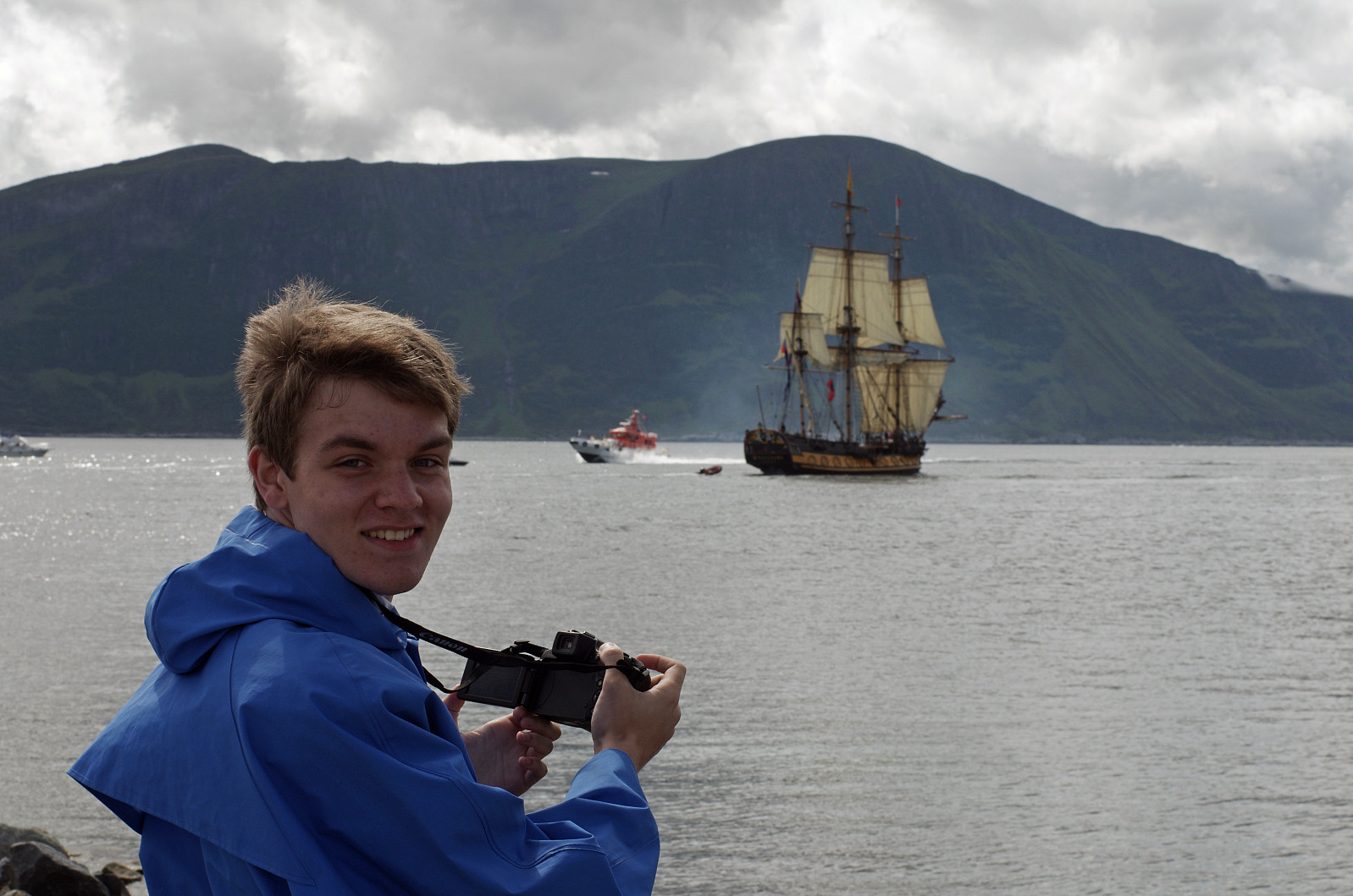 On this day I had a very nice hike on Godøy Island with my cousin Alexander from America. The Tall Ships Races had been in Ålesund for the last few days, and there was going to be a ship parade as all the ships were destined to leave Ålesund for their next harbor on this particular day. We had planned to climb the mountain of Godøy island in order to get a really good view of the Tall Ships Parade from the very summit of the mountain as the ships were departing. As we were driving towards the island, however, we noticed that much of the mountain on the island was concealed by low clouds, however, and so we decided to watch the tall ships from the breakwater of the Hogstein Lighthouse instead. It was an amazing experience to watch all these ships (Images 1 and 2). This event took some hours, >>>
From Djuv to Storehornet on Godøy Island
- Date:
- 04.07.2015
- Characteristic:
- Hillwalk
- Duration:
- 1:49h
- Distance:
- 3.3km
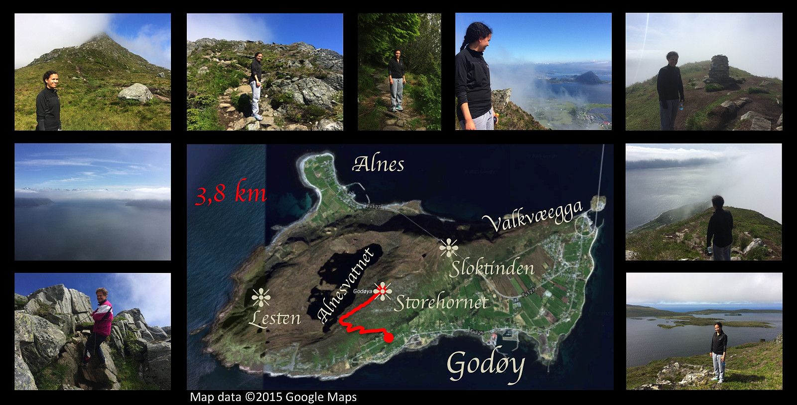 On this day I had a very nice trip to the summit of Storhornet on Godøy Island along with my older daughter. We went by car to a nice parking spot that has been made for mountain trekkers at Gjuv, and started our trek from there. The path up to about 270 m.a.m.s.l. is quite nice though a little bit wet in the upper part. Following this path you reach a mountain pass between Mount Storhornet on one side and Mount Lesten on the other side. From there the rather nice path goes down to the lake Alnesvatnet. Just there in the pass, however, you just take a track up to the right [i.e. eastwards], and this track will then lead you up to the summit of Storhornet. On this particular day, we noticed as we embarked on this last, rather steep climb, that the summit of the mountain was shrouded in clouds. >>>
Summiting Storhornet on Godøy Island twice in a day.
- Date:
- 20.06.2015
- Characteristic:
- Hillwalk
- Duration:
- 5:48h
- Distance:
- 17.6km
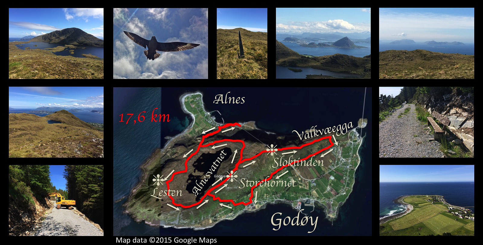 I had another nice hiking trip on the mountain of Godøy island this day. I started out from Alnes, and climbed up to the lake Alnesvatnet; then circumscribed the lake taking a track that I haven't used earlier. I had previously walked along the shore of the lake, and also over the mountain called Lesten, but this time I chose an in-between path about midway between the lake and the summit of Lesten, before ascending the final climb to the peak Storehornet, 497 meters above sea level. From Storehornet I went down the mountain ridge Valkvæegga to Valkvæ, and then westwards to Djuv on the south side of the mountain along a road under construction called Fjellfotveien (i.e. The Mountain Foot Road ). From Djuv I then climbed up to Storehornet a second time on this day, before finding my way down >>>
Round-trip on eastern part of the mountain of Godøy Island
- Date:
- 13.06.2015
- Characteristic:
- Hillwalk
- Duration:
- 4:43h
- Distance:
- 14.8km
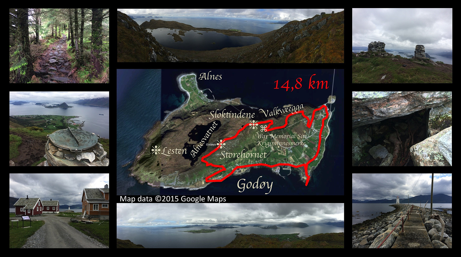 On this day I went for yet another hike on the mountain of the island Godøy, close to were we're living. This time I set out from a place called Djuv (or Juv) on the south side of the Island, and climbed towards the summit of the island, i.e. the peak called Storhornet. From Storhornet I took a somewhat peculiar way northeastwards, however, following first a little edge downwards to a viewpoint overlooking the southern and eastern parts of the island. From this spot I climbed back up to the pond called Lillevatnet, however, and then onto the peak called Sloktinden (there is actually about three peaks that are called Sloktindane [in plural form] by the locals, hence the singular form Sloktinden is something you're not likely to hear apart from here on Peakbook; anyway I climbed onto the easternmost >>>
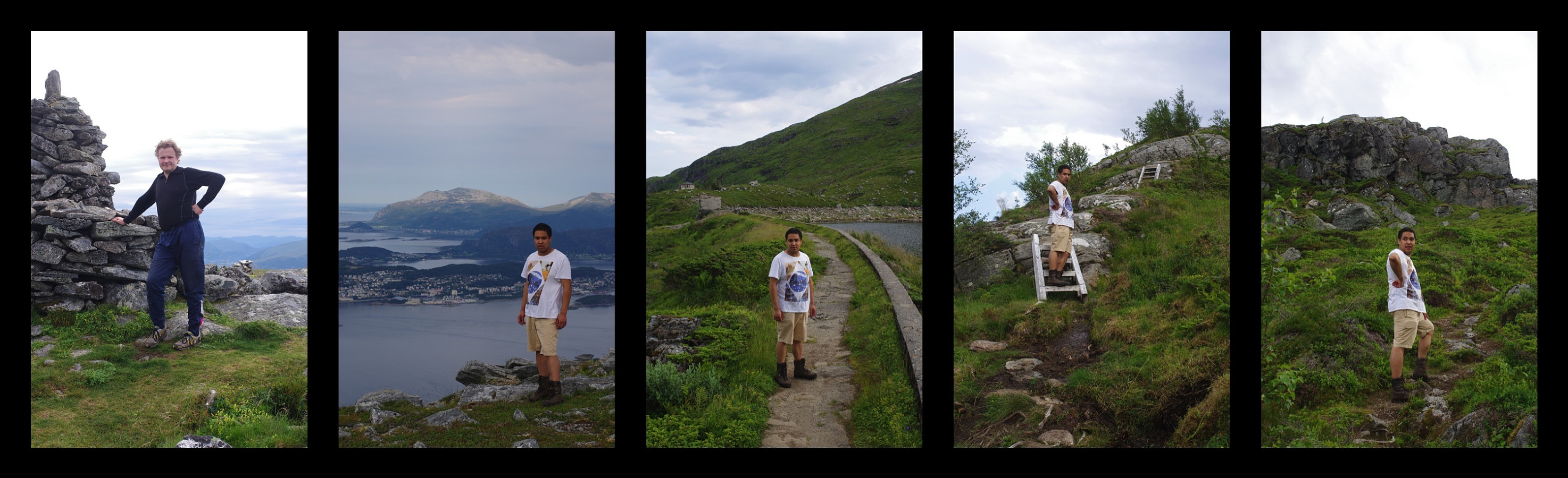
Hiking Mount Sulafjellet with my cousin and my two sons.
- Date:
- 06.06.2015
- Characteristic:
- Hillwalk
- Duration:
- 6:27h
- Distance:
- 11.6km
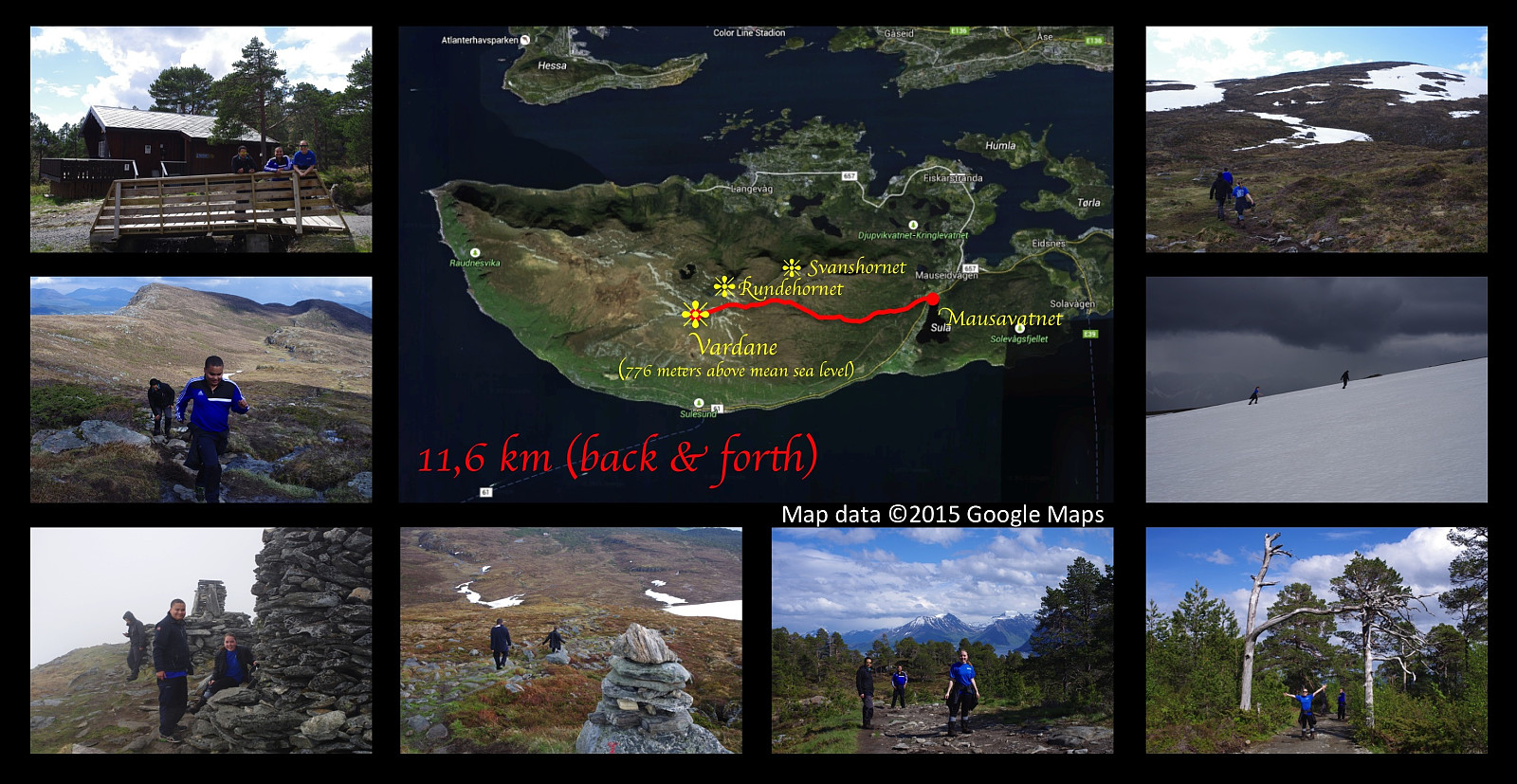 I went hiking on a very nice mountain trip on this day with my two sons Bror and Dag and my cousin Savanna . We set out from lake Mausavatnet, and climbed the mountain of the island Sula, located just south of Ålesund, up to its highest peak commonly called Vardane , 776 meters above mean sea level. The weather was nice with sunshine for most of our trip, but as we were approaching the summit, it changed within minutes to foggy, cold, rainy, and very windy; hence we were robbed of the nice view that we were anticipating to have at the peak of the mountain. I had planned to shoot a picture of Savanna and my boys with our home island of Vigra in the background, but that didn't work out... Being completly soaked by the rain, we couln't risk getting cold by waiting for the weather to improve, and >>>
