Archive - Date
Archive - Activity
-
Bike trip (108)
- Bike trip - mixed (25)
- Bike trip - road (83)
-
Drive (9)
- Car drive (9)
-
Other trip (3)
- Kayaking (3)
-
Ski trip (109)
- Backcountry skiing (65)
- Cross-country skiing (44)
- Trip by foot (1782)
Collected lists
-
Voss ≥ 100m pf.
(96/98)
 97%
97% -
Opptur Hordaland
(143/159)
89%
-
Stasjoner på Bergensbanen
(31/40)
77%
-
Ulvik ≥ 100m pf.
(28/38)
73%
-
Hordaland ≥ 100m pf.
(613/863)
71%
-
Mjølfjell PF > 100m
(21/31)
67%
-
Jondal ≥ 100m pf.
(15/23)
65%
-
Sunnhordland PF >= 100m
(104/186)
55%
-
Dagsturhyttene i Vestland
(33/61)
54%
-
Hordaland: Hardanger PF>=100m
(186/359)
51%
-
Kvinnherad ≥ 100m pf.
(40/79)
50%
-
DNT-hytter i Hordaland
(22/45)
48%
-
Sogndal ≥ 100m pf.
(23/81)
28%
-
Vik i Sogn ≥ 100m pf.
(8/46)
17%
-
DNT-hytter i Sogn og Fjordane
(8/47)
17%
-
Eidfjord ≥ 100m pf.
(7/42)
16%
-
Etne ≥ 100m pf.
(7/51)
13%
-
Ullensvang ≥ 100m pf.
(21/153)
13%
-
Sogn - Sør for Sognefjorden PF>=100m
(17/159)
10%
-
Opptur i Sogn og Fjordane peaks
(17/177)
9%

Ustetind from Kikut
- Date:
- 28.03.2017
- Characteristic:
- Backcountry skiing
- Duration:
- 7:23h
- Distance:
- 28.4km
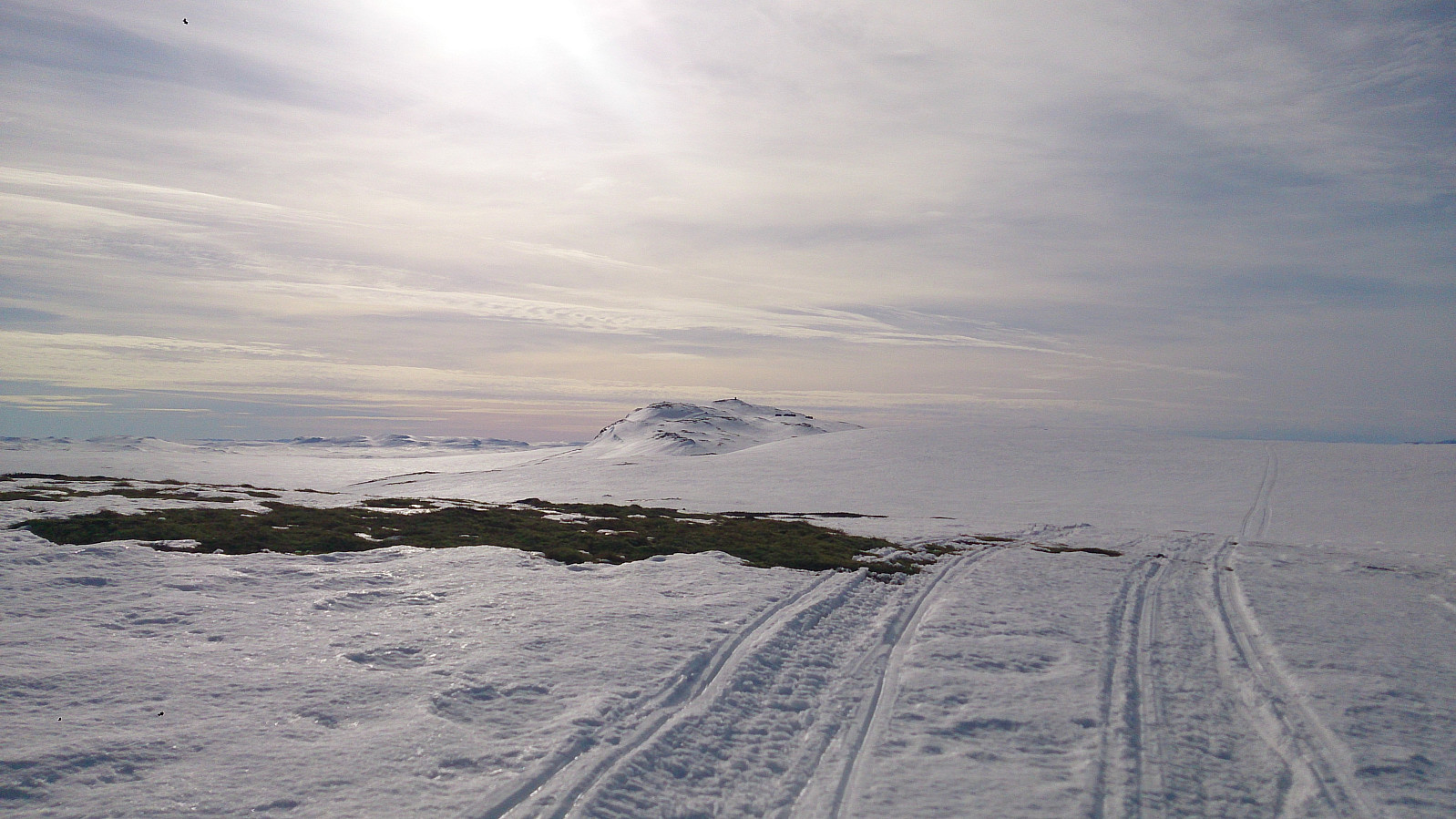 Eight degrees, sunny, almost no clouds, and close to no wind. Only the snow conditions could have been better, as for many sections of the trail we could see the ground through the snow, while for other parts the snow melting during the previous day had turned into ice overnight. Yet at other places we had to leave the trail completely for smaller detours to avoid larger wet areas. Luckily this greatly improved as the trip progressed.
The first summit visited was Birgithovda , an easy to reach summit that is very close to the main winter trail. I had to remove my skis to reach the summit though, as all the snow had melted towards the summit. Even though this summit is relatively low compared to its surroundings, it still provided nice views as can be seen from the pictures.
The trip quickly continued to >>>
Eight degrees, sunny, almost no clouds, and close to no wind. Only the snow conditions could have been better, as for many sections of the trail we could see the ground through the snow, while for other parts the snow melting during the previous day had turned into ice overnight. Yet at other places we had to leave the trail completely for smaller detours to avoid larger wet areas. Luckily this greatly improved as the trip progressed.
The first summit visited was Birgithovda , an easy to reach summit that is very close to the main winter trail. I had to remove my skis to reach the summit though, as all the snow had melted towards the summit. Even though this summit is relatively low compared to its surroundings, it still provided nice views as can be seen from the pictures.
The trip quickly continued to >>>
Ruperanden from Kikut
- Date:
- 27.03.2017
- Characteristic:
- Cross-country skiing
- Duration:
- 1:38h
- Distance:
- 7.5km
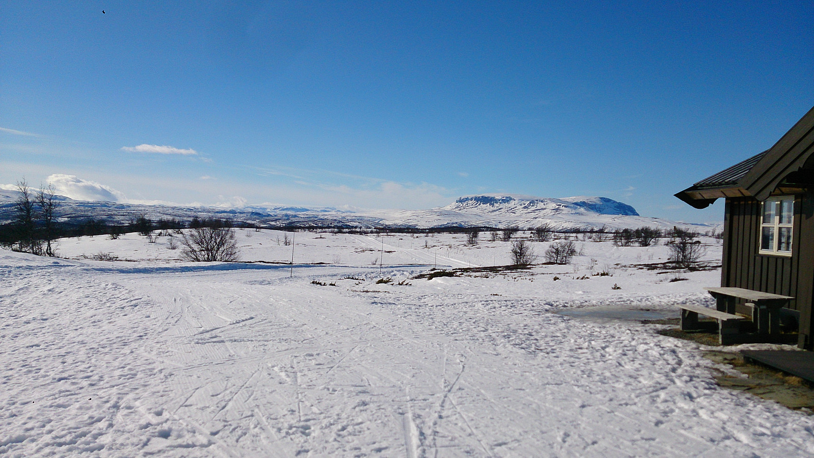 Short skiing trip from Kikut to Ruperanden . The skiing conditions were poor at the start of the trip, where we had to look out for rocks sticking out of the snow in order to not damage our skis. But as soon as we hit the main skiing trail the conditions improved significantly. The wind started to pick up during the trip though. Tailwind on the way there and an even stronger head-wind on the way back towards Kikut.
Hellen Festning
- Date:
- 26.03.2017
- Characteristic:
- Hike
- Duration:
- 0:37h
- Distance:
- 3.3km
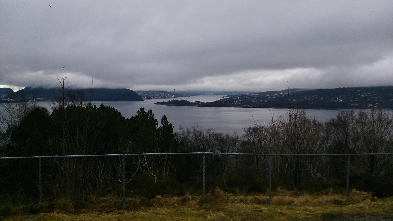 Short hike across Hellen Festning.
Lyshornet and Vetla Lyshornet
- Date:
- 18.03.2017
- Characteristic:
- Hillwalk
- Duration:
- 2:23h
- Distance:
- 6.1km
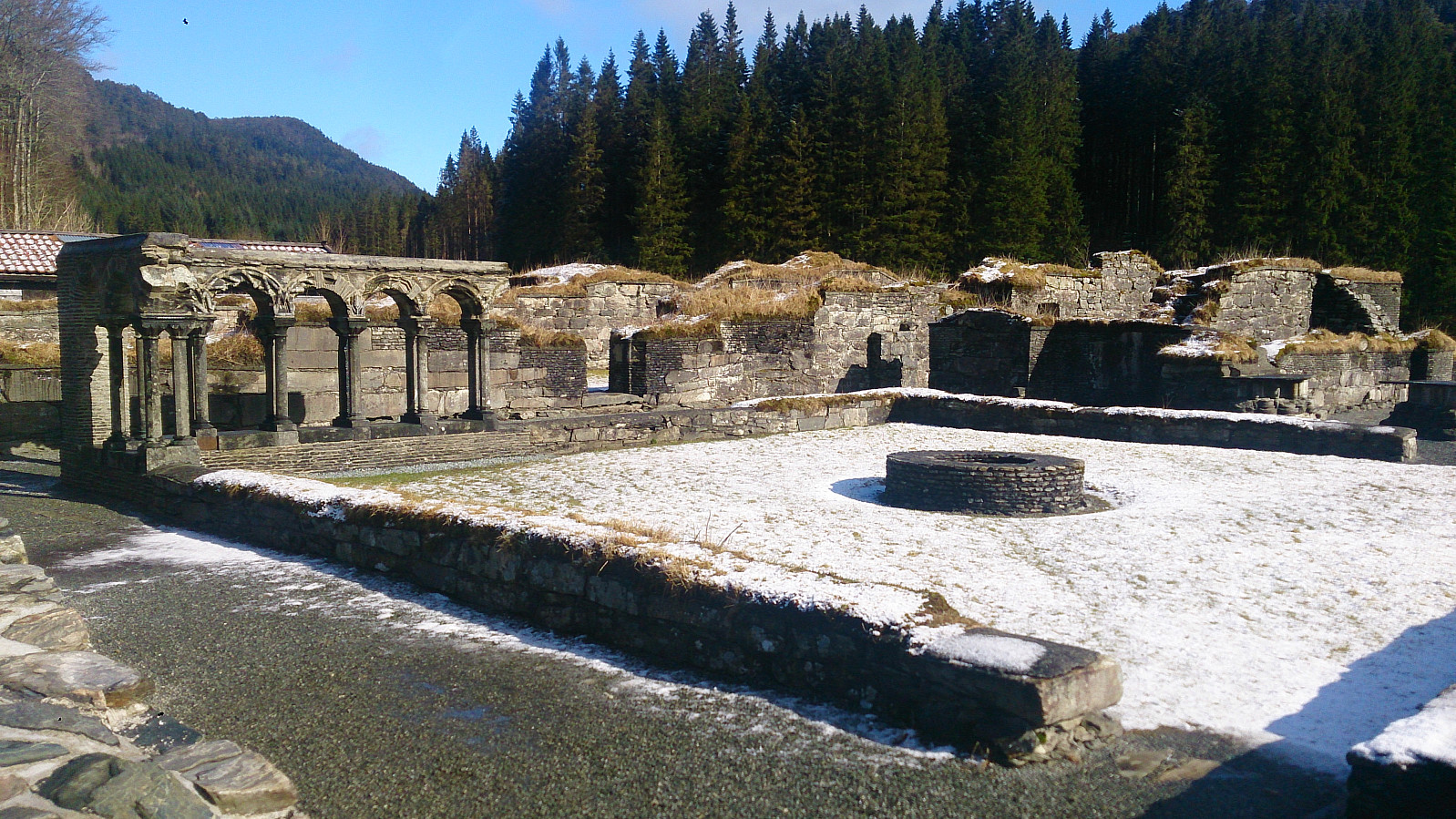 We started from the parking lot next to the Lysekloster Ruins . (Note that the number of parking spots is limited (less than 10?), so keep this in mind if doing this hike on a weekend with nice weather.) From there we followed the standard trail through the woods to the summit of Lyshornet . Snow started appearing at around 300 meters and from there on the trail was covered by snow and ice all the way to the summit.
For return we decided to follow the advice of some fellow hikers and follow in their footsteps by taking a longer U-turn across Vetla Lyshornet (see map for details). This was a nice addition to an otherwise short hike. The trail was not always easy to locate though, so it was a good thing we had footprints in the snow to follow.
In the end our U-turn ended up connecting with the end of the gravel road that we briefly crossed >>>
We started from the parking lot next to the Lysekloster Ruins . (Note that the number of parking spots is limited (less than 10?), so keep this in mind if doing this hike on a weekend with nice weather.) From there we followed the standard trail through the woods to the summit of Lyshornet . Snow started appearing at around 300 meters and from there on the trail was covered by snow and ice all the way to the summit.
For return we decided to follow the advice of some fellow hikers and follow in their footsteps by taking a longer U-turn across Vetla Lyshornet (see map for details). This was a nice addition to an otherwise short hike. The trail was not always easy to locate though, so it was a good thing we had footprints in the snow to follow.
In the end our U-turn ended up connecting with the end of the gravel road that we briefly crossed >>>
Hamrefjellet, Vardane and Torneberget
- Date:
- 26.02.2017
- Characteristic:
- Hillwalk
- Duration:
- 3:05h
- Distance:
- 9.2km
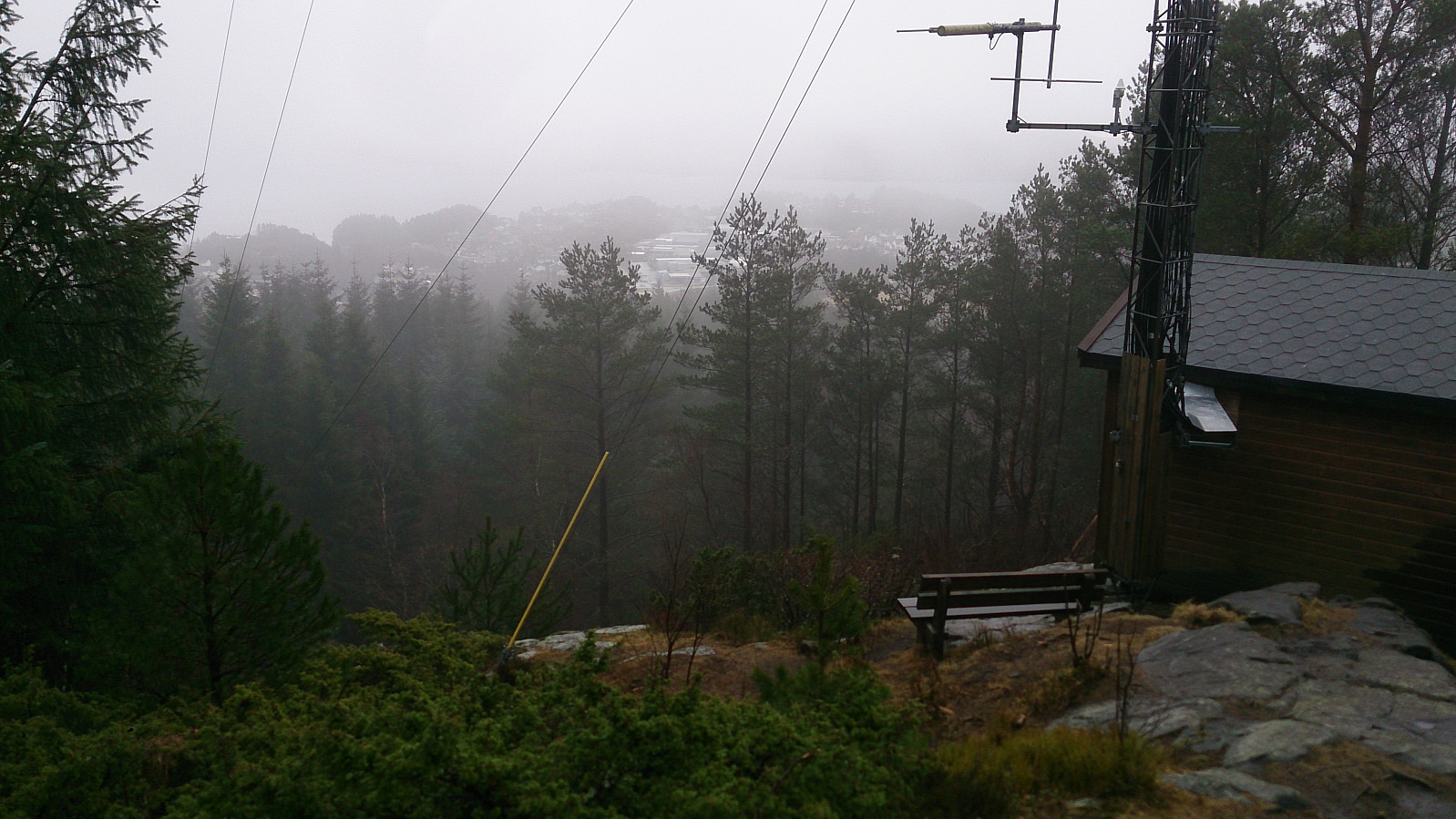
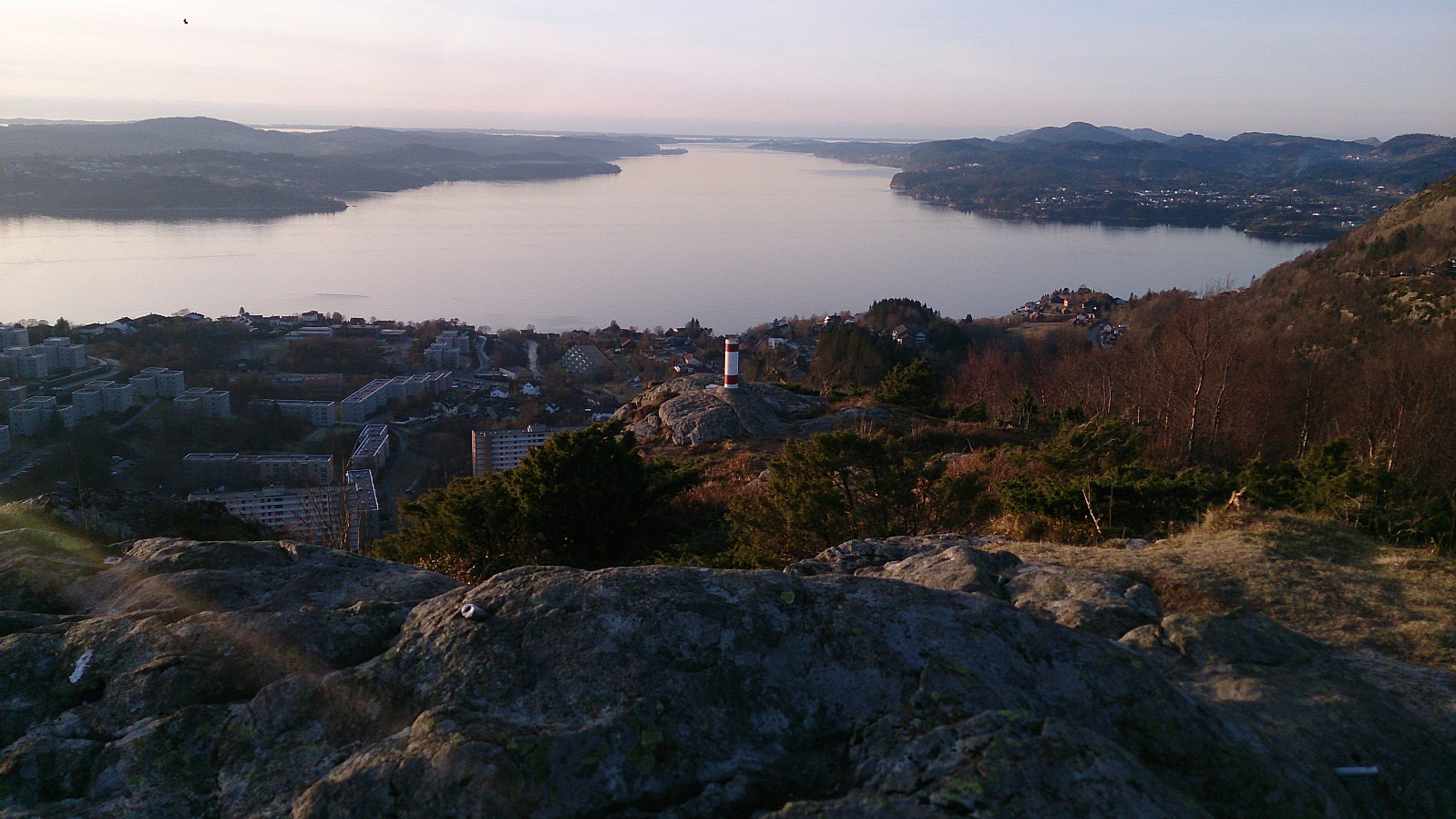
 The trip started by talking the bus to Vallaheiene where I quickly located the signs for Smøråsfjellet. Not too difficult to locate the right trail, but the trail itself was a bad combination of ice and mud. The top of Hamrefjellet provided only limited views, so I decided to continue to a viewpoint called the "Orange Bench" ("Appelsinbenken" in Norwegian), which turned out to be a significant upgrade with nice views across Fanafjorden.
I returned to the main trail around Bjørnevatnet and then took a detour to pass by the two smaller summits of Vardane and Torneberget . The former had nice views, while the latter views left a lot to be desired. The hike was then completed by walking down to Litle Tveiten and from there back to Nesttun Terminal for the tram back to the city center.
The trip started by talking the bus to Vallaheiene where I quickly located the signs for Smøråsfjellet. Not too difficult to locate the right trail, but the trail itself was a bad combination of ice and mud. The top of Hamrefjellet provided only limited views, so I decided to continue to a viewpoint called the "Orange Bench" ("Appelsinbenken" in Norwegian), which turned out to be a significant upgrade with nice views across Fanafjorden.
I returned to the main trail around Bjørnevatnet and then took a detour to pass by the two smaller summits of Vardane and Torneberget . The former had nice views, while the latter views left a lot to be desired. The hike was then completed by walking down to Litle Tveiten and from there back to Nesttun Terminal for the tram back to the city center.
Krossfjellet and Storeknappen
- Date:
- 19.02.2017
- Characteristic:
- Hillwalk
- Duration:
- 2:30h
- Distance:
- 10.5km
 Started by taking the bus to Frekhaug Terminal and locating the road towards Sagstad. I followed this road until getting to the road to Øvre Sagstad and then followed this smaller road until reaching the start of the trail. Note that the road seems to go straight through a private property, but don't worry, you are on the right track and you'll soon see the signs for Krossfjellet .
The trail started as a gravel road but halfway to the summit it changed into a smaller but still easy to follow trail. All in all, a nice and fairly short hike. Just too bad that the fog ruined the views completely. On the way back, I decided to swing by Sakstadnuten, but this turned out to be a waste of time as there was no real summit and only very limited views. I therefore decided to not add Sakstadnuten as a separate PB-element.
Started by taking the bus to Frekhaug Terminal and locating the road towards Sagstad. I followed this road until getting to the road to Øvre Sagstad and then followed this smaller road until reaching the start of the trail. Note that the road seems to go straight through a private property, but don't worry, you are on the right track and you'll soon see the signs for Krossfjellet .
The trail started as a gravel road but halfway to the summit it changed into a smaller but still easy to follow trail. All in all, a nice and fairly short hike. Just too bad that the fog ruined the views completely. On the way back, I decided to swing by Sakstadnuten, but this turned out to be a waste of time as there was no real summit and only very limited views. I therefore decided to not add Sakstadnuten as a separate PB-element.
Toppenipa and Toppefjellet
- Date:
- 13.02.2017
- Characteristic:
- Hillwalk
- Distance:
- 5.0km
 Short afternoon hike to Toppenipa and Toppefjellet. Forgot to turn on the GPS, hence no GPS tracking. The total distance is an approximation.
Harafjellet and Store Kongshaugen
- Date:
- 12.02.2017
- Characteristic:
- Hillwalk
- Duration:
- 3:08h
- Distance:
- 12.2km
 Started by taking the bus to Storavatnet Terminal. From there I tried to locate a trail to Harafjellet . I found one promising option, but either I lost it along the way or the trail did not go to the summit, so I ended up taking a shortcut through the terrain to get to the trail that follows the ridge of Harafjellet. The summit itself provided little with regards to views, but luckily I came across a local hiker that showed me a much better viewpoint just to the north of the summit. Hence I would strongly recommend walking these extra couple of hundred meters if visiting Harafjellet.
I then followed the trail back to Storavatnet and continued along the winding gravel road taking me all the way to Gullaksdalen , where I followed a smaller trail to the south end of Storavatnet. However, I then figured out that I had >>>
Started by taking the bus to Storavatnet Terminal. From there I tried to locate a trail to Harafjellet . I found one promising option, but either I lost it along the way or the trail did not go to the summit, so I ended up taking a shortcut through the terrain to get to the trail that follows the ridge of Harafjellet. The summit itself provided little with regards to views, but luckily I came across a local hiker that showed me a much better viewpoint just to the north of the summit. Hence I would strongly recommend walking these extra couple of hundred meters if visiting Harafjellet.
I then followed the trail back to Storavatnet and continued along the winding gravel road taking me all the way to Gullaksdalen , where I followed a smaller trail to the south end of Storavatnet. However, I then figured out that I had >>>
Liatårnet and Pyttane
- Date:
- 11.02.2017
- Characteristic:
- Hillwalk
- Duration:
- 4:22h
- Distance:
- 14.3km
 The hike started by talking the bus to where Bildøybakken meets Døsjevegen (bus stop called Døsjeskiftet). From there I easily followed the paved road towards Bildøyvatnet. However before reaching Bildøyvatnet I started on a trail going south on the east side of Bildøyvatnet, taking me to Skinntikavarden . Next, I followed the trail towards Skitnafenet , but not all the way to the top (more on that later).
The trail took me down to the paved road going to Pyttane , which I followed all the way to the top, visiting both towers, before moving on towards Liatårnet , the highest summit of the day. After descending from Liatårnet I followed the paved road 200 meters or so in the westerly direction before locating a trail heading north (it was indicated by multiple signs, but I can't remember the names on the signs). This trail took me >>>
The hike started by talking the bus to where Bildøybakken meets Døsjevegen (bus stop called Døsjeskiftet). From there I easily followed the paved road towards Bildøyvatnet. However before reaching Bildøyvatnet I started on a trail going south on the east side of Bildøyvatnet, taking me to Skinntikavarden . Next, I followed the trail towards Skitnafenet , but not all the way to the top (more on that later).
The trail took me down to the paved road going to Pyttane , which I followed all the way to the top, visiting both towers, before moving on towards Liatårnet , the highest summit of the day. After descending from Liatårnet I followed the paved road 200 meters or so in the westerly direction before locating a trail heading north (it was indicated by multiple signs, but I can't remember the names on the signs). This trail took me >>>
Skåldalsnipa from Arna Terminal
- Date:
- 05.02.2017
- Characteristic:
- Hillwalk
- Duration:
- 3:21h
- Distance:
- 10.3km
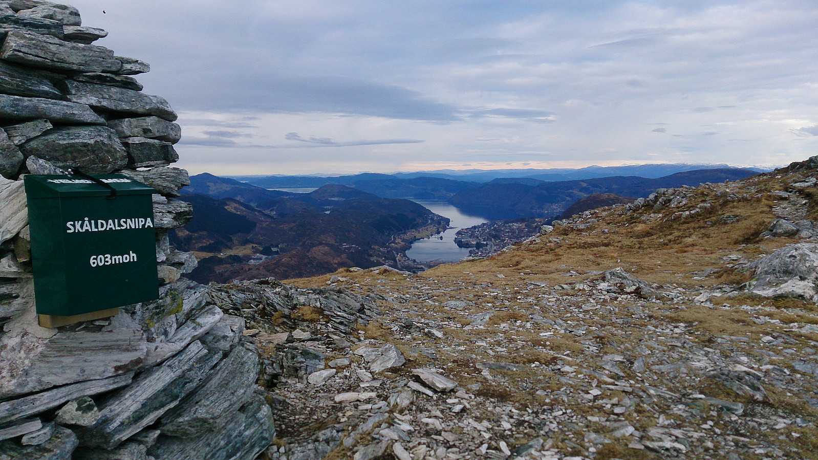 Warning: This hike is not recommended for those afraid of heights, as it includes some fairly steep sections where the trail goes close to the edge of the cliff. This can probably be avoided by choosing a different path up to Stemmebrunane, but I could not figure out where this path started.
My trip started by talking the bus to Arna Terminal and from there walking south towards Raudtjern (see map for details). Hundred meters or so before reaching Raudtjern I took the trail going left towards Stemmebrunane. The trail is indicated on the map, but may be a bit hard to locate. As a tip, look out for the information sign about entering a restricted area due to drinking water, as this indicates the start of the trail.
At this point the hike changed dramatically, with the trail winding back and forth >>>
Warning: This hike is not recommended for those afraid of heights, as it includes some fairly steep sections where the trail goes close to the edge of the cliff. This can probably be avoided by choosing a different path up to Stemmebrunane, but I could not figure out where this path started.
My trip started by talking the bus to Arna Terminal and from there walking south towards Raudtjern (see map for details). Hundred meters or so before reaching Raudtjern I took the trail going left towards Stemmebrunane. The trail is indicated on the map, but may be a bit hard to locate. As a tip, look out for the information sign about entering a restricted area due to drinking water, as this indicates the start of the trail.
At this point the hike changed dramatically, with the trail winding back and forth >>>
