Archive - Date
Archive - Activity
-
Bike trip (108)
- Bike trip - mixed (25)
- Bike trip - road (83)
-
Drive (9)
- Car drive (9)
-
Other trip (3)
- Kayaking (3)
-
Ski trip (109)
- Backcountry skiing (65)
- Cross-country skiing (44)
- Trip by foot (1782)
Collected lists
-
Voss ≥ 100m pf.
(96/98)
 97%
97% -
Opptur Hordaland
(143/159)
89%
-
Stasjoner på Bergensbanen
(31/40)
77%
-
Ulvik ≥ 100m pf.
(28/38)
73%
-
Hordaland ≥ 100m pf.
(613/863)
71%
-
Mjølfjell PF > 100m
(21/31)
67%
-
Jondal ≥ 100m pf.
(15/23)
65%
-
Sunnhordland PF >= 100m
(104/186)
55%
-
Dagsturhyttene i Vestland
(33/61)
54%
-
Hordaland: Hardanger PF>=100m
(186/359)
51%
-
Kvinnherad ≥ 100m pf.
(40/79)
50%
-
DNT-hytter i Hordaland
(22/45)
48%
-
Sogndal ≥ 100m pf.
(23/81)
28%
-
Vik i Sogn ≥ 100m pf.
(8/46)
17%
-
DNT-hytter i Sogn og Fjordane
(8/47)
17%
-
Eidfjord ≥ 100m pf.
(7/42)
16%
-
Etne ≥ 100m pf.
(7/51)
13%
-
Ullensvang ≥ 100m pf.
(21/153)
13%
-
Sogn - Sør for Sognefjorden PF>=100m
(17/159)
10%
-
Opptur i Sogn og Fjordane peaks
(17/177)
9%

Bønes søyle
- Date:
- 27.01.2024
- Characteristic:
- Hike
- Duration:
- 0:47h
- Distance:
- 4.0km
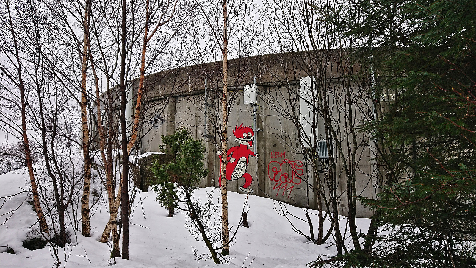
 Yet another gray weekend and yet another short Saturday hike. This time to the trig marker at Bønes . I started by taking the bus to "Bønes senter" and from there completed the short walk to today's target. The trig marker was located on a small hill next to several houses but could be easily accessed from the northwest via a small playground. There was even a weak path which helped reduce the feeling of trespassing. Given that the visit of the trig marker had taken less than five minutes, I extended the hike by walking along the roads to Oasen before taking the bus home.
Hellen festning and Furukammen
- Date:
- 26.01.2024
- Characteristic:
- Hike
- Duration:
- 1:05h
- Distance:
- 5.0km
 Short local evening hike.
Ørneberget and Furukammen
- Date:
- 25.01.2024
- Characteristic:
- Hillwalk
- Duration:
- 0:59h
- Distance:
- 4.5km
 Short local evening hike.
Across Hellen festning
- Date:
- 23.01.2024
- Characteristic:
- Hike
- Duration:
- 0:36h
- Distance:
- 3.2km
 Short local evening hike before it started raining again.
Alvehaugen and Høyde ved Janaflaten
- Date:
- 21.01.2024
- Characteristic:
- Hillwalk
- Duration:
- 0:36h
- Distance:
- 2.2km
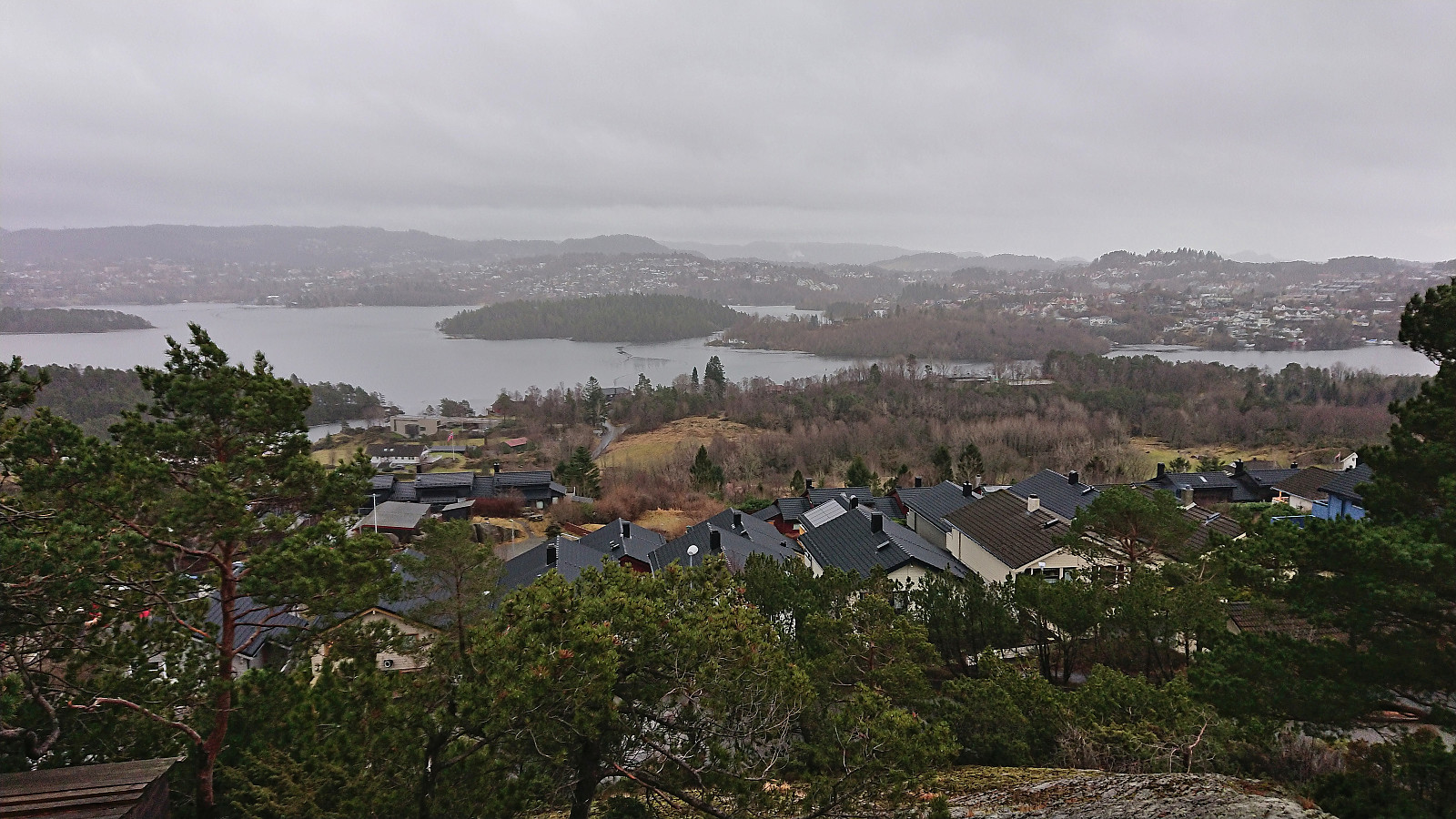
 On a gray Sunday where the rain showers did their best to melt the recent snow and make all surfaces slippery, I once again turned to the Alle topper i Bergen list and decided on two minor hills just east of Sotrabroen.
First up was Alvehaugen which could be spotted immediately after getting off the bus. Getting to the summit however required a bit more work but could be fairly easily done via a short off-trail ascent from the north.
I descended the same way and headed the short distance south to Høyde ved Janaflaten . Here the ascent was easier than expected as most of the trees shown covering the summit in previous trip reports had been removed and it was now simply a matter of walking up to the highest point. While the removal of the trees had resulted in better views, it was still a rather uninteresting small hill.
The short hike was then concluded >>>
On a gray Sunday where the rain showers did their best to melt the recent snow and make all surfaces slippery, I once again turned to the Alle topper i Bergen list and decided on two minor hills just east of Sotrabroen.
First up was Alvehaugen which could be spotted immediately after getting off the bus. Getting to the summit however required a bit more work but could be fairly easily done via a short off-trail ascent from the north.
I descended the same way and headed the short distance south to Høyde ved Janaflaten . Here the ascent was easier than expected as most of the trees shown covering the summit in previous trip reports had been removed and it was now simply a matter of walking up to the highest point. While the removal of the trees had resulted in better views, it was still a rather uninteresting small hill.
The short hike was then concluded >>>
Hellen festning and Furukammen
- Date:
- 20.01.2024
- Characteristic:
- Hike
- Duration:
- 1:57h
- Distance:
- 5.1km
 Short local Saturday hike where the snow showers gradually turned into rain showers.
Skiing across Vidden after dark
- Date:
- 19.01.2024
- Characteristic:
- Backcountry skiing
- Duration:
- 4:53h
- Distance:
- 21.1km
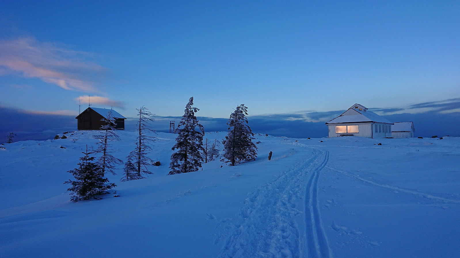
 Started the weekend early to take advantage of the recent massive snowfall before it would start raining heavily during the next couple of days. After taking the cable car (230 kr) to the top of Ulriken (or more correctly to Ulriken Vest ), I put on the skis and headed towards Turnerhytten . The visibility was not the best and I constantly had to consider whether my plan to ski across Vidden would be doable after all. At Turnerhytten the visibility gradually improved and I decided to at least continue to Byfjellenes høyeste punkt before deciding. When getting there the visibility had thankfully further improved. Encouraged by also seeing other skiers I decided to continue.
Shortly after passing Skjulet I connected with the trails of the other skiers and could then easily follow these all the way to Borgaskaret. It would probably have been possible >>>
Started the weekend early to take advantage of the recent massive snowfall before it would start raining heavily during the next couple of days. After taking the cable car (230 kr) to the top of Ulriken (or more correctly to Ulriken Vest ), I put on the skis and headed towards Turnerhytten . The visibility was not the best and I constantly had to consider whether my plan to ski across Vidden would be doable after all. At Turnerhytten the visibility gradually improved and I decided to at least continue to Byfjellenes høyeste punkt before deciding. When getting there the visibility had thankfully further improved. Encouraged by also seeing other skiers I decided to continue.
Shortly after passing Skjulet I connected with the trails of the other skiers and could then easily follow these all the way to Borgaskaret. It would probably have been possible >>>
Furukammen and Hellen festning
- Date:
- 18.01.2024
- Characteristic:
- Hike
- Duration:
- 1:36h
- Distance:
- 4.0km
 Short local evening hike in another at least 20 cm of new snow.
Skiing: Fløyen and Rundemanen
- Date:
- 17.01.2024
- Characteristic:
- Cross-country skiing
- Duration:
- 4:05h
- Distance:
- 17.9km
 Left work a couple of hours early to enjoy the last part of a day of excellent winter weather. After the massive snowfall from the day before there was plenty of fresh snow. The skis came on just after exiting Fløibanen and stayed on until the top of Øyjorden (except for most of Hellemyrstien where I concluded that it was just as fast to walk).
Øyjorden and Helleveien
- Date:
- 16.01.2024
- Characteristic:
- Hike
- Duration:
- 1:28h
- Distance:
- 4.6km
 Short local evening hike in lots of new snow.
