Archive - Date
Archive - Activity
-
Bike trip (108)
- Bike trip - mixed (25)
- Bike trip - road (83)
-
Drive (9)
- Car drive (9)
-
Other trip (3)
- Kayaking (3)
-
Ski trip (109)
- Backcountry skiing (65)
- Cross-country skiing (44)
- Trip by foot (1782)
Collected lists
-
Voss ≥ 100m pf.
(96/98)
 97%
97% -
Opptur Hordaland
(143/159)
89%
-
Stasjoner på Bergensbanen
(31/40)
77%
-
Ulvik ≥ 100m pf.
(28/38)
73%
-
Hordaland ≥ 100m pf.
(613/863)
71%
-
Mjølfjell PF > 100m
(21/31)
67%
-
Jondal ≥ 100m pf.
(15/23)
65%
-
Sunnhordland PF >= 100m
(104/186)
55%
-
Dagsturhyttene i Vestland
(33/61)
54%
-
Hordaland: Hardanger PF>=100m
(186/359)
51%
-
Kvinnherad ≥ 100m pf.
(40/79)
50%
-
DNT-hytter i Hordaland
(22/45)
48%
-
Sogndal ≥ 100m pf.
(23/81)
28%
-
Vik i Sogn ≥ 100m pf.
(8/46)
17%
-
DNT-hytter i Sogn og Fjordane
(8/47)
17%
-
Eidfjord ≥ 100m pf.
(7/42)
16%
-
Etne ≥ 100m pf.
(7/51)
13%
-
Ullensvang ≥ 100m pf.
(21/153)
13%
-
Sogn - Sør for Sognefjorden PF>=100m
(17/159)
10%
-
Opptur i Sogn og Fjordane peaks
(17/177)
9%

Furukammen and Helleveien
- Date:
- 11.05.2024
- Characteristic:
- Hike
- Duration:
- 2:10h
- Distance:
- 5.4km
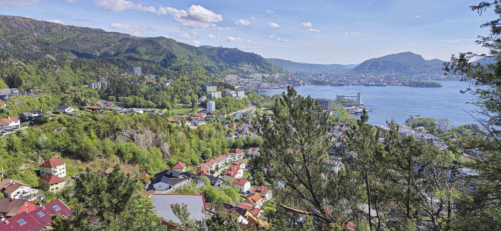 Short local hike on a warm Saturday.
Across Hellen festning
- Date:
- 10.05.2024
- Characteristic:
- Hike
- Duration:
- 0:37h
- Distance:
- 3.1km
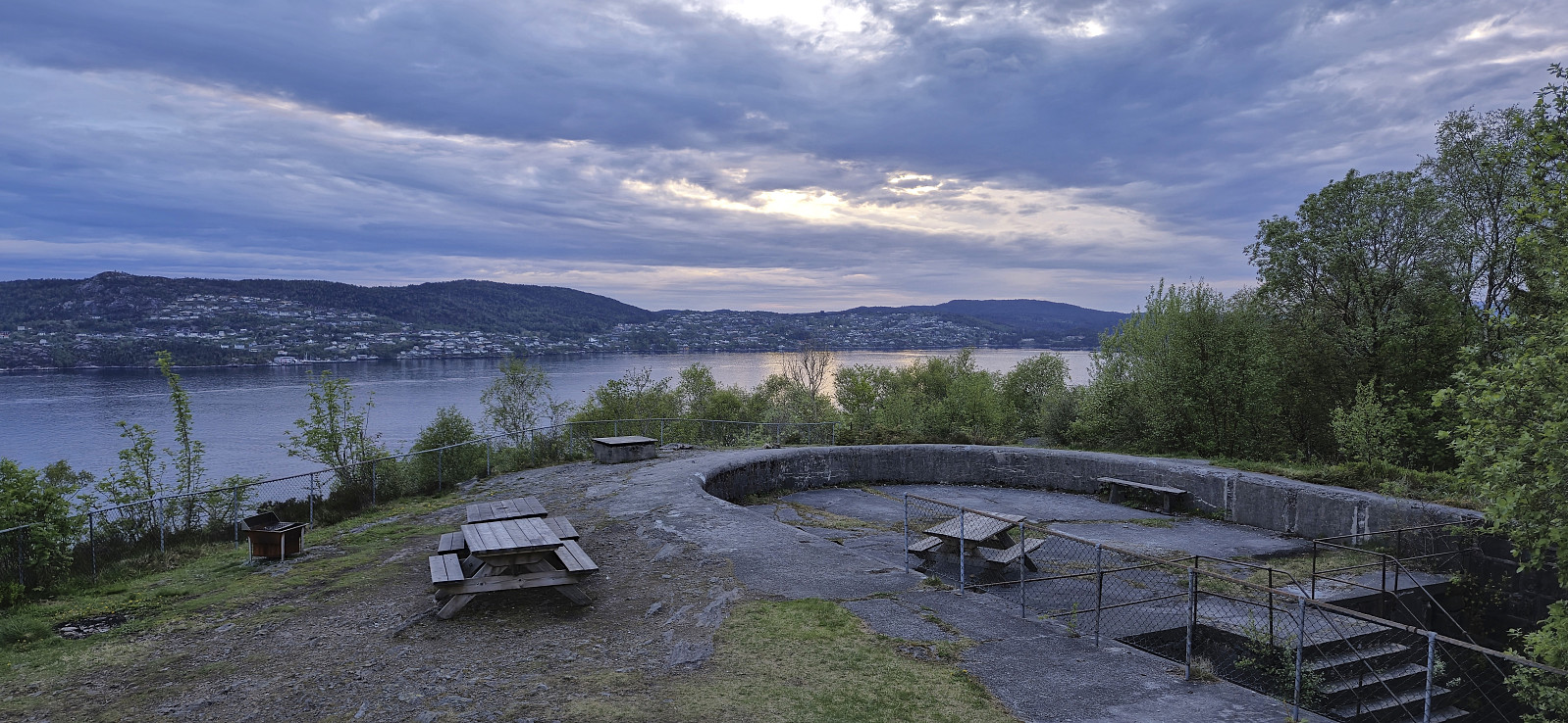 Short local evening hike.
Gaukavarden and Hinderåsen
- Date:
- 09.05.2024
- Characteristic:
- Hillwalk
- Duration:
- 1:23h
- Distance:
- 4.8km
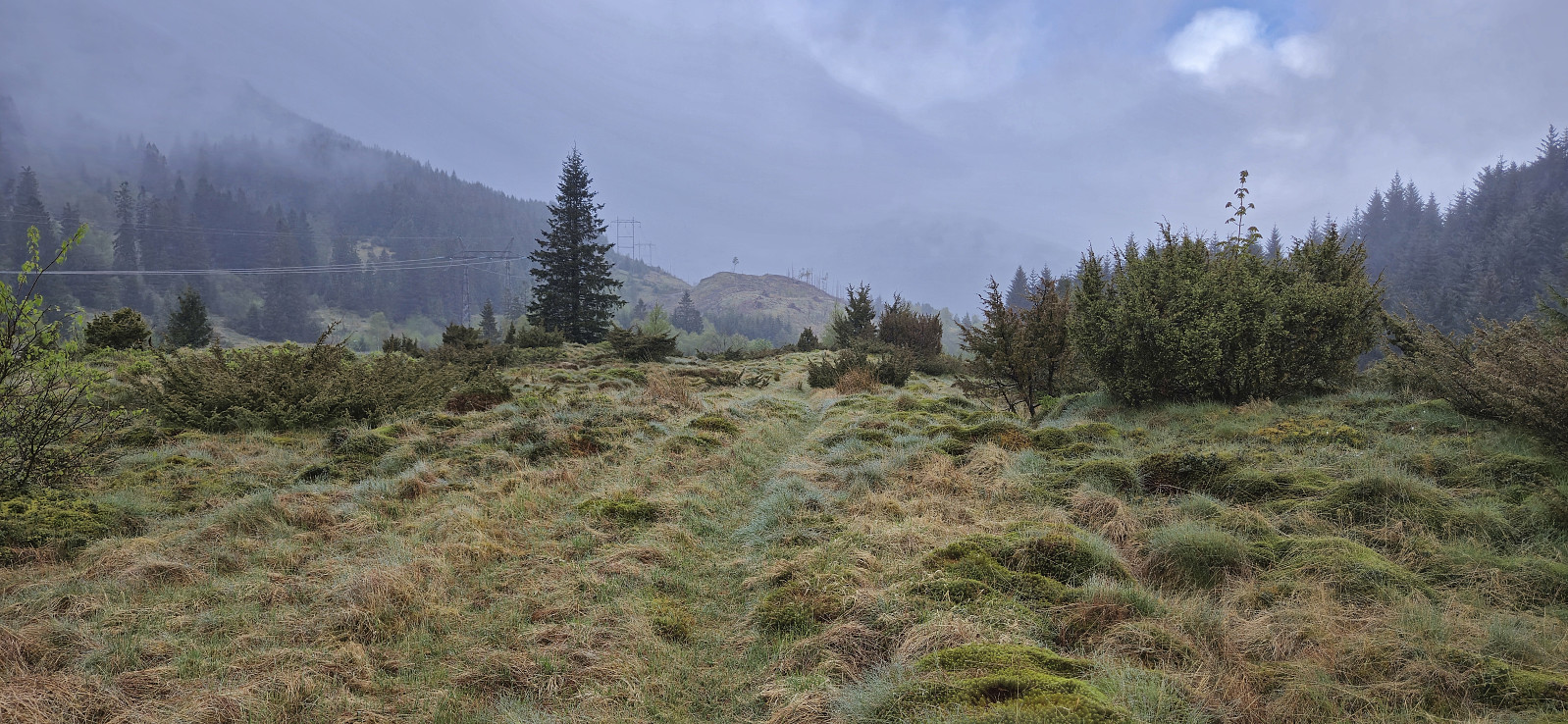 A short hike in Arna to visit Gaukavarden and Hinderåsen (the latter added as its own PB-element). I got off at "Haukeland sør" and followed Brattlandsvegen until just west of the summit. From there I headed off-trail to the summit which was easily reached. The views were limited by the low-hanging clouds but I could at least see Haukelandsvatnet.
I descended north along a weak trail that turned into a tractor road before connecting with the gravel road north of Gaukavarden. Next, I made a quick visit of Hinderåsen , which despite its name (directly translates into "obstacle hill"), could be ascended without any issues. It even provided ok views to the north with Loneheia visible in the distance.
While there was a weak trail continuing north from the highest point, after passing through a gate, I decided to not >>>
A short hike in Arna to visit Gaukavarden and Hinderåsen (the latter added as its own PB-element). I got off at "Haukeland sør" and followed Brattlandsvegen until just west of the summit. From there I headed off-trail to the summit which was easily reached. The views were limited by the low-hanging clouds but I could at least see Haukelandsvatnet.
I descended north along a weak trail that turned into a tractor road before connecting with the gravel road north of Gaukavarden. Next, I made a quick visit of Hinderåsen , which despite its name (directly translates into "obstacle hill"), could be ascended without any issues. It even provided ok views to the north with Loneheia visible in the distance.
While there was a weak trail continuing north from the highest point, after passing through a gate, I decided to not >>>
Across Hellen festning
- Date:
- 07.05.2024
- Characteristic:
- Hike
- Duration:
- 0:36h
- Distance:
- 3.1km
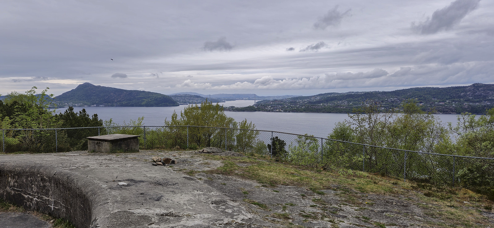 Short local evening hike.
Furukammen
- Date:
- 04.05.2024
- Characteristic:
- Hike
- Duration:
- 2:31h
- Distance:
- 4.5km
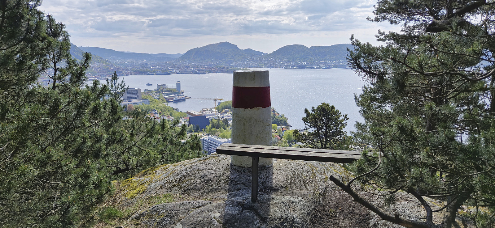 Short local Saturday hike.
Across Hellen festning
- Date:
- 02.05.2024
- Characteristic:
- Hike
- Duration:
- 0:36h
- Distance:
- 3.2km
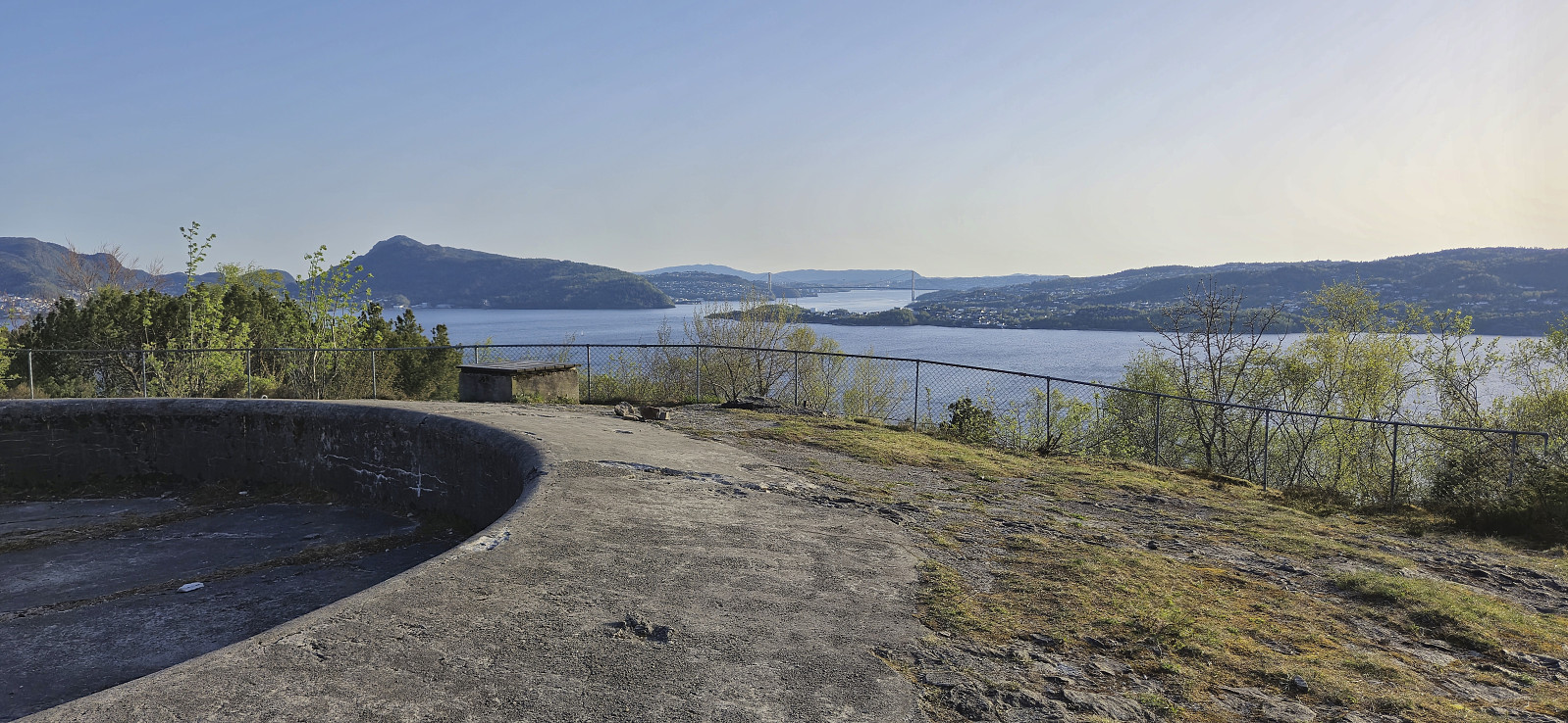 Short local evening hike.
Tverrfjellet
- Date:
- 01.05.2024
- Characteristic:
- Hillwalk
- Duration:
- 2:28h
- Distance:
- 7.7km
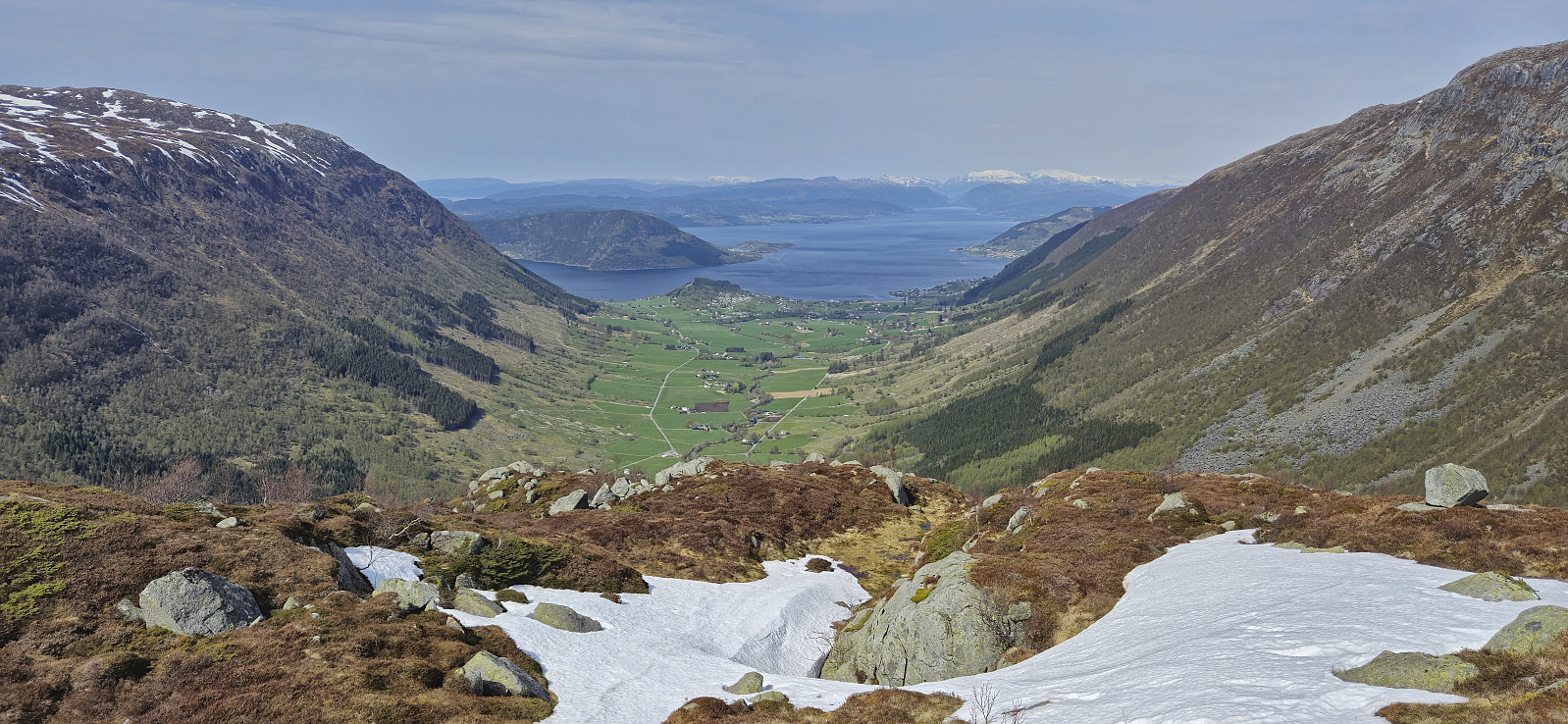 After our visit of Skorpo , we wanted to have a go at one more peak before heading back to Bergen and decided on Tverrfjellet in Omvikdalen. (To be more precise, we decided on the lower peak with that name on the eastern side of Omvikdalen, as there is also a higher peak with the same name on the other side. Not a lot of points for creativity when naming mountains in this area in other words...)
We parked at a small parking lot at the trailhead and from there followed a gravel road up to Aterstadvatnet. Here we had to cross the river to continue on the marked trail to the summit. There were several steppingstones that made the crossing straightforward, however avoiding wet shoes was not really an option.
Kjell here decided to turn back and returned to his car, while Petter and I started on the initially relatively steep ascent >>>
After our visit of Skorpo , we wanted to have a go at one more peak before heading back to Bergen and decided on Tverrfjellet in Omvikdalen. (To be more precise, we decided on the lower peak with that name on the eastern side of Omvikdalen, as there is also a higher peak with the same name on the other side. Not a lot of points for creativity when naming mountains in this area in other words...)
We parked at a small parking lot at the trailhead and from there followed a gravel road up to Aterstadvatnet. Here we had to cross the river to continue on the marked trail to the summit. There were several steppingstones that made the crossing straightforward, however avoiding wet shoes was not really an option.
Kjell here decided to turn back and returned to his car, while Petter and I started on the initially relatively steep ascent >>>
Skorpo
- Date:
- 01.05.2024
- Characteristic:
- Hillwalk
- Duration:
- 1:59h
- Distance:
- 5.2km
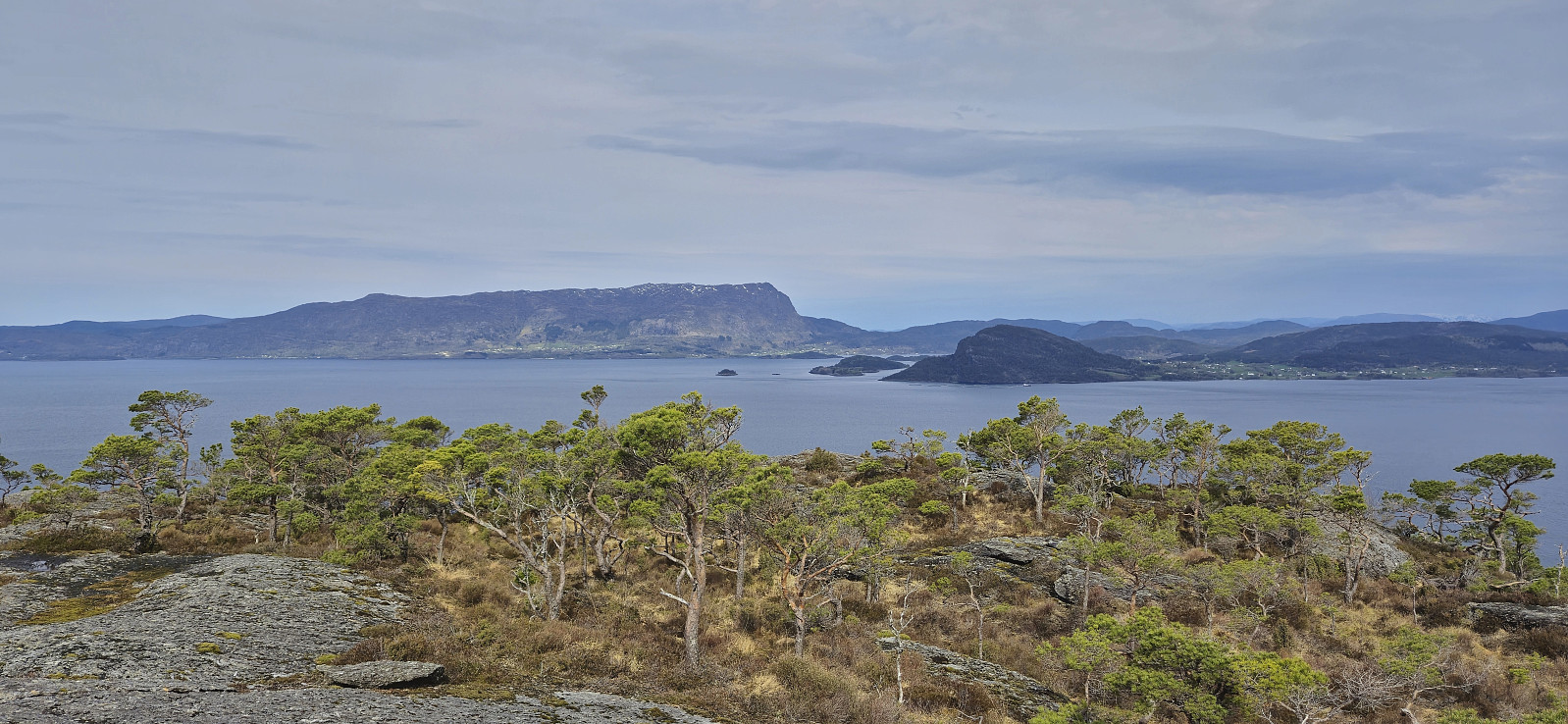 Shortly after our successful ascent of Storhaugen på Seløy , Kjell managed to secure yet another boat ride, this time to from Stølavika to the island of Skorpo . Once more both Petter and Endre were eager to join, but in the end Endre decided to instead use the one to retrieve his car in Ortnevik (left there after his impressive skiing trip to Voss ).
Petter picked me up at 07:00 for the drive to Gjermundshamn and the ferry to Årsnes. We met up with Kjell on the ferry and drove together from Årsnes to the agreed upon pickup point in Stølavika, where only minutes later the boat showed up and transported us to Søre Skorpevågen at Skorpo. A short trip taking less than ten minutes.
From Søre Skorpevågen we did as recommend by the boat owner and followed a gravel road west until reaching a tractor road, and later trail, marked with red T's, which we then proceeded to follow up to the cairn at the hill east >>>
Shortly after our successful ascent of Storhaugen på Seløy , Kjell managed to secure yet another boat ride, this time to from Stølavika to the island of Skorpo . Once more both Petter and Endre were eager to join, but in the end Endre decided to instead use the one to retrieve his car in Ortnevik (left there after his impressive skiing trip to Voss ).
Petter picked me up at 07:00 for the drive to Gjermundshamn and the ferry to Årsnes. We met up with Kjell on the ferry and drove together from Årsnes to the agreed upon pickup point in Stølavika, where only minutes later the boat showed up and transported us to Søre Skorpevågen at Skorpo. A short trip taking less than ten minutes.
From Søre Skorpevågen we did as recommend by the boat owner and followed a gravel road west until reaching a tractor road, and later trail, marked with red T's, which we then proceeded to follow up to the cairn at the hill east >>>
Skredderdalen and Hellemyrstien
- Date:
- 28.04.2024
- Characteristic:
- Hike
- Duration:
- 2:17h
- Distance:
- 9.9km
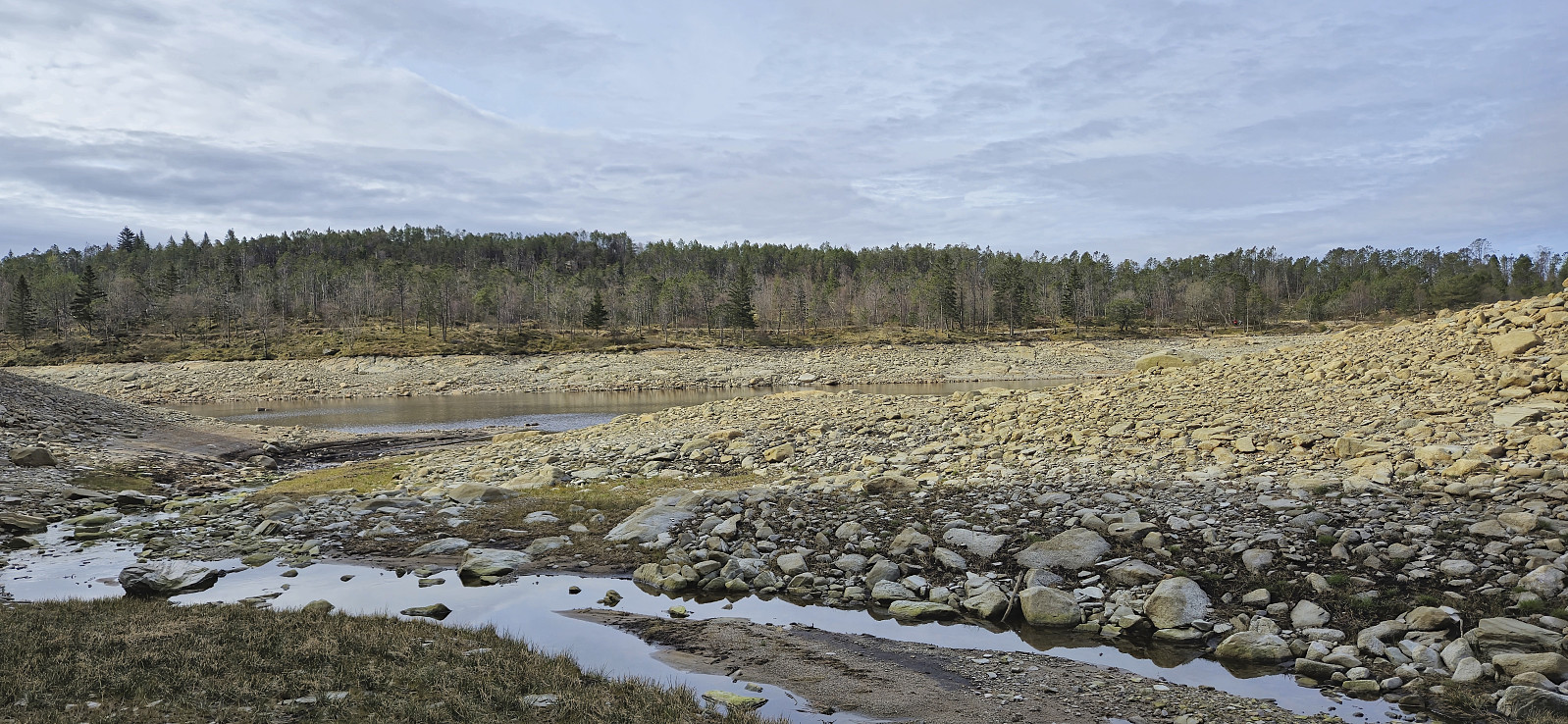 Local Sunday hike to check out the refurbished trail in Skredderdalen (now with lots of new stone steps, still lots of work left for the lower part of the trail though). On the way home I also took advantage of the reduced water level of Storevatnet for a visit of an unnamed ruin northeast of the lake .
Hellen festning and Furukammen
- Date:
- 25.04.2024
- Characteristic:
- Hike
- Duration:
- 2:48h
- Distance:
- 4.4km
 Short local evening hike.
