Archive - Date
Archive - Activity
-
Bike trip (108)
- Bike trip - mixed (25)
- Bike trip - road (83)
-
Drive (9)
- Car drive (9)
-
Other trip (3)
- Kayaking (3)
-
Ski trip (109)
- Backcountry skiing (65)
- Cross-country skiing (44)
- Trip by foot (1782)
Collected lists
-
Voss ≥ 100m pf.
(96/98)
 97%
97% -
Opptur Hordaland
(143/159)
89%
-
Stasjoner på Bergensbanen
(31/40)
77%
-
Ulvik ≥ 100m pf.
(28/38)
73%
-
Hordaland ≥ 100m pf.
(613/863)
71%
-
Mjølfjell PF > 100m
(21/31)
67%
-
Jondal ≥ 100m pf.
(15/23)
65%
-
Sunnhordland PF >= 100m
(104/186)
55%
-
Dagsturhyttene i Vestland
(33/61)
54%
-
Hordaland: Hardanger PF>=100m
(186/359)
51%
-
Kvinnherad ≥ 100m pf.
(40/79)
50%
-
DNT-hytter i Hordaland
(22/45)
48%
-
Sogndal ≥ 100m pf.
(23/81)
28%
-
Vik i Sogn ≥ 100m pf.
(8/46)
17%
-
DNT-hytter i Sogn og Fjordane
(8/47)
17%
-
Eidfjord ≥ 100m pf.
(7/42)
16%
-
Etne ≥ 100m pf.
(7/51)
13%
-
Ullensvang ≥ 100m pf.
(21/153)
13%
-
Sogn - Sør for Sognefjorden PF>=100m
(17/159)
10%
-
Opptur i Sogn og Fjordane peaks
(17/177)
9%

Skagen and Veten from Vikaleitet
- Date:
- 29.10.2016
- Characteristic:
- Hillwalk
- Duration:
- 3:43h
- Distance:
- 12.7km
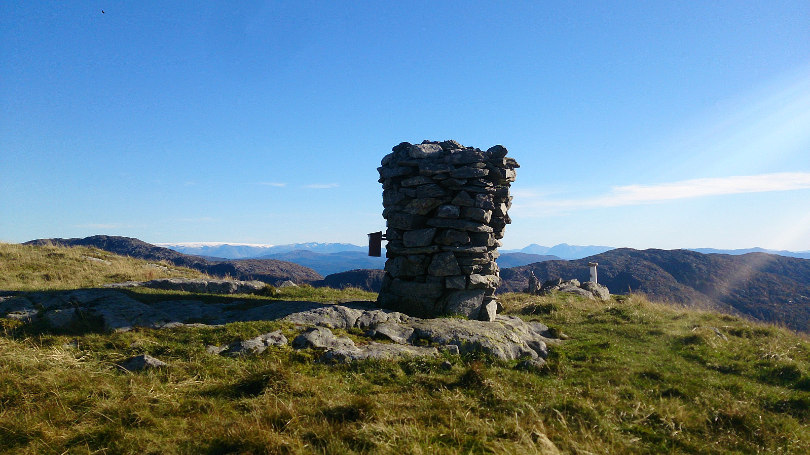
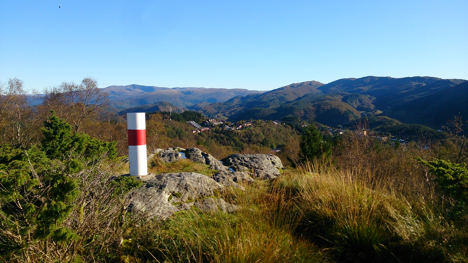
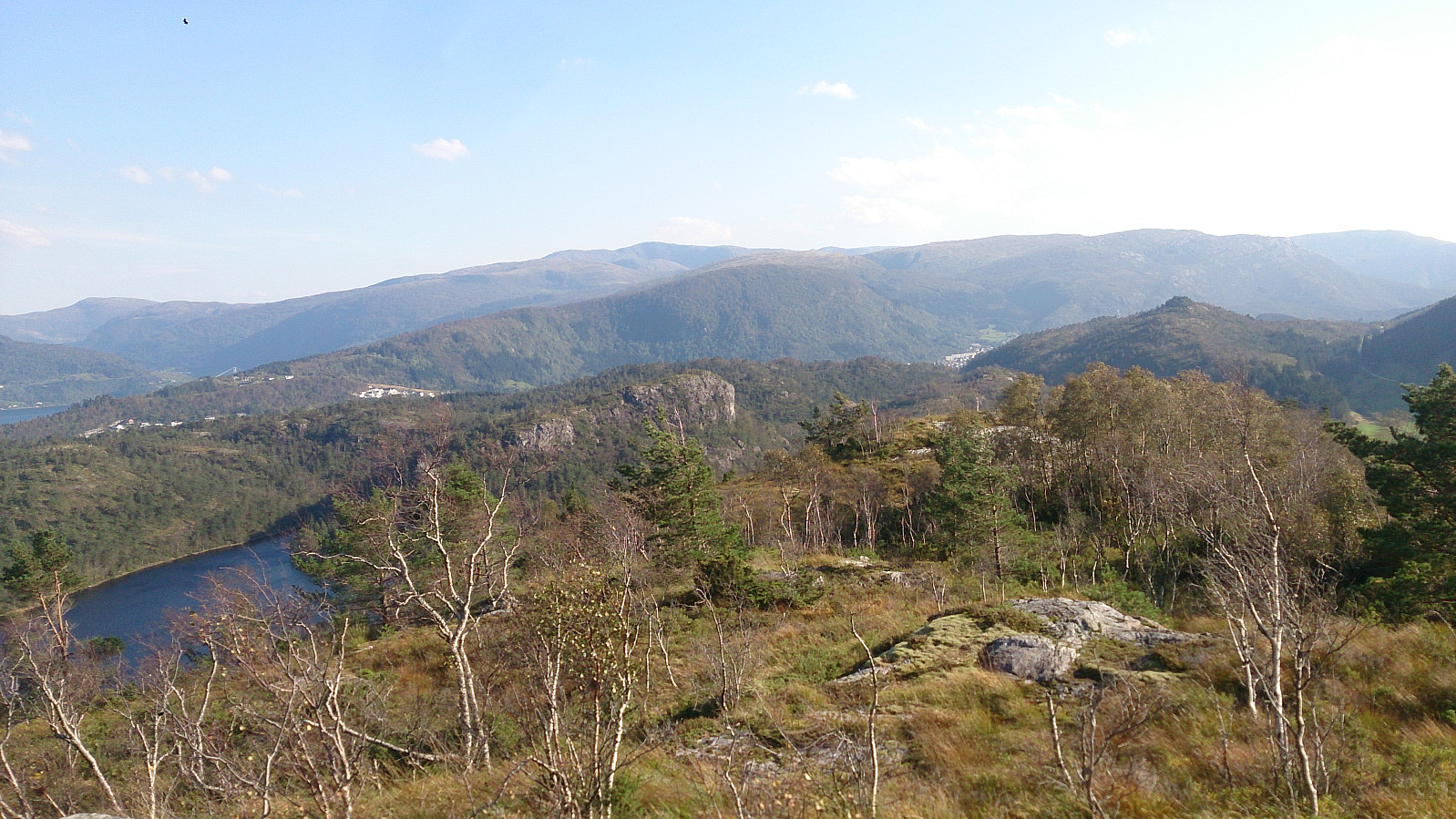
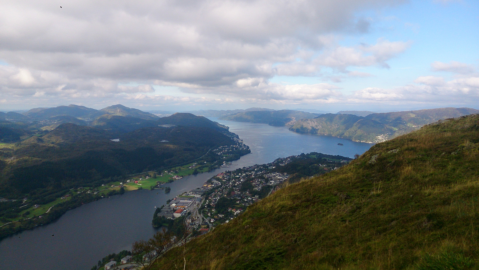
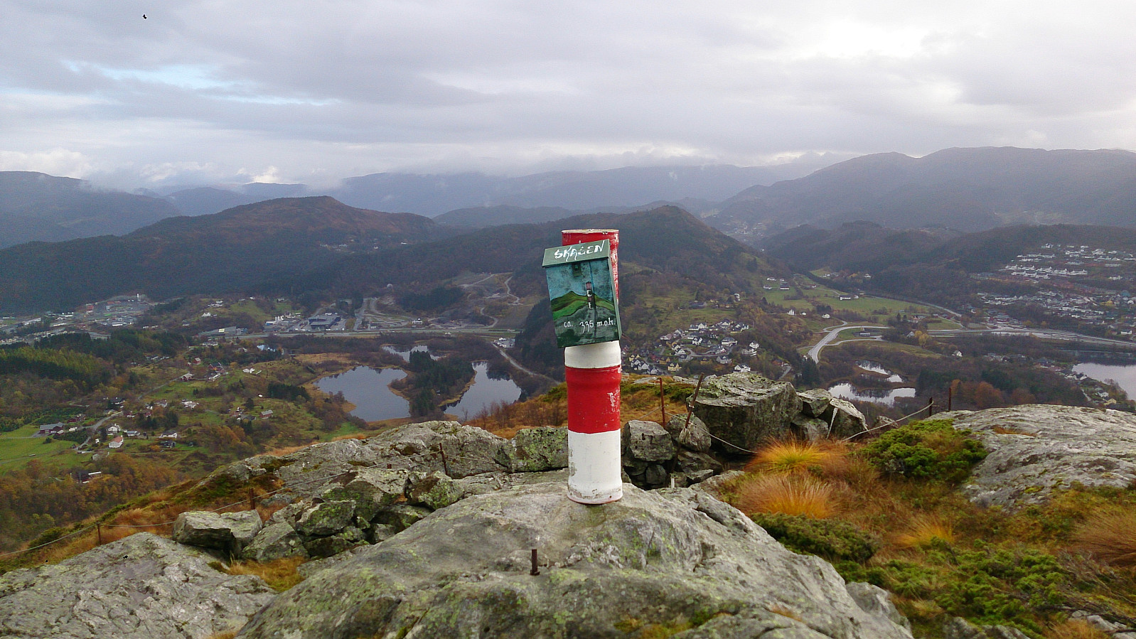 Started by taking the bus to Vikaleitet and walking up Sæterstølsvegen (note that the GPS tracking was not turned on until 10-15 min into the hike). From Sæterstøl I easily located the trail towards Veten and followed it until I found a smaller trail in the direction of Skagen . Even though it is not a very high peak, it did provide some nice views.
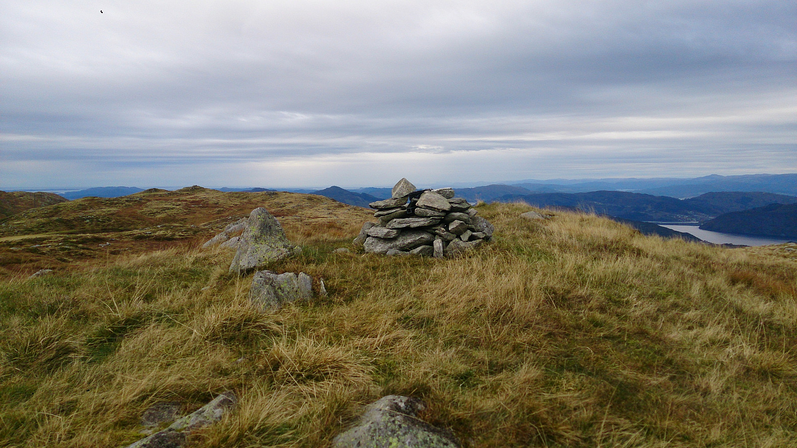
From Skagen I continued onwards to Veten and after a short break at the top, I decided to go via Storsåta (a smaller peak to the west of Veten). I did not locate a trail to the summit of Storsåta, but it was not too difficult to reach. However, it was not really worth it as the views were pretty poor. It got a bit better when walking 50 meters or so northeast through the trees at the summit, but still not a summit I can really recommend.
I returned to the trail >>>
Started by taking the bus to Vikaleitet and walking up Sæterstølsvegen (note that the GPS tracking was not turned on until 10-15 min into the hike). From Sæterstøl I easily located the trail towards Veten and followed it until I found a smaller trail in the direction of Skagen . Even though it is not a very high peak, it did provide some nice views.
From Skagen I continued onwards to Veten and after a short break at the top, I decided to go via Storsåta (a smaller peak to the west of Veten). I did not locate a trail to the summit of Storsåta, but it was not too difficult to reach. However, it was not really worth it as the views were pretty poor. It got a bit better when walking 50 meters or so northeast through the trees at the summit, but still not a summit I can really recommend.
I returned to the trail >>>
Borga from Hardbakkedalen
- Date:
- 16.10.2016
- Characteristic:
- Hillwalk
 Started from Svartediket and from there hiked up Hardbakkedalen to get to Borgaskaret. There I followed the trail towards Grønetua , but before reaching Grønetua I turned east on a trail towards Borga . But as far as I could tell, the trail did not head to the summit of Borga, so after a while I decided to rather try the quickest route to the top, entering the Borga plateau at the northwest corner. From there I could easily follow an unmarked trail to the summit. From the summit I followed more or less the same route back to Grønteua and from there passed by Vikinghytten , before crossing Rundemanen on the way to the city center.
Knappenfjellet to Nipedalen
- Date:
- 15.10.2016
- Characteristic:
- Hillwalk
 Started by taking the bus to Straume Bro and from there walking towards Hesthaugen for the real start of the hike. I followed the trail across Knappenfjellet and continued down to Gjeddevatnet and onwards along the main road to the end of Bjørndalsvatnet, where I found a trail taking me through the forest via Svartatjørna and Tennebekktjørna to Nipedalen, and finally down to Lyngbø for the bus back to the city center.
See this hike for a GPS track of the same route.
Started by taking the bus to Straume Bro and from there walking towards Hesthaugen for the real start of the hike. I followed the trail across Knappenfjellet and continued down to Gjeddevatnet and onwards along the main road to the end of Bjørndalsvatnet, where I found a trail taking me through the forest via Svartatjørna and Tennebekktjørna to Nipedalen, and finally down to Lyngbø for the bus back to the city center.
See this hike for a GPS track of the same route.
Ulriken
- Date:
- 12.10.2016
- Characteristic:
- Hillwalk
 Short evening hike to the summit of Ulriken , with a short detour to Turnerhytten on the ascent.
Hauggjelsvarden from Isdalen
- Date:
- 09.10.2016
- Characteristic:
- Hillwalk
 Started from Svartediket and walked to the start of Isdalen. I then climbed up Isdalen to Hauggjelsvarden and from there followed the standard trail across Vidden, with a minor detour to the top of Storhaugen . (For a GPS track of the trail up Isdalen, see this hike: Isdalen .)
Hausdalshorga from Osavatnet
- Date:
- 04.10.2016
- Characteristic:
- Hillwalk
- Duration:
- 5:30h
 A perfect October day for hiking! We started from the parking lot at Osavatnet and from there followed the unmarked trail to Austefjellet . Here we had a short break before continuing to Hausdalshorga . After another short break we took the same route back to Austefjellet and from there followed the trail to Redningshytten , Svartavatnet and finally back to the car.
Birkelandsnipa and Nonhøyen
- Date:
- 02.10.2016
- Characteristic:
- Hillwalk
 Took the bus to Hetlebakkvegen and walked towards Hetlebakkstemma. Just before Hetlebakkstemma I followed the trail towards Birkelandsnipa . From the summit I continued towards Birkeland. This trail however disappeared, but in the end I reached the main road (E16).
I then walked towards Liavatnet, but decided on a detour to Nonhøyen , following Langarinden almost all the way to the summit. From Nonhøyen I continued to Flaktveit and Kråvatnet, before heading back to Nyborg and the bus back home.
Took the bus to Hetlebakkvegen and walked towards Hetlebakkstemma. Just before Hetlebakkstemma I followed the trail towards Birkelandsnipa . From the summit I continued towards Birkeland. This trail however disappeared, but in the end I reached the main road (E16).
I then walked towards Liavatnet, but decided on a detour to Nonhøyen , following Langarinden almost all the way to the summit. From Nonhøyen I continued to Flaktveit and Kråvatnet, before heading back to Nyborg and the bus back home.
Sjurstonipa, Spåkefjellet and Beitelen
- Date:
- 25.09.2016
- Characteristic:
- Hillwalk
 Started by taking the bus to Gamsevegen and walking to the summit of Sjurstonipa . From there I continued south to Stemmevatnet before heading back up Sjurstodalen and across Spåkefjellet , and then down to the bridge at the end of Spåkevatnet. Next, I followed the road towards Gaupås before locating the trail to Beitelen . The views from the summit itself were limited, but there were better views both south and north of the summit.
Reppadalen and Ådnanipa
- Date:
- 18.09.2016
- Characteristic:
- Hillwalk
 We parked at the parking lot next to Stølsvegen and followed the marked trail to Reppadalen. This started out as a gravel road that turned into a smaller trail when getting closer to Reppadalen. From Reppadalen we followed another trail towards Ådnanipa and from there continued north to Åsheim, before taking a U-turn and following the gravel road back to the car.
Gullfjelltoppen from Gullbotn
- Date:
- 15.09.2016
- Characteristic:
- Hillwalk
 We started from Gullbotn on what would turn out to be the warmest September day in Bergen history (only to be beaten the following day). 20-25 degrees and sunny, with close to no wind, turned this into a harder hike than expected. From Gullbotn we followed the cairns to the summit of Gullfjelltoppen where we had an extended break enjoying the views before taking the same route back to the car.
