Archive - Date
Archive - Activity
-
Bike trip (108)
- Bike trip - mixed (25)
- Bike trip - road (83)
-
Drive (9)
- Car drive (9)
-
Other trip (3)
- Kayaking (3)
-
Ski trip (109)
- Backcountry skiing (65)
- Cross-country skiing (44)
- Trip by foot (1782)
Collected lists
-
Voss ≥ 100m pf.
(96/98)
 97%
97% -
Opptur Hordaland
(143/159)
89%
-
Stasjoner på Bergensbanen
(31/40)
77%
-
Ulvik ≥ 100m pf.
(28/38)
73%
-
Hordaland ≥ 100m pf.
(613/863)
71%
-
Mjølfjell PF > 100m
(21/31)
67%
-
Jondal ≥ 100m pf.
(15/23)
65%
-
Sunnhordland PF >= 100m
(104/186)
55%
-
Dagsturhyttene i Vestland
(33/61)
54%
-
Hordaland: Hardanger PF>=100m
(186/359)
51%
-
Kvinnherad ≥ 100m pf.
(40/79)
50%
-
DNT-hytter i Hordaland
(22/45)
48%
-
Sogndal ≥ 100m pf.
(23/81)
28%
-
Vik i Sogn ≥ 100m pf.
(8/46)
17%
-
DNT-hytter i Sogn og Fjordane
(8/47)
17%
-
Eidfjord ≥ 100m pf.
(7/42)
16%
-
Etne ≥ 100m pf.
(7/51)
13%
-
Ullensvang ≥ 100m pf.
(21/153)
13%
-
Sogn - Sør for Sognefjorden PF>=100m
(17/159)
10%
-
Opptur i Sogn og Fjordane peaks
(17/177)
9%

Ørneberget and Furukammen
- Date:
- 18.10.2022
- Characteristic:
- Hillwalk
- Duration:
- 0:51h
- Distance:
- 3.9km
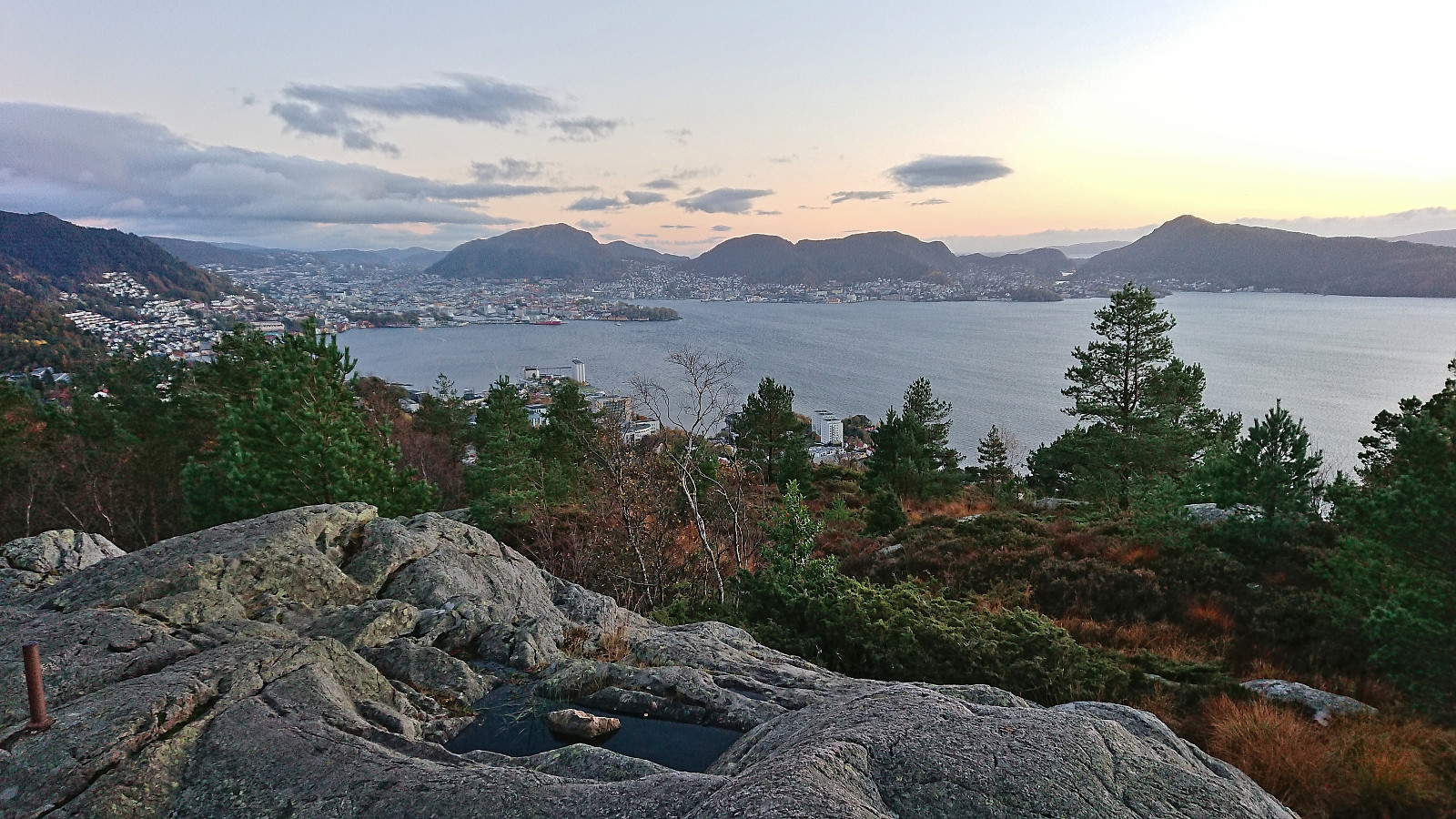 Short local evening hike after work.
Fagerdalsfjellet
- Date:
- 16.10.2022
- Characteristic:
- Hillwalk
- Duration:
- 0:28h
- Distance:
- 1.9km
 Short local Sunday hike managing to avoid most of the rain.
Slettefjellet via Eikemostølen
- Date:
- 15.10.2022
- Characteristic:
- Hillwalk
- Duration:
- 4:53h
- Distance:
- 12.0km
 I started by taking the train to Dale and from there the bus to Eikemo. As I was the only passenger on the bus (and would be so for the return as well), I got a bit of extra service and was dropped off right at the trailhead (the official stop is just 150 meters earlier though). The start of the trail was clearly visible from the road due the many tree trunks marked with blue paint, although the sign for Eikemostølen shown in arntfla (Arnt Flatmo) 's external trip report from 2005 was now on the ground and hardly visible.
Following the marked trail made it relatively straightforward to ascend to Eikemostølen, however the trail was clearly not very frequently used and a bit weak at times before pretty much disappearing altogether just before reaching Eikemostølen. While the cabin was still standing when Arnt visited it back in 2005, the roof had now caved >>>
I started by taking the train to Dale and from there the bus to Eikemo. As I was the only passenger on the bus (and would be so for the return as well), I got a bit of extra service and was dropped off right at the trailhead (the official stop is just 150 meters earlier though). The start of the trail was clearly visible from the road due the many tree trunks marked with blue paint, although the sign for Eikemostølen shown in arntfla (Arnt Flatmo) 's external trip report from 2005 was now on the ground and hardly visible.
Following the marked trail made it relatively straightforward to ascend to Eikemostølen, however the trail was clearly not very frequently used and a bit weak at times before pretty much disappearing altogether just before reaching Eikemostølen. While the cabin was still standing when Arnt visited it back in 2005, the roof had now caved >>>
Store and Vetle Finsenuten from Finse 1222
- Date:
- 30.09.2022
- Characteristic:
- Hillwalk
- Duration:
- 2:47h
- Distance:
- 9.9km
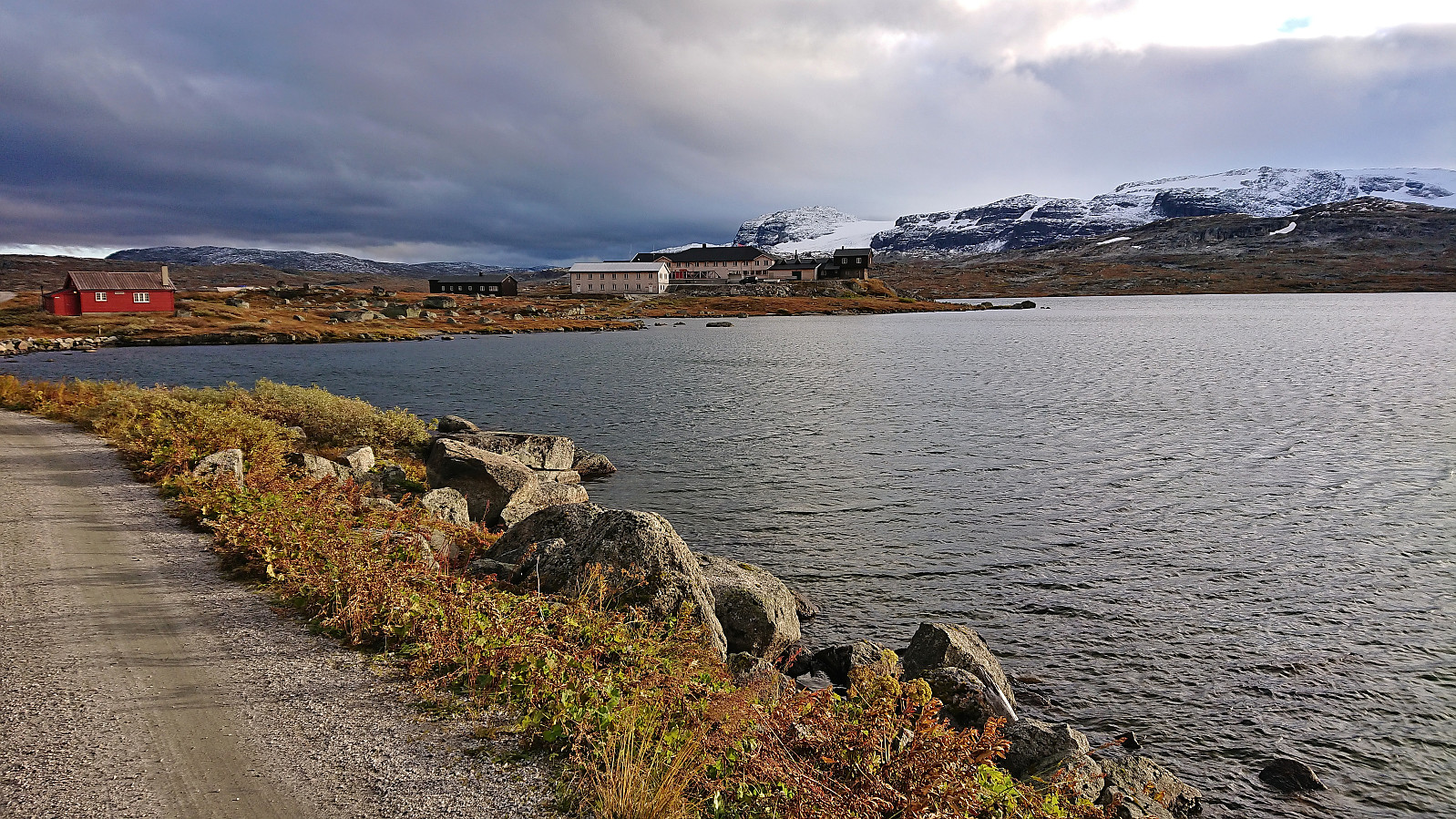 On the way back from a conference in Sundvollen , I stopped at Finse with the plan to go hiking both Friday afternoon and Saturday morning before completing the train ride back to Bergen. Less than 15 minutes after checking in at Finse 1222 I had therefore changed into hiking gear and was on my way to Store Finsenuten . The sun was shining, but a strong cold wind from the southeast made it anything but warm.
After crossing the tunnel covering the railroad tracks, I continued north along a weak trail before heading off-trail up Finseskaret. South of the summit I came across a trail marked with small cairns that I could follow all the way to the large cairn at the highest point of Store Finsenuten. Great views from the summit, but with the strong wind almost making it difficult to stand upright, and the sun now having disappeared behind the clouds, >>>
On the way back from a conference in Sundvollen , I stopped at Finse with the plan to go hiking both Friday afternoon and Saturday morning before completing the train ride back to Bergen. Less than 15 minutes after checking in at Finse 1222 I had therefore changed into hiking gear and was on my way to Store Finsenuten . The sun was shining, but a strong cold wind from the southeast made it anything but warm.
After crossing the tunnel covering the railroad tracks, I continued north along a weak trail before heading off-trail up Finseskaret. South of the summit I came across a trail marked with small cairns that I could follow all the way to the large cairn at the highest point of Store Finsenuten. Great views from the summit, but with the strong wind almost making it difficult to stand upright, and the sun now having disappeared behind the clouds, >>>
Kongens utsikt and Abborås from Sundvolden Hotel
- Date:
- 29.09.2022
- Characteristic:
- Hillwalk
- Duration:
- 2:39h
- Distance:
- 10.5km
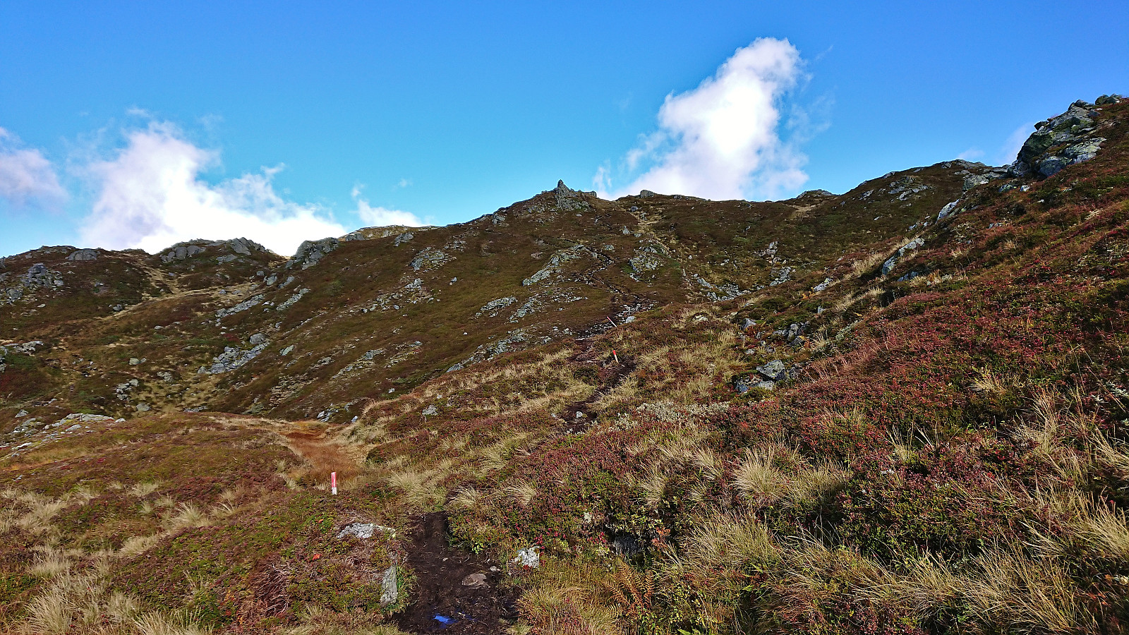
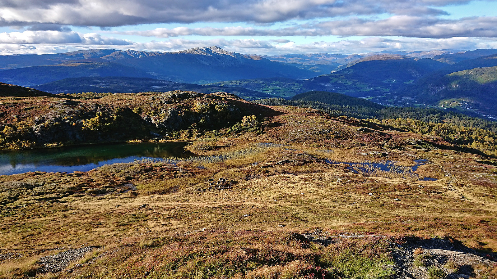
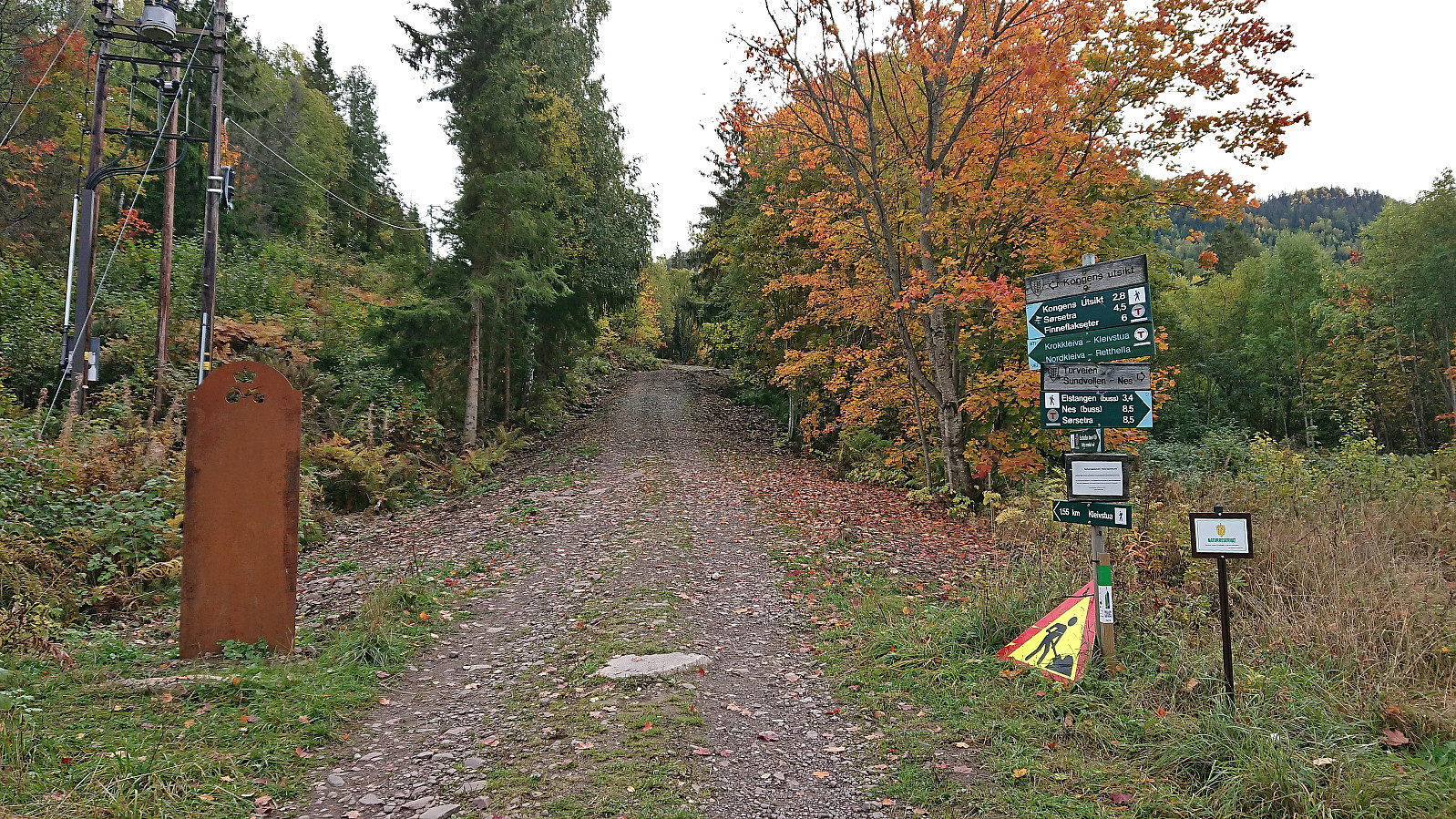 When attending a conference at Sundvolden Hotel , I took a slightly longer break before dinner to check out the views at Kongens utsikt . After a short walk south along the road I arrived at the marked trailhead at Krokkleiva and proceeded to follow the gravel road up to Kleivstua . Here I continued on the marked trail to the excellent views at Kongens utsikt.
I still had plenty of time before the conference dinner and also made a quick visit of Abboråsen less than 1.5 km to the south. There were trails/tractor roads almost all the way to the highest point, except for the final 100 meters. The summit could thus be easily reached but provided next to no views or other interesting features. I therefore did not stay long before returning to the trail and then heading back to Kleivstua.
At Kleivstua I made a minor detour north to Dronningens utsikt , however the views >>>
When attending a conference at Sundvolden Hotel , I took a slightly longer break before dinner to check out the views at Kongens utsikt . After a short walk south along the road I arrived at the marked trailhead at Krokkleiva and proceeded to follow the gravel road up to Kleivstua . Here I continued on the marked trail to the excellent views at Kongens utsikt.
I still had plenty of time before the conference dinner and also made a quick visit of Abboråsen less than 1.5 km to the south. There were trails/tractor roads almost all the way to the highest point, except for the final 100 meters. The summit could thus be easily reached but provided next to no views or other interesting features. I therefore did not stay long before returning to the trail and then heading back to Kleivstua.
At Kleivstua I made a minor detour north to Dronningens utsikt , however the views >>>
Malmangersnuten from Rosendal kai
- Date:
- 24.09.2022
- Characteristic:
- Hillwalk
- Duration:
- 3:19h
- Distance:
- 9.6km
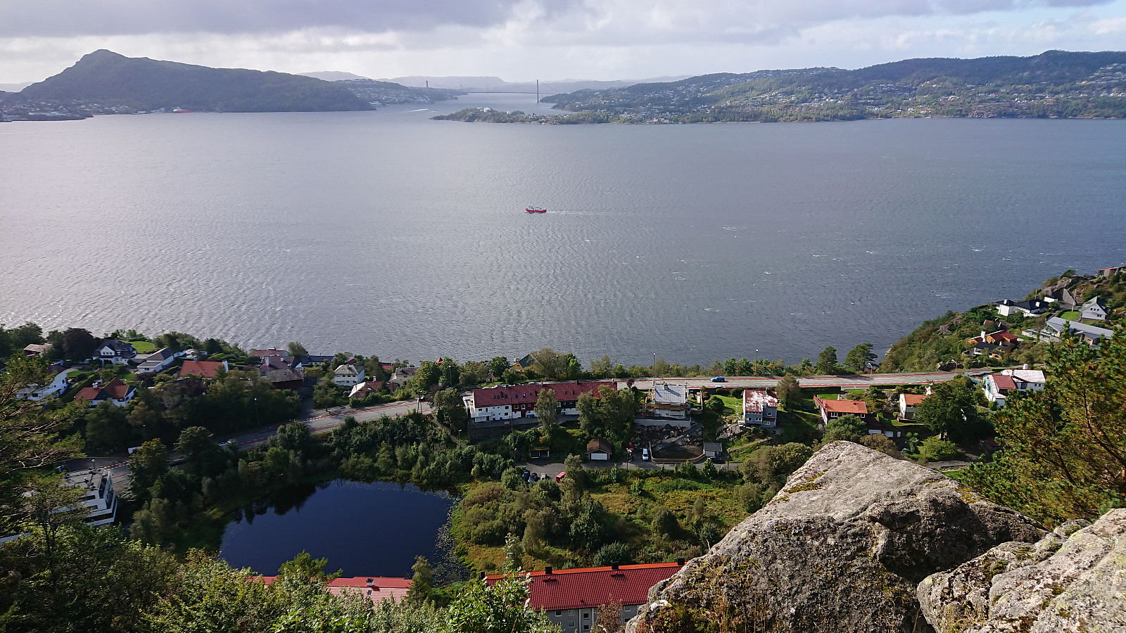
 Ascending to the top of Malmangersnuten had been on my list ever since I had to turn back at the viewpoint called Hjort just below the summit in May 2008 in order to not be too late for a conference dinner at Baroniet Rosendal . There would be a tight schedule this time around as well, in total 3.5 hours from disembarking in Rosendal until the boat would take me back to Bergen.
The two-hour boat trip from Bergen was very nice and provided excellent views along the way. Upon arriving at Rosendal, I immediately headed south to the marked trailhead for Malmangersnuten. After leaving the main road, this included a walk alongside an old stone fence and then a short stretch following a gravel road. The trail was initially climbing steeply inside a relatively dark forest, before the vegetation grew less dense and the views gradually started >>>
Ascending to the top of Malmangersnuten had been on my list ever since I had to turn back at the viewpoint called Hjort just below the summit in May 2008 in order to not be too late for a conference dinner at Baroniet Rosendal . There would be a tight schedule this time around as well, in total 3.5 hours from disembarking in Rosendal until the boat would take me back to Bergen.
The two-hour boat trip from Bergen was very nice and provided excellent views along the way. Upon arriving at Rosendal, I immediately headed south to the marked trailhead for Malmangersnuten. After leaving the main road, this included a walk alongside an old stone fence and then a short stretch following a gravel road. The trail was initially climbing steeply inside a relatively dark forest, before the vegetation grew less dense and the views gradually started >>>
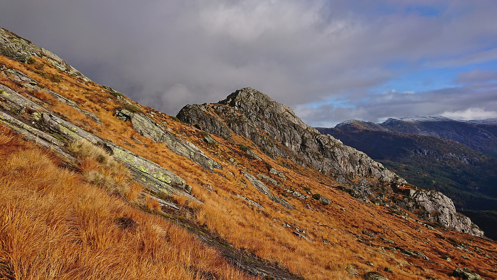
Skamdalshorgi, Tinden and Grønahorgi
- Date:
- 18.09.2022
- Characteristic:
- Hillwalk
- Duration:
- 8:34h
- Distance:
- 29.4km
 Ever since I ran out of time three weeks ago , it felt like I had some unfinished business in Granvin. At the first opportunity I therefore once again took the train to Voss and the bus to Bulkokrysset with the plan to finally ascend Skamdalshorgi . My plan almost got off to a bad start though, as the bus from Voss for some reason did not leave the main road for the detour around Tunsbergtunnelen, thus skipping the bus stop at the start of Bulkovegen that I had gotten off at last time. But thankfully I realized this change just in time and managed to get off the bus before it actually went through the tunnel.
With this initial scare out of the way, I walked the short distance to the start of Bulkovegen and proceeded to follow it south to the unmarked trailhead for Skamdalshorgi just north of the summit. (Note that while most of the parking >>>
Ever since I ran out of time three weeks ago , it felt like I had some unfinished business in Granvin. At the first opportunity I therefore once again took the train to Voss and the bus to Bulkokrysset with the plan to finally ascend Skamdalshorgi . My plan almost got off to a bad start though, as the bus from Voss for some reason did not leave the main road for the detour around Tunsbergtunnelen, thus skipping the bus stop at the start of Bulkovegen that I had gotten off at last time. But thankfully I realized this change just in time and managed to get off the bus before it actually went through the tunnel.
With this initial scare out of the way, I walked the short distance to the start of Bulkovegen and proceeded to follow it south to the unmarked trailhead for Skamdalshorgi just north of the summit. (Note that while most of the parking >>>
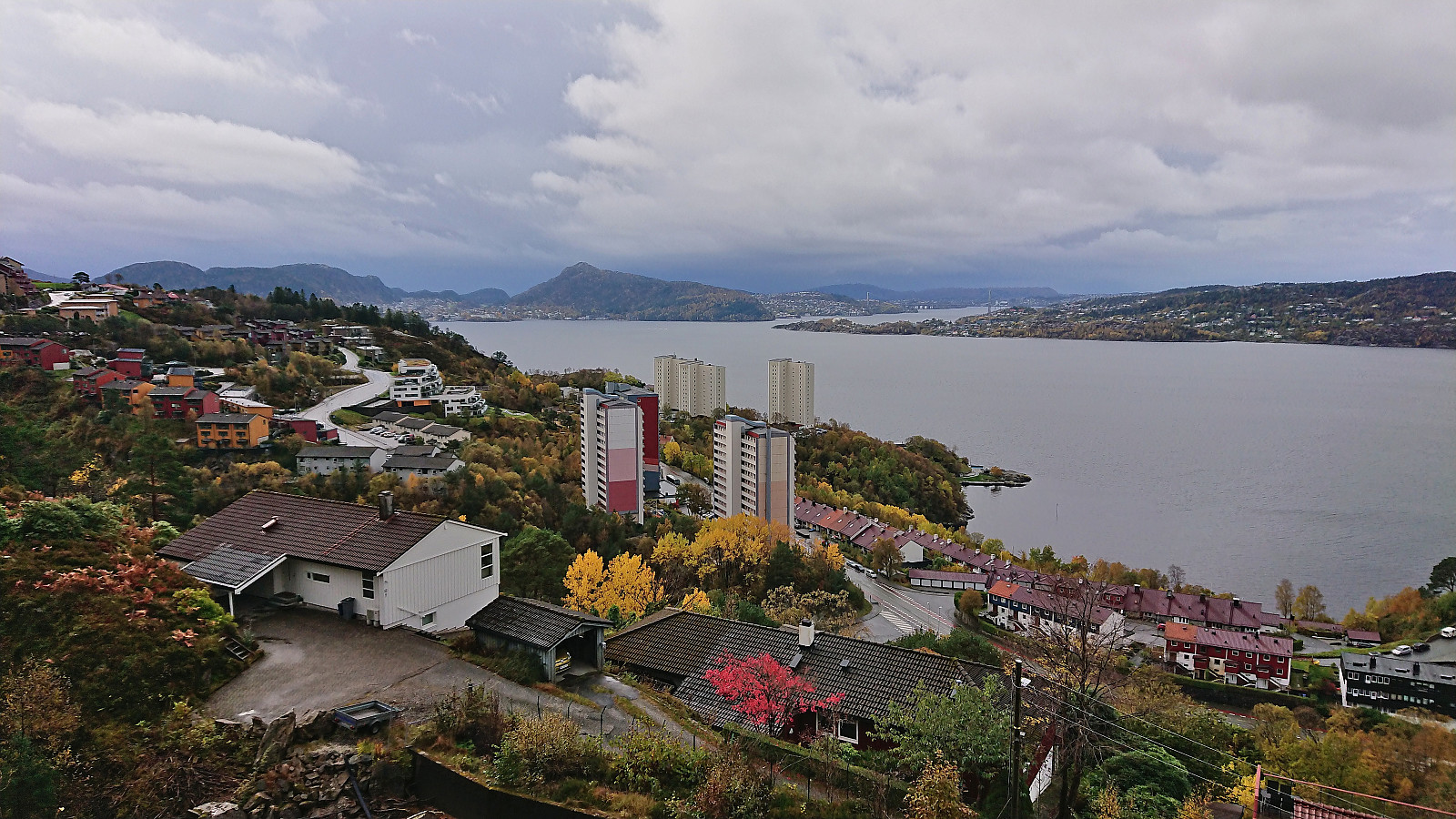
Ørneberget and Hellen festning
- Date:
- 17.09.2022
- Characteristic:
- Hillwalk
- Duration:
- 1:00h
- Distance:
- 4.1km
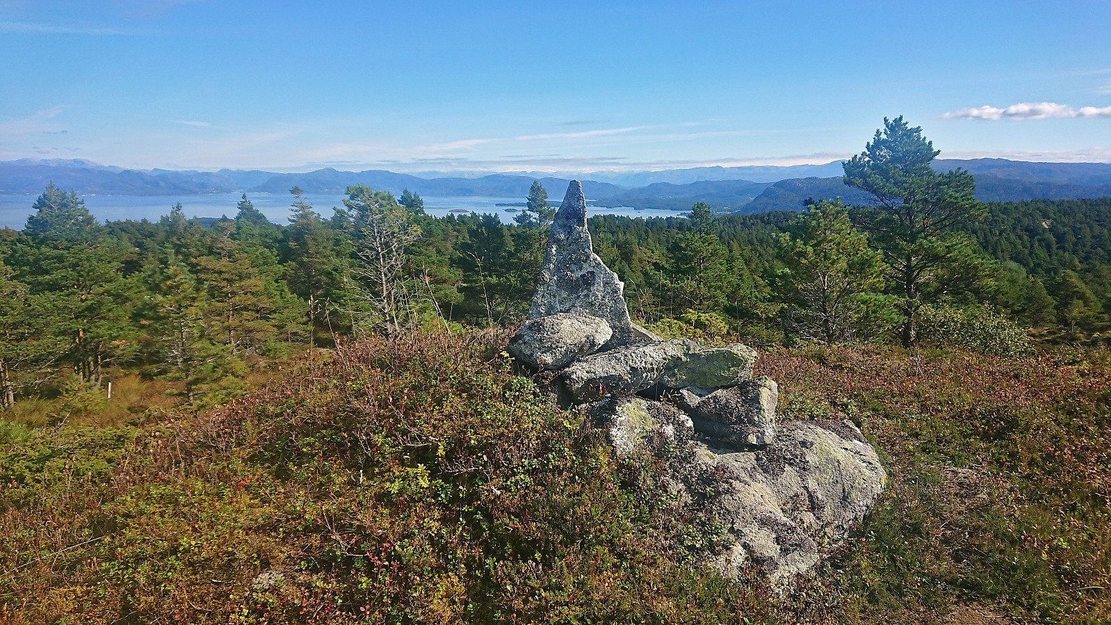
 Short local Saturday hike.
Gjøvågsfjellet
- Date:
- 10.09.2022
- Characteristic:
- Hillwalk
- Duration:
- 1:10h
- Distance:
- 3.4km
 After cycling from Våge , I left my bike at the marked trailhead for Gjøvågsvarden and continued on foot along the marked trail. I quickly arrived at the trig marker indicating the summit and could enjoy its excellent panoramic views. However, earlier studies of the map had indicated that there was a slightly higher hill around 300 meters further south, and there was even a trail heading in this direction. I therefore continued along this trail, which, while a bit weaker than the trail to the trig marker, easily took me all the way to the small cairn marking this alternative southern summit. No sign next to the cairn itself, but just to the southwest there was a sign with the name Stålhuo, but whether this is the name of the summit or just the adjacent viewpoint I am not sure. In any case, I had now definitely visited the highest point of Gjøvågsfjellet >>>
Ørneberget and Furukammen
- Date:
- 06.09.2022
- Characteristic:
- Hillwalk
- Duration:
- 0:50h
- Distance:
- 4.0km
 Short local evening hike.
