Archive - Date
Archive - Activity
-
Bike trip (108)
- Bike trip - mixed (25)
- Bike trip - road (83)
-
Drive (9)
- Car drive (9)
-
Other trip (3)
- Kayaking (3)
-
Ski trip (109)
- Backcountry skiing (65)
- Cross-country skiing (44)
- Trip by foot (1782)
Collected lists
-
Voss ≥ 100m pf.
(96/98)
 97%
97% -
Opptur Hordaland
(143/159)
89%
-
Stasjoner på Bergensbanen
(31/40)
77%
-
Ulvik ≥ 100m pf.
(28/38)
73%
-
Hordaland ≥ 100m pf.
(613/863)
71%
-
Mjølfjell PF > 100m
(21/31)
67%
-
Jondal ≥ 100m pf.
(15/23)
65%
-
Sunnhordland PF >= 100m
(104/186)
55%
-
Dagsturhyttene i Vestland
(33/61)
54%
-
Hordaland: Hardanger PF>=100m
(186/359)
51%
-
Kvinnherad ≥ 100m pf.
(40/79)
50%
-
DNT-hytter i Hordaland
(22/45)
48%
-
Sogndal ≥ 100m pf.
(23/81)
28%
-
Vik i Sogn ≥ 100m pf.
(8/46)
17%
-
DNT-hytter i Sogn og Fjordane
(8/47)
17%
-
Eidfjord ≥ 100m pf.
(7/42)
16%
-
Etne ≥ 100m pf.
(7/51)
13%
-
Ullensvang ≥ 100m pf.
(21/153)
13%
-
Sogn - Sør for Sognefjorden PF>=100m
(17/159)
10%
-
Opptur i Sogn og Fjordane peaks
(17/177)
9%

Åsen from Fonnaland/Vikøyvegen
- Date:
- 02.04.2022
- Characteristic:
- Hillwalk
- Duration:
- 1:09h
- Distance:
- 5.6km
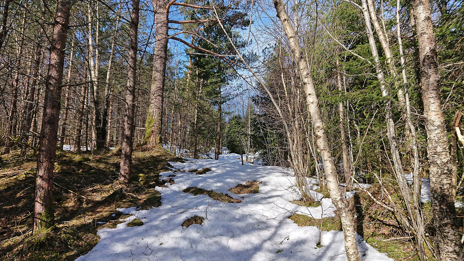 A short hike to the summit of Åsen starting from the bus stop at the main road and heading up the paved side road to Øvre Aksnes. After passing the final house (and a turkey farm, see elbow (Vegard Magnussen) 's trip report as I did not see any turkeys myself), I continued on a tractor road that took me almost all the way to the summit. Reaching the summit was thus straightforward and only required a short off-trail section (less than 150 meters). Still some snow on the tractor road and at the summit area, but it was packed hard and I could easily walk on top of it. No clear highest point and very limited views, hence I did not stay long before returning along the same route. Overall, not the most interesting summit, but the excellent views from Øvre Aksnes more than made up for it.
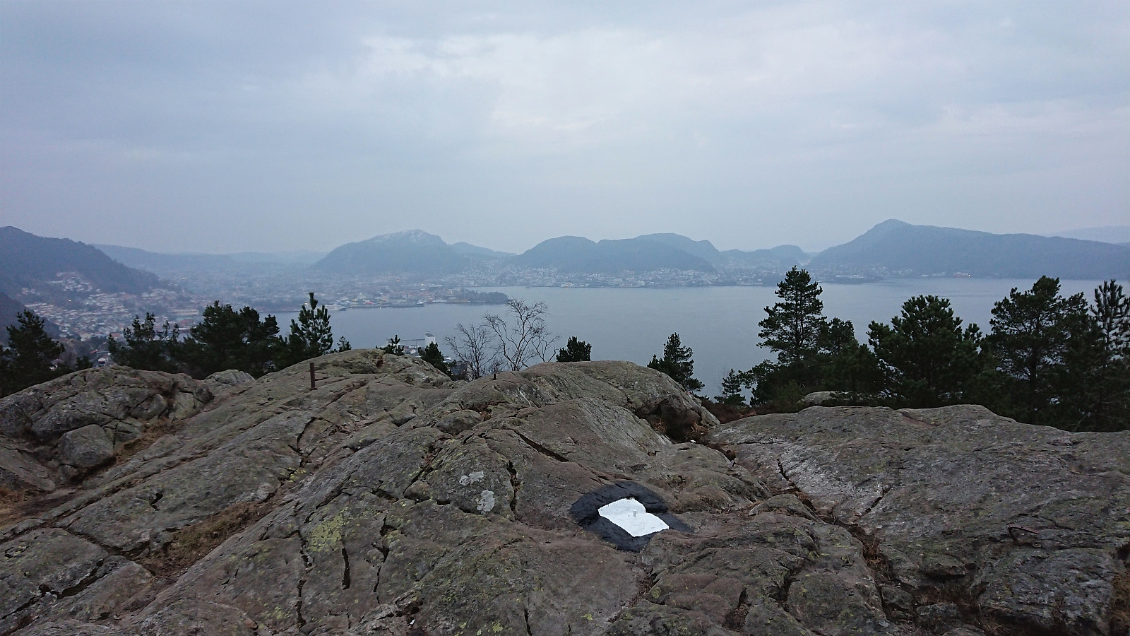
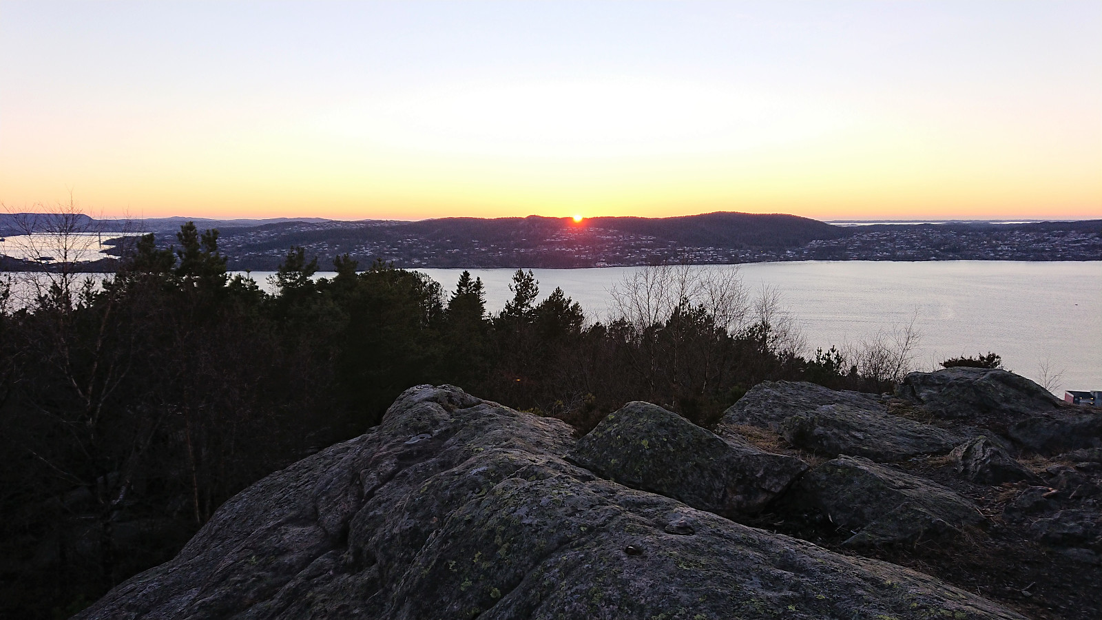
Stoltzekleiven and Sandviksfjellet
- Date:
- 30.03.2022
- Characteristic:
- Hillwalk
- Duration:
- 1:51h
- Distance:
- 8.5km
 Local evening hike after work. Took it relatively easy up Stoltzekleiven , making it to the top in 19 minutes 15 seconds.
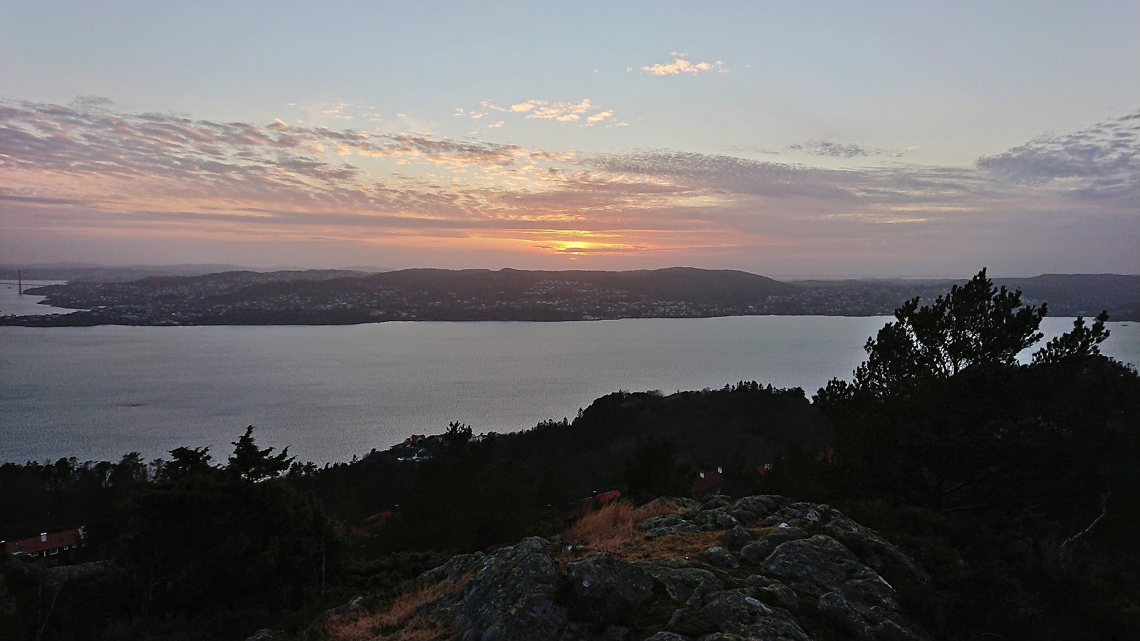
Håmanen
- Date:
- 29.03.2022
- Characteristic:
- Hillwalk
- Duration:
- 1:18h
- Distance:
- 6.1km
 Local evening hike after work.
Bjørnehaugen from Gjermundshamn
- Date:
- 26.03.2022
- Characteristic:
- Hillwalk
- Duration:
- 5:44h
- Distance:
- 21.4km
 A return to Gjermundshamn for a visit of Bjørnehaugen . Note that on the map the area is referred to as Bjørnehaugen, i.e. one extra 's', while the summit is named Bjørnahaugen, but for simplicity I will stick with name used on PB.
As usual when visiting a remote minor summit with limited views, I made it into a longer trip to make it slightly more interesting. In this particular case this was only partly voluntary, as the only way for me to get anywhere close to Bjørnehaugen (without needing a car) was to first take the bus to Gjermundshamn and then start my hike from there. And while this initial walk along the road may seem boring, the limited traffic and the excellent views towards the snow-capped mountains across the fjord made for a rather enjoyable start to the trip.
Shortly after passing Tveitane, >>>
A return to Gjermundshamn for a visit of Bjørnehaugen . Note that on the map the area is referred to as Bjørnehaugen, i.e. one extra 's', while the summit is named Bjørnahaugen, but for simplicity I will stick with name used on PB.
As usual when visiting a remote minor summit with limited views, I made it into a longer trip to make it slightly more interesting. In this particular case this was only partly voluntary, as the only way for me to get anywhere close to Bjørnehaugen (without needing a car) was to first take the bus to Gjermundshamn and then start my hike from there. And while this initial walk along the road may seem boring, the limited traffic and the excellent views towards the snow-capped mountains across the fjord made for a rather enjoyable start to the trip.
Shortly after passing Tveitane, >>>
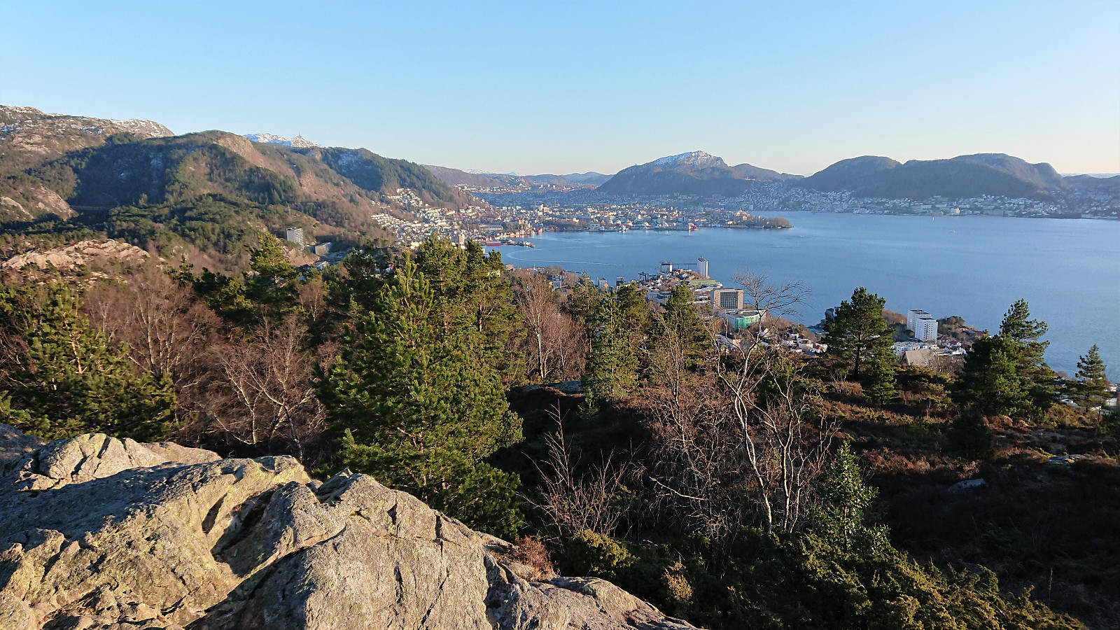
Ørneberget and Furukammen
- Date:
- 23.03.2022
- Characteristic:
- Hillwalk
- Duration:
- 0:52h
- Distance:
- 4.0km
 Short local hike after work.
Ørneberget and Hellen festning
- Date:
- 18.03.2022
- Characteristic:
- Hillwalk
- Duration:
- 0:58h
- Distance:
- 4.2km
 Short local hike after work.
Hovdaberget, Hatlesteinen and Geitaknottane
- Date:
- 12.03.2022
- Characteristic:
- Hillwalk
- Duration:
- 5:43h
- Distance:
- 17.3km
 I started by taking the bus to Gjermundshamn where I ended up taking the bus one stop too far, but thankfully managed to get off before the bus drove onto the ferry. After returning to the crossroads a couple hundred meters to the southwest, I walked along the road to Ølve until reaching the marked trailhead for Blånuten . No sidewalks, but very limited traffic.
I left the road/trail heading for Blånuten at the first crossroads and instead followed a tractor road taking me all the way to Hovdaberget and its spectacular views. Very easy to get to and highly recommended for its excellent views towards the many mountains across the fjord. Especially beautiful at this time of the year due to the snow-capped peaks.
After a quick off-trail visit of the summit of Hjortlandshovda , a major let down after the views at Hovdaberget and >>>
I started by taking the bus to Gjermundshamn where I ended up taking the bus one stop too far, but thankfully managed to get off before the bus drove onto the ferry. After returning to the crossroads a couple hundred meters to the southwest, I walked along the road to Ølve until reaching the marked trailhead for Blånuten . No sidewalks, but very limited traffic.
I left the road/trail heading for Blånuten at the first crossroads and instead followed a tractor road taking me all the way to Hovdaberget and its spectacular views. Very easy to get to and highly recommended for its excellent views towards the many mountains across the fjord. Especially beautiful at this time of the year due to the snow-capped peaks.
After a quick off-trail visit of the summit of Hjortlandshovda , a major let down after the views at Hovdaberget and >>>
Ørneberget and Hellen festning
- Date:
- 11.03.2022
- Characteristic:
- Hillwalk
- Duration:
- 0:58h
- Distance:
- 4.6km
 Short local hike after work.
Ørneberget and Ørneberget NV
- Date:
- 08.03.2022
- Characteristic:
- Hillwalk
- Duration:
- 0:52h
- Distance:
- 3.6km
 Short local hike after work. (The GPS stopped working shortly into the hike, and not detect until almost back home, hence no GPS track. See Ørneberget and Ørneberget NV for an identical hike.)
Fagerdalsfjellet and Eidsvågsneset/Furubotn
- Date:
- 04.03.2022
- Characteristic:
- Hillwalk
- Duration:
- 0:54h
- Distance:
- 3.7km
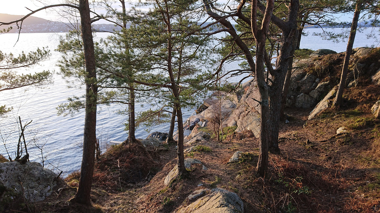 Short local hike after work including an exploration of the northern tip of Eidsvågsneset/Furubotn, an area I had previously assumed was only available via trespassing. This was however far from the case, and it was even set up as a local recreational area that was easily accessible.
