Archive - Date
Archive - Activity
-
Climbing (43)
- Alpine climbing (31)
- Ice climbing (3)
- Mixed climbing (1)
- Sport climbing (3)
- Via ferrata (1)
-
Other trip (5)
- Expedition (5)
-
Other winter trip (5)
- Snowshoe trip (5)
-
Ski trip (449)
- Backcountry skiing (4)
- Cross-country skiing (2)
- Randonnée/Telemark (441)
-
Trip by foot (507)
- Alpine trip (47)
- Hike (196)
- Hillwalk (205)
- Jogging (4)
- Walk (55)
Peakbook-Friends


Five Sisters of Kintail
- Date:
- 16.04.2011
Did this route with James Yip and Andy Laing on a rather dull and damp day after coming back from Svalbard. Still, I'd had a good night's sleep at the Ratagan youth hostel compared with the other alternative of camping in the rain, so it wasn't all a bad start! The route has a reputation for being a really fantastic high level ridge walk with great views and an airy feel about it, but I don't think we really got to appreciate it's finest moments with the weather we had. Only after we'd left Sgurr Fhuaran and were well on the way to Sgurr na Carnach did it start to brighten up a little - enough to actually see the loch at the eastern end! But by no means sunny. It was overcast but not quite as misty, and the descent down the steep and wet grassy slopes into Glen Lichd wasn't that pleasant either >>>
Hiorthfjellet
- Date:
- 26.03.2011
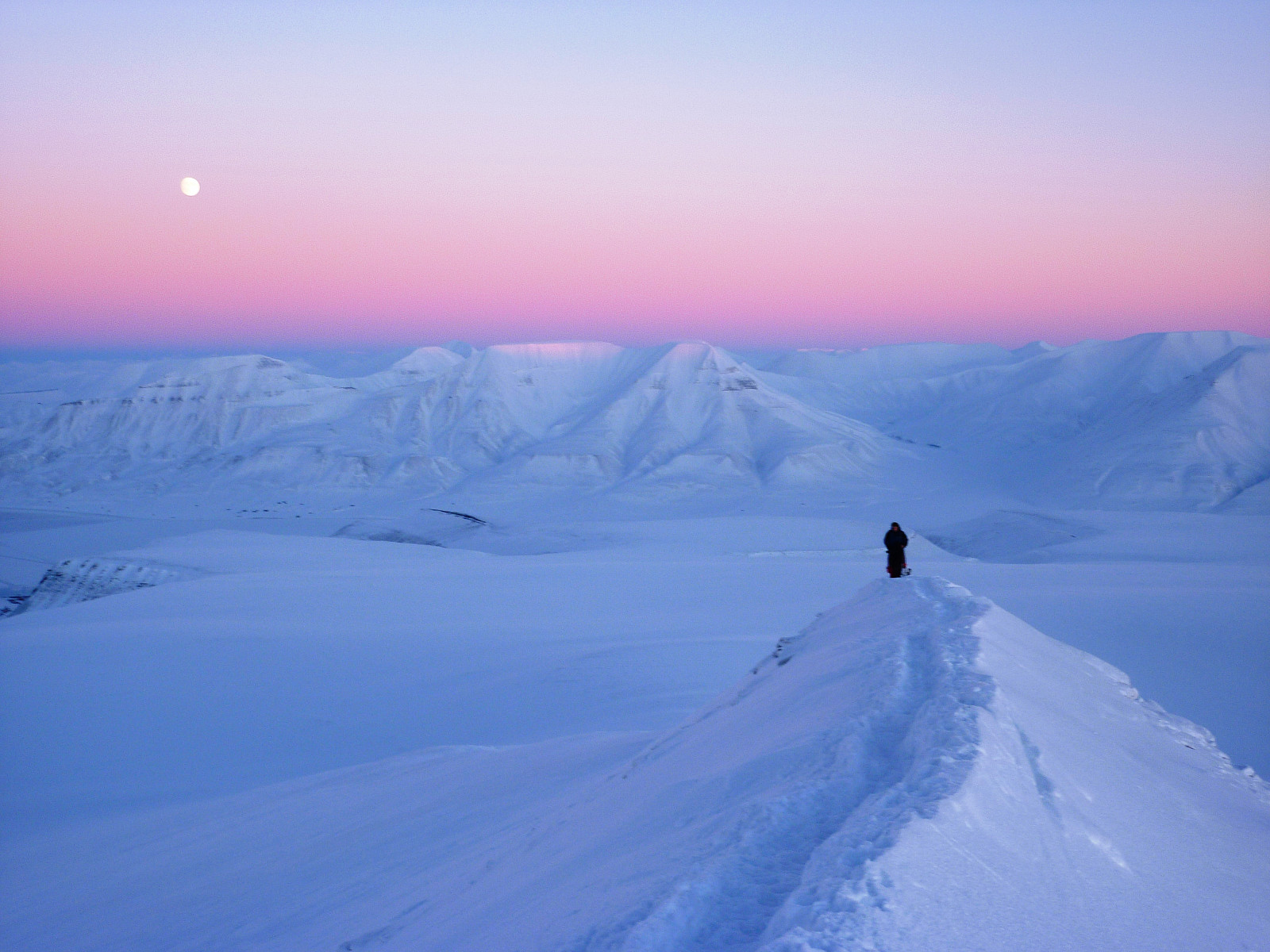
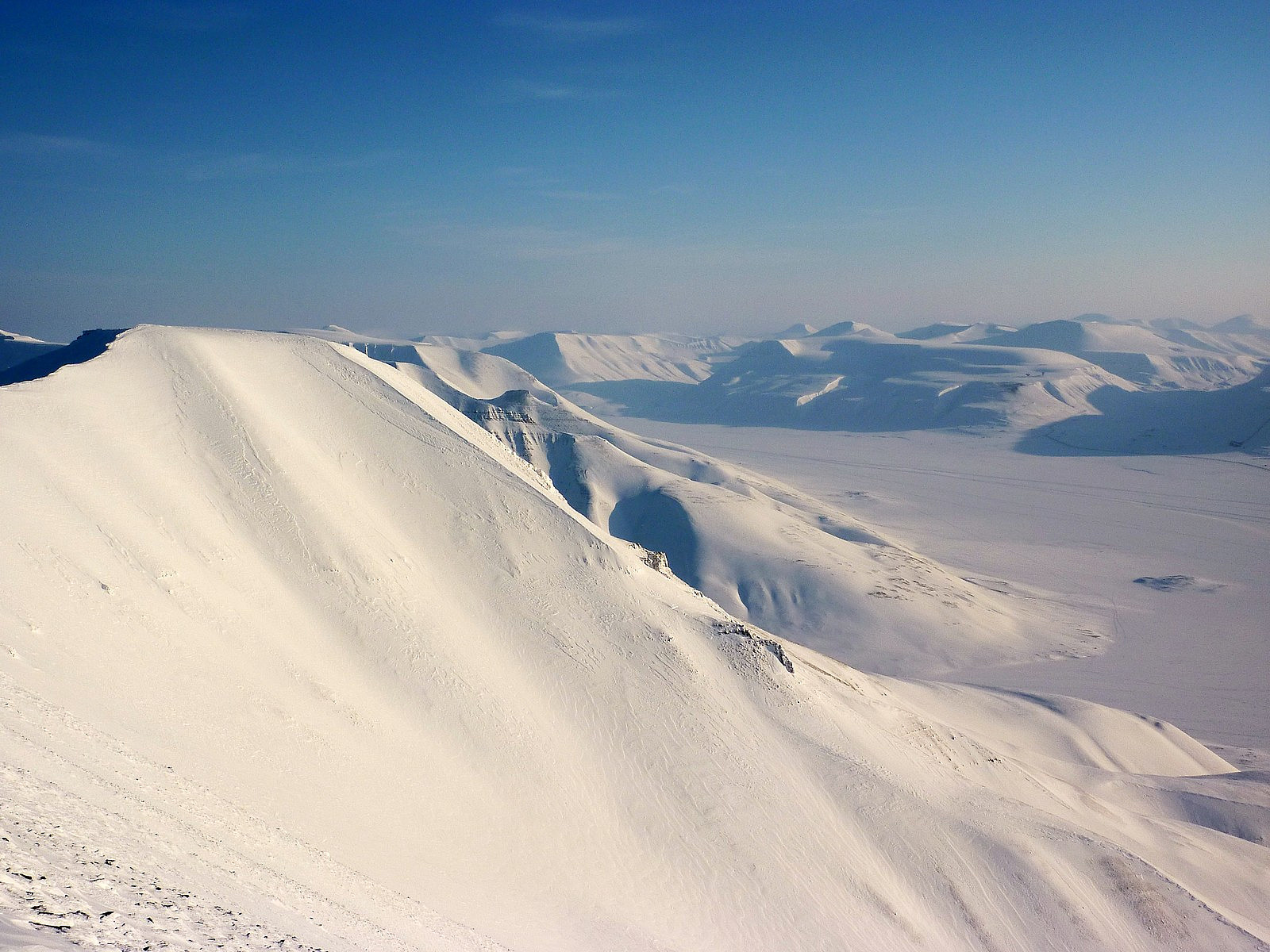 One of my most memorable days on Svalbard ever. Hiortfjellet had been one of the iconic mountains of all my visits to Svalbard since being a UNIS student in 2007, but somehow I'd never found people to do the trip up there with. But finally, during the week leading up to the hike, I found some students who were also interested in taking a trip to Hiortfjellet as well and quite fortunately some of them had snowmobiles, which made getting across Adventdalen a lot quicker! We had the perfect weather for it too. Another very sunny and warm day, although you'd never have guessed it was still -22. Anyway, a group of us - around 8 altogether, scootered out and over the fjord to Hiorthhamn and parked up beside one of the cabins. From there we followed the scooter tracks up to the TV station. I guess >>>
Trollsteinen
- Date:
- 16.02.2011
- Characteristic:
- Hike
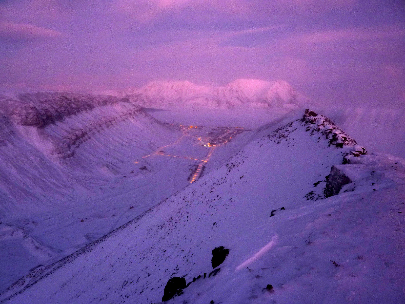
 Fantastic trip up Trollsteinen with Robert, Mari and a bunch of other friends from Svalbard to see the sun come back out from behind the mountains. It was a very cold (-20) day down in town, and I had some reservations over whether my Scarpa Charmoz boots would be much good in keeping my toes warm for several hours out hiking in the snow, but I kept with them anyway and crossed my fingers that they wouldn't get too cold.
I met up with the other students at about 8.30 at the barracks, and from there we took the usual way up Larsbreen toward Trollsteinen. Plenty of other locals and students out today too, so it was by no means a quiet day out. It was a great atmosphere though. Everyone was super happy about the terrific weather and views, and we were all super excited about the prospect of seeing >>>
Fantastic trip up Trollsteinen with Robert, Mari and a bunch of other friends from Svalbard to see the sun come back out from behind the mountains. It was a very cold (-20) day down in town, and I had some reservations over whether my Scarpa Charmoz boots would be much good in keeping my toes warm for several hours out hiking in the snow, but I kept with them anyway and crossed my fingers that they wouldn't get too cold.
I met up with the other students at about 8.30 at the barracks, and from there we took the usual way up Larsbreen toward Trollsteinen. Plenty of other locals and students out today too, so it was by no means a quiet day out. It was a great atmosphere though. Everyone was super happy about the terrific weather and views, and we were all super excited about the prospect of seeing >>>
Sarkofagen
- Date:
- 29.01.2011
- Characteristic:
- Hike
 Trip up to Sarkofagen with the Aberystwyth students; Hannah, Frances, Andrew and Stuart. We had -9 down in the valley and not a lot of daylight to work with, but we made pretty good progress up Larsbreen. I felt a little too warm in fact, and eventually decided to take off my synthetic jacket. The others seemed quite happy to keep their clothes on though.
The wind had been quite OK down in the lower part of Larsbreen, I guess we had been quite sheltered. But higher up, as we approached the ridge between Sarkofagen and Lars Hiertafjellet, it got extremely windy. I put my jacket back on as well as my insulated trousers over my waterproof trousers. It really was *that* cold! Despite the less-than-ideal weather no one suggested we give up and turn so we ended up continuing to the top of Sarkofagen >>>
Trip up to Sarkofagen with the Aberystwyth students; Hannah, Frances, Andrew and Stuart. We had -9 down in the valley and not a lot of daylight to work with, but we made pretty good progress up Larsbreen. I felt a little too warm in fact, and eventually decided to take off my synthetic jacket. The others seemed quite happy to keep their clothes on though.
The wind had been quite OK down in the lower part of Larsbreen, I guess we had been quite sheltered. But higher up, as we approached the ridge between Sarkofagen and Lars Hiertafjellet, it got extremely windy. I put my jacket back on as well as my insulated trousers over my waterproof trousers. It really was *that* cold! Despite the less-than-ideal weather no one suggested we give up and turn so we ended up continuing to the top of Sarkofagen >>>
Glovers Chimney (III)
- Date:
- 12.12.2010
- Characteristic:
- Ice climbing
 Some old pictures from a really good route. Fantastic ice at the first pitch, followed by good quality neve in the main gully. Didn't bother belaying too much there and moved together on a long rope for a lot of the time since the conditions were so good. Last pitch up into Tower Gap was fun, but finished in the dark, the rock on both sides of the gully was completely glazed in ice but surprisingly OK for finding ice axe placements. Continued up Tower Ridge to reach the summit plateau before descending. This trip will be remembered for all the wrong reasons.
Langdale in winter
- Date:
- 28.11.2010
Yet more fine and settled weather brought the wonderful cold and crisp conditions for winter walking that we often dream of having, so after a late start I headed over to Langdale to set off amongst some of my most well-known fells. Snow underfoot was hard and in fact, perfect for crampons - so I pulled on the pair I'd brought with me and speedily made my way across Bowfell first, then on towards Esk Pike and Esh Hause. I met only one other group of hikers along the way, who were very friendly and chatted for a while with me but they were going in the opposite direction so sadly I didn't have their company for long! Anyway, after that I continued along the familiar route towards the top of Esk Pike, then down to the haus and Angle Tarn. At this point I was debating whether or not to take the >>>

