Archive - Date
Archive - Activity
-
Climbing (43)
- Alpine climbing (31)
- Ice climbing (3)
- Mixed climbing (1)
- Sport climbing (3)
- Via ferrata (1)
-
Other trip (5)
- Expedition (5)
-
Other winter trip (5)
- Snowshoe trip (5)
-
Ski trip (449)
- Backcountry skiing (4)
- Cross-country skiing (2)
- Randonnée/Telemark (441)
-
Trip by foot (507)
- Alpine trip (47)
- Hike (196)
- Hillwalk (205)
- Jogging (4)
- Walk (55)
Peakbook-Friends


Jegihorn
- Date:
- 10.08.2018
- Characteristic:
- Sport climbing
- Duration:
- 4:00h
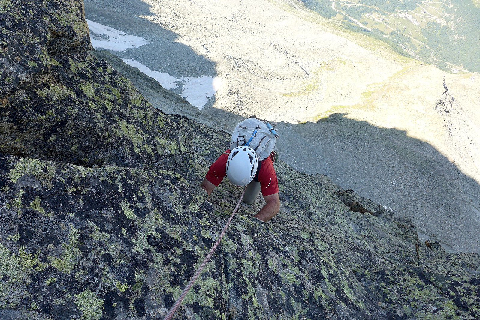
 For the final day of the week climbing with Tim we left Evolene at 7.30am and headed over to Saas Grund to do a quick climb up the Jegihorn. Well, actually the intention was never to make it a quick climb, but that's how it turned out anyway. After driving through thick valley fog for most of the way we were still optimistic that the weather would be much better up high (assuming the webcam at Hohsaas we had checked was not from a previous sunny day!) and after getting off at Kreuzboden (ca. 2400m) we were met by somewhat better visibility and the odd glimpse of blue sky. In any case it was a very pleasant temperature to walk to the base of the climbing routes in. I think we used around an hour to do the approach walk (about 500m elevation gain) in a relaxed pace.
Once we arrived at the foot >>>
For the final day of the week climbing with Tim we left Evolene at 7.30am and headed over to Saas Grund to do a quick climb up the Jegihorn. Well, actually the intention was never to make it a quick climb, but that's how it turned out anyway. After driving through thick valley fog for most of the way we were still optimistic that the weather would be much better up high (assuming the webcam at Hohsaas we had checked was not from a previous sunny day!) and after getting off at Kreuzboden (ca. 2400m) we were met by somewhat better visibility and the odd glimpse of blue sky. In any case it was a very pleasant temperature to walk to the base of the climbing routes in. I think we used around an hour to do the approach walk (about 500m elevation gain) in a relaxed pace.
Once we arrived at the foot >>>
Grand Combin
- Date:
- 09.08.2018
- Characteristic:
- Alpine climbing
- Duration:
- 7:45h
 The Grand Combin ended up being the major summit of the week climbing with Tim and we were also joined by Janine and aspirant mountain guide Jack. It was nice to have another female for company, although when the other female has previously been on the British skimo racing team it made me a bit nervous about the pace we’d be hiking up to the Valsorey hut in ;) We left Evolene at around 9am on the wednesday and stopped at Martigny to pick up Jack before continuing the journey up to Bourg St. Bernard where the trail to the hut starts. With about 1200m of height gain it’s regarded as one of the "longer" hut walks and fortunately that means it also ends up being quieter. There was only a group of three female hikers and another couple other than us staying at the hut that evening. >>>
Pointe de Tsalion
- Date:
- 05.08.2018
- Characteristic:
- Alpine climbing
- Duration:
- 11:00h
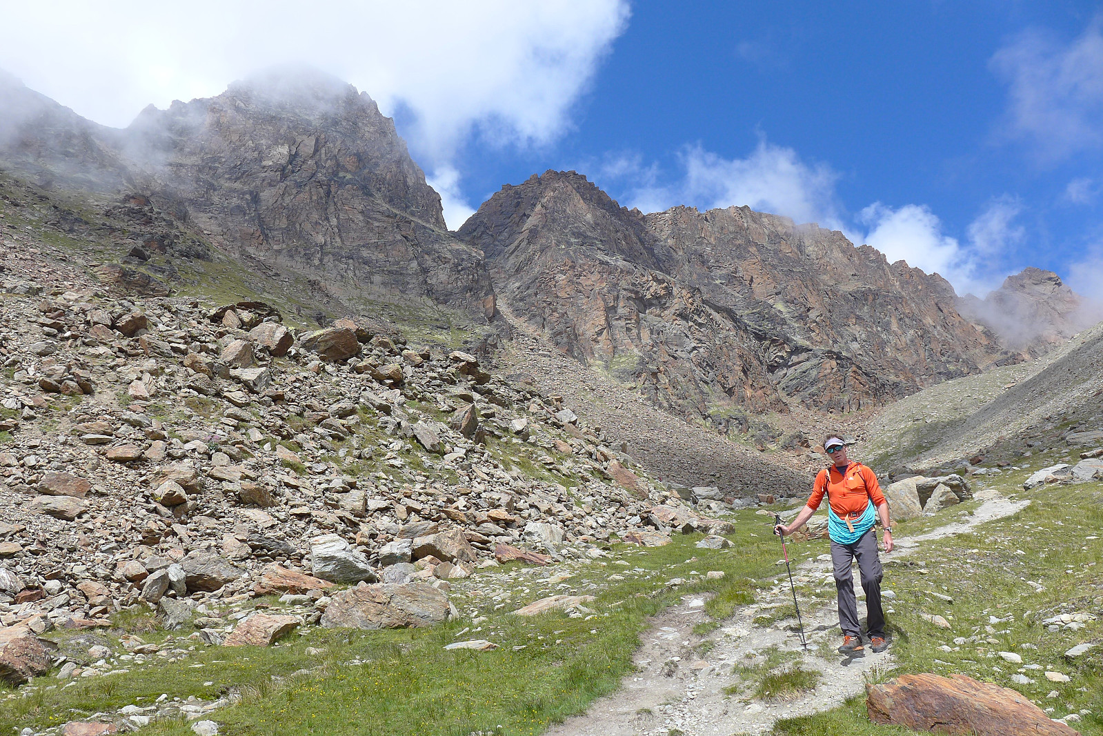
 For the past 5 years I have tended to spend my annual summer holiday in the Alps climbing with a guide and in keeping with tradition I did the same this year with Evolene as the main base for 2 weeks. I’d been paired up with David for the first half of the week and British mountain guide Tim Neill. David’s climbing CV was probably at least 5 times longer than mine so it was going to prove a challenge to decide on climbing objectives to do which he hadn’t already done! With somewhat unstable weather forecasted for the week we ended up making the most of the good weather for our first day and headed off to Arolla at 6am to do a day trip up Pointe de Tsalion and climb the route Voie de la Cabane (D-), which basically follows a not-so-prominent spine that goes up the west side of the mountain. >>>
Store Blåmann
- Date:
- 28.07.2018
- Characteristic:
- Hike
- Duration:
- 2:48h
- Distance:
- 7.4km
 Morgentur før jobb. Fin utsikt som alltid men ALTFOR varmt og tungt! Håper det varme været tar slutt snart.....?
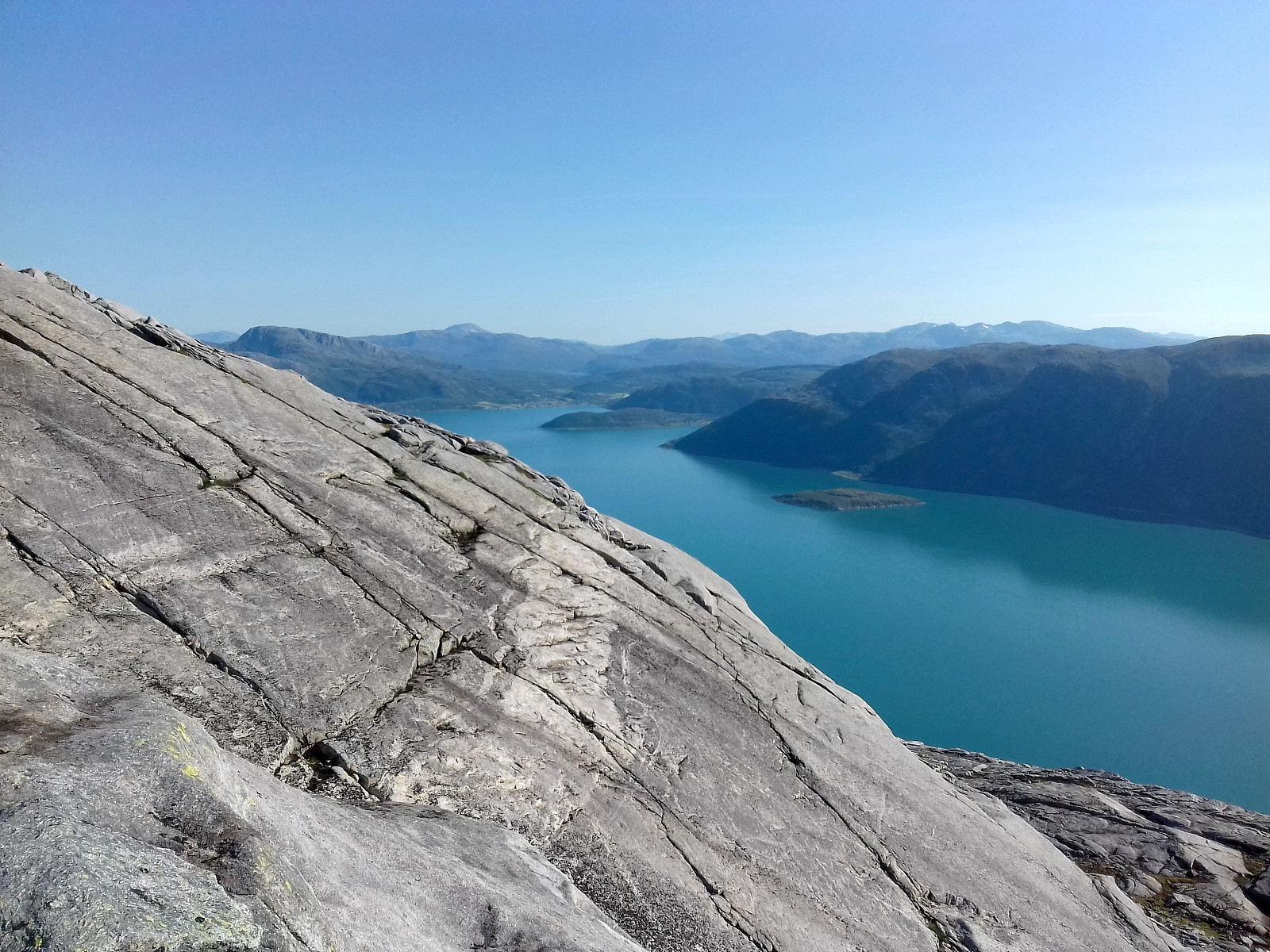
Vengsøytraversen
- Date:
- 27.07.2018
- Characteristic:
- Hike
- Duration:
- 5:16h
- Distance:
- 14.8km
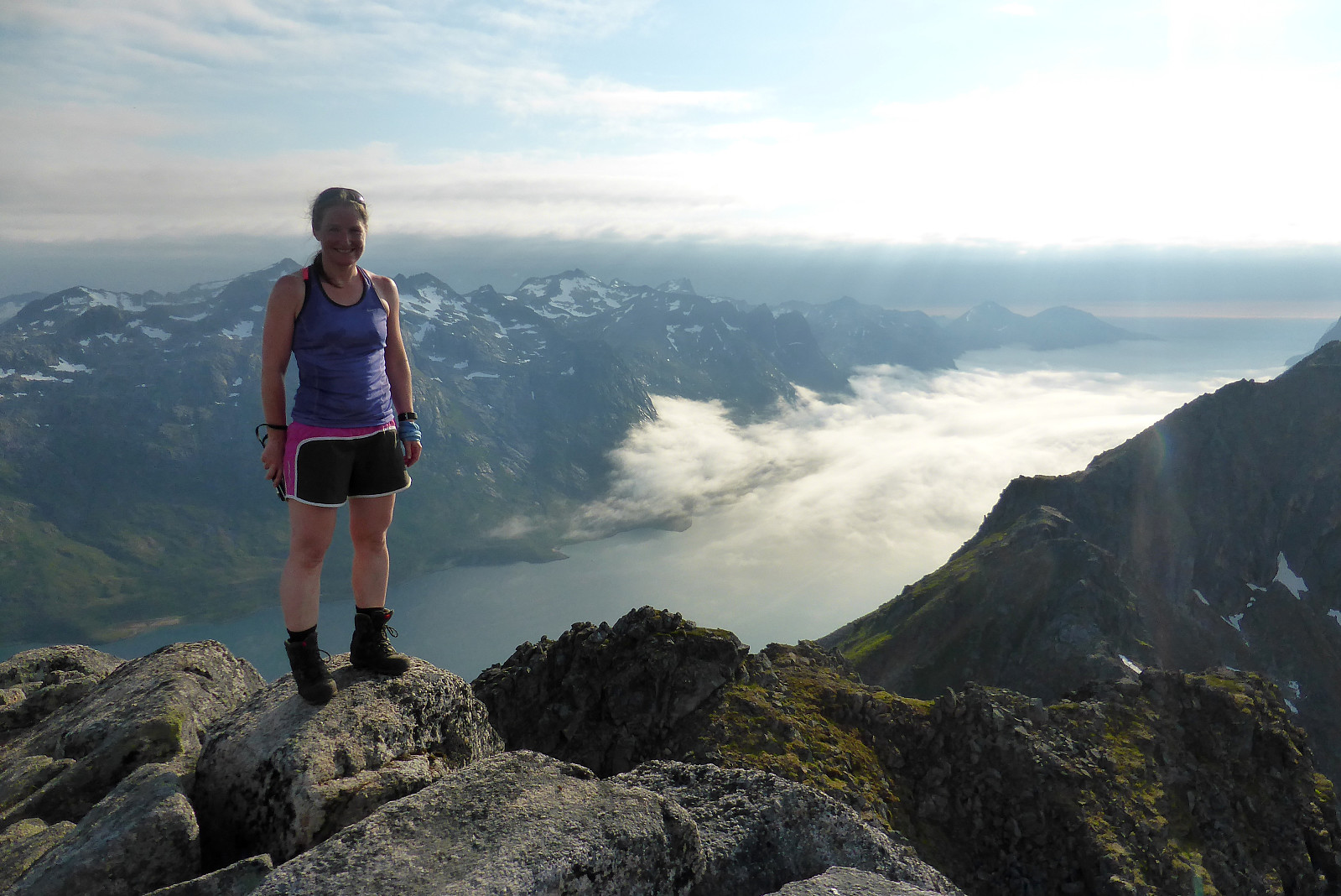
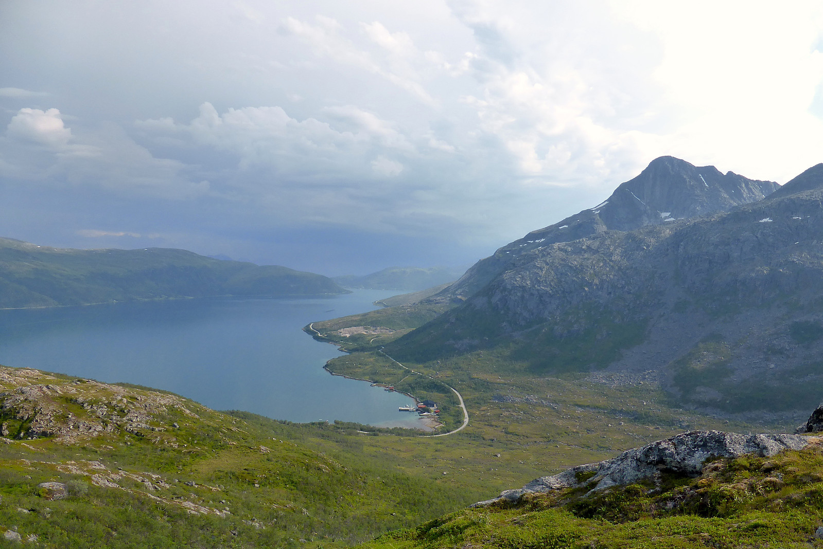
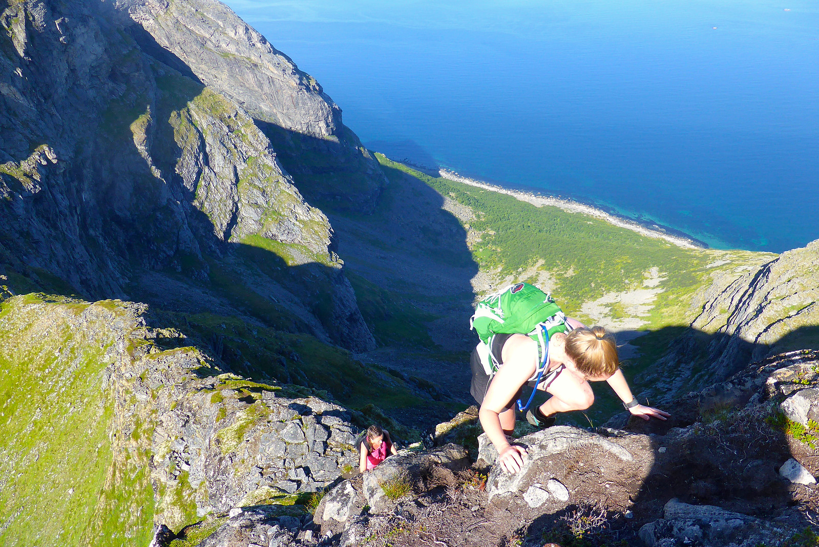 Værprognosen for helgen så noe elendig ut for å gå på tur (det var meldt opp mot 28-29 grader på søndag, noe som betyr innendørs aktiviteter for min del) så jeg benyttet anledning til å ta avspasering denne fredagen og komme meg ut på tur mens det var fortsatt OK turvær. Vengsøytraversen er en av mine favoritter på sommerstid og jeg hadde lyst til å gå den før jeg drar på ferie. Rakk første ferga fra Belvik som gikk kl.7.30 og der traff jeg også to medisinstudenter, Ragnhild og Katarina som hadde tenkt å gå traversen. De hadde ikke gått den før så jeg spurte om de ville gå den i lag, noe som de synes var helt OK siden jeg har vært der et par ganger før og er rimelig godt kjent med turen. Fergeturen tar omtrent en halvtime så v begynte å gå noen minutter etter >>>
Buren
- Date:
- 22.07.2018
- Characteristic:
- Hike
- Duration:
- 2:38h
- Distance:
- 7.0km
 Koselig trøstetur med Sola19 (Solveig Føreland) etter flueangrep og snutur på Bentsjordtinden!
Middagsfjellet
- Date:
- 21.07.2018
- Characteristic:
- Hike
- Duration:
- 1:53h
- Distance:
- 9.0km
 Kom tilbake til byen etter morgentur til Blåtinden, handlet litt mat, spiste lunsj hjemme og så kjørte ut mot Kvaløya for å gå en liten ettermiddagstur før regnværet kom. Begynte turen ca. kl15 fra parkeringa ved Ti på Topp-skilt og visste at det var meldt mulighet for tordenvær i 17-tiden så jeg hadde ikke så god tid på meg og rakk akkurat å jogge ned før de mørke skyene hadde kommet til fjellene nord for Ersfjorden.
Blåtinden
- Date:
- 21.07.2018
- Characteristic:
- Hike
- Duration:
- 2:31h
- Distance:
- 9.8km
 Nok en fin tur med litt morgentåke under 300moh. Det ble veldig varmt da den forsvant!

