Archive - Date
Archive - Activity
-
Climbing (43)
- Alpine climbing (31)
- Ice climbing (3)
- Mixed climbing (1)
- Sport climbing (3)
- Via ferrata (1)
-
Other trip (5)
- Expedition (5)
-
Other winter trip (5)
- Snowshoe trip (5)
-
Ski trip (449)
- Backcountry skiing (4)
- Cross-country skiing (2)
- Randonnée/Telemark (441)
-
Trip by foot (507)
- Alpine trip (47)
- Hike (196)
- Hillwalk (205)
- Jogging (4)
- Walk (55)
Peakbook-Friends


Helvellyn + more
- Date:
- 02.09.2017
- Characteristic:
- Hillwalk
- Distance:
- 16.7km
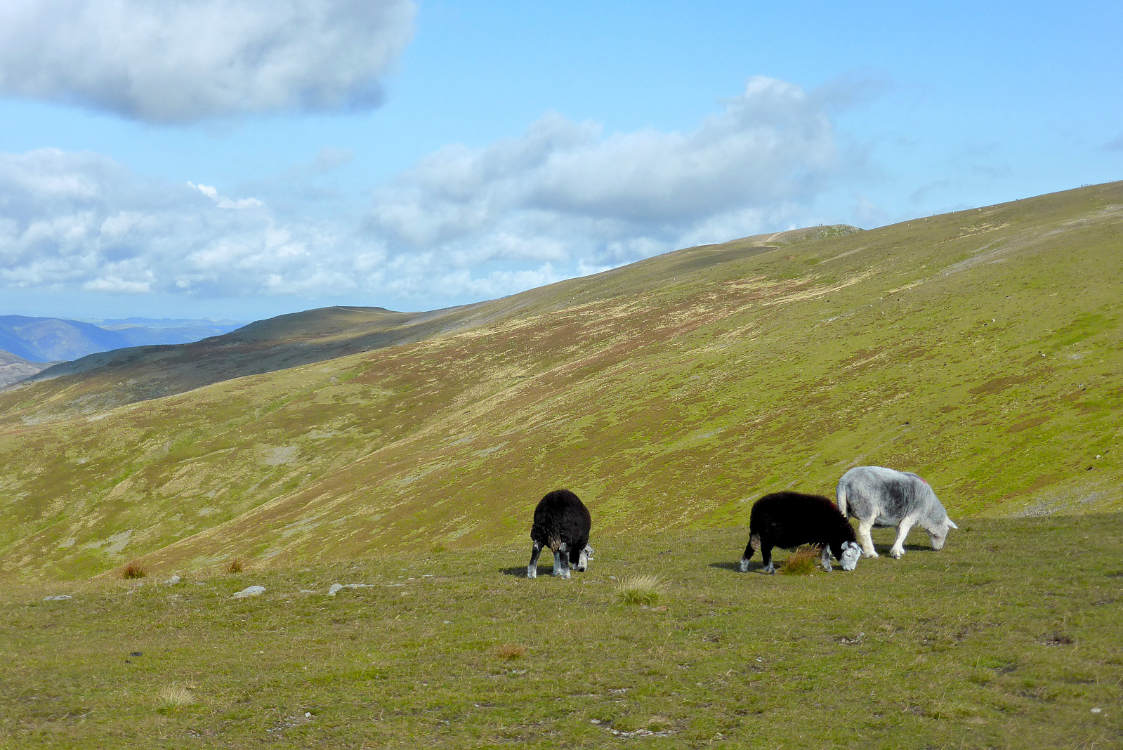 En fin morgentur mens jeg var på en kjapp helgetur til Storbritannia for å flykte fra gråværet i Tromsø. Massevis av gode turstier, sommervær og mange glade mennesker (og sauer) i fjellet. Herlig!
Fairfield
- Date:
- 01.09.2017
- Characteristic:
- Walk
- Duration:
- 2:15h
 Hoppet på flyet kl.06.30 fra Tromsø til Oslo, sprang til neste fly fra Oslo til Manchester, hentet en leiebil derfra og kjørte nordover mot Windermere om ettermiddagen. Og så var det bare å komme meg ut på en liten ettermiddagstur for å få litt lufting :)
Great Langdale round
- Date:
- 18.06.2017
- Characteristic:
- Hillwalk
- Distance:
- 20.2km
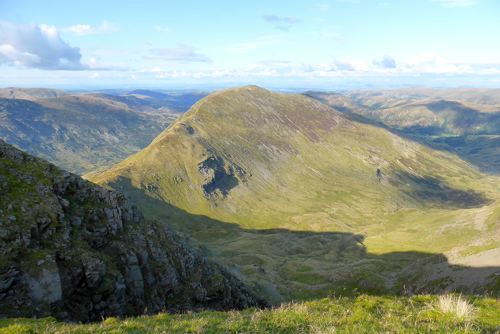
 Siden været var så fint igjen i dag tok jeg anledning til å stikke til fjells i nordvest England og gå en rundtur i Great Langdale. Har gått denne turen mange ganger før, men nå har det vært flere år siden sist. Gledet meg til å gå den igjen! Startet kl.9 fra Old Dungeon Ghyll hotell og gikk opp den lille veien bak campingplassen for å komme meg opp til stien som går opp mot Pike of Blisco. Fulgte den opp til toppen og så var det en liten tur nedover før stien fortsatte i retning Crinkle Crags og Shelter Crags. Klarte å gå ned på feil siden av fjellet etter litt klyving opp til Long Top pga litt tåke, men skjønte fort at terrenget så ikke kjent ut så jeg gikk tilbake og fant stien igjen.Tuslet videre mot Three Tarns og starten av stigningen opp Bow Fell. Fremdeles litt >>>
Great Gable
- Date:
- 23.12.2015
- Characteristic:
- Hillwalk
- Duration:
- 3:00h
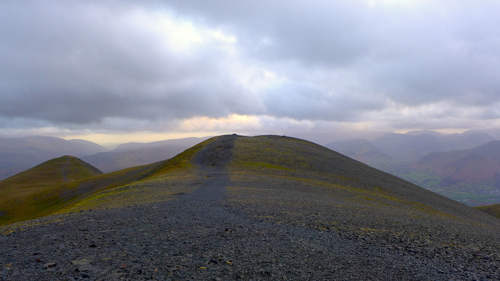
 Tok en liten morgentur opp Great Gable med start fra Seathwaite. Få folk ut på tur da jeg var der men møtte flere på vei ned. Mer overskyet enn som var meldt (#lurtavBBC??) men likevel ingen regn. Altfor mildt for denne årstiden og helt snø- og isfritt. Gadd ikke med å lete etter en lunsjplass i le for vinden så jeg gikk ned til bilen igjen og kjørte litt nordover mot Skiddaw hvor gikk en kjapp etter-lunsj tur.
Skiddaw
- Date:
- 23.12.2015
- Characteristic:
- Hillwalk
- Duration:
- 2:30h
 Kom ned fra Great Gable og tok en liten lunsjpause på bensinstasjonen i Keswick. Og så dro jeg på en liten tur til Skiddaw for å utnytte resten av dagslys (mange timer med dagslys her, flere enn 7 timer!!). Parkerte ved Underscar hotel og fulgte stien opp fjellet. Her var det skikkelig fint vær, ihvertfall den første halvtimen på tur opp. Deretter skyet det til og det var surt med sterk kuling helt til topps og ned igjen. Men det var likevel godt med å ha fått litt påfyll av vitamin D :)

