Archive - Date
Archive - Activity
-
Climbing (43)
- Alpine climbing (31)
- Ice climbing (3)
- Mixed climbing (1)
- Sport climbing (3)
- Via ferrata (1)
-
Other trip (5)
- Expedition (5)
-
Other winter trip (5)
- Snowshoe trip (5)
-
Ski trip (449)
- Backcountry skiing (4)
- Cross-country skiing (2)
- Randonnée/Telemark (441)
-
Trip by foot (507)
- Alpine trip (47)
- Hike (196)
- Hillwalk (205)
- Jogging (4)
- Walk (55)
Peakbook-Friends


Great Langdale round
- Date:
- 18.06.2017
- Characteristic:
- Hillwalk
- Distance:
- 20.2km
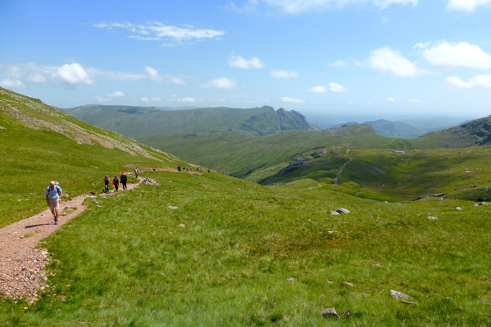 Siden været var så fint igjen i dag tok jeg anledning til å stikke til fjells i nordvest England og gå en rundtur i Great Langdale. Har gått denne turen mange ganger før, men nå har det vært flere år siden sist. Gledet meg til å gå den igjen! Startet kl.9 fra Old Dungeon Ghyll hotell og gikk opp den lille veien bak campingplassen for å komme meg opp til stien som går opp mot Pike of Blisco. Fulgte den opp til toppen og så var det en liten tur nedover før stien fortsatte i retning Crinkle Crags og Shelter Crags. Klarte å gå ned på feil siden av fjellet etter litt klyving opp til Long Top pga litt tåke, men skjønte fort at terrenget så ikke kjent ut så jeg gikk tilbake og fant stien igjen.Tuslet videre mot Three Tarns og starten av stigningen opp Bow Fell. Fremdeles litt >>>
Great Gable
- Date:
- 23.12.2015
- Characteristic:
- Hillwalk
- Duration:
- 3:00h
 Tok en liten morgentur opp Great Gable med start fra Seathwaite. Få folk ut på tur da jeg var der men møtte flere på vei ned. Mer overskyet enn som var meldt (#lurtavBBC??) men likevel ingen regn. Altfor mildt for denne årstiden og helt snø- og isfritt. Gadd ikke med å lete etter en lunsjplass i le for vinden så jeg gikk ned til bilen igjen og kjørte litt nordover mot Skiddaw hvor gikk en kjapp etter-lunsj tur.
Damp day in Langdale
- Date:
- 07.12.2013
- Characteristic:
- Hillwalk
- Duration:
- 5:00h
- Distance:
- 9.5km
 Var i Storbritannia noen dager i forbindelse med et møte, så brukte anledning for en tur med gamle venner. Dessverre var været like dårlig som var meldt og lørdagen ble jeg søkkvått til tross for at jeg hadde nylig impregnert jakken min. Antar at det på tide å kjøpe ny vanntett jakke nå ;-)
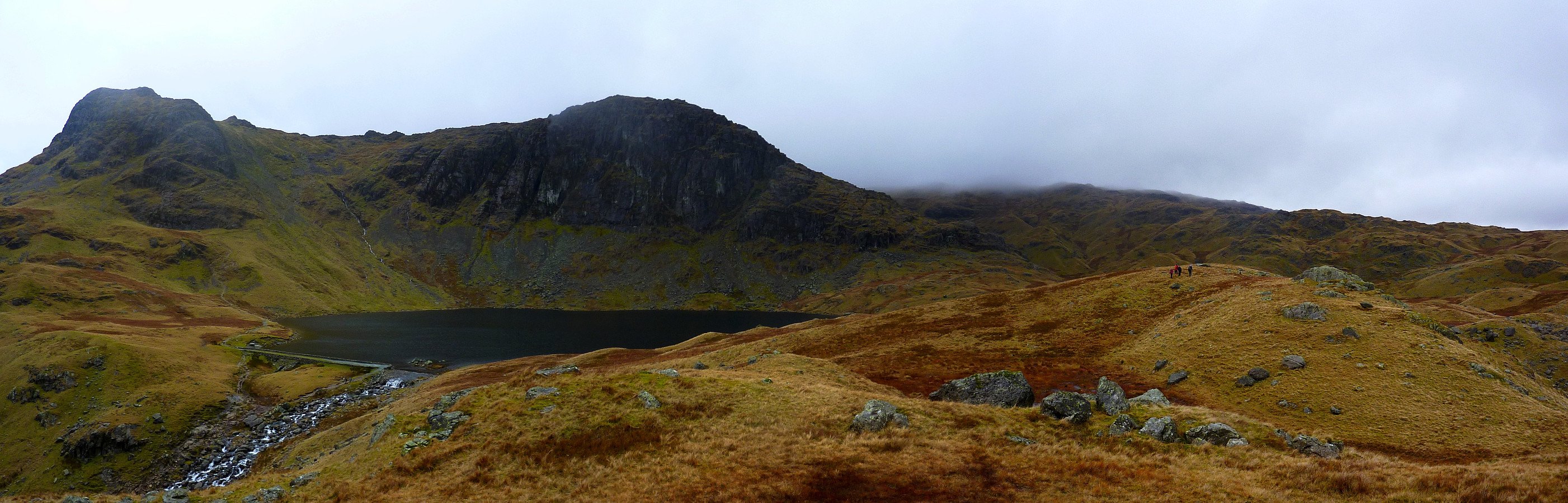
Vi begynte turen fra parkeringsplassen like ved Stickle Barn puben og gikk opp mot Blea Rigg istedenfor å bruke stien som går rett opp til Stickle Tarn. Deretter gikk vi videre i retning Easedale Tarn, spiste en liten lunsj der før vi fortsatte opp til Tarn Crag. Ikke god sikt i dag og det var vanskelig å kjenne området som jeg skulle vært ganske kjent med. Derfra var det bare å gå tilbake til Stickle Barn igjen ved å gå ned til Codale Tarn, krysse elva og gå opp på en god sti over >>>
Var i Storbritannia noen dager i forbindelse med et møte, så brukte anledning for en tur med gamle venner. Dessverre var været like dårlig som var meldt og lørdagen ble jeg søkkvått til tross for at jeg hadde nylig impregnert jakken min. Antar at det på tide å kjøpe ny vanntett jakke nå ;-)
Vi begynte turen fra parkeringsplassen like ved Stickle Barn puben og gikk opp mot Blea Rigg istedenfor å bruke stien som går rett opp til Stickle Tarn. Deretter gikk vi videre i retning Easedale Tarn, spiste en liten lunsj der før vi fortsatte opp til Tarn Crag. Ikke god sikt i dag og det var vanskelig å kjenne området som jeg skulle vært ganske kjent med. Derfra var det bare å gå tilbake til Stickle Barn igjen ved å gå ned til Codale Tarn, krysse elva og gå opp på en god sti over >>>
Helm Crag
- Date:
- 16.08.2013
- Characteristic:
- Walk
- Duration:
- 1:30h
- Distance:
- 7.0km
 Took a short walk up Helm Crag after our trip to Helvellyn earlier in the day. Parked up outside of Grasmere since there was little space along the road in the town. Went up fairly briskly in trainers. It was a little bit boring, except for the top 10m which involved a little scrambling. Cloudy but fortunately no rain until we were nearly back down again.
The Coledale classic
- Date:
- 13.12.2012
- Characteristic:
- Hillwalk
- Duration:
- 5:00h
- Distance:
- 16.0km
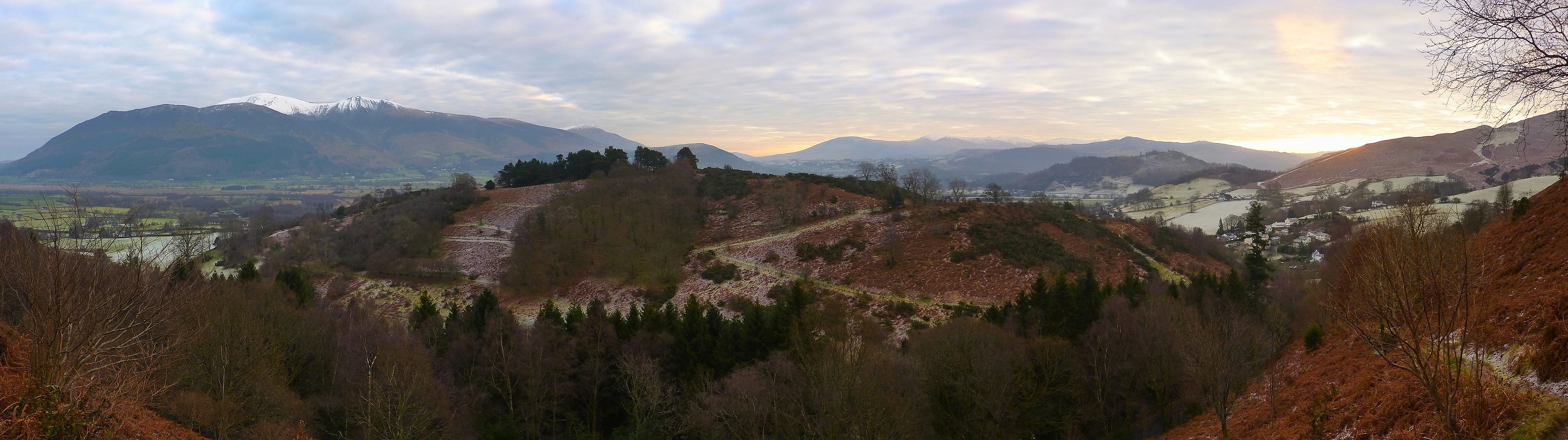 Only one day after I thought I'd had the best welcome back to Lakeland, I was treated to yet another cracking day out on the fells with more unbelievably good weather and views which were very pleasing on the eye! There were of course so many of my favourite routes I could have chosen to do, but this hike was a bit closer to the youth hostel I was staying at and quite conveniently had a free parking place at the start of the route. I first did the route 11 years ago and on all occasions I have been back and repeated it, it has never failed to bring a smile to the face even though it isn't much of a strenuous walk. It takes in 6 tops in a 16km circuit around Coledale which lies a few miles outside of Keswick in the northern end of the Lake District. There are several other tops which can be >>>
Scafell Pike
- Date:
- 12.12.2012
- Characteristic:
- Hike
- Distance:
- 12.0km
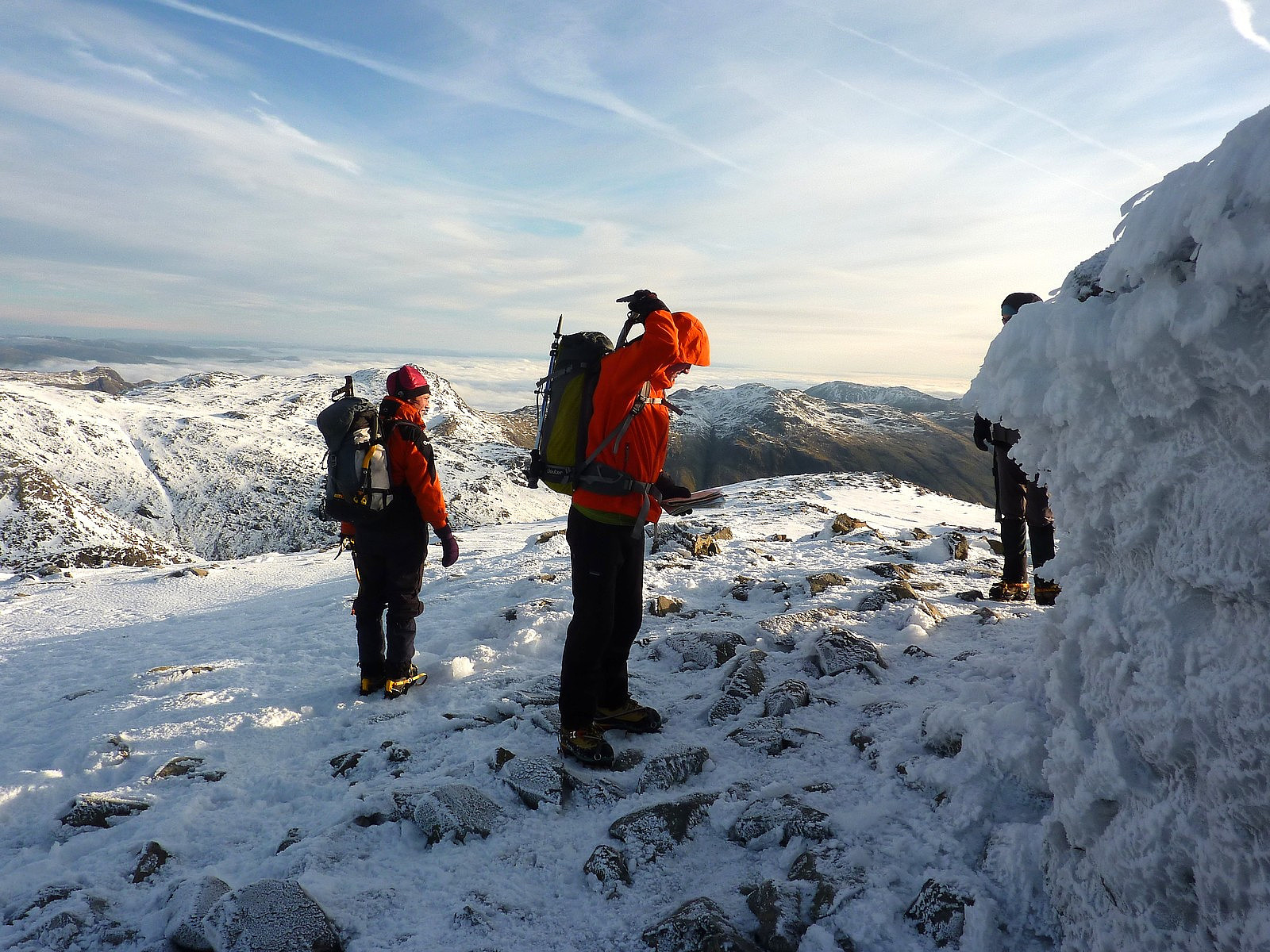 There isn't anything quite as pleasing as a good hike in familiar surroundings, with superb weather and solid snow. Quite surprisingly this trip satisfied all three criteria (not something which often happens in this corner of England) and made it a very enjoyable day out in the UK hills again. After a quiet night spent in the Borrowdale youth hostel, my friend Sue and I headed for Scafell Pike with the intention of going up the Corridor route which goes around the north-western side of the mountain. In the summer time Scafell Pike usually has a reputation for attracting big crowds and it doesn't end up being the nicest experience. But today we were really fortunate and saw very few other hikers, maybe half a dozen close to the summit but none on our route up!
The approach toward Styhead Tarn >>>
There isn't anything quite as pleasing as a good hike in familiar surroundings, with superb weather and solid snow. Quite surprisingly this trip satisfied all three criteria (not something which often happens in this corner of England) and made it a very enjoyable day out in the UK hills again. After a quiet night spent in the Borrowdale youth hostel, my friend Sue and I headed for Scafell Pike with the intention of going up the Corridor route which goes around the north-western side of the mountain. In the summer time Scafell Pike usually has a reputation for attracting big crowds and it doesn't end up being the nicest experience. But today we were really fortunate and saw very few other hikers, maybe half a dozen close to the summit but none on our route up!
The approach toward Styhead Tarn >>>
Langdale circuit
- Date:
- 07.04.2012
- Characteristic:
- Hillwalk
A chilled out day walk with a group of walkers I met in Langdale. We headed up toward Red tarn below Pike of Blisco first, then up the nice gentle slopes to Long Top. From there you get nice views over the Langdale valley, and then a little bit of excitement to do the Bad Step to get to the second top on Crinkle Crags. More undulating walking follows before reaching Three Tarns, from where we took a quick dash to the top of Bowfell and then back down the Band to return to Great Langdale. A nice day, but not all that challenging in terms of strenuousness. Still, it was a pleasant weather and good company too.

