Archive - Date
Archive - Activity
-
Climbing (43)
- Alpine climbing (31)
- Ice climbing (3)
- Mixed climbing (1)
- Sport climbing (3)
- Via ferrata (1)
-
Other trip (5)
- Expedition (5)
-
Other winter trip (5)
- Snowshoe trip (5)
-
Ski trip (449)
- Backcountry skiing (4)
- Cross-country skiing (2)
- Randonnée/Telemark (441)
-
Trip by foot (507)
- Alpine trip (47)
- Hike (196)
- Hillwalk (205)
- Jogging (4)
- Walk (55)
Peakbook-Friends
Great Langdale round
- Date:
- 18.06.2017
- Characteristic:
- Hillwalk
- Distance:
- 20.2km
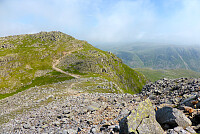
 Siden været var så fint igjen i dag tok jeg anledning til å stikke til fjells i nordvest England og gå en rundtur i Great Langdale. Har gått denne turen mange ganger før, men nå har det vært flere år siden sist. Gledet meg til å gå den igjen! Startet kl.9 fra Old Dungeon Ghyll hotell og gikk opp den lille veien bak campingplassen for å komme meg opp til stien som går opp mot Pike of Blisco. Fulgte den opp til toppen og så var det en liten tur nedover før stien fortsatte i retning Crinkle Crags og Shelter Crags. Klarte å gå ned på feil siden av fjellet etter litt klyving opp til Long Top pga litt tåke, men skjønte fort at terrenget så ikke kjent ut så jeg gikk tilbake og fant stien igjen.Tuslet videre mot Three Tarns og starten av stigningen opp Bow Fell. Fremdeles litt >>>
Scafell Pike
- Date:
- 12.12.2012
- Characteristic:
- Hike
- Distance:
- 12.0km
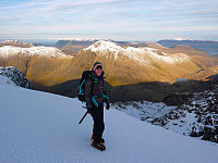
 There isn't anything quite as pleasing as a good hike in familiar surroundings, with superb weather and solid snow. Quite surprisingly this trip satisfied all three criteria (not something which often happens in this corner of England) and made it a very enjoyable day out in the UK hills again. After a quiet night spent in the Borrowdale youth hostel, my friend Sue and I headed for Scafell Pike with the intention of going up the Corridor route which goes around the north-western side of the mountain. In the summer time Scafell Pike usually has a reputation for attracting big crowds and it doesn't end up being the nicest experience. But today we were really fortunate and saw very few other hikers, maybe half a dozen close to the summit but none on our route up!
The approach toward Styhead Tarn >>>
Langdale circuit
- Date:
- 07.04.2012
- Characteristic:
- Hillwalk
A chilled out day walk with a group of walkers I met in Langdale. We headed up toward Red tarn below Pike of Blisco first, then up the nice gentle slopes to Long Top. From there you get nice views over the Langdale valley, and then a little bit of excitement to do the Bad Step to get to the second top on Crinkle Crags. More undulating walking follows before reaching Three Tarns, from where we took a quick dash to the top of Bowfell and then back down the Band to return to Great Langdale. A nice day, but not all that challenging in terms of strenuousness. Still, it was a pleasant weather and good company too.
Langdale in winter
- Date:
- 28.11.2010
Yet more fine and settled weather brought the wonderful cold and crisp conditions for winter walking that we often dream of having, so after a late start I headed over to Langdale to set off amongst some of my most well-known fells. Snow underfoot was hard and in fact, perfect for crampons - so I pulled on the pair I'd brought with me and speedily made my way across Bowfell first, then on towards Esk Pike and Esh Hause. I met only one other group of hikers along the way, who were very friendly and chatted for a while with me but they were going in the opposite direction so sadly I didn't have their company for long! Anyway, after that I continued along the familiar route towards the top of Esk Pike, then down to the haus and Angle Tarn. At this point I was debating whether or not to take the >>>
Scafell Pike from Langdale
- Date:
- 02.07.2010
This was the first of a 2-day backpacking trip with my one-year-younger sister. After driving up to the Lakes on an unusually busy Thursday afternoon, we stayed at the youth hostel in Grasmere and then drove down to the National Trust car park at Dungeon Ghyll the next morning. From here it was a nice stroll down the valley to the Band, and a straightforward ascent with the views of Harrison Stickle and Pike of Stickle took us up to Three Tarns. I'd done this route many times before, so there's very little to say other than from Bowfell we carried on to Esk Pike while enjoying the views of Scafell's west-facing slopes. Esk Pike is one of my favourite viewpoints, because not only do you get the airy drop down over Great Moss and Eskdale itself, but also across to the Scafell-Great End massif >>>
Seathwaite circuit
- Date:
- 06.03.2010
With winter still in full swing in the Lakes, I was back up with a friend of mine from Loughborough. We had been staying at the Derwentwater youth hostel the previous night, so we had good access to the Borrowdale fells and beyond. In the end we decided on a route from Seatoller, which took in the ascent of Glaramara. It was a nice stony path to start off with, but by the time we neared the summit, shortly behind a party of lads, there was a good covering of snow. More traipsing through snow ensued to descend and walk along to Allen Crags, with great views over to Honister and the western fells. From Allen Crags we headed down in the direction of Esk Hause before bearing in a (north?)westerly direction towards Sprinkling tarn and Styhead tarn. From there we made one last ascent of the day to >>>


