Archive - Date
Archive - Activity
-
Climbing (43)
- Alpine climbing (31)
- Ice climbing (3)
- Mixed climbing (1)
- Sport climbing (3)
- Via ferrata (1)
-
Other trip (5)
- Expedition (5)
-
Other winter trip (5)
- Snowshoe trip (5)
-
Ski trip (449)
- Backcountry skiing (4)
- Cross-country skiing (2)
- Randonnée/Telemark (441)
-
Trip by foot (507)
- Alpine trip (47)
- Hike (196)
- Hillwalk (205)
- Jogging (4)
- Walk (55)
Peakbook-Friends


Mont Maudit - Kuffner Arete
- Date:
- 26.06.2023
- Characteristic:
- Alpine climbing
- Duration:
- 12:15h
- Distance:
- 13.9km
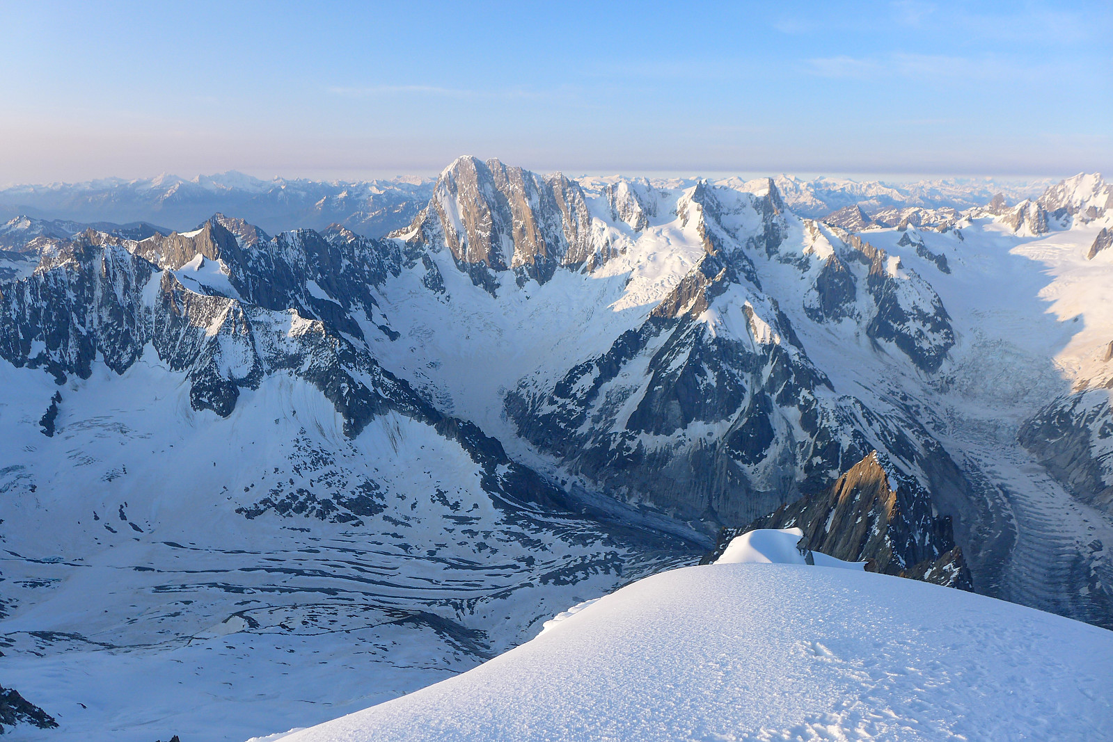
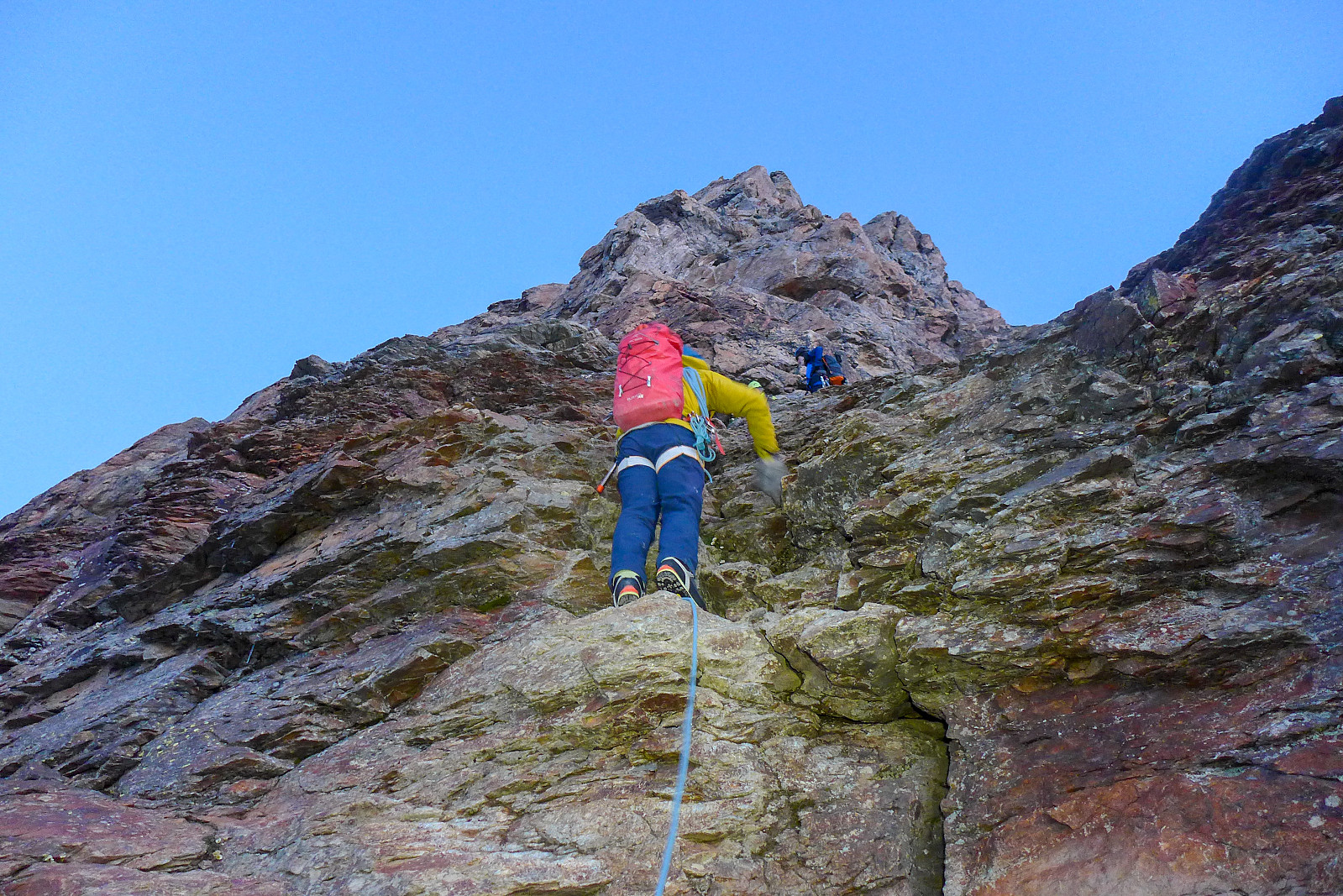
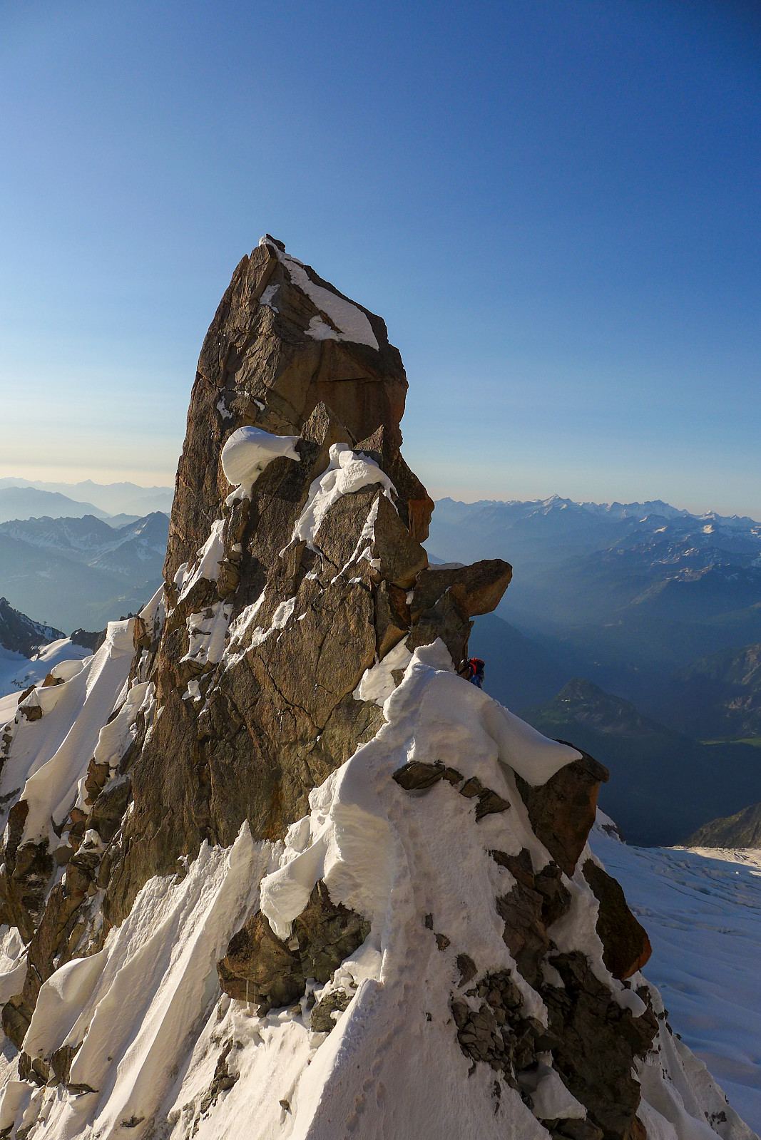 The Kuffner ridge on Mont Maudit has been sitting on my “wishlist” for a number of years; not just because Mont Maudit is also on the 4000m list, but because of what I’d heard from other people and seen cool pictures from the route. Moreover, the route description opens with “This is one of the finest ridge climbs in the Alps, combining snow aretes with interesting mixed sections and unfolds amongst scenery of the highest order....”. After a binned attempt in June 2022 (we only got as far as Cirque Maudit after a night with no decent refreeze) I was super keen to make the most of any opportunity with good weather and snow conditions this year. Since the Col de la Fourche bivouac hut got swept down off the ridge and destroyed last summer by rockfall, our only options were to start >>>
Nordend
- Date:
- 24.06.2023
- Characteristic:
- Alpine trip
- Duration:
- 10:10h
- Distance:
- 11.0km
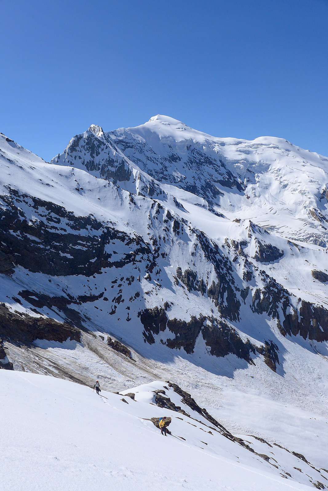
 Nordend is one of the 50 major 4000m summits listed in Martin Moran’s guidebook to the 4000m peaks of the Alps, despite having a prominence of less than 100m, so it was on my to-do list for this summer even though given the choice I’d rather have done a ski-assisted ascent much like I’d done on the Dufourspitze a couple of years earlier. After almost an entire week of strong gales and a storm depositing new snow up high I’d originally wanted to use the new weather window to go and climb the Kuffner Arete on Mont Maudit, but since both the Torino and Cosmiques huts were full for friday and saturday night, we ended up heading to Nordend first since there was still many availabe beds in the Monte Rosa hut, which had literally just opened for the summer season. We drove over to Zermatt >>>
Aiguille Verte - Whymper Couloir
- Date:
- 18.06.2023
- Characteristic:
- Alpine climbing
- Duration:
- 11:00h
- Distance:
- 9.0km
 After acclimatising in the Saas valley I was originally supposed to head over to Evolene on the saturday and meet up with British mountain guide Tim Neill and climb with him for a couple of weeks again. I was really looking forward to this as it had been a few years since he’d been out in the Alps for the summer season. We had been keeping in contact during the week about potential objectives, and as things turned out it looked like there would be a weather window for doing the Whymper couloir on the Aiguille Verte on the saturday/sunday after my trip up the Lagginhorn. I had hoped to have had two good nights sleep down in the valley before embarking on another 4000er like the Verte, but as most of the routes on the Aiguille Verte are a bit tricky to get in good condition this opportunity >>>
Lagginhorn
- Date:
- 15.06.2023
- Characteristic:
- Hike
- Duration:
- 6:50h
- Distance:
- 8.6km
 I had planned to head up the Lagginhorn for acclimatisation quite far in advance, and so booked a place in the Weissmies hut before I'd even left Norway. It was quite lucky then that I'd struck a nice weather window this week. Had a nice relaxing walk up to the hut on the wednesday, and was welcomed by the hut guardian Roberto just as I arrived and for some reason he already seemed to know who I was. When I asked how, he replied that I was the only person booked to stay at the hut that night - a bit of a novelty! As the day went on, another group of 3 (one guide and two Swiss guests) turned up, so I wasn't eating dinner alone that evening, but I did get an entire empty dormitory for myself ;-) Had a great night's sleep until 4am the following morning, then had a relaxed breakfast. The other >>>
Jegihorn
- Date:
- 12.06.2023
- Characteristic:
- Hike
- Duration:
- 4:00h
 Første dag i Saas Grund etter en lang reise sørover fra Tromsø. Tok gondolen opp til Kreuzboden og gikk opp mot Jegihorn for å få meg en liten akklimatiseringstur. Var fint vær og godt å se et ordentlig snødekke på de fleste fjellene! For en gangs skyld så Lagginhorn ganske spennende ut, mesteparten av vestryggen var snødekt og det var et pent spor som strakk seg langs hele vestryggen :-) Fulgte blå/hvit skilting oppover og tok mange pauser underveis. Kroppen kjente på at den hadde blitt transportert ganske raskt fra havnivå til over 3000 moh! Det lå en del snø på ruten som gjorde det litt mer tidkrevende men den var stort sett fast and fint å gå på, ihvertfall i 10-11 tiden (var betydelig bløtere på turen ned). Angret litt på at jeg tok gåstavene opp til toppen da de >>>
Lagginhorn
- Date:
- 11.07.2022
- Characteristic:
- Hike
- Duration:
- 6:20h
- Distance:
- 10.4km
 I had a few days to spare before I should have been flying home (thanks to SAS I didn't and got delayed by an extra 9 days instead) and decided to go for a last visit to 4000m and hike up the Lagginhorn via the west ridge. Had expected a little more scrambling but it turned out to be just a walk. In comparison to the Weissmies south ridge this was a bit dull but a well marked, nice walk nonetheless and the views were OK! 5h 40m up and back to the Weissmies hut, then a break before walking down to the lift t Kreuzboden.
Täschhorn
- Date:
- 08.07.2022
- Characteristic:
- Alpine climbing
- Duration:
- 9:35h
- Distance:
- 14.8km
 The final two days climbing with Graham this year were planned to be spent on the Täschhorn-Dom traverse, although when we left Evolene early on the thursday morning the weather forecast was indicating pretty strong winds up high for both days and I was a bit concerned about whether it would end up being too much wind for doing an exposed ridge traverse. We decided to stick with the plan and see how things turned out anyway. We were planning to do the traverse and descend all the way back down to the valley in one day, so a lot of food was packed both for snacks and for dinner/breakfast at the Mischabeljoch bivouac hut, which was the starting point for the south ridge of the Täschhorn. Originally we’d thought to go up to the bivouac hut by starting from Täschalp and hiking up the Weingarten >>>
Jungfrau
- Date:
- 06.07.2022
- Characteristic:
- Alpine trip
- Duration:
- 6:54h
- Distance:
- 9.6km
 After Les Droites the weather forecast for my final week in the Alps, with the exception of Monday, was supposed to be more settled, sunny and warm and it looked like the perfect opportunity to (finally) try and do the Täschhorn-Dom traverse which I’d been wanting to do for several years. Initially it seemed like a good idea to head up on the tuesday to the Mischabeljoch bivouac hut and do the traverse the following day, but after discovering the hut was fully booked for tuesday night we decided to scrap that plan. I wasn’t too sure about doing the traverse on thursday either since the forecast was showing cloudier weather so in the end I suggested to Graham that we go to the Jungfrau at the start of the week and try to do the Täschhorn-Dom traverse thursday/friday to make the most of the good weather. >>>

