Archive - Date
Archive - Activity
-
Climbing (43)
- Alpine climbing (31)
- Ice climbing (3)
- Mixed climbing (1)
- Sport climbing (3)
- Via ferrata (1)
-
Other trip (5)
- Expedition (5)
-
Other winter trip (5)
- Snowshoe trip (5)
-
Ski trip (449)
- Backcountry skiing (4)
- Cross-country skiing (2)
- Randonnée/Telemark (441)
-
Trip by foot (507)
- Alpine trip (47)
- Hike (196)
- Hillwalk (205)
- Jogging (4)
- Walk (55)
Peakbook-Friends


Store Blåmann
- Date:
- 13.09.2012
- Characteristic:
- Hike
- Duration:
- 5:00h
 Another opportunity for hiking with my friend Terese ( TerFlo (Terese Flo) ) came up when she had two days off work. Simultaneously the weather for both these days was forecasted to be fine and dry, so we met up on the Thursday with a plan to ascend Store Blåmann, yet another of (in my opinion) Tromsø's 'classic' hikes. It is actually quite a short trip, with less than 3km from the parkeringplass to the top of the mountain, so there was no hurry to start early and we left Tromsø at around kl.10 in rather tett tåke. Fortunately, by the time we had reached Kaldfjord the fog had been left behind us and we could see the Blåmann across the fjord under blue skies. It seemed like my dream to go back up the mountain with sunshine and good visibility might about to become true. So both of us were excited and feeling >>>
Hamperokken
- Date:
- 02.09.2012
- Characteristic:
- Hike
- Duration:
- 7:00h
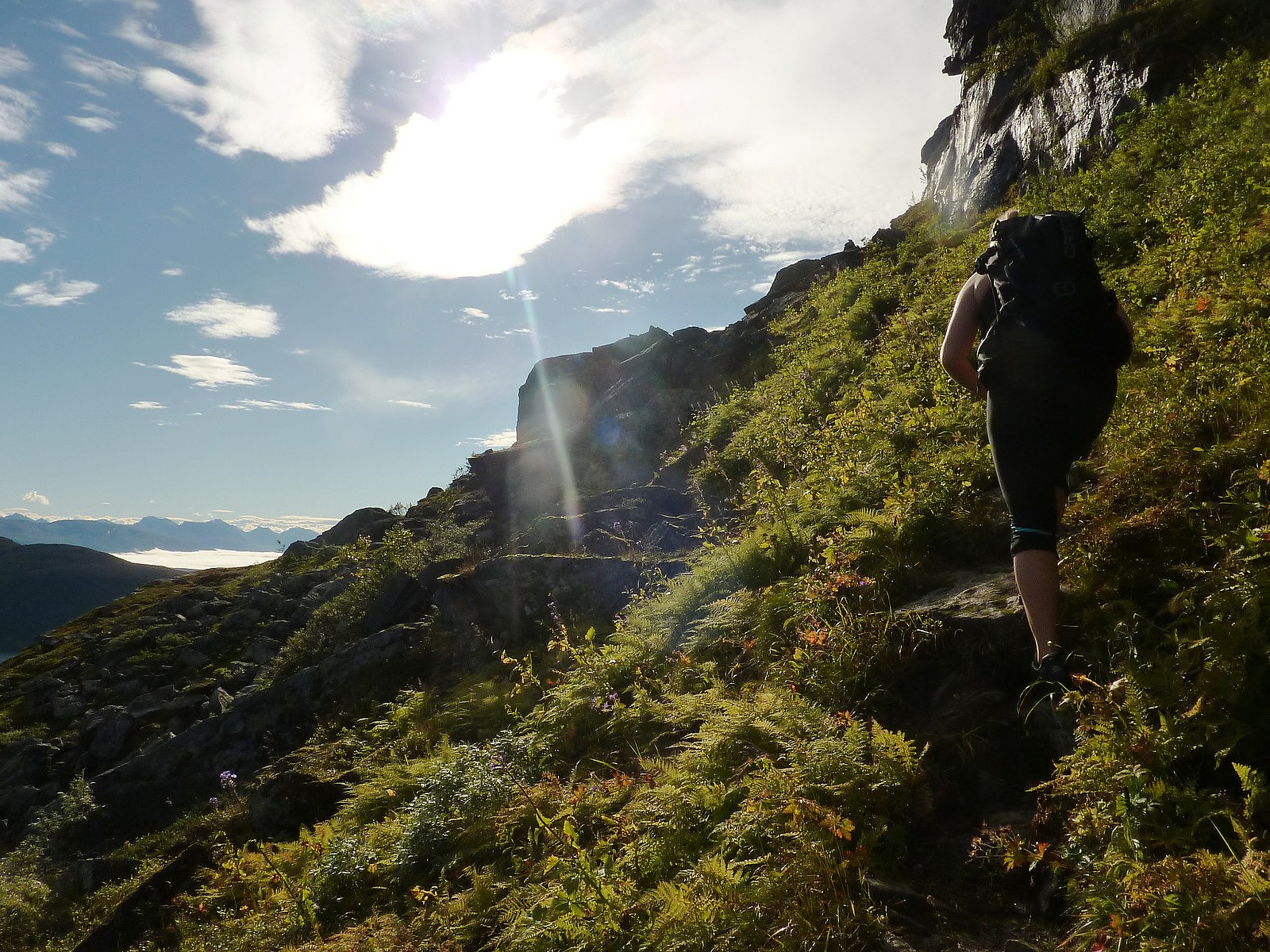
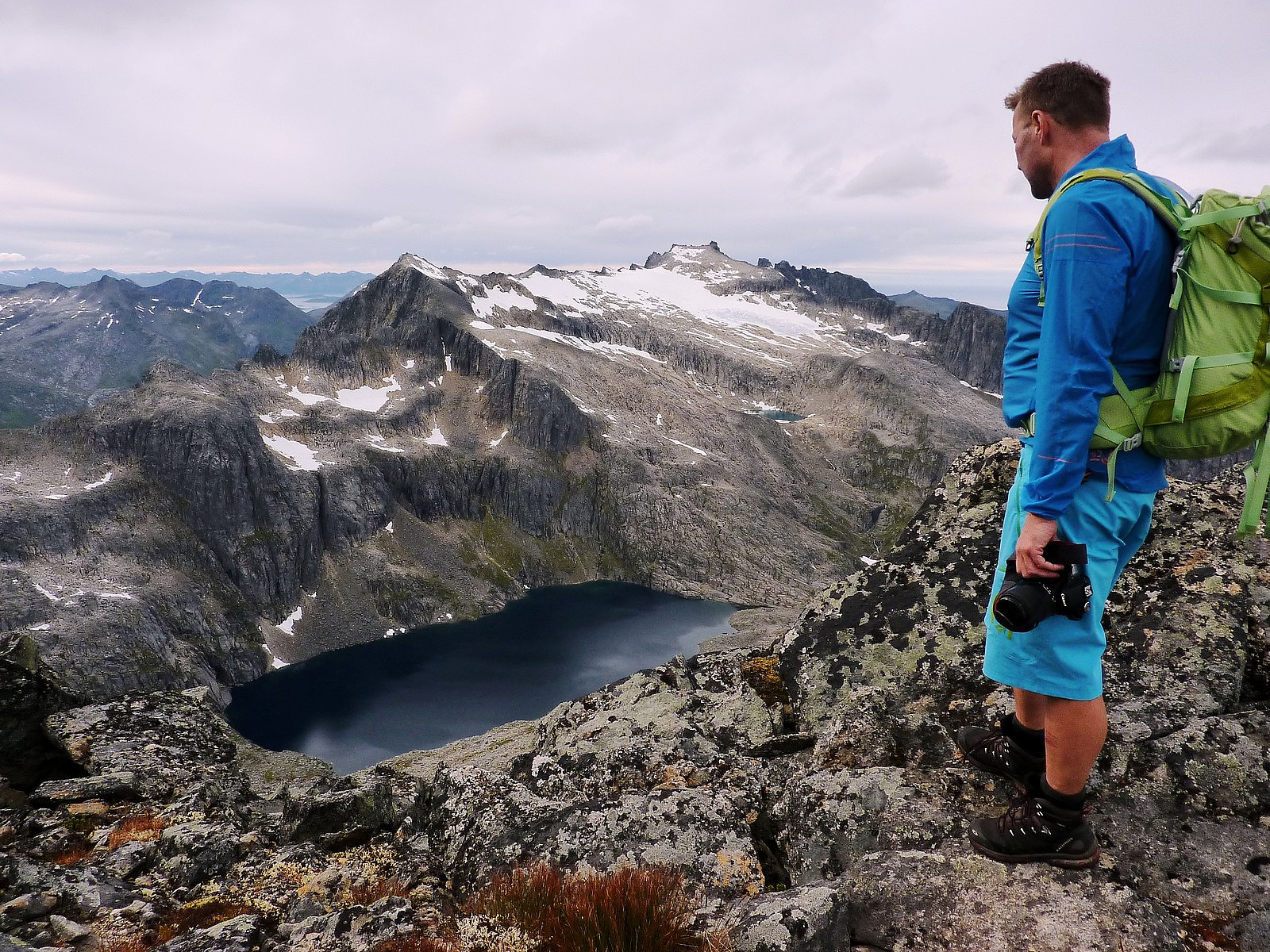
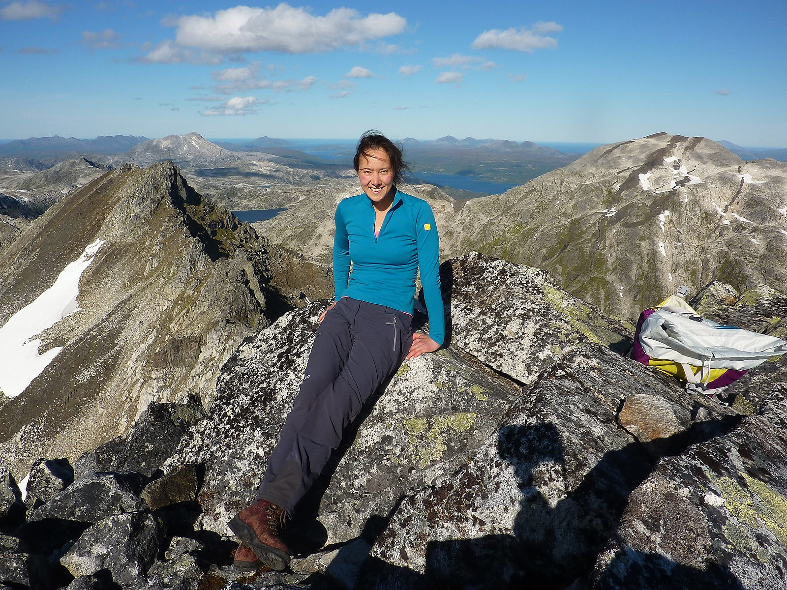
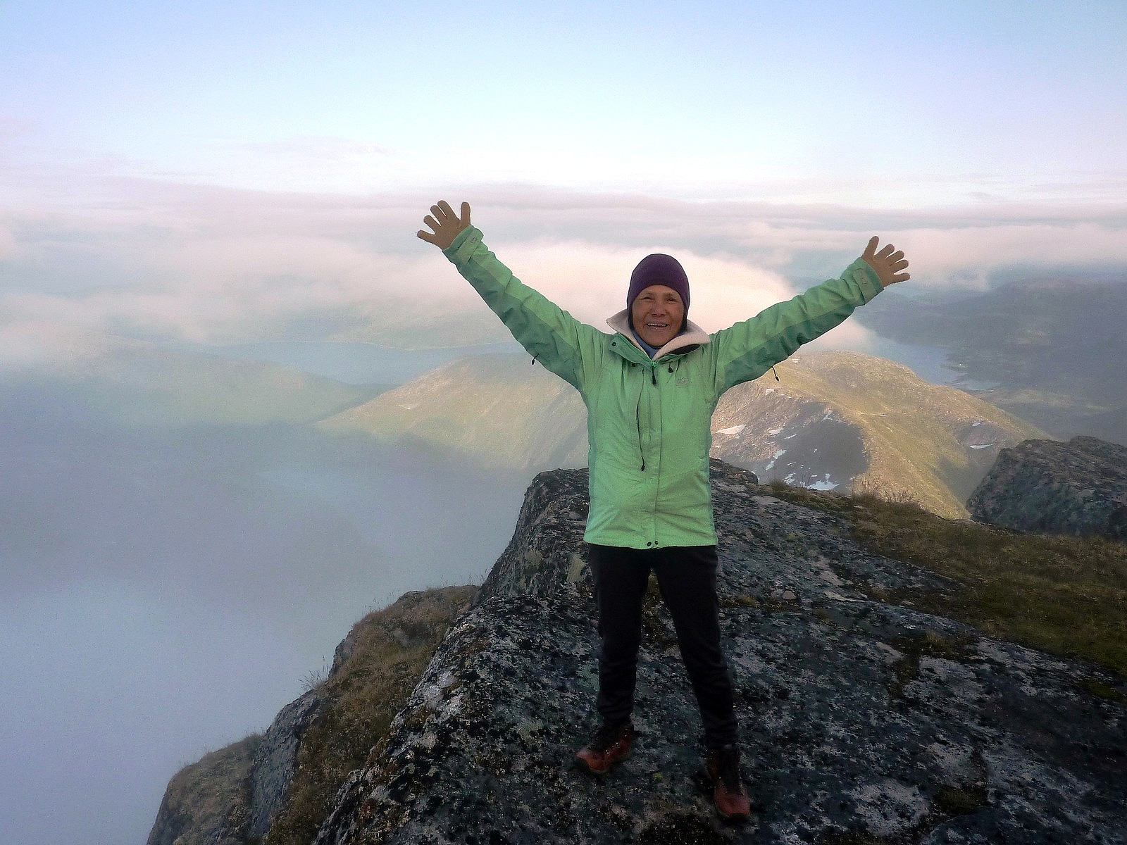
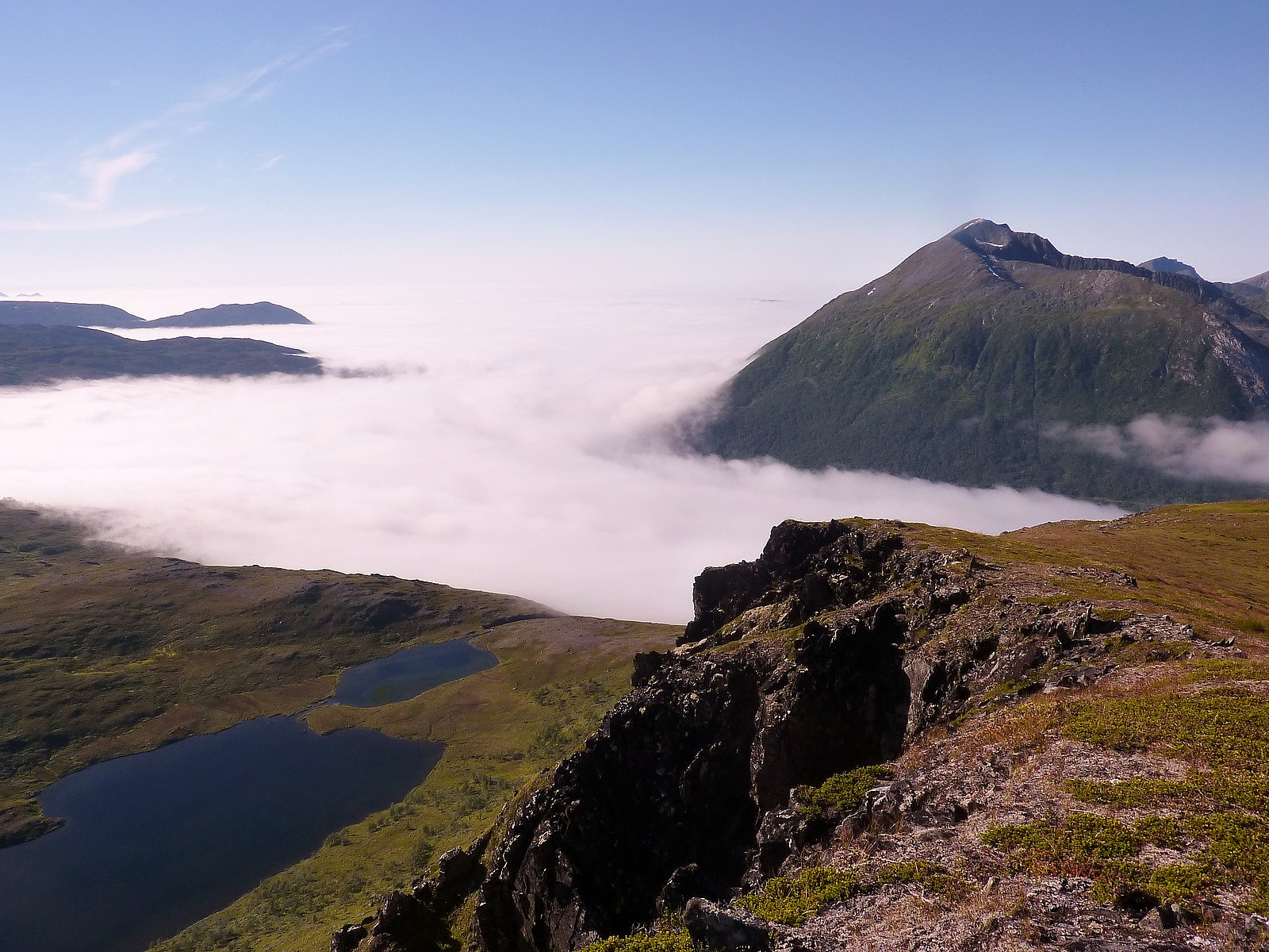
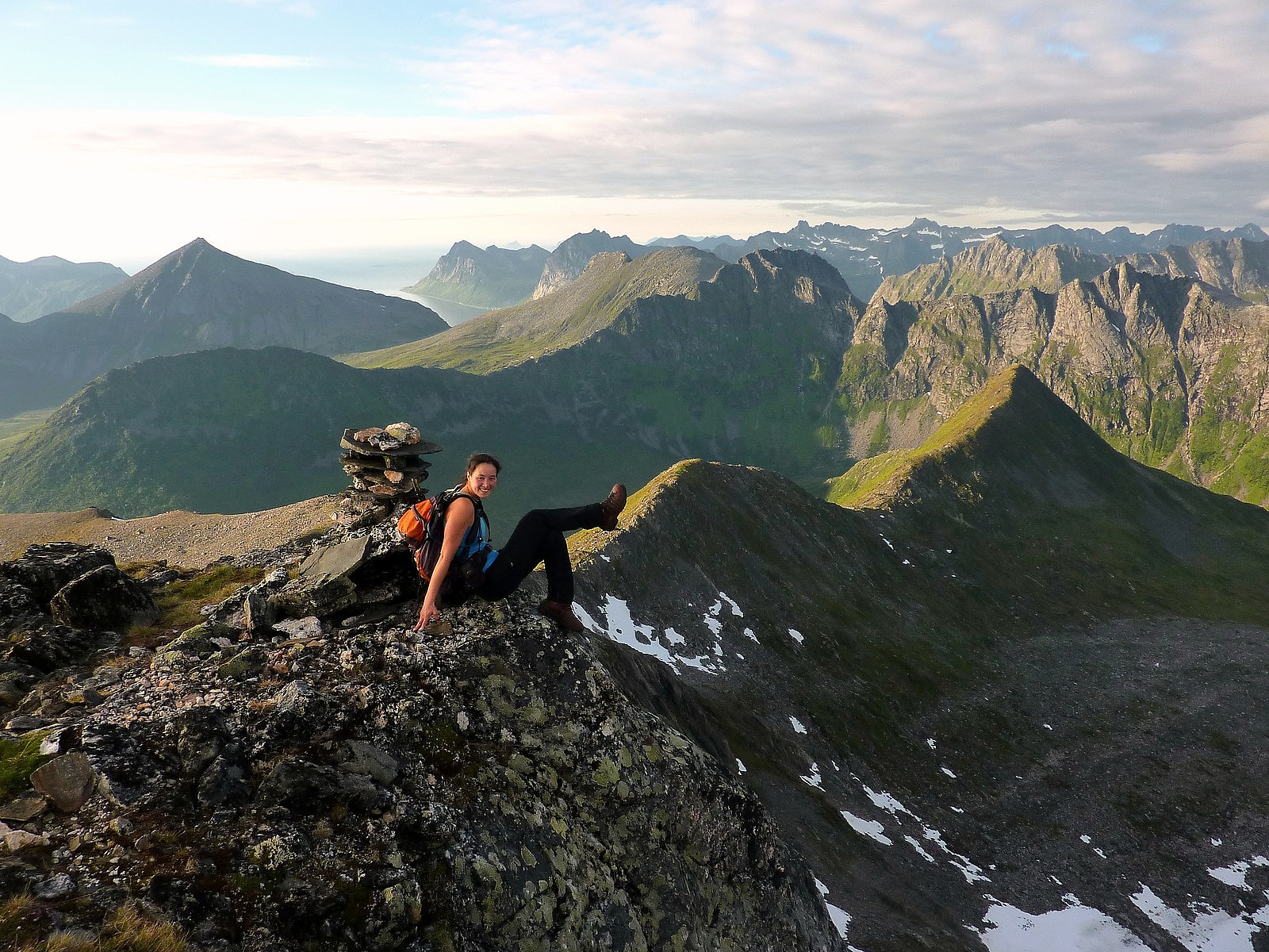
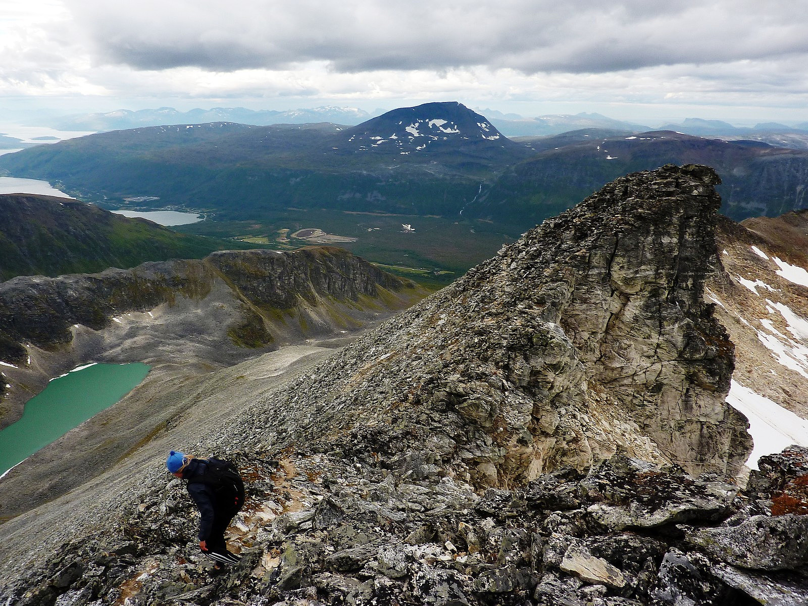 Hamperokken is I think, probably one of the 'classics' to do in Tromsø. For me, this was to be my second ascent of Hamperokken (the first time being on a super-summery day in August 2009). The opportunity to make a return visit came along when my friend TerFlo (Terese Flo) who I'd met on a previous fjellsportgruppa trip said she would join. Initially my plan was to take a hike up Tverrbotnfjellet, another mountain quite close to Hamperokken but on the other side of Lavangsdalen. But since Terese had not been to Hamperokken and neither had I for about 3 years, I suggested we take a trip here instead. On the plus side too, the weather was forecasted to be good for most of the day but rain was edging in from the west, so going further east would at least buy us some extra minutes of dry weather later on in the >>>
Styrmannstinden
- Date:
- 01.09.2012
- Characteristic:
- Hike
- Duration:
- 4:00h
 There isn't a lot to say about this trip, apart from that the views are really nice and there is a very pleasant path that goes up from Grøtfjorden all the way up to the climbers hut at the pass between Styrmannstinden and Zapffetoppen....I took this hike with a guy from the fjellsportgruppa,who I hadn't met before but who had responded to a message I posted on the facebook group. Anyway, he turned out to be good, friendly company and that at least made the trip a bit more fun. The route is fairly short, about 2.5km from the car to the top and the path is well-trodden for most of the way up. It was a shame that it got bit cloudier through the course of the day, because it had started off so bright and sunny when we'd left Tromsø, but even with the cloud the summit views were excellent, and >>>
Skulgamtinden
- Date:
- 30.08.2012
- Characteristic:
- Hillwalk
- Duration:
- 6:30h
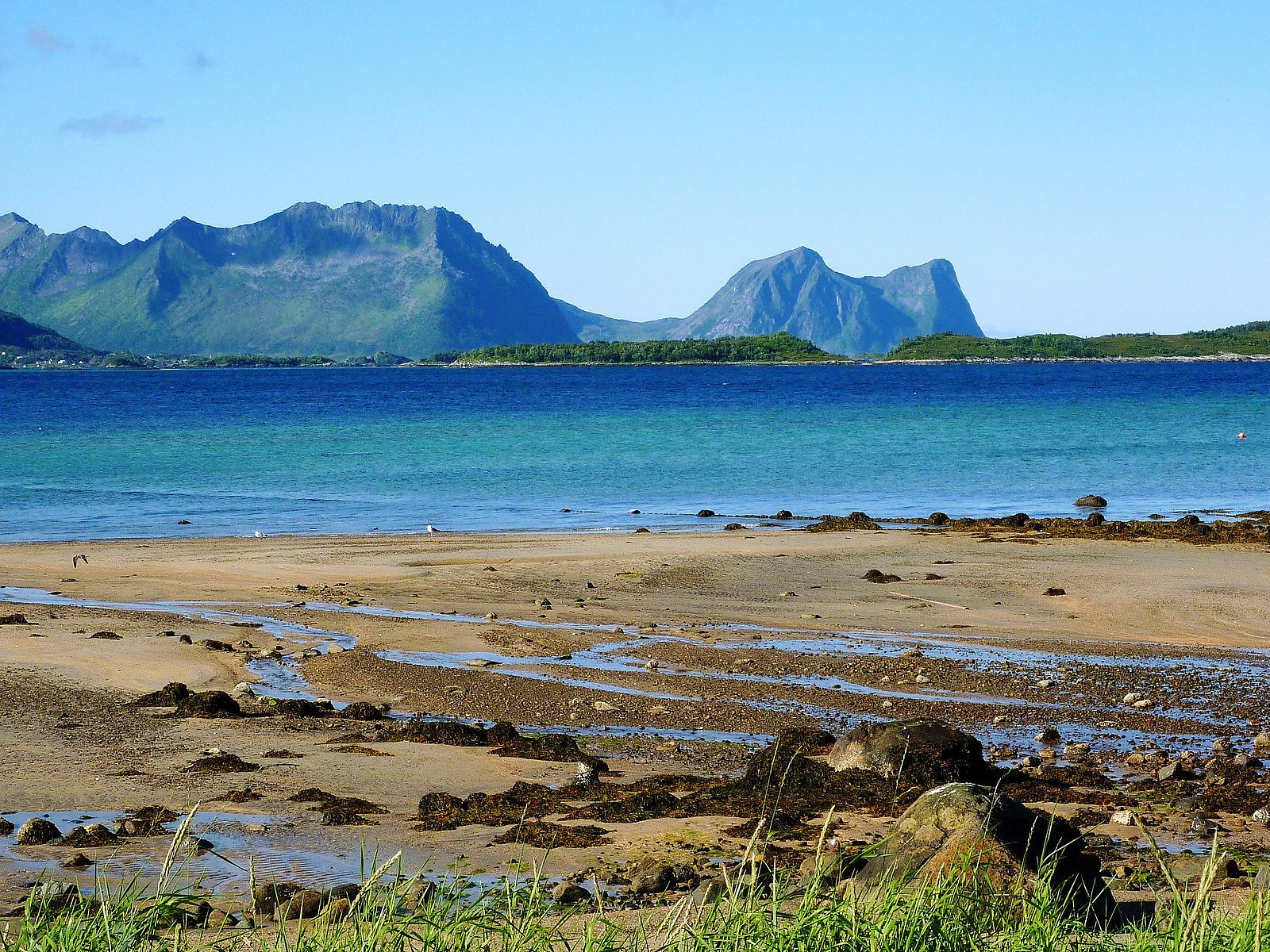
 Third official day of summer - and possibly the final one of the year for Tromsø! Seemed like too good an opportunity to miss another potentially great day of hiking, so I emailed the admin staff and told them I was taking it as a holiday. Destination: Ringvassøya. Peak: Skulgamtinden. Why? Well, firstly, I can see Ringvassøya from my bedroom window every time I pull back the blinds, and moreover, I see Skulgamtinden from my apartment as well. I've seen it through last autumn, winter, the spring and the summer. Every hour of the day it sits proudly above the fjord, and I am quite ashamed to say that even having lived in Tromsø for nearly a year now I still have not paid a visit to Ringvassøya, even though it is only a short drive away. So today I set out to achieve two goals - to visit >>>
Husfjellet
- Date:
- 19.08.2012
- Characteristic:
- Walk
- Duration:
- 3:00h
 After a not-so-good night sleep at Mefjord Brygge due to some unexpected music festivities in the early morning, my mum was not feeling in such a good mood for another hike. It was pretty unfortunate because the morning was bright and the skies were blue. It was a perfect sunny day for getting the amazing views that I'd hoped we'd get on the hike to Keipen the previous day. Since we also needed to get the 1700 ferry from Botnhamn it also meant that there was not a lot of time to play with....so we planned to drive to Skaland, where my mum would take things easy and stroll along the beach and have a look around Berg village, and I would take a quick hike up to Husfjellet and meet her again for lunch. That way both of us would be happy! It was a gorgeous drive from Mefjordvaer, and we passed >>>
Keipen
- Date:
- 18.08.2012
- Characteristic:
- Hillwalk
- Duration:
- 6:30h
 This was one trip I had had high hopes for. My mum was visiting me for a few days, and one of the things I really wanted for her to see the absolutely amazing views over Mefjord. Keipen seemed like quite a nice choice of mountain to see it because it is one of the Lenvik Ti på Topp, and I simply assumed that it would not be too difficult a walk to do. Unfortunately, as we drove over from Tromso it was obvious that there was a lot of low cloud to budge before these really fantastic views could be seen from the mountain! It was about midday when we arrived at Botnhamn, and we thought that we'd wait for a little longer before starting the hike because the weather forecast had promised more sun later in the day.
Most of the route descriptions I'd found for Keipen recommend starting from the entrance >>>
This was one trip I had had high hopes for. My mum was visiting me for a few days, and one of the things I really wanted for her to see the absolutely amazing views over Mefjord. Keipen seemed like quite a nice choice of mountain to see it because it is one of the Lenvik Ti på Topp, and I simply assumed that it would not be too difficult a walk to do. Unfortunately, as we drove over from Tromso it was obvious that there was a lot of low cloud to budge before these really fantastic views could be seen from the mountain! It was about midday when we arrived at Botnhamn, and we thought that we'd wait for a little longer before starting the hike because the weather forecast had promised more sun later in the day.
Most of the route descriptions I'd found for Keipen recommend starting from the entrance >>>
Synnøvjordtinden
- Date:
- 15.08.2012
- Characteristic:
- Hillwalk
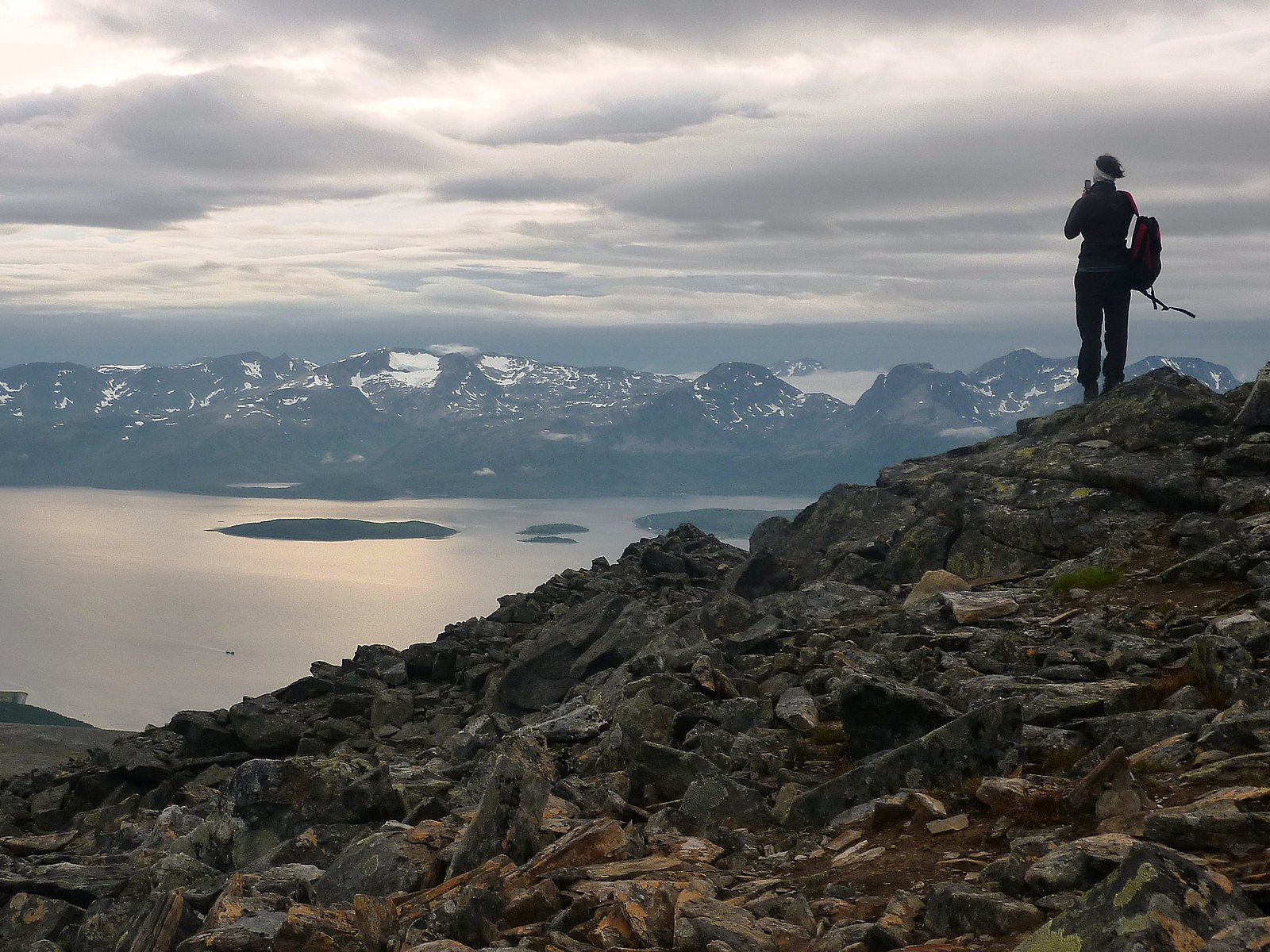
 I took this peak as an afternoon trip, with the hope that the path which I'd seen marked on the map also existed on the ground as well! It was also the second day of low-level fog which had pretty much engulfed the whole of Tromsøya, but higher up above about 300m, it was bright and clear. So, a mountain hike seemed like the perfect way to escape the dull and cool fog below and get some warm sunshine up high. Synnøvjordtinden is also located at the western end of Kattfjord, almost directly opposite Vasstinden across Nordfjorden, and I was keen to see Vasstinden from a different perspective, simply because I had such good memories of the evning trip I'd taken there a few weeks earlier. Anyway, quite helpfully as I was driving along the road through Synnøvjorda I noticed a red arrow at the >>>
Ullstinden
- Date:
- 31.07.2012
- Characteristic:
- Hillwalk
- Duration:
- 4:30h
 monakaup (Mona Kaupang) , one of the friends I had made from an FSG trip happened to have a whole day off - and both of us were keen to make the most of it if weather permitted. As things turned out, a load of rain was forecasted during the daytime, and rather than go out and deliberately get wet we chose to postpone a trip until the evening, when dry weather was supposed to come along. Our choice of mountain was Ullstinden, probably quite a popular winter peak and also a summer one because it is a Ti på Topp trip, although it is not the true summit of Ullstinden which is the recommended Ti på Topp route but the south-west summit. Well, it was good enough for us, and provided about 10km of walking up and down. Perfect for an evening. Depressingly though, when we met up at the Joker on Dramsveien, it was pretty wet >>>
Vasstinden
- Date:
- 29.07.2012
- Characteristic:
- Hillwalk
- Duration:
- 4:00h
 There is nothing more satisfying than spending 5 hours in warm coastal sunshine while the rest of the city is covered in fog. That's exactly how things turned out on the last Sunday afternoon in July. For everyone living on the eastern side of Tromsøya, it probably would have appeared to have been a dull and grey day. For people like me living on the western side however, I could see a huge patch of blue sky and glorious sunshine illuminating pretty much the whole of Kvaløya for the whole day (although the cloud and fog were kind of moving slowly across from east to west by evening), and it would have been such a shame not to snatch the chance to enjoy it too!
So that it how the Vasstinden plans were made. I suggested to my friend Ilona that we head out for a hike, as far west as possible >>>
There is nothing more satisfying than spending 5 hours in warm coastal sunshine while the rest of the city is covered in fog. That's exactly how things turned out on the last Sunday afternoon in July. For everyone living on the eastern side of Tromsøya, it probably would have appeared to have been a dull and grey day. For people like me living on the western side however, I could see a huge patch of blue sky and glorious sunshine illuminating pretty much the whole of Kvaløya for the whole day (although the cloud and fog were kind of moving slowly across from east to west by evening), and it would have been such a shame not to snatch the chance to enjoy it too!
So that it how the Vasstinden plans were made. I suggested to my friend Ilona that we head out for a hike, as far west as possible >>>

