Archive - Date
Archive - Activity
-
Climbing (43)
- Alpine climbing (31)
- Ice climbing (3)
- Mixed climbing (1)
- Sport climbing (3)
- Via ferrata (1)
-
Other trip (5)
- Expedition (5)
-
Other winter trip (5)
- Snowshoe trip (5)
-
Ski trip (449)
- Backcountry skiing (4)
- Cross-country skiing (2)
- Randonnée/Telemark (441)
-
Trip by foot (507)
- Alpine trip (47)
- Hike (196)
- Hillwalk (205)
- Jogging (4)
- Walk (55)
Peakbook-Friends


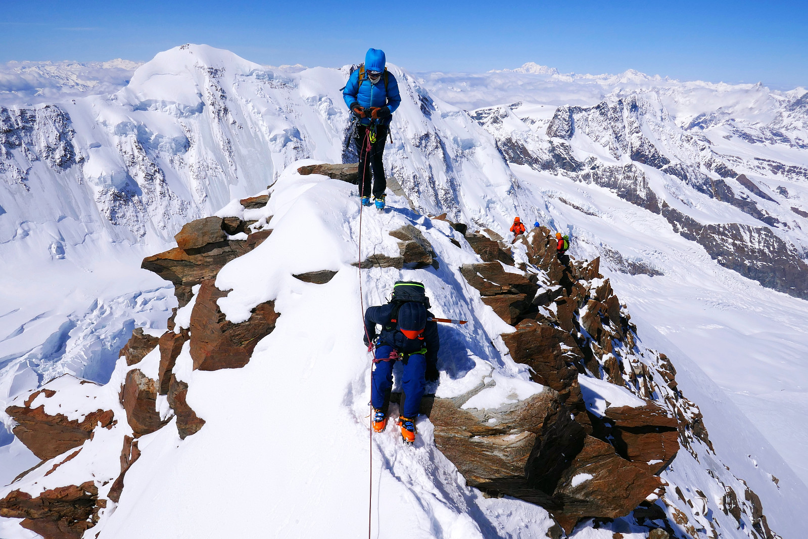
Dôme & Aiguille de Rochefort
- Date:
- 18.07.2019
- Characteristic:
- Alpine climbing
- Duration:
- 10:05h
- Distance:
- 8.6km
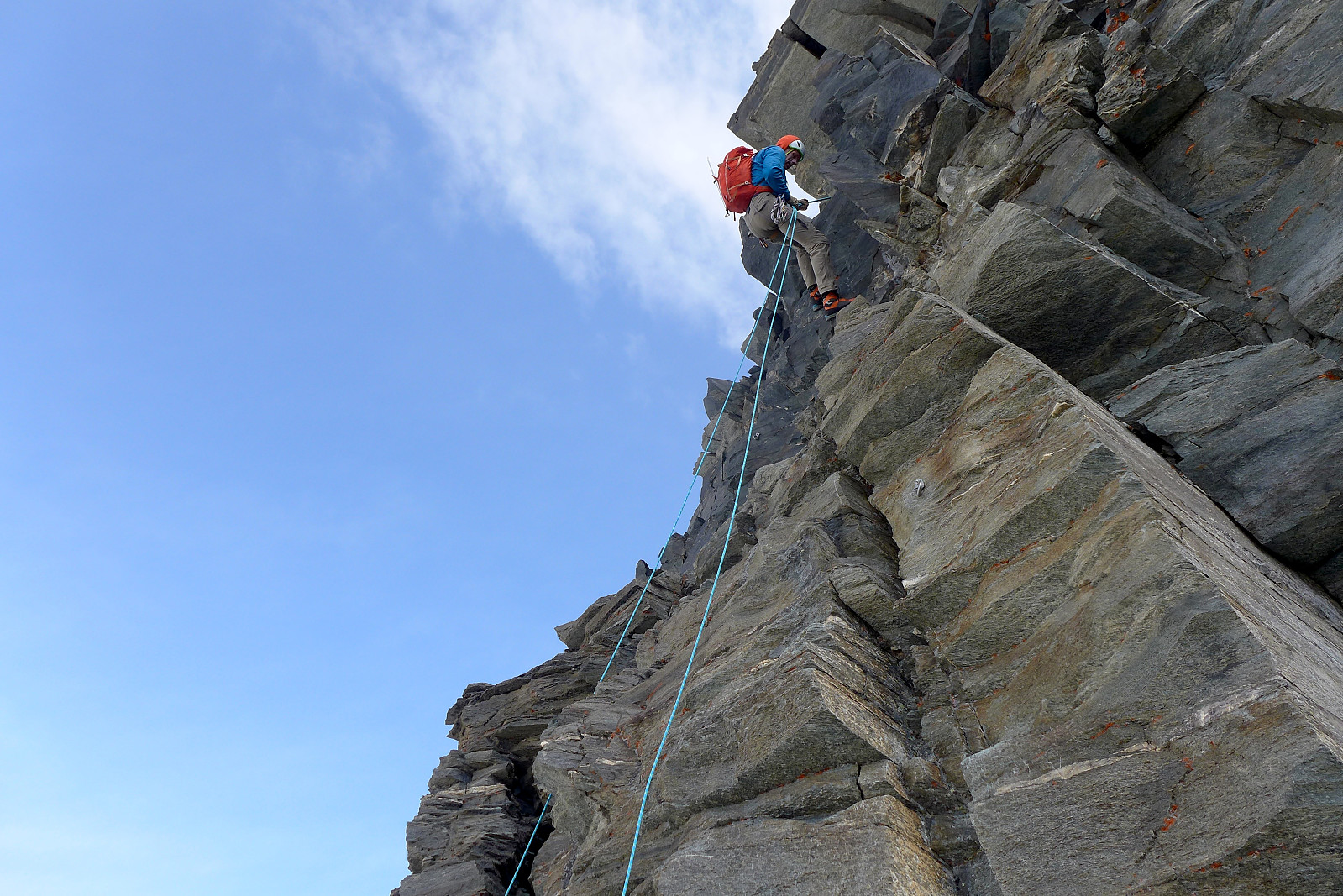
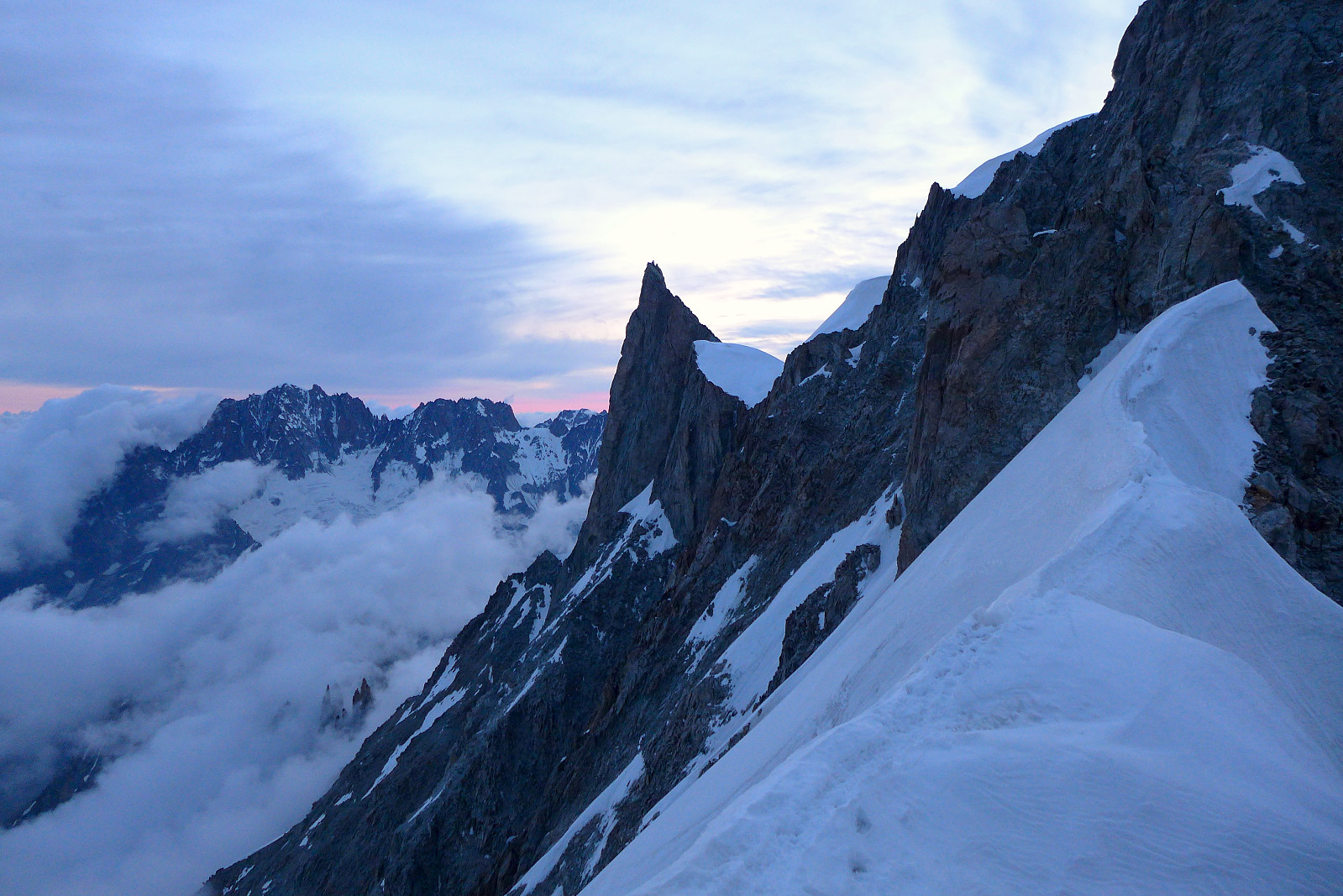 After coming back to Evolene from Saas Almagell there was a bit of a swap with guides so for the remainder of the 10 days I was going to be climbing again with Tim Neill whom I’d had a great week with in 2018. First on the plan was to make a new attempt to do the Rochefort traverse over Aiguilles de Rochefort and Dome de Rochefort – and fortunately there were beds available at the Torino hut for the following night when we wanted to get up there. The drive from Evolene to Courmayeaur took a couple of hours via the Grand St. Bernard pass and driving around through Aosta and finally northward to Courmayeur where we did a quick shopping trip at a local supermarket. Having gotten used to grocery shopping at Norwegian and Swiss prices, Italy seemed super cheap!
We then hopped onto the Skyway >>>
After coming back to Evolene from Saas Almagell there was a bit of a swap with guides so for the remainder of the 10 days I was going to be climbing again with Tim Neill whom I’d had a great week with in 2018. First on the plan was to make a new attempt to do the Rochefort traverse over Aiguilles de Rochefort and Dome de Rochefort – and fortunately there were beds available at the Torino hut for the following night when we wanted to get up there. The drive from Evolene to Courmayeaur took a couple of hours via the Grand St. Bernard pass and driving around through Aosta and finally northward to Courmayeur where we did a quick shopping trip at a local supermarket. Having gotten used to grocery shopping at Norwegian and Swiss prices, Italy seemed super cheap!
We then hopped onto the Skyway >>>
Weissmies
- Date:
- 16.07.2019
- Characteristic:
- Alpine climbing
- Duration:
- 6:00h
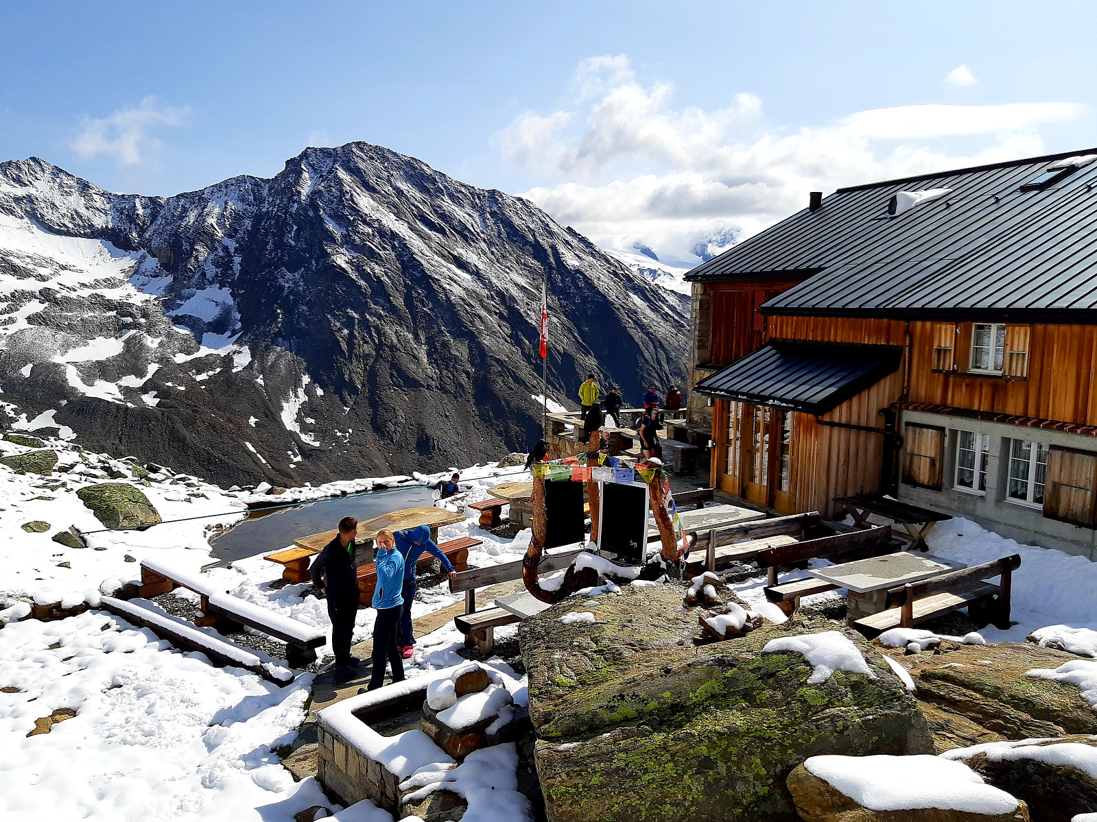 Back in the Alps again for my 10th summer visit, and like the previous 3 years with a base again in Evolene. I felt semi-acclimatised after having spent a few days hiking up to 3200m in the Saas valley the week before and since I’d arranged to have 1:1 guiding this year I was keen to tick off a few more of the 4000m peaks. For the first trip I was climbing with guide Graham Frost who I’d done the Dent Blanche with back in 2016 and initially I’d suggested heading over to the Torino hut to start with the Rochefort Arete since both the Aiguille de Rochefort and Dome de Rochefort were relatively low 4000ers and easy to access. However, since the Torino hut was fully booked and it had dumped it down with new snow on the first night we ended up joining guides Tim and Jon who were working for >>>
Jegihorn
- Date:
- 10.07.2019
- Characteristic:
- Hike
- Duration:
- 2:31h
- Distance:
- 5.6km
 Første dag på tur i Saas-dalen og det var en nydelig varm dag. Fikk utnyttet min "Citizens Pass" som gjør at man får bruke de fleste heiser gratis når man bor på en av de overnattingsstedene i Saas Grund/Saas Fee. Tok heisen opp til Kreuzboden og fulgte blå/hvit merking opp mot Jegihorn. På ca. 2700moh deler stien seg slik at den høyre stien går opp mot via ferrataen og den venstre fører man opp mot klatreveggen og stien som går rundt. Gikk i rolig tempo og tok flere små pauser underveis for å ta bilder, men det var litt under 1,5t opp alikevel. Flott utsikt mot mange av de 4000m toppene på andre siden av dalen bl.a. Strahlhorn, Allalinhorn, Alphubel, Taschhorn, Dom, Lenzspitze, Nadelhorn….. og så Lagginhorn og Weissmies som var i nærheten. Fin og kort morgentur >>>
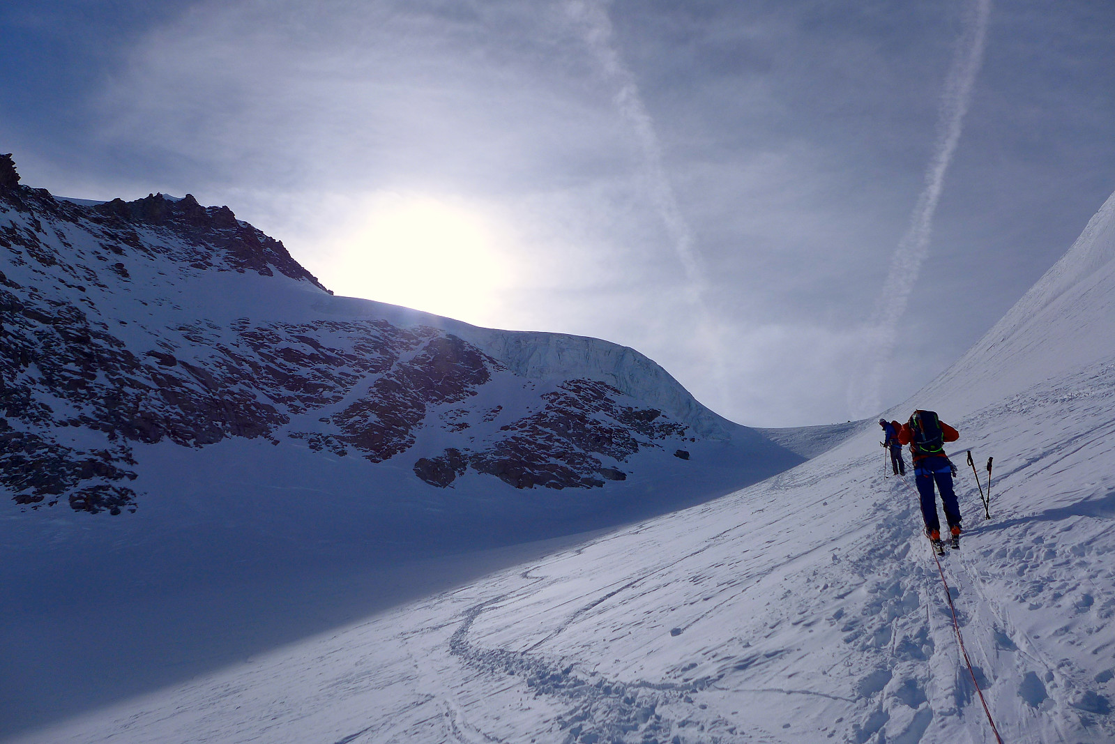
Pollux
- Date:
- 14.05.2019
- Characteristic:
- Alpine trip
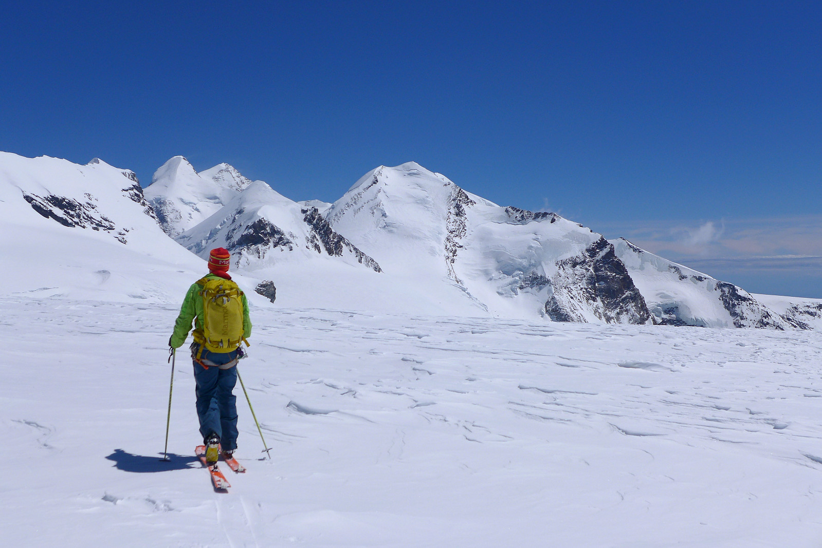 After having a chilled out weekend in Chamonix after our trip up the Dufourspitze I’d decided to stay for an extra few days in the Alps to make the most of the sunny weather that had been forecasted for the coming week, though I’d missed the fact that there were strong winds up high of around 70-80kph as well. Anyway since Rob and Simon were off to make an attempt on Mont Blanc, I was going to meet up with guide Thor Husted who was originally from Taos in New Mexico but had been living and working in Chamonix for a good part of the past 2 decades. We had a brief chat about possible objectives - I was at first keen to do an ascent of the Dom though after having taken into consideration the forecasted winds for tuesday morning, this didn’t seem particularly likely. The choice was mainly >>>
Dufourspitze
- Date:
- 10.05.2019
- Characteristic:
- Randonnée/Telemark
- Duration:
- 9:00h
- Distance:
- 24.0km
 I first climbed the Dufourspitze in 2003 as a novice mountaineer with the late female British guide Brede Arkless as the final peak on a 4-day long trip around the Italian side of the Monte Rosa massif. Due to my camera betteries dying at the Gnifetti hut I never did get any photos to remember the spectacular ridge traverse over the Zumsteinspitze and Dufourspitze from the Margherita hut, but had not forgotten that it was a peak to return to and do again! Sixteen years later, and after having a one day break following our ascent of the Gran Paradiso we had a few options for finishing off the week given that the weather in the Zermatt valley was forecasted to be awesome on the Friday. With the exception of the Dom and Bishorn there aren’t actually that many peaks in the Zermatt valley that >>>
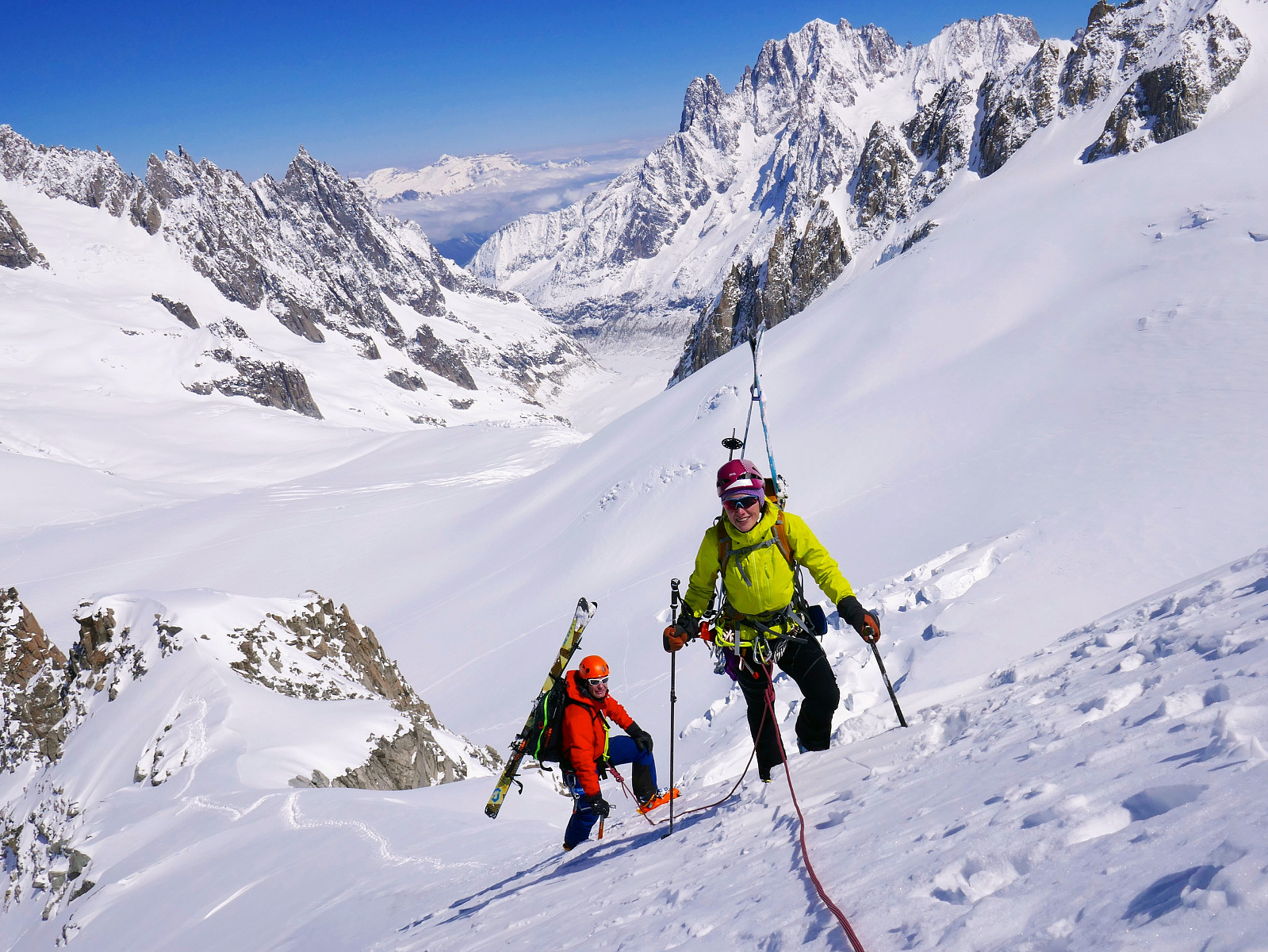
Gran Paradiso
- Date:
- 07.05.2019
- Characteristic:
- Randonnée/Telemark
- Duration:
- 8:24h
- Distance:
- 25.4km
 Another year and another trip to the Alps :) This year I was joining Simon (who I didn’t know before arriving in Chamonix) and our guide Rob Jarvis who I’ve skied with several times before, for a 4-day trip into the Bernese Oberland with the hope of ticking off some of the major 4000m peaks in the area. Well, that was the original plan anyway. Unfortunately the first week of May seemed to be offering nothing but unsettled weather north of the Rhone valley with a lot of new snow being dumped in the mountains - and most up in the Bernese Oberland. We’d already heard that there had been some avalanche fatalities in the Bernese Oberland in the week before we’d arrived, so it was a reminder that conditions were still full on winter up high. With the unsettled forecast in mind but potential >>>
Petit Flambeau
- Date:
- 06.05.2019
- Characteristic:
- Randonnée/Telemark
 Half day acclimatisation trip with Rob and Simon from the Skyway lift on the italian side of Mont Blanc. Skied Down the glacier west of the Petit Flambeau but not all the way down to the Glacier du Geant; skinned back up to a saddle on the north ridge of the peak and then walked up the rest of it. Great views and nice to have some light exercise before driving south to the Gran Paradiso.
Ober Gabelhorn
- Date:
- 15.08.2018
- Characteristic:
- Alpine climbing
- Duration:
- 12:00h
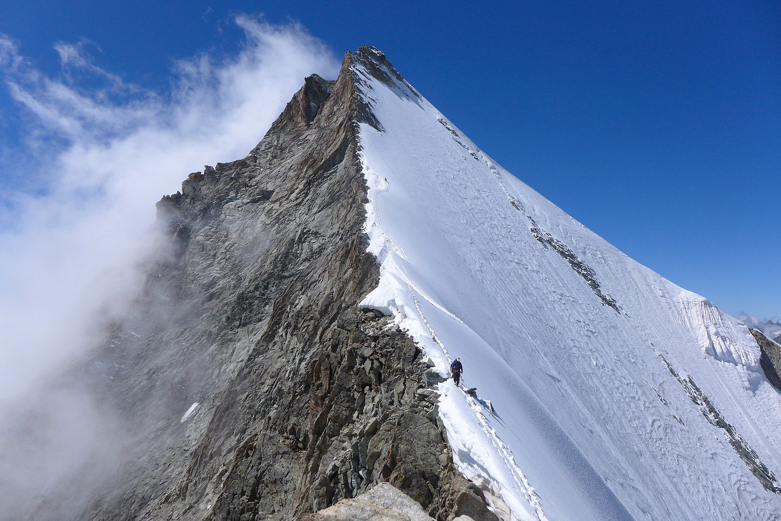 The weather was pretty wet on the Monday after we’d done the Gastlosen traverse, so we had ended up doing two short climbs at Bramois just outside of Sion and then going to the nearest cafe to plan the remainder of the week. Basically the weather was going to still be a little damp on Tuesday but both Wednesday and Thursday were looking good with a fairly high degree of certainty on meteoblue.com. The logical thing to do (in my mind at least) was to go to a hut where we could do two days of climbing and make the most of the good weather days, and the Rothorn hut seemed like the perfect solution since it gives access to both the Ober Gabelhorn and Zinalrothorn, two beautiful (and pointy) 4000m peaks which I have wanted to climb for much too long! The north face of the Ober Gabelhorn is a particularly >>>
Jegihorn
- Date:
- 10.08.2018
- Characteristic:
- Sport climbing
- Duration:
- 4:00h
 For the final day of the week climbing with Tim we left Evolene at 7.30am and headed over to Saas Grund to do a quick climb up the Jegihorn. Well, actually the intention was never to make it a quick climb, but that's how it turned out anyway. After driving through thick valley fog for most of the way we were still optimistic that the weather would be much better up high (assuming the webcam at Hohsaas we had checked was not from a previous sunny day!) and after getting off at Kreuzboden (ca. 2400m) we were met by somewhat better visibility and the odd glimpse of blue sky. In any case it was a very pleasant temperature to walk to the base of the climbing routes in. I think we used around an hour to do the approach walk (about 500m elevation gain) in a relaxed pace.
Once we arrived at the foot >>>
For the final day of the week climbing with Tim we left Evolene at 7.30am and headed over to Saas Grund to do a quick climb up the Jegihorn. Well, actually the intention was never to make it a quick climb, but that's how it turned out anyway. After driving through thick valley fog for most of the way we were still optimistic that the weather would be much better up high (assuming the webcam at Hohsaas we had checked was not from a previous sunny day!) and after getting off at Kreuzboden (ca. 2400m) we were met by somewhat better visibility and the odd glimpse of blue sky. In any case it was a very pleasant temperature to walk to the base of the climbing routes in. I think we used around an hour to do the approach walk (about 500m elevation gain) in a relaxed pace.
Once we arrived at the foot >>>
Grand Combin
- Date:
- 09.08.2018
- Characteristic:
- Alpine climbing
- Duration:
- 7:45h
 The Grand Combin ended up being the major summit of the week climbing with Tim and we were also joined by Janine and aspirant mountain guide Jack. It was nice to have another female for company, although when the other female has previously been on the British skimo racing team it made me a bit nervous about the pace we’d be hiking up to the Valsorey hut in ;) We left Evolene at around 9am on the wednesday and stopped at Martigny to pick up Jack before continuing the journey up to Bourg St. Bernard where the trail to the hut starts. With about 1200m of height gain it’s regarded as one of the "longer" hut walks and fortunately that means it also ends up being quieter. There was only a group of three female hikers and another couple other than us staying at the hut that evening. >>>

