Archive - Date
Archive - Activity
-
Climbing (43)
- Alpine climbing (31)
- Ice climbing (3)
- Mixed climbing (1)
- Sport climbing (3)
- Via ferrata (1)
-
Other trip (5)
- Expedition (5)
-
Other winter trip (5)
- Snowshoe trip (5)
-
Ski trip (449)
- Backcountry skiing (4)
- Cross-country skiing (2)
- Randonnée/Telemark (441)
-
Trip by foot (507)
- Alpine trip (47)
- Hike (196)
- Hillwalk (205)
- Jogging (4)
- Walk (55)
Peakbook-Friends


Unterrothorn
- Date:
- 15.08.2015
- Characteristic:
- Hillwalk
- Duration:
- 4:15h
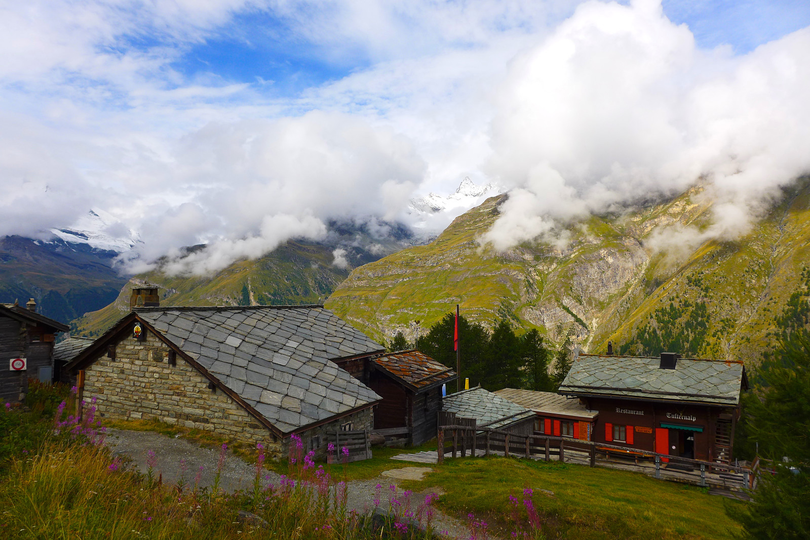 Nesten siste dag på ferie og været var ikke helt topps, så det ble en tur opp Rothorn. God sti/løype hele veien opp med skilting. Ble tatt igjen av to spreke karer omtrent en halvtime før jeg ankom toppen, men det var ellers lite folk ut på tur da jeg gikk opp. Relativt folksomt da jeg jogget ned i pøsregnet. Kan ikke si at det var en kjempefin tur, men det føltes godt å ha fått litt lufting før mye reising.
Jegigrat
- Date:
- 12.08.2015
- Characteristic:
- Alpine climbing
- Duration:
- 9:30h
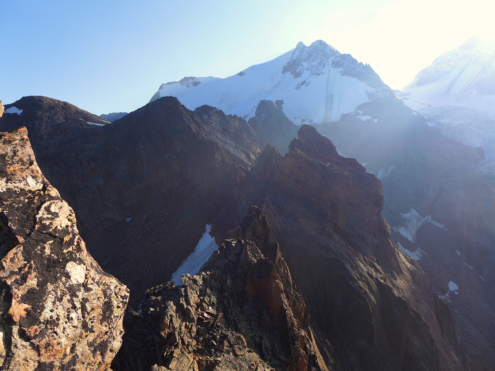 Final proper climb for this holiday. I’d had a few quiet days in Zermatt while there was thundery wet weather going and we had a quick chat after the weekend to plan where we would head next. Initially we’d thought to finish off with a relatively big objective – the east ridge on the Weisshorn – but after hearing that new snow had been dumped down to at least 3300m as a result of the bad weather it didn’t sound like there would be ideal conditions for doing that route. The visibility in Zermatt was still not good enough to allow for any mountains to be visible so it was difficult to evaluate the conditions up high. So instead our final objective ended up being the Jegigrat, a ridge connecting the Jegihorn and Fletschhorn a little north of the Weissmies hut. The highest top on the >>>
Breithorn
- Date:
- 08.08.2015
- Characteristic:
- Hike
- Duration:
- 1:30h
 Etter en latterlig varm fredag var jeg klar for en liten tur igjen. Varmen gjør meg raskt sliten og denne lørdagen skulle bli like varm som fredagen så det var kjekt å starte litt tidlig. Rocio skulle tilbringe helgen i Chamonix da de neste par dagene hadde fått en dårlig værmelding så planen var å vente til etter helgen og ta en prat om hvor vi skulle dra på siste turen da. Fikk høre med Boris og Ed siden de skulle overnatte på samme hotellet i Zermatt som meg og fant ut at de hadde planlagt å gå en liten morgentur til Breithorn. Spurte om jeg kunne bli med og heldigvis svarte de med ja, så plutselig så lørdagen min ikke så kjedelig ut. Vi tok frokost kl.7 og gikk opp til heisen like etter kl.7.30 for å kunne rekke den første som skulle opp til Klein Matterhorn kl.8. Føltes >>>
Matterhorn
- Date:
- 06.08.2015
- Characteristic:
- Alpine trip
- Duration:
- 8:30h
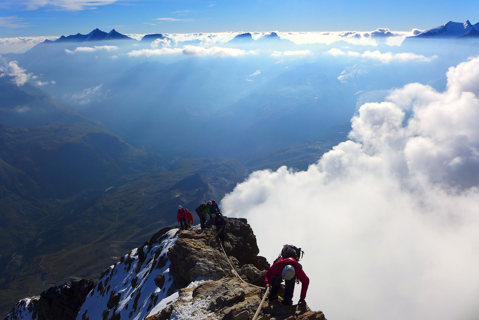 Having come down from the Eiger we now needed a new objective since the updated weather forecast seemed to be pretty promising for the next couple of days. Rocio had mentioned she had thought about doing a traverse of the Matterhorn, starting in Italy and finishing on the Swiss side but as a result of the hot temperatures this summer the Italian side of the mountain was recently closed because of rockfall risk. Fortunately the Hörnli ridge on the Swiss side was not. I have to admit that despite knowing about this famous Toblerone mountain since before I was even a teenager it has never been on my to-do list. I’ve heard a lot about how popular the ascent of the mountain is from the Hörnli ridge so anyone wanting to climb it must be able to move more or less continuously from start to finish >>>
Eiger traverse
- Date:
- 03.08.2015
- Characteristic:
- Alpine trip
- Duration:
- 9:00h
 After spending a night at the Cosmiques hut, Rocio and I discussed a few of our options in Chamonix. Rocio was keen to get some AD/D graded ridge climbs done and first on the list of possibilities was the Eiger since the heat wave in Europe this summer had now made the Mittellegi ridge in reasonable condition. I had of course done minimal research on the Eiger beforehand but I came here really to just do some decent climbing so if Rocio thought it was worth doing then I was more than happy to go along with it! It looked like Monday was going to be a decent weather day for summiting any peak so ideally we needed to be doing the walk in to a hut the next day. Unfortunately it seemed there were no beds available at the Mittellegi hut on Sunday night. So we needed a new plan. The south ridge on >>>
Aiguilles Crochues
- Date:
- 31.07.2015
- Characteristic:
- Alpine trip
- Duration:
- 4:00h
 Første dagen på alpeferie i år og det ble en nydelig tur over Aiguilles Crochues. Planen for denne ferien var å reise rundt med min venninne og aspirantguide Rocio. Tidligere i år hadde hun spurt meg om jeg var interessert i å teame opp med henne og finne noen fine alpinegger å klatre da hun hadde noen frie uker i forkant av sin siste eksamen og ville øve mest mulig. Siden jeg ikke hadde lagt ferieplanen akkurat da var det derfor et fint tilbud som jeg naturlig takket ja til. Vi møttes på Fleur des Neiges hvor jeg hadde overnattet og diskuterte planen for de neste dagene basert på værmeldinga og mtp akklimatisering. Været her i Chamonix var nydelig og varmt så det virket som en god ide å utnytte det istedenfor å kjøre østover mot Valaisalpene med en gang og finne på noe der. >>>
Punta de la Pierre
- Date:
- 02.02.2015
- Characteristic:
- Randonnée/Telemark
- Duration:
- 5:00h
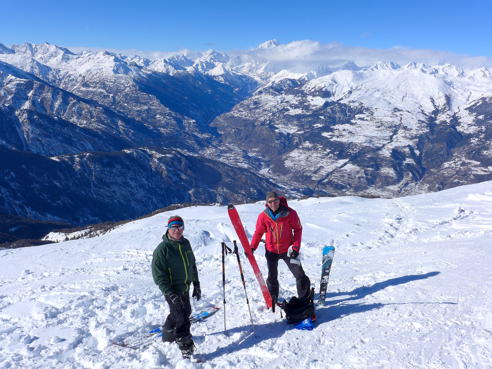 Da var det min siste hel dag på ferie i Chamonix og for å utnytte den ble jeg med på en tur med Rob og tre andre som hadde meldt seg på turen – John, James og Adam. Jeg hadde uansett ikke noen turkompiser å dra på tur med og var ikke kjent med turmuligheter i området, så å være med på en guidede dagstur virket som en naturlig og enkel løsning. Nok en gang var det snøvær i Chamonix men det så ut til å bli mye finere vær på andre siden av den Mont Blanc tunnelen i Aostadalen. Skredfaren var en 3-er der i dag mens det var fortsatt på nivå 4 i Chamonix.
Planen var derfor å gå opp Pointe de la Pierre fra ei liten bygd som heter Ozein, på ca. 1400m. Turen går mye i slakt terreng på nord/nordvestsiden av fjellet, så det skulle være et trygt valg med god tørrsnø her. Det >>>
Da var det min siste hel dag på ferie i Chamonix og for å utnytte den ble jeg med på en tur med Rob og tre andre som hadde meldt seg på turen – John, James og Adam. Jeg hadde uansett ikke noen turkompiser å dra på tur med og var ikke kjent med turmuligheter i området, så å være med på en guidede dagstur virket som en naturlig og enkel løsning. Nok en gang var det snøvær i Chamonix men det så ut til å bli mye finere vær på andre siden av den Mont Blanc tunnelen i Aostadalen. Skredfaren var en 3-er der i dag mens det var fortsatt på nivå 4 i Chamonix.
Planen var derfor å gå opp Pointe de la Pierre fra ei liten bygd som heter Ozein, på ca. 1400m. Turen går mye i slakt terreng på nord/nordvestsiden av fjellet, så det skulle være et trygt valg med god tørrsnø her. Det >>>
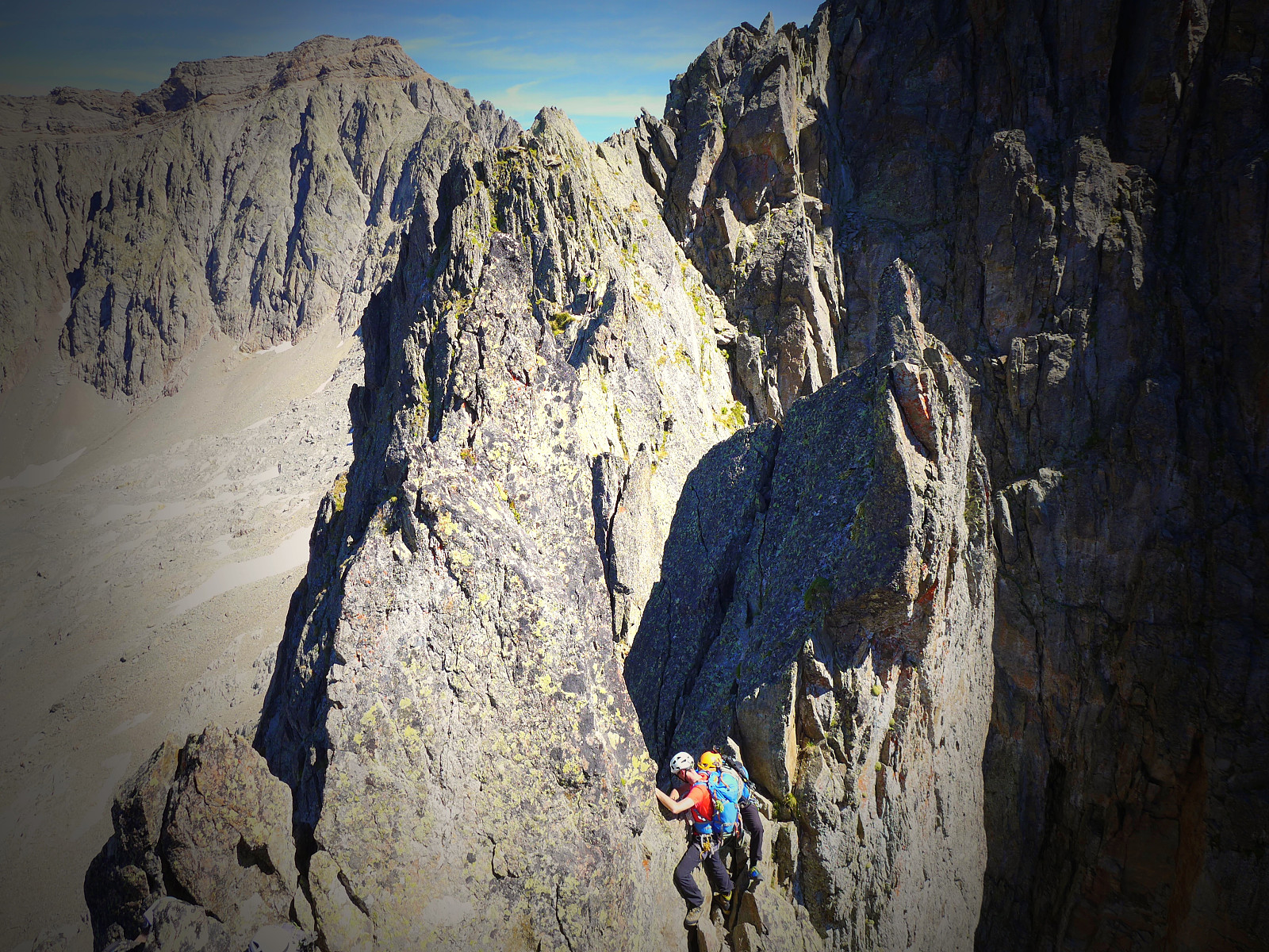
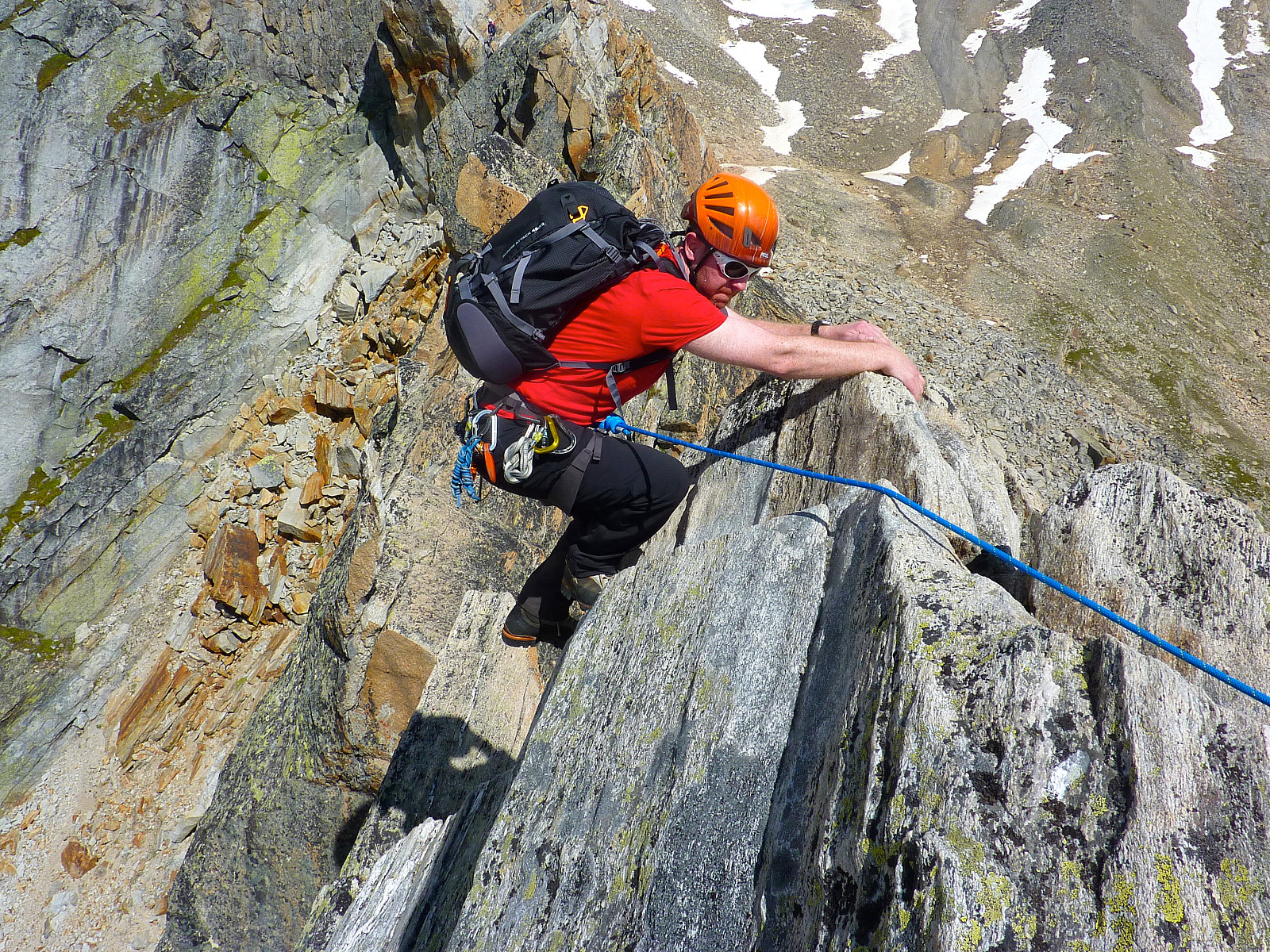
Portjengrat traverse
- Date:
- 22.08.2014
- Characteristic:
- Alpine climbing
- Duration:
- 10:30h
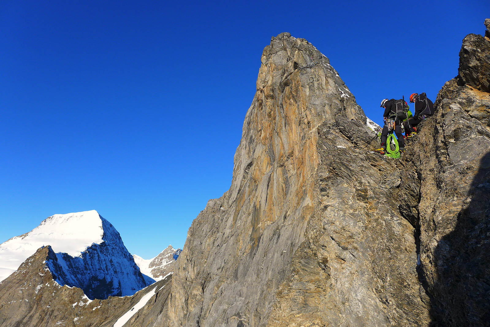
 Final day of the climbing week. Objective: Portjengrat. This is a ca. 1km long ridge route at alpine AD/AD+ and according to the guidebook, required in the region of 9 hours to complete from the Almageller hut. Originally Terry had proposed that we have breakfast at 3.30am again to leave by 4am, but since the hut wardens weren’t serving breakfast earlier than 5am, it meant that we would aim to leave by 5.30am. Luxury alpine start?(!). I slept incredibly well, despite sharing a small dormitory with approx. 8 or 9 other guys. This has to be the first time EVER I have stayed in an alpine hut with so many guys who DON’T snore! Unbelievable. In a good way :)
The atmosphere round our table at breakfast was somewhat quiet, in contrast to some of the other groups who seemed un-normally chatty for >>>
Final day of the climbing week. Objective: Portjengrat. This is a ca. 1km long ridge route at alpine AD/AD+ and according to the guidebook, required in the region of 9 hours to complete from the Almageller hut. Originally Terry had proposed that we have breakfast at 3.30am again to leave by 4am, but since the hut wardens weren’t serving breakfast earlier than 5am, it meant that we would aim to leave by 5.30am. Luxury alpine start?(!). I slept incredibly well, despite sharing a small dormitory with approx. 8 or 9 other guys. This has to be the first time EVER I have stayed in an alpine hut with so many guys who DON’T snore! Unbelievable. In a good way :)
The atmosphere round our table at breakfast was somewhat quiet, in contrast to some of the other groups who seemed un-normally chatty for >>>
Dri Hörnli
- Date:
- 21.08.2014
- Characteristic:
- Alpine climbing
- Duration:
- 6:00h
 After some heavy rain showers during the previous evening, we all woke up to a surprisingly sunny morning in Saas Grund. Turns out the weather was proving to be better than what we’d expected from the forecast. Anyway, we had a decent, laid-back breakfast and got ready to leave at around 10am. The plan for today was to walk up to the Almageller hut, leave behind stuff we didn’t need and then do an afternoon climb on the Dri Horlini (or Dri Hörnli), which is graded at around 4/4+. It was great to be wearing lighter and more flexible boots today too! I had only tested out a pair of Scarpa Rebel Lite goretex boots on one or two hikes before leaving Tromsø, so I hoped they would be equally as comfortable now.
The walk up to the hut starts from Saas Almagell. We saved ourselves one or two hundred >>>
After some heavy rain showers during the previous evening, we all woke up to a surprisingly sunny morning in Saas Grund. Turns out the weather was proving to be better than what we’d expected from the forecast. Anyway, we had a decent, laid-back breakfast and got ready to leave at around 10am. The plan for today was to walk up to the Almageller hut, leave behind stuff we didn’t need and then do an afternoon climb on the Dri Horlini (or Dri Hörnli), which is graded at around 4/4+. It was great to be wearing lighter and more flexible boots today too! I had only tested out a pair of Scarpa Rebel Lite goretex boots on one or two hikes before leaving Tromsø, so I hoped they would be equally as comfortable now.
The walk up to the hut starts from Saas Almagell. We saved ourselves one or two hundred >>>

