Babia Góra - 1,725m

|
|

© Martin Kovář |
||||||||||||||||||||||||||
| Content | |
|---|---|
| Language | |
| Adviser | none |
| Statistics |
Overall 8 members have registered 19 ascents of Babia Góra. Babia Góra is contained on 4 lists. |
Map
Introduction
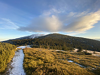
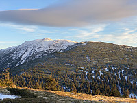
Babia Góra [ˈbabja ˈɡura] (in Polish), literally Old Wives' or Witches' Mountain, is a massif situated on the border between Poland and Slovakia in the Western Beskidy Mountains. The name is also applied to the culmination of the massif, Diablak ("Devil's Peak"), which is also the highest peak of this part of the Carpathian Mountains, at 1,725 metres (5,659 ft) above sea level.
Other pictures
Trip Reports

- 1


User comments