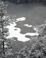
Around Spelhaugen in the snow (27.12.2015)

Written by HHauser (Helwig Hauser)

| Start point | Ørnahaugen (65m) |
|---|---|
| Endpoint | Varden (45m) |
| Characteristic | Hillwalk |
| Duration | 1h 30min |
| Distance | 5.0km |
| Vertical meters | 291m |
| GPS |
|
| Ascents | Langaheia (130m) | 27.12.2015 |
|---|---|---|
| Visits of other PBEs | Lurane (120m) | 27.12.2015 |
| Spelhaugen p-plass (60m) | 27.12.2015 | |
| Sælen kirke p-plass (15m) | 27.12.2015 |

Trip Summary
We started from Ørnahaugen and descended along a small path towards Lauvåstjørna, first. Instead of walking further on Barliveien (towards Spelhaugen), we turned right and took a pedestrians path up towards Løvåsbakken. Before getting down, in between the blocks, there, we turned left and passed by the blocks on their backside. When coming to a simple street, we turned left and followed this street up to a parking place between the trees. From there, we went in western direction, up and down (on Lurane), before turning a bit more nothwards. There, we connected to a major path, which leads us down towards the very end of Spelhaugen. Instead of walking down to the parking place, we stepped down a steep slope and came to this gravel road, which connects Spelhaugen and Tennebekktjørna. We walked this road down a little, into the direction Spelhaugen, but before coming to the parking spot, we turned right and took the path which leads up to Krokatjørna. Instead of passing by Krokatjørna on the western side, we crossed over Langaheia, from where we enjoyed a good view on Krokatjørna. From there, we walked down towards Varden. All in all, this was a nice and refreshing hike through Kanadaskogen in fresh winter snow. :-)
Photos
Selected photos are available as Google+ photo album.


User comments