Finnbunuten (15.10.2016)

Written by HHauser (Helwig Hauser)

| Start point | Samecampen (780m) |
|---|---|
| Endpoint | Rv13 (915m) |
| Characteristic | Hillwalk |
| Duration | 5h 00min |
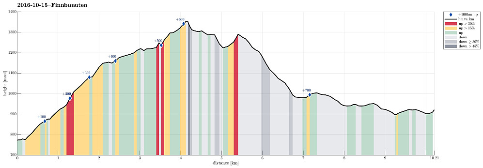
| Distance | 10.2km |
| Vertical meters | 776m |
| GPS |
|
| Ascents | Finnbunuten (1,357m) | 15.10.2016 |
|---|---|---|
| Visits of other PBEs | Samecampen Vikafjell (780m) | 15.10.2016 |
| Sendedalen parkering (921m) | 15.10.2016 |

Trip Summary
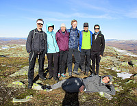
We left E16 northeast of Voss and took road 13 to the north in the direction of Myrkdalen, Vikafjellet. We passed Myrkdalen and the ski center north of it, driving into Holedalen. At the very end of that valley, the road winds steeply upwards at Halsabakkane with the help of four u-turns. Only shortly after, we parked (near Samecampen at Vikafjellet) and crossed the Sendo stream using the rest of a small bridge that leads over to the other, southwestern side. A few minutes later, we reached a place called Finnbuene, where previously people stayed in summer. From there, we continued in southeastern direction towards the edge above Holedalen. While ascending, we slowing changed to a more southern course, heading into the direction of Kaldavatnet. Hiking this part of this trip is straight forward and simple; it's basically possible to choose between a variety of different routes, all leading further upwards. Above Kaldavatnet, we came more and more onto a westbound route, now oriented directly towards the top of Finnbufjellet. At the top, at Finnbunuten, we found ourselves in the company of quite many others; maybe most of them had ascended Finnbunuten from Myrkdalen, right south of this top. Since it was quite windy and not exactly warm, we countinued basically right away, aiming to complete a round back to our parked cars. The original plan, inspired by a trip description in book Opptur Hordaland, was to continue along the ridge in southwestern direction, before turning right and into Sengedalen (towards Holmavatnet). We went down into the dip right next to Finnbunuten (southwest of the top) and aimed at following the ridge further on its northwestern side (on the upper edge of the steep, northwestern side of Finnbufjellet). Soon after, we started to consider a different route down, rounding Fjærestadbotnane on the eastern and than northern side. It also looked like if it would be possible to somehow reach this ridge, north of Fjærestadbotnane, descending diagonally from Finnbufjellet into northern direction. After having started into this direction, we nonetheless had to understand that this route was more difficult than expected. We continued along the upper side of some taller, vertical cliffs. Eventually, we had to ascend, again, a good bit, before finding an area, where it was possible to cross over to the ridge, which we had aimed at. We found a large patch of old snow, many meters thick, still, which we used to get over and down. Once on this ridge, it was straight forward and easy to step down into Sengedalen (the southestern side of it). East of the northern end of Kinglavatnet, we found a simple path that continued in northeastern direction, following the southeastern side of Sengedalen. This path leads further around the northern end of Finnbufjellet and connects back to Finnbuene, where we had started out hike. Around half the way along this path, we decided, however, to cross over to the northern side of Sengedalen. With a bit of back and forth (there are also a few parts within Sengedalen that we nontrivial to cross over), we came to some heights directly south of Lars-Olavatnet. We found a suitable spot to cross over the water that leaves Lars-Olavatnet (Sendo), at its very eastern end, and connected to the well-marked hiking path through Sendedalen that extends along the northwestern side of this wide valley. Shortly after, we then reached the road 13, which concluded this hike. All in all, this hike was very nice, in beautiful autumn weather (it was windy and not really warm, but not too cold, fortunately). Once again it became clear that comparably small obstacles (few meters high cliffs, for example) can still require some significant detours, when hiking without a path. This is good to keep in mind.
Photos
Selected photos are available as Google photo album.
Useful Resources
See also the related FB-page Hiking around Bergen, Norway.
Web page WestCoastPeaks.com provides useful information about Grøndalsfjellet and Finnbunuten and also Petter Bjørstad has a useful page about Finnbunuten.


User comments