Arkiv - dato
Arkiv - aktivitet
-
Annen tur (3)
- Kajakkpadling (3)
- Fottur (1782)
-
Kjøretur (9)
- Biltur (9)
-
Skitur (109)
- Fjellskitur (65)
- Langrennstur (44)
-
Sykkeltur (108)
- Blandet sykling (25)
- Gatesykling (83)
Lister jeg samler etter
-
Voss ≥ 100m pf.
(96/98)
 97%
97% -
Opptur Hordaland
(143/159)
89%
-
Stasjoner på Bergensbanen
(31/40)
77%
-
Ulvik ≥ 100m pf.
(28/38)
73%
-
Hordaland ≥ 100m pf.
(613/863)
71%
-
Mjølfjell PF > 100m
(21/31)
67%
-
Jondal ≥ 100m pf.
(15/23)
65%
-
Sunnhordland PF >= 100m
(104/186)
55%
-
Dagsturhyttene i Vestland
(33/61)
54%
-
Hordaland: Hardanger PF>=100m
(186/359)
51%
-
Kvinnherad ≥ 100m pf.
(40/79)
50%
-
DNT-hytter i Hordaland
(22/45)
48%
-
Sogndal ≥ 100m pf.
(23/81)
28%
-
Vik i Sogn ≥ 100m pf.
(8/46)
17%
-
DNT-hytter i Sogn og Fjordane
(8/47)
17%
-
Eidfjord ≥ 100m pf.
(7/42)
16%
-
Etne ≥ 100m pf.
(7/51)
13%
-
Ullensvang ≥ 100m pf.
(21/153)
13%
-
Sogn - Sør for Sognefjorden PF>=100m
(17/159)
10%
-
Opptur-topper i Sogn og Fjordane
(17/177)
9%

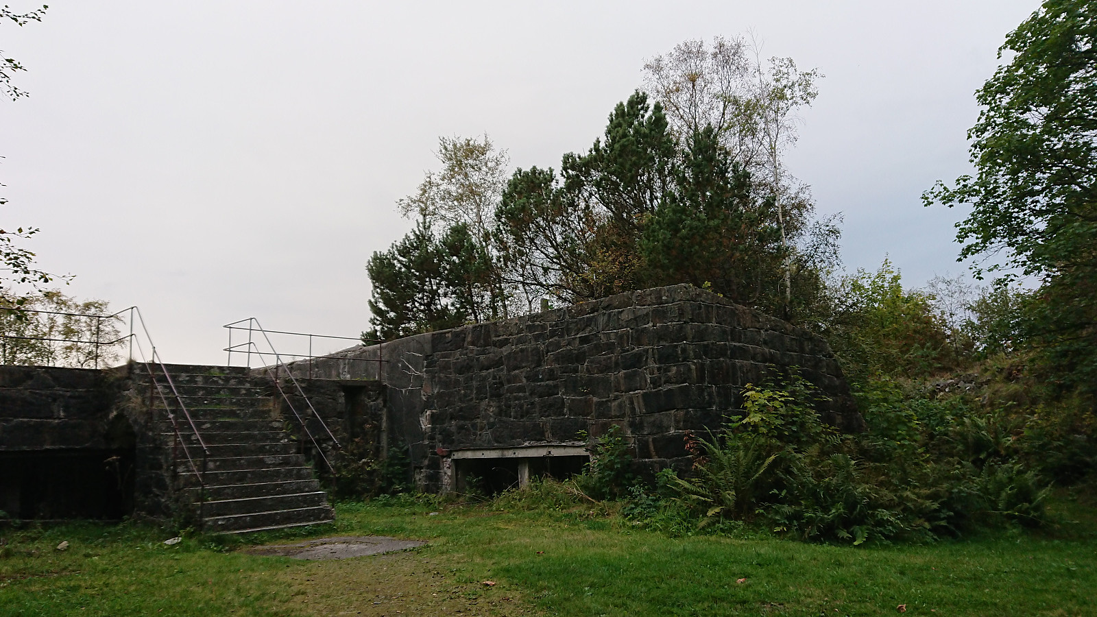
Across Hellen festning
- Dato:
- 23.09.2021
- Turtype:
- Fottur
- Turlengde:
- 0:34t
- Distanse:
- 3,2km
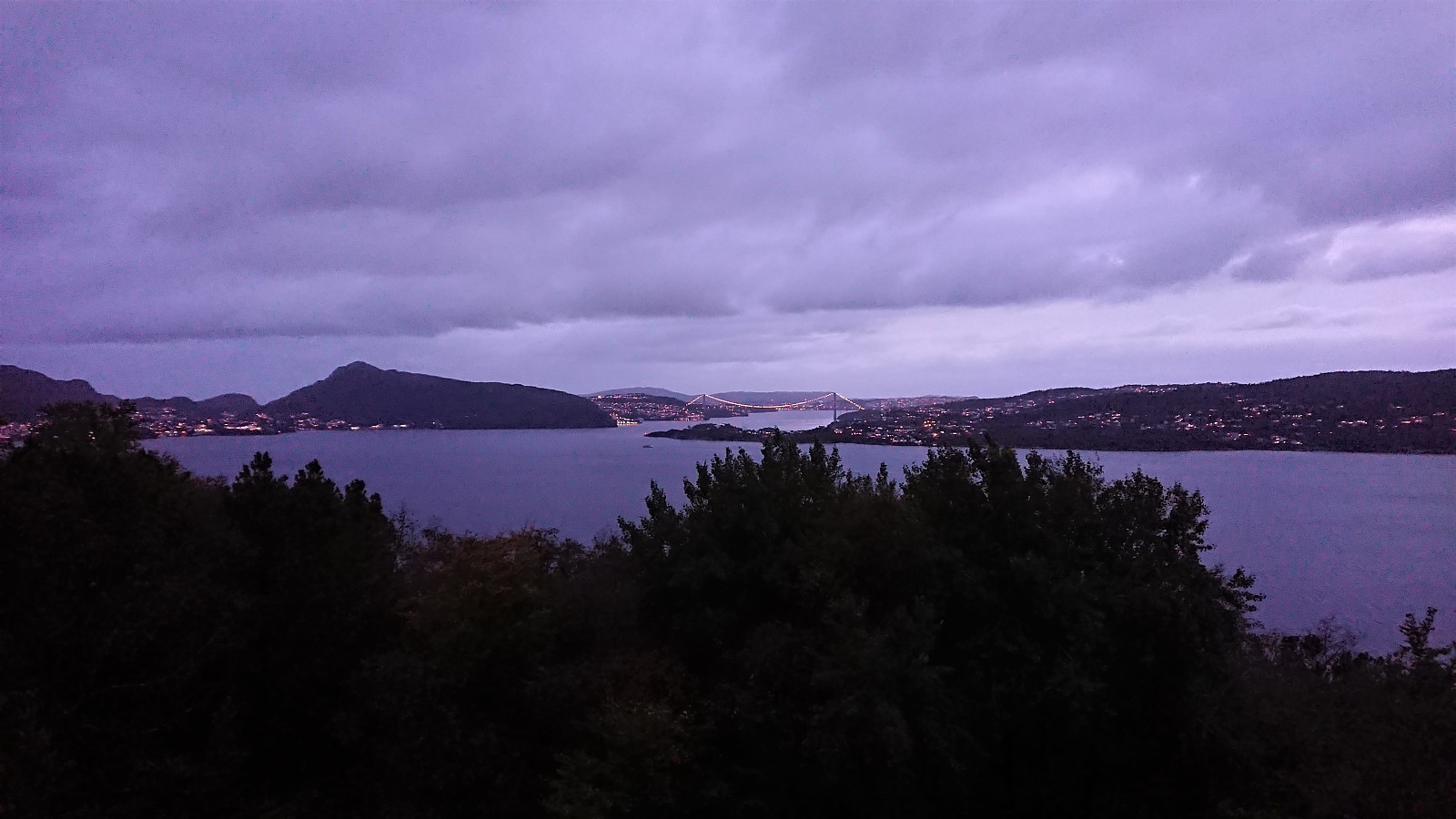 Another short local evening hike.
Across Hellen festning
- Dato:
- 21.09.2021
- Turtype:
- Fottur
- Turlengde:
- 0:36t
- Distanse:
- 3,1km
 Short local hike after a day at the home office.
Cycling: Storahugen
- Dato:
- 19.09.2021
- Turtype:
- Gatesykling
- Turlengde:
- 2:19t
- Distanse:
- 32,2km
 Short bike trip with the main objective of visiting Storahugen , yet another new minor peak on the Alle topper i Bergen list. Not much to say about this one. Limited views, but at least it can be easily accessed via a trail from the north. And getting to the trailhead by bike was straightforward, which overall made for a more interesting trip. When at the summit I also noticed that there are plenty of other small named hills in the area. So I have a feeling I'll be coming back when more of these are added to the Alle topper i Bergen list. But given that I had not in advanced looked into whether any of these could be easily accessed or not, this would have to wait.
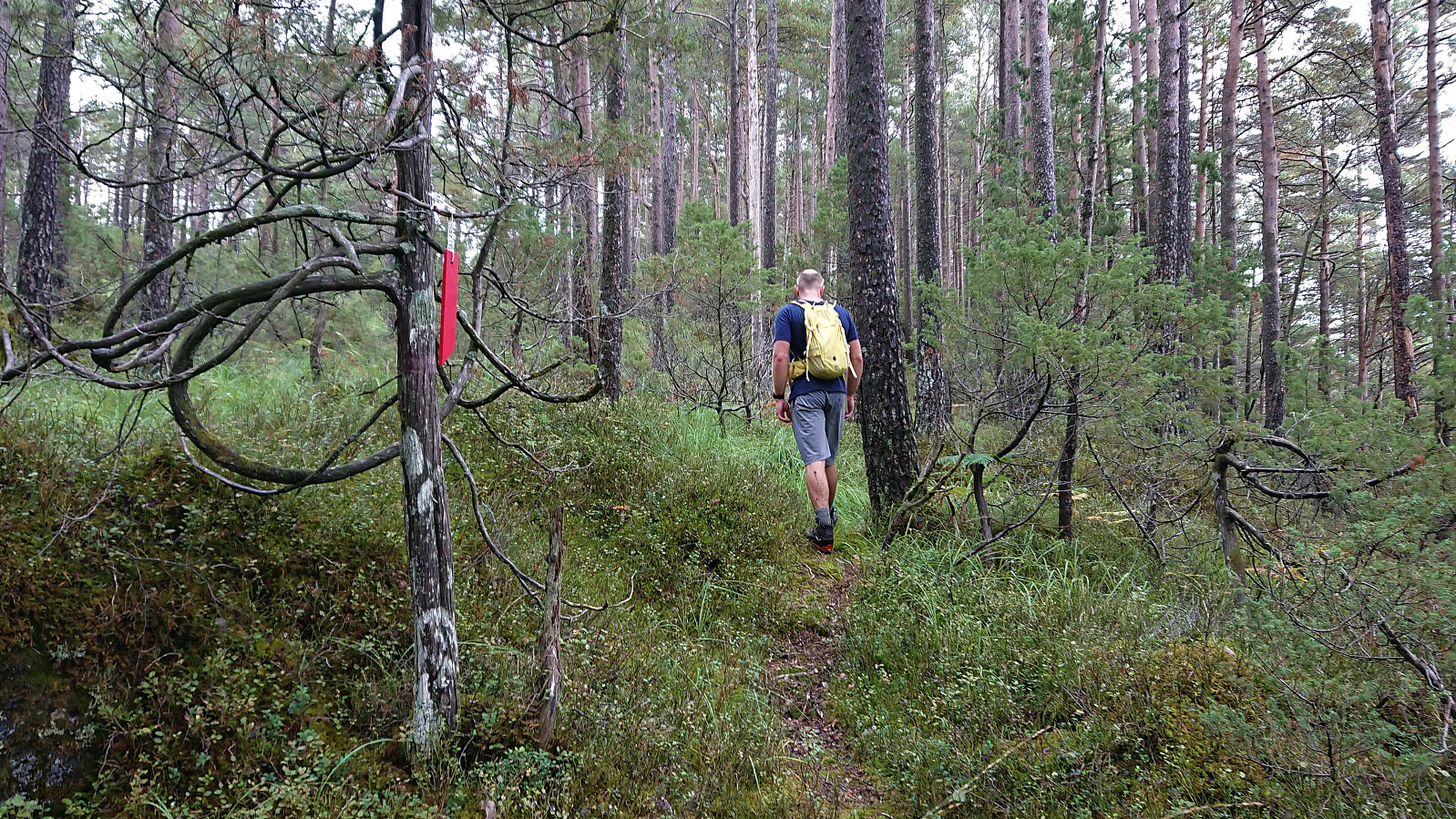
Vedasnerta and Nessteinen from Nes/Mundheimsvegen
- Dato:
- 18.09.2021
- Turtype:
- Fjelltur
- Turlengde:
- 6:17t
- Distanse:
- 18,9km
 Since my trip to Vågenipen and Lukefjellet two weeks earlier , I had wanted to get a closer look at Vedasnerta and Nessteinen on the opposite side of Mundheimsdalen, as they both looked quite dramatic from a distance. When researching how to best visit both summits, I came across a route description at ut.no that looked very promising as it indicated a marked trail all the way to the summit of Nessteinen: https://ut.no/turforslag/119653/nessteinen . The suggestion did not mention Vedasnerta at all, but I assumed that the short off-trail ascent from Vatnadalsvatnet (in the valley between Nessteinen and Vedasnerta) would not be too difficult.
I started by taking the bus from Bergen to Mundheim. Here I switched to a connecting bus heading for Norheimsund, which I only stayed on for two stops before getting off at the bus stop called Teigland right next to the start of the tractor road indicated on the route at >>>
Since my trip to Vågenipen and Lukefjellet two weeks earlier , I had wanted to get a closer look at Vedasnerta and Nessteinen on the opposite side of Mundheimsdalen, as they both looked quite dramatic from a distance. When researching how to best visit both summits, I came across a route description at ut.no that looked very promising as it indicated a marked trail all the way to the summit of Nessteinen: https://ut.no/turforslag/119653/nessteinen . The suggestion did not mention Vedasnerta at all, but I assumed that the short off-trail ascent from Vatnadalsvatnet (in the valley between Nessteinen and Vedasnerta) would not be too difficult.
I started by taking the bus from Bergen to Mundheim. Here I switched to a connecting bus heading for Norheimsund, which I only stayed on for two stops before getting off at the bus stop called Teigland right next to the start of the tractor road indicated on the route at >>>
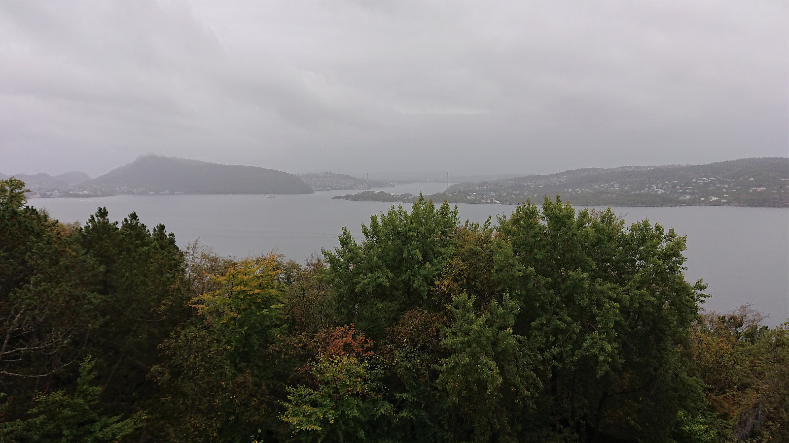
Across Hellen festning
- Dato:
- 15.09.2021
- Turtype:
- Fottur
- Turlengde:
- 0:37t
- Distanse:
- 3,2km
 Short local evening hike.
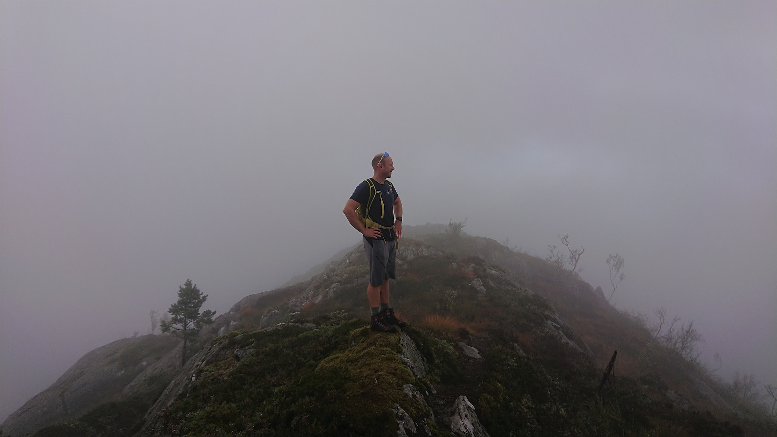
Heinakken and Kjerringefjellet
- Dato:
- 12.09.2021
- Turtype:
- Fjelltur
- Turlengde:
- 2:50t
- Distanse:
- 7,4km
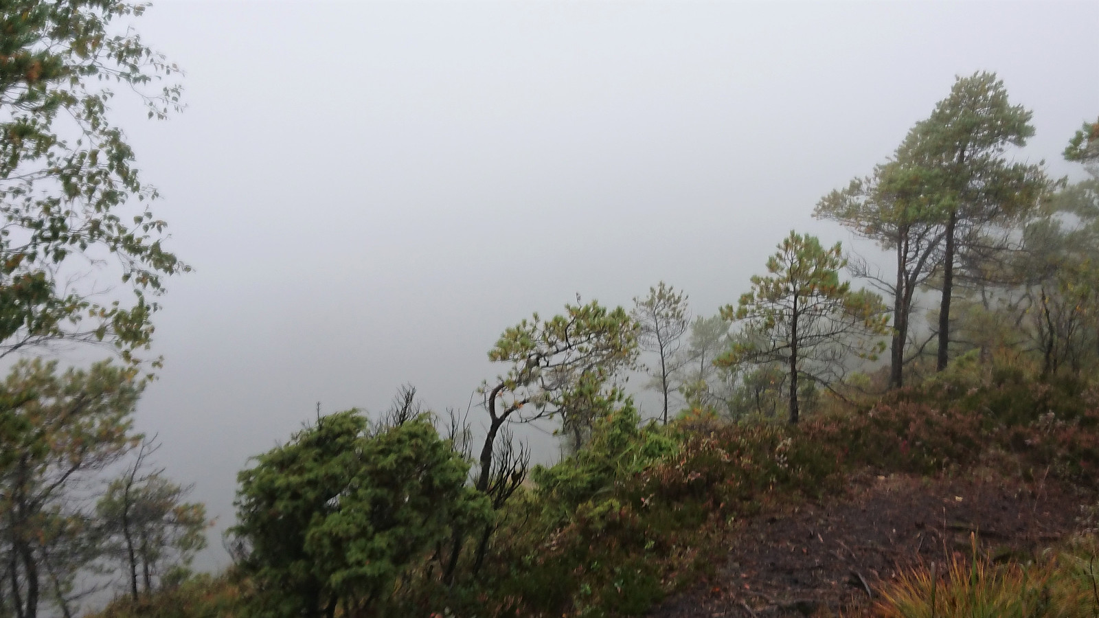
 After our failure at obtaining any views at all from Matrenipa , me and Fjellsamleren (Endre Myrdal Olsen) did not give up, got back in the car, and drove to the valley in between Heinakken and Kjerringefjellet . Here we found parking on the side of the road, right next to the marked trailhead for Heinakken, and proceeded to follow the marked trail (quite wet at times, but otherwise easy to follow) all the way to the large cairn south of the summit, were we finally escaped the fog and were rewarded by excellent panoramic views across Masfjorden.
From the large cairn we shortly retraced out steps before making the final ascent to the summit of Heinakken from the southeast. No trails to the summit, but reaching it did not provide any difficulties. Great views from the summit as well, but if visiting Heinakken it is clearly recommended to also make the short detour >>>
After our failure at obtaining any views at all from Matrenipa , me and Fjellsamleren (Endre Myrdal Olsen) did not give up, got back in the car, and drove to the valley in between Heinakken and Kjerringefjellet . Here we found parking on the side of the road, right next to the marked trailhead for Heinakken, and proceeded to follow the marked trail (quite wet at times, but otherwise easy to follow) all the way to the large cairn south of the summit, were we finally escaped the fog and were rewarded by excellent panoramic views across Masfjorden.
From the large cairn we shortly retraced out steps before making the final ascent to the summit of Heinakken from the southeast. No trails to the summit, but reaching it did not provide any difficulties. Great views from the summit as well, but if visiting Heinakken it is clearly recommended to also make the short detour >>>
Matrenipa
- Dato:
- 12.09.2021
- Turtype:
- Fjelltur
- Turlengde:
- 1:38t
- Distanse:
- 3,9km
 On the drive home to Bergen from our day of wet hikes with no views in Masfjorden (see Kyrkjehovda , Vardegga from Fossåskaret , Snaueggi - an unplanned roundtrip and Ølveshovda ) me and Fjellsamleren (Endre Myrdal Olsen) could not help but note the excellent weather forecasts for the next day, i.e. warm and sunny, and thus agreed to have another joint hike, with the hope that maybe we could actually see something from one of the summits this time around.
We decided on three summits in Masfjorden and met up the next day for the drive to Matre and the parking lot west of Matrenipa . On the drive there we however could not help but notice that, except for it not raining, the weather looked very similar to the day before with the now familiar fog hiding most of the mountain tops. Hopefully that today it would at least partly clear up we started on the marked trail to Matrenipa.
The trail was very wet but overall easy to follow and we >>>
On the drive home to Bergen from our day of wet hikes with no views in Masfjorden (see Kyrkjehovda , Vardegga from Fossåskaret , Snaueggi - an unplanned roundtrip and Ølveshovda ) me and Fjellsamleren (Endre Myrdal Olsen) could not help but note the excellent weather forecasts for the next day, i.e. warm and sunny, and thus agreed to have another joint hike, with the hope that maybe we could actually see something from one of the summits this time around.
We decided on three summits in Masfjorden and met up the next day for the drive to Matre and the parking lot west of Matrenipa . On the drive there we however could not help but notice that, except for it not raining, the weather looked very similar to the day before with the now familiar fog hiding most of the mountain tops. Hopefully that today it would at least partly clear up we started on the marked trail to Matrenipa.
The trail was very wet but overall easy to follow and we >>>
Ølveshovda
- Dato:
- 11.09.2021
- Turtype:
- Fjelltur
- Turlengde:
- 1:05t
- Distanse:
- 4,0km
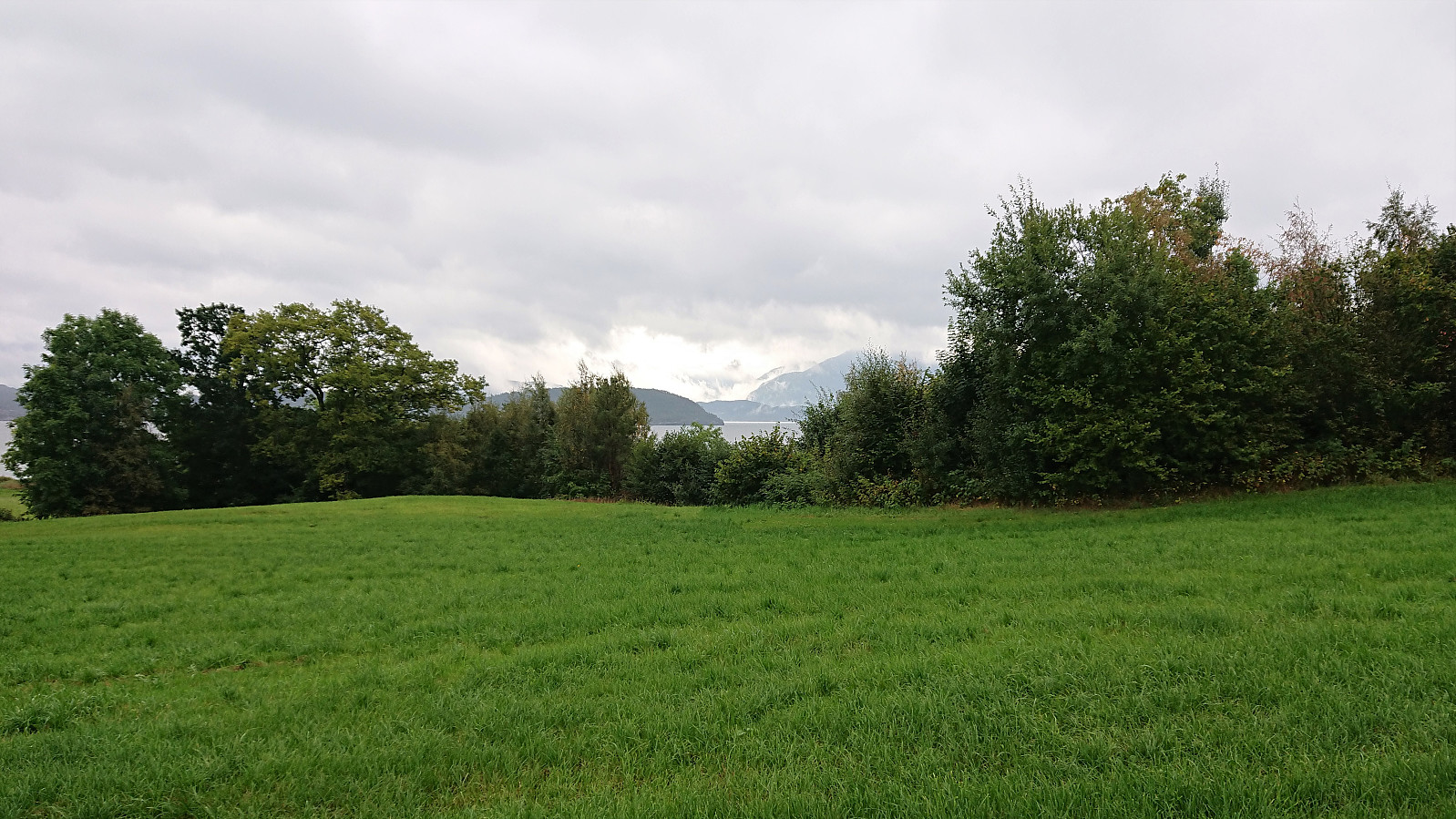 After visiting Kyrkjehovda , Vardegga and Snaueggi in pouring rain and with little to no views due to a particularly thick fog, both me and Fjellsamleren (Endre Myrdal Olsen) felt a drop in motivation. However, given that we were now very close to Ølveshovda we decided to make one last push and also visit it before returning to Bergen.
We parked next to Ølve Kyrkje and continued on foot along a gravel road to the marked trailhead. We could now for the first time look across Kvinnheradsfjorden and spot both Snilstveitsøy and several of the higher mountains behind it. Maybe we could finally get some views from one of the visited summits? However, we soon ascended into the thick fog, and it became clear that there would be no views this time either.
While the information sign at the start of the hike had encouraged us to take it slow and enjoy the views, we did not >>>
After visiting Kyrkjehovda , Vardegga and Snaueggi in pouring rain and with little to no views due to a particularly thick fog, both me and Fjellsamleren (Endre Myrdal Olsen) felt a drop in motivation. However, given that we were now very close to Ølveshovda we decided to make one last push and also visit it before returning to Bergen.
We parked next to Ølve Kyrkje and continued on foot along a gravel road to the marked trailhead. We could now for the first time look across Kvinnheradsfjorden and spot both Snilstveitsøy and several of the higher mountains behind it. Maybe we could finally get some views from one of the visited summits? However, we soon ascended into the thick fog, and it became clear that there would be no views this time either.
While the information sign at the start of the hike had encouraged us to take it slow and enjoy the views, we did not >>>
Snauegga - an unplanned roundtrip
- Dato:
- 11.09.2021
- Turtype:
- Fjelltur
- Turlengde:
- 1:15t
- Distanse:
- 4,5km
 After visiting Kyrkjehovda and Vardegga , me and Fjellsamleren (Endre Myrdal Olsen) drove south to Berge where we easily located the marked trailhead for Snauegga (the sign says Eggjane). However, the suggested route was blocked with a herd of what was either very large calves or bulls. This left us rather skeptical with regards to passing right by them, especially as they all seemed rather interested in us. We therefore decided to make a short detour hoping the large animals would stay where they were and not follow us. And besides having to cross two barbed wire fences (of which the first was partly hidden and close to the ground), our plan was a success and we were shortly back on track.
This would not last for long though, as we soon realized that we had made a wrong turn when the tractor road forked early on. We were now in the valley east of the >>>
After visiting Kyrkjehovda and Vardegga , me and Fjellsamleren (Endre Myrdal Olsen) drove south to Berge where we easily located the marked trailhead for Snauegga (the sign says Eggjane). However, the suggested route was blocked with a herd of what was either very large calves or bulls. This left us rather skeptical with regards to passing right by them, especially as they all seemed rather interested in us. We therefore decided to make a short detour hoping the large animals would stay where they were and not follow us. And besides having to cross two barbed wire fences (of which the first was partly hidden and close to the ground), our plan was a success and we were shortly back on track.
This would not last for long though, as we soon realized that we had made a wrong turn when the tractor road forked early on. We were now in the valley east of the >>>
Vardegga from Fossåskaret
- Dato:
- 11.09.2021
- Turtype:
- Fjelltur
- Turlengde:
- 1:07t
- Distanse:
- 4,4km
 After our trip to Kyrkjehovda , me and Fjellsamleren (Endre Myrdal Olsen) drove to Fossåskaret where we passed through a gate and found parking on a small open area next to two stacks of firewood. There was even an information sign for hikers from which the trail was marked all the way to the summit of Vardegga . We started southeast, first on a steep tractor road before later leaving the road behind and continuing on a trail marked with red paint.
The summit was therefore reached without any issues, except for the pouring rain making it increasingly difficult to take pictures (hence the blurry picture of Endre at the summit). On the other hand, there was not much reason to take pictures anyway as the most likely excellent views were today well-hidden behind a thick layer of fog. We therefore did not stay long before retracing our steps back to the car, only >>>
After our trip to Kyrkjehovda , me and Fjellsamleren (Endre Myrdal Olsen) drove to Fossåskaret where we passed through a gate and found parking on a small open area next to two stacks of firewood. There was even an information sign for hikers from which the trail was marked all the way to the summit of Vardegga . We started southeast, first on a steep tractor road before later leaving the road behind and continuing on a trail marked with red paint.
The summit was therefore reached without any issues, except for the pouring rain making it increasingly difficult to take pictures (hence the blurry picture of Endre at the summit). On the other hand, there was not much reason to take pictures anyway as the most likely excellent views were today well-hidden behind a thick layer of fog. We therefore did not stay long before retracing our steps back to the car, only >>>
