Arkiv - dato
Arkiv - aktivitet
-
Annen tur (5)
- Ekspedisjon (5)
-
Annen vintertur (5)
- Trugetur (5)
- Fottur (507)
-
Klatring (43)
- Alpin klatring (31)
- Isklatring (3)
- Miksklatring (1)
- Sportsklatring (3)
- Via ferrata (1)
-
Skitur (449)
- Fjellskitur (4)
- Langrennstur (2)
- Randonnée/Telemark (441)
"Peakbookvenner"


Skamtinden
- Dato:
- 08.06.2012
- Turtype:
- Fjelltur
- Turlengde:
- 4:00t
- Distanse:
- 5,0km
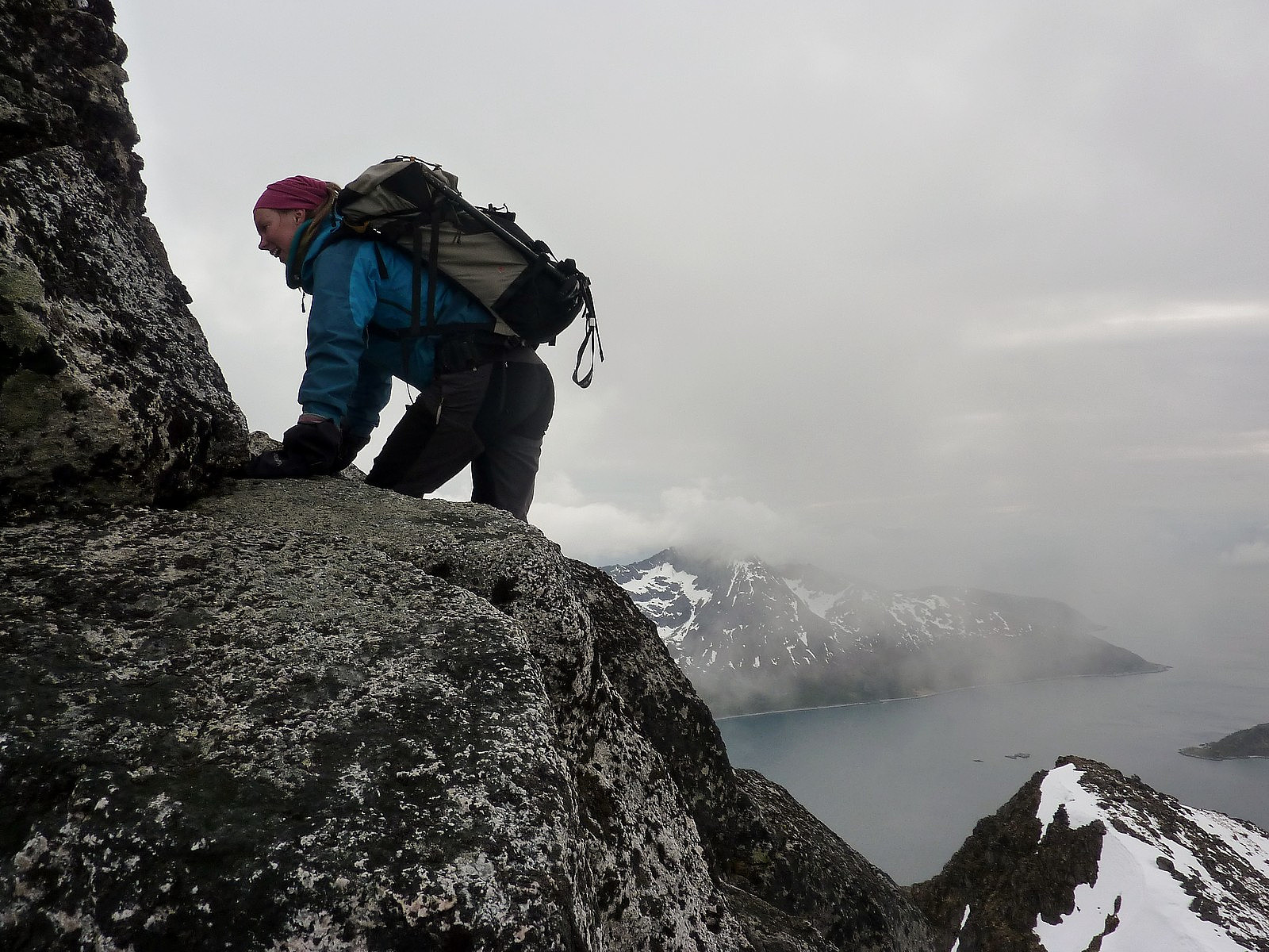 This was a really great evening trip after work, one that nearly didn't happen because it had been a bit of a rainy day and I was thinking to postpone the hike. Fortunately, neither Ane or myself decided to call each other in the end and we met up as planned, at the K1 car park. We took my car out onto Kvaloya and took the road around the northern side of the island towards Tromvik. Up until then the road surface had some bumps but then between Tromvik and Rekvik it turned to gravel instead, so it took a long time just to drive those few kiometres further to Rekvik, where we were starting the hike from.
So, straight out of the car it was cool but not cold, and it was straight up the mountain from there. It was a well-marked trail through the forest on the lower part of Skamtinden, which helped >>>
This was a really great evening trip after work, one that nearly didn't happen because it had been a bit of a rainy day and I was thinking to postpone the hike. Fortunately, neither Ane or myself decided to call each other in the end and we met up as planned, at the K1 car park. We took my car out onto Kvaloya and took the road around the northern side of the island towards Tromvik. Up until then the road surface had some bumps but then between Tromvik and Rekvik it turned to gravel instead, so it took a long time just to drive those few kiometres further to Rekvik, where we were starting the hike from.
So, straight out of the car it was cool but not cold, and it was straight up the mountain from there. It was a well-marked trail through the forest on the lower part of Skamtinden, which helped >>>
Andersdaltinden
- Dato:
- 16.05.2012
- Turtype:
- Fottur
- Turlengde:
- 5:30t
 The weather was forecasted to be 12 degrees and sunshine, so I seized the moment and decided to go on a trip instead of going to work! I decided to return to Andersdaltinden, since I had not made the summit on the previous attempt almost 2 weeks earlier because of really strong winds on the mountain. Parked up at about 0915 at the bottom near the information area and began the hike up through the forests. The snow was, as I expected, super soft but seemed quite stable. But it was mega hard work, and many times during the first half hour of the hike I didn't think I would bother going much farther before giving up on the mission! However, I had my mp3 player banging out some great tunes and since there was no hurry to get back I made a point of persevering with the hike and just thought of the >>>
Blåtinden
- Dato:
- 21.04.2012
- Turtype:
- Trugetur
- Turlengde:
- 5:00t
 The hike up Blåtinden was a something of a multi-visit trip, since I had made an ascent of this mountain in the autumn of 2011 with my sister, and remember the views as being really good, especially when you get quite high on to the upper slopes of the mountain. Then, in January I also took a hike in the hope of seeing the sun make its return back to the Arctic, but the hike had taken me a very long time (we're talking like 2 hours here), just to get up and above the forests on the very lowest part of the mountain - simply because there had been such deep snow to hike through and at that point in the season had not discovered the possible benefits of snow shoes or skis......! This time however, I had plenty of daylight and was armed with snow shoes. When I parked at the foot of the mountain >>>
Langdale circuit
- Dato:
- 07.04.2012
- Turtype:
- Fjelltur
A chilled out day walk with a group of walkers I met in Langdale. We headed up toward Red tarn below Pike of Blisco first, then up the nice gentle slopes to Long Top. From there you get nice views over the Langdale valley, and then a little bit of excitement to do the Bad Step to get to the second top on Crinkle Crags. More undulating walking follows before reaching Three Tarns, from where we took a quick dash to the top of Bowfell and then back down the Band to return to Great Langdale. A nice day, but not all that challenging in terms of strenuousness. Still, it was a pleasant weather and good company too.
Buren
- Dato:
- 03.04.2012
- Turtype:
- Fottur
- Turlengde:
- 3:30t
- Distanse:
- 7,0km
 This was what I'd generally regard as a semi-spontaneous trip, because it was planned only the day before we went. There was a cloudless sky, lots of sunshine and plenty of fresh air - just what we needed after a day in the office! With only -3 or -4 at the bottom of the mountain by Kaldfjord, conditions seemed perfect for a hike. My friend Lene had not been out on a mountain since our last hike together to Stor Kjølen, and that was in the previous autumn so she was equally thrilled to be getting out once more in a different part of Tromsø.
Neither of us had much of a plan for route-finding, but we figured that since this was quite a popular choice of skiing destination, there should be some pretty obvious tracks we could follow all the way up. And that's what we did. It was almost too easy, >>>
This was what I'd generally regard as a semi-spontaneous trip, because it was planned only the day before we went. There was a cloudless sky, lots of sunshine and plenty of fresh air - just what we needed after a day in the office! With only -3 or -4 at the bottom of the mountain by Kaldfjord, conditions seemed perfect for a hike. My friend Lene had not been out on a mountain since our last hike together to Stor Kjølen, and that was in the previous autumn so she was equally thrilled to be getting out once more in a different part of Tromsø.
Neither of us had much of a plan for route-finding, but we figured that since this was quite a popular choice of skiing destination, there should be some pretty obvious tracks we could follow all the way up. And that's what we did. It was almost too easy, >>>
Trollsteinen
- Dato:
- 24.03.2012
- Turtype:
- Fottur
- Turlengde:
- 4:00t
 This was to be my first ever ski trip on fjellski! The lovely Kine Halse who was spending a few months at UNIS had very fortunately been able to borrow some telemark utstyr from a friend, which meant she offered to lend me her skis to use for a trip. More luckily was that her boots actually fitted me even though they were 2 sizes smaller than my usual boots! So on a crisp and sunny saturday morning, we drove up to Nybyen and parked up just at the end of the last barracks. We met here with one of Kine's friends, Karoline Kirsch and she joined us for the trip to Trollsteinen. It was a little windy here, as it always is, and I changed from my thin down jacket to my full-on Rab Summit down jacket. It was -12 in the valley, but felt so much colder with the wind chill, coupled with the fact I'd done >>>
Resurrection (III,V)
- Dato:
- 29.01.2012
- Turtype:
- Alpin klatring
- Turlengde:
- 10:00t
 We woke up to a clear sky in Strathcarron and with an early start we left the cottage at 7am and drove north to the Fannaichs, a nice little bundle of munros north of Torridon/south of Ullapool. It wasn't all that cold outside, but after disembarking from the van it felt very chilly with the wind blowing once again. We began the walk-in from somewhere on the A835 and headed straight out in a more or less southwesterly direction towards the coire, passing Loch a' Mhadaidh on the way.
It was roughly 7 or 8 km just to reach the foot of the climb, and with all our climbing gear weighing down the rucksacks, it made for quite a lengthy day out ahead of us (and hence the early start)! Sadly too, by the time we reached it, we'd been abandoned by the sun and it was windy enough to have both Debbie and >>>
We woke up to a clear sky in Strathcarron and with an early start we left the cottage at 7am and drove north to the Fannaichs, a nice little bundle of munros north of Torridon/south of Ullapool. It wasn't all that cold outside, but after disembarking from the van it felt very chilly with the wind blowing once again. We began the walk-in from somewhere on the A835 and headed straight out in a more or less southwesterly direction towards the coire, passing Loch a' Mhadaidh on the way.
It was roughly 7 or 8 km just to reach the foot of the climb, and with all our climbing gear weighing down the rucksacks, it made for quite a lengthy day out ahead of us (and hence the early start)! Sadly too, by the time we reached it, we'd been abandoned by the sun and it was windy enough to have both Debbie and >>>
Right End Buttress (III)
- Dato:
- 28.01.2012
- Turtype:
- Miksklatring
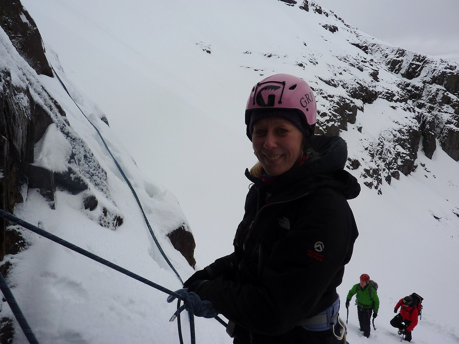 We (Debbie Spencer and myself) climbed a mixed route called Right End Buttress on Fuar Tholl with Martin Moran during a weekend of instructed climbing.It wasn't a particularly dry day and for the most of it we were in low cloud and damp air; the walk up from the valley and into the coire itself was a bit wet underfoot, and very mild. But it wasn't properly raining, which was a positive thing! We climbed as two teams of 3, with Ewen leading the guys; it was a beautiful route with some elegant moves and I thoroughly enjoyed the problems. Overall I think it added up to 4 pitches (?) in length, the hardest of which were contained within pitches 1 and 2. There are opportunities for harder variations of the route (which we of course found ourselves climbing since it was Martin leading!)
The summit >>>
We (Debbie Spencer and myself) climbed a mixed route called Right End Buttress on Fuar Tholl with Martin Moran during a weekend of instructed climbing.It wasn't a particularly dry day and for the most of it we were in low cloud and damp air; the walk up from the valley and into the coire itself was a bit wet underfoot, and very mild. But it wasn't properly raining, which was a positive thing! We climbed as two teams of 3, with Ewen leading the guys; it was a beautiful route with some elegant moves and I thoroughly enjoyed the problems. Overall I think it added up to 4 pitches (?) in length, the hardest of which were contained within pitches 1 and 2. There are opportunities for harder variations of the route (which we of course found ourselves climbing since it was Martin leading!)
The summit >>>

