Slættaratindur (02.05.2015)

Skrevet av HHauser (Helwig Hauser)

| Startsted | Eiðisskarð (380moh) |
|---|---|
| Sluttsted | Eiðisskarð (380moh) |
| Turtype | Fjelltur |
| Turlengde | 3t 30min |
| Distanse | 3,3km |
| Høydemeter | 535m |
| GPS |
|
| Bestigninger | Slættaratindur (880moh) | 02.05.2015 |
|---|

Trip Summary
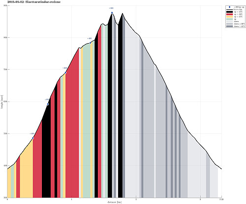
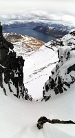
We drove up to Eiðisskarð (pass between Slættaratindur in the north and Vaðhorn in the south) and parked near the highest point on that pass (at about 380m above sealevel). From there, we basically headed straight northwards, (more or less) straight up the quite steep south-slope of Slættaratindur. Doing so, we quickly reached a high ridge, which extends eastwards from Slættaratindur. The ascend was OK (with regular hiking boots) even though it quickly became unavoidable to pass over patches of (steep) snow -- there it was necessary to walk carefully and set each foot consciously. We then followed the ridge towards Slættaratindur. We tried two or three ascends from the eastside, but the proved to be very difficult (climbing, very steep, icy and snowy, etc.) and we decided to descend a little, again, and try further westwards. This proved to be a good strategy -- basically, the more you approach the top from the west, the easier the ascend should be (if not completely easy, though). Once we reached the top, we really found it exceptional that the very top of Slættaratindur is flat. In fact, the flat top is certainly big enough so that a helicopter could land, or that you could do a relaxed dance up there! :-) Descending, we actually chose to head more to the west (than which route we had chosen upwards) and it was OK (careful walking was required, though, due to the steep slope and the snow and ice along the path). Once we were underneath the rocky top, we aimed back to the car along a diagonal route across the southern slope of Slættaratindur. For this, it was (most likely) mandatory to put on our crampons -- with them, it was safe and relaxed to cross the very steep snow fields underneath the top. Back to the car we were highly satisfied with the tour! :-)
Photos
Selected photos are available as Google photo album.
Useful Resources
Web page Hikr.org provides hiking reports about Slættaratindur.


Kommentarer