Bont from Jordalen (20.06.2015)

Skrevet av HHauser (Helwig Hauser)

| Startsted | Jordalen (520moh) |
|---|---|
| Sluttsted | Jordalen (520moh) |
| Turtype | Fjelltur |
| Turlengde | 2t 00min |
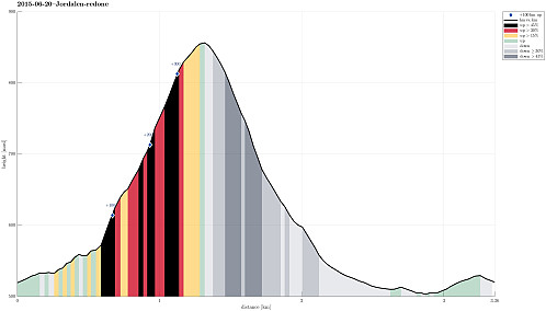
| Distanse | 3,4km |
| Høydemeter | 380m |
| GPS |
|
| Andre besøkte PBE'er | Fossaholena (830moh) | 20.06.2015 |
|---|

Trip Summary
Leaving Nærøydalen (just underneath Stalheim) to the north, we entered Jordalen through the steep, narrow and slippery tunnels that lead from about 130m above sealevel (in Nærøydalen) up to Jordalen (on about 420masl) -- quite impressive to start with! :-)
We then drove up to the first farm on the eastern side of the valley (at about 520masl).
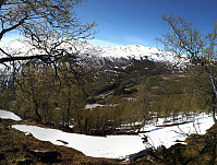
From there, we first followed a forest path, leading gently upwards in a northeastern direction. We crossed a fence and then ascended (more or less following the steepest possible path) towards the east, later more towards SE. We passed a place that is called Bont (almost flat), before we continued towards Fossaholena. All in all, we did not get up to significant heights -- instead, we met an increasing amount of snow and since we did not have appropriate gear for going over steep snow, we turned around (at a bit above 800masl, approximately at the tree line) and went back. Downwards, we followed a small stream, which lead us to a place called Øyane. From there, we basically took the street back to our car, adding a small detour to a small bridge over the main stream in Jordalen.
All in all, this was a short walk in beautiful weather and in beautiful nature -- the terrain was steep, but good to walk on.
Photos
Selected photos are available as Google+ photo album.


Kommentarer