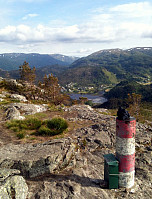
Hetlebakksåta and Birkelandsnipa (27.06.2015)

Skrevet av HHauser (Helwig Hauser)

| Startsted | Breistein (25moh) |
|---|---|
| Sluttsted | Breistein (25moh) |
| Turtype | Fjelltur |
| Turlengde | 2t 19min |
| Distanse | 10,1km |
| Høydemeter | 729m |
| GPS |
|
| Bestigninger | Birkelandsnipa (288moh) | 27.06.2015 |
|---|---|---|
| Hetlebakksåta (334moh) | 27.06.2015 | |
| Birkelandsnipa, SØ (265moh) | 27.06.2015 | |
| Andre besøkte PBE'er | Hetlebakk parkering (privat) (160moh) | 27.06.2015 |

Trip Summary
I parked in Breistein, near the place, where the ferry leaves to Osterøy. Right from there, I found a simple path through the forest up to a paved forest path, which lead me first in northwestern direction. After a turn to the left, I found the path towards Hetlebakksåta -- easily visible -- leaving to the left. I followed this (nice!) path upwards, first via Nuken, then Fjellbruna, towards Fjellsteinen, where a beautiful small lake is formed by a dam. Easily and quickly, I continued upwards to Hetlebakksåta, from where I enjoyed nice views in all directions (mostly towards south, west, and north, though). From there, I descended, first in southern direction, then turning right and continuing in northwestern direction, towards Hetlebakka. I followed a narrow street to the other side, turned left and continued southwards, along Hetlebakkstemma. Before actually descending towards the water, I found a gravel road that left to the right, which I followed a bit upwards. From there, basically, a fierce bush war started, upwards to Birkelandsnipa. Mostly, I fought myself upwards without any path, which certainly wasn't the most enjoying experience! I got across Kvamsskaret and made it to Birkelandsnipa -- what a fight with flora and fauna, argh! First, I had hoped that with this move to the top, I would find some reasonable path back, but no: It continued brutally, especially, when I left the simple path that I had first followed in northern direction (turning right, in eastern direction, heading back towards Hetlebakksåta). I fought myself through bushes, narrow forest stretches, and across very wet terrain, until I got to Birkelandsstemma. From there, first via Furkamshaugane, I got close to the houses of Hetlabakka, again, before turning left (in northern direction), where I found a nice path that leads up to Fjellsteinen (where the nice small lake is). From there, I descended towards Breistein and back to the car. While the paths on Hetlabakksåta were easy to find and nice to walk, fighting myself up and around Birkelandsnipa was not really a lot of fun!
Photos
Selected photos are available as Google+ photo album.
Useful Resources
Web page WestCoastPeaks.com provides useful information about Hetlebakksåta
and also Petter Bjørstad has a useful page about Hetlebakksåta as well as one about Birkelandsnipa.
Web page UT.no from the Norwegian Trekking Association recommends another hike up and down Hetlebakksåta.
On Bergentopp 200 there is a page (in Norwegian) about Birkelandsnipa and one about Hetlebakksåta.


Kommentarer