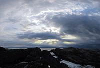
Barmaneset on Algrøyna (14.08.2015)

Skrevet av HHauser (Helwig Hauser)

| Startsted | Nordre Øyavegen (25moh) |
|---|---|
| Sluttsted | Nordre Øyavegen (25moh) |
| Turtype | Fottur |
| Turlengde | 2t 30min |
| Distanse | 7,0km |
| Høydemeter | 322m |
| GPS |
|
| Andre besøkte PBE'er | Algrøyna parkering (20moh) | 14.08.2015 |
|---|---|---|
| Langtrotten (22moh) | 14.08.2015 | |
| Trollskogen (15moh) | 14.08.2015 |

Trip Summary
We parked on Nordre Øyavegen, right before getting close to the few houses on northern Algrøyna. From there, we first followed the road further (and down and upwards, again), before continuing on Kongvikvegen (to the west). After maybe 200m, a barn is on the left side with some signs that hiking tracks are leaving the road from there (down between the road and the barn through a narrow passage). Once this entry point is found, the rest of the tour is quite straight forward (or more in a round, actually). We walked out Barmaneset to the west, approaching Rognkallen and Langtrotten at the end of this peninsula (and Kungvika on our right). Once we came close to Krabbakeila, right between Rognkallen and Langtrotten, where the ocean waters get wild, even on a very calm day, we first approached a small bay with a little fishing(?) hut. At this spot, it wasn't 100% clear of where to continue, but eventually, after one iteration of back and forth, we saw that going first down a little more, then rounding the rock towards the south at half-high elevation, passing through a narrow passage further southwards, and then turning right, again, brought us in a very good way to the outer part of Langtrotten. There, we really enjoyed spectacular impressions from the wild island nature at Algrøyna -- wow! We took several pictures and continued further out -- to actually get to the outermost parts of Langtrotten, we also had to cross a deep crevasse, jumping from one side to the other -- nothing for possibly weak nerves. At the very end of Langtrotten, which also raises quite a bit above the sea level, we enjoyed magnificent views in all directions! Our path back then followed Barmaneset, again -- this time eastwards, of course, and more on the southern edge of the peninsula (mostly without path -- still relatively easy to walk). At Mynteidet (the southern end of it), we turned then right, taking the path which rounds Storavatnet on its southern side, rounding first Kvernhushaugen. In Storavatnet, right before entering Trollskogen, we also refreshed ourselves with a short dip -- nice! :-) From there, it's basically a short way back -- following the blue marking of the path back to the street. All in all, a very nice evening tour in fantastic landscape -- what a great country for hiking! :-)
Photos
Selected photos are available as Google+ photo album.


Kommentarer